
Jackson County is one of the 36 counties in the U.S. state of Oregon. As of the 2020 census, the population was 223,259. The county seat is Medford. The county is named for Andrew Jackson, the seventh president of the United States.

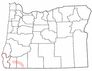
Eagle Point is a city in Jackson County, Oregon, United States. The population was 8,469 at the 2010 census, up from 4,798 at the 2000 census. As of 2018, the estimated population was 9,408.

The Pudding River is a 62-mile (100 km) tributary of the Molalla River in the U.S. state of Oregon. Its drainage basin covers 528 square miles (1,368 km2). Among its tributaries are Silver Creek, Butte Creek, Abiqua Creek, and the Little Pudding River.

The Rogue River in southwestern Oregon in the United States flows about 215 miles (346 km) in a generally westward direction from the Cascade Range to the Pacific Ocean. Known for its salmon runs, whitewater rafting, and rugged scenery, it was one of the original eight rivers named in the Wild and Scenic Rivers Act of 1968. Beginning near Crater Lake, which occupies the caldera left by the explosive volcanic eruption and collapse of Mount Mazama, the river flows through the geologically young High Cascades and the older Western Cascades, another volcanic province. Further west, the river passes through multiple exotic terranes of the more ancient Klamath Mountains. In the Kalmiopsis Wilderness section of the Rogue basin are some of the world's best examples of rocks that form the Earth's mantle. Near the mouth of the river, the only dinosaur fragments ever discovered in Oregon were found in the Otter Point Formation, along the coast of Curry County.

Mount McLoughlin is a dormant steep-sided stratovolcano, or composite volcano, in the Cascade Range of southern Oregon and within the United States Sky Lakes Wilderness. It is one of the volcanic peaks in the Cascade Volcanic Arc, within the High Cascades sector. A prominent landmark for the Rogue River Valley, the mountain is north of Mount Shasta, and south-southeast of Crater Lake. It was named around 1838 after John McLoughlin, a Chief Factor for the Hudson's Bay Company. Mount McLouglin's prominence has made it a landmark to Native American populations for thousands of years.

The Umpqua River on the Pacific coast of Oregon in the United States is approximately 111 miles (179 km) long. One of the principal rivers of the Oregon Coast and known for bass and shad, the river drains an expansive network of valleys in the mountains west of the Cascade Range and south of the Willamette Valley, from which it is separated by the Calapooya Mountains. From its source northeast of Roseburg, the Umpqua flows northwest through the Oregon Coast Range and empties into the Pacific at Winchester Bay. The river and its tributaries flow almost entirely within Douglas County, which encompasses most of the watershed of the river from the Cascades to the coast. The "Hundred Valleys of the Umpqua" form the heart of the timber industry of southern Oregon, generally centered on Roseburg.

The Illinois River is a tributary, about 56 miles (90 km) long, of the Rogue River in the U.S. state of Oregon. It drains part of the Klamath Mountains in northern California and southwestern Oregon. The river's main stem begins at the confluence of its east and west forks near Cave Junction in southern Josephine County. Its drainage basin includes Sucker Creek, which rises in the Red Buttes Wilderness, near Whiskey Peak on the California state line. The main stem flows generally northwest in a winding course past Kerby and through the Siskiyou National Forest and Kalmiopsis Wilderness. It joins the Rogue River from the south at Agness on the Curry–Josephine county line, 27 miles (43 km) from the Pacific Ocean.
The Rogue Valley is a valley region in southwestern Oregon in the United States. Located along the middle Rogue River and its tributaries in Josephine and Jackson counties, the valley forms the cultural and economic heart of Southern Oregon near the California border. The largest communities in the Rogue Valley are Medford, Ashland and Grants Pass. The most populated part of the Rogue Valley is not along the Rogue proper, but along the smaller Bear Creek tributary. The Rogue Valley is a popular fall destination in Oregon because of the hardwood forests there.

The Applegate River is a 51-mile (82 km)-long tributary of the Rogue River in the U.S. state of Oregon. It drains approximately 698 square miles (1,810 km2). Rising in northern California, it soon crosses the border and flows northeast then northwest to meet the Rogue about 6 miles (9.7 km) west of Grants Pass. It drains forested foothills of the Siskiyou Mountains along the Oregon–California border.

Lake Creek is an unincorporated community about 20 miles (32 km) east of Medford, in Jackson County, Oregon, United States. The community takes its name from Lake Creek, an important local stream.

Roxy Ann Peak, also known as Roxy Ann Butte, is a 3,576-foot-tall (1,090 m) mountain in the Western Cascade Range at the eastern edge of Medford, Oregon. Composed of several geologic layers, the majority of the peak is of volcanic origin and dates to the early Oligocene epoch. It is primarily covered by oak savanna and open grassland on its lower slopes, and mixed coniferous forest on its upper slopes and summit, stopping short of the summit. Despite the peak's relatively small topographic prominence of 753 feet (230 m), it rises 2,200 feet (670 m) above Medford and is visible from most of the Rogue Valley. The mountain is Medford's most important viewshed, open space reserve, and recreational resource.

Upper Table Rock and Lower Table Rock are two prominent volcanic plateaus located just north of the Rogue River in Jackson County, Oregon, U.S. Created by an andesitic lava flow approximately seven million years ago and shaped by erosion, they now stand about 800 feet (240 m) above the surrounding Rogue Valley. The Table Rocks are jointly owned; The Nature Conservancy is responsible for 3,591 acres (1,453 ha), while the Bureau of Land Management is responsible for 1,280 acres (520 ha).

The Rogue River in the U.S. state of Oregon begins at Boundary Springs on the border between Klamath and Douglas counties near the northern edge of Crater Lake National Park. The Rogue River flows generally west for 215 miles (346 km) from the Cascade Range through the Rogue River – Siskiyou National Forest and the Klamath Mountains to the Pacific Ocean at Gold Beach. Communities along its course include Union Creek, Prospect, Trail, Shady Cove, Gold Hill, and Rogue River, all in Jackson County; Grants Pass, and Galice in Josephine County, and Agness, Wedderburn and Gold Beach in Curry County. Significant tributaries include the South Fork Rogue River, Elk Creek, Bear Creek, the Applegate River, and the Illinois River. Arising at 5,320 feet (1,622 m) above sea level, the river loses more than 1 mile (1.6 km) in elevation by the time it reaches the Pacific.

Grave Creek is a tributary, about 40 miles (64 km) long, of the Rogue River in southwestern Oregon in the United States.

Marial is an unincorporated community and the site of a former post office in Curry County, Oregon, United States. Located along the Rogue River about 48 miles (77 km) from its mouth on the Pacific Ocean, the area was home to Takelma Indians, then to white and Karok settlers, before becoming part of a designated wilderness. Buildings preserved at the Rogue River Ranch pioneer farm complex, listed on the National Register of Historic Places, represent the former center of Marial. Nearby are the Tucker Flat Campground and a riverside lodge named Marial.

Little Butte Creek is a 17-mile-long (27 km) tributary of the Rogue River in the U.S. state of Oregon. Its drainage basin consists of approximately 354 square miles (917 km2) of Jackson County and another 19 square miles (49 km2) of Klamath County. Its two forks, the North Fork and the South Fork, both begin high in the Cascade Range near Mount McLoughlin and Brown Mountain. They both flow generally west until they meet near Lake Creek. The main stem continues west, flowing through the communities of Brownsboro, Eagle Point, and White City, before finally emptying into the Rogue River about 3 miles (5 km) southwest of Eagle Point.
Big Butte Creek is a 12-mile-long (19 km) tributary of the Rogue River in the U.S. state of Oregon. It drains approximately 245 square miles (635 km2) of Jackson County. Its two forks, the North Fork and the South Fork, both begin high in the Cascade Range near Mount McLoughlin. Flowing predominantly west, they meet near the city of Butte Falls. The main stem flows generally northwest until it empties into the Rogue Falls was incorporated in 1911, and remains the only incorporated town within the watershed's boundaries.
Big Butte Springs are natural springs located near the south fork of Big Butte Creek in Jackson County, Oregon, about 30 miles (48 km) north of Medford. It provides 26 million US gallons (98,000,000 L) of high quality water per day. The springs provide enough water to meet the needs of the valley for seven months of the year. During the remaining five months, water is pumped and treated from the Rogue River. The springs provide water to over 115,000 customers.

Union Creek is a 15-mile (24 km) long tributary of the Rogue River in the U.S. state of Oregon. Beginning west of Union Peak in the Cascade Range, it flows through the Rogue River – Siskiyou National Forest to meet the Rogue at Union Creek and the Union Creek Historic District.
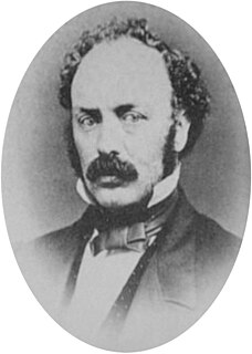
Charles Stewart Drew, also known as C.S. Drew, was a representative in the legislature of the Oregon Territory of the United States and quartermaster general of the territorial militia in the 1850s. During the American Civil War, he was a Union Army officer, serving in the 1st Oregon Cavalry regiment. He eventually reached the rank of lieutenant colonel. In 1864, he led an Army reconnaissance party into southeastern Oregon. The expedition, known as the Owyhee Reconnaissance, traveled through uncharted country from Fort Klamath to Fort Boise and back. Drew was the author of two historically important military reports; one documented Indian attacks on American settlers in the Oregon Territory and the other was his report of the Owyhee Reconnaissance.


