Taggerty

Last updated

Taggerty
Victoria
Taggerty Hall.JPG
Public hall
Australia Victoria Murrindindi Shire location map.svg
Red pog.svg
Taggerty
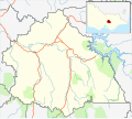
Location in Shire of Murrindindi
Coordinates 37°19′18″S145°42′43″E / 37.32167°S 145.71194°E / -37.32167; 145.71194
Population328 (2016 census) [1]
Postcode(s) 3714
Location
LGA(s) Shire of Murrindindi
State electorate(s) Eildon
Federal division(s) Indi

Taggerty is a town in central Victoria, Australia. It is located at the intersection of Maroondah Highway and Thornton Road. The Acheron River also crosses the highway at Taggerty. At the 2016 census, Taggerty and the surrounding area had a population of 328. [1]

A pastoral run called Taggerty Run was established in 1846. The homestead of the run was called Taggerty House. Gold was discovered along the Acheron River in 1870, which led to the establishment of two settlements, named Acheron Lower (now known as Acheron) and Acheron Upper (now known as Taggerty). The Post Office opened on April 15, 1876 and was renamed Taggerty in 1893. [2] Acheron Upper Primary School opened in 1875. The general store opened in 1891, as did a butter factory, reflecting the area's shift from gold mining towards dairy farming. The town was given the name Taggerty in 1890 to avoid confusion with Acheron Lower.

Today Taggerty remains a small township, with a general store, primary school (closed 2017), a town hall, a caravan park, and several bed and breakfasts.

Related Research Articles

<span class="mw-page-title-main">Yea, Victoria</span> Town in Victoria, Australia

Yea is a town in Victoria, Australia 112 kilometres (70 mi) north-east of the state capital Melbourne at the junction of the Goulburn Valley Highway and the Melba Highway, in the Shire of Murrindindi local government area. In an area originally inhabited by the Taungurung people, it was first visited by Europeans of the Hume and Hovell expedition in 1824, and within 15 years most of the land in the area had been taken up by graziers. Surveyed in 1855, the township grew as a service centre for grazing, gold-mining and timber-getting in the area.

Mount Duneed is a suburb of Geelong, Victoria, Australia. It is divided between the City of Greater Geelong and Surf Coast Shire local government areas. Mount Duneed itself is an extinct volcano and the remains of the crater can be seen in the Mount Duneed Recreation Reserve.

<span class="mw-page-title-main">Woods Point, Victoria</span> Town in Victoria, Australia

Woods Point is a small town in Victoria, Australia and is located on the banks of the Goulburn River. At the 2021 census, Woods Point and the surrounding area had a population of 33, down from 37 in 2016 census.

Acheron is a locality in Victoria, Australia. At the 2021 census, Acheron had a population of 146.

<span class="mw-page-title-main">Waubra</span> Town in Victoria, Australia

Waubra is a town in Victoria, Australia. The town is on the Sunraysia Highway, 33 kilometres (21 mi) north west of Ballarat and split between the Pyrenees Shire and City of Ballarat local government areas. At the 2021 census, Waubra and the surrounding area had a population of 308.

<span class="mw-page-title-main">Lilydale, Tasmania</span> Town in Tasmania, Australia

Lilydale, originally known as Upper Piper, is a small town in northern Tasmania, Australia. The town is 28 kilometres (17 mi) northeast of Launceston and is a part of the Launceston municipality, except for about 4% which is in the Dorset LGA. It is located near Mount Arthur. At the 2016 census, Lilydale had a population of 277. The town's notable attractions include the Lilydale Falls, two small waterfalls, Mount Arthur, and, along the main street, a series of telegraph poles painted with murals.

<span class="mw-page-title-main">Cape Clear, Victoria</span> Town in Victoria, Australia

Cape Clear is a small town located in Victoria, Australia. Cape Clear has a hotel and a general store. The town is close to the Woady Yaloak River. The area was once vibrant during the gold rush in the 19th century with the area swamping to 25,000 people during the height of the gold rush with the local population being lower than 1,000. Cape Clear Post Office opened on 17 April 1865. and still ran and owned by the same family. It is now largely dependent on farming.

<span class="mw-page-title-main">Tooleybuc</span> Town in New South Wales, Australia

Tooleybuc is a town in the western Riverina district of New South Wales, Australia. The town is located on the Mallee Highway, 919 kilometres (571 mi) southwest of the state capital, Sydney and 381 kilometres (237 mi) north west of Melbourne. Situated on the banks of the Murray River across from Piangil in the neighbouring state of Victoria, at the 2011 census, Tooleybuc has a population of 277. The town is in the Murray River Council local government area. The Tooleybuc Bridgekeepers Cottage close to the Tooleybuc Bridge is of particular local historic interest. It is open to the public.

<span class="mw-page-title-main">Taradale, Victoria</span> Town in Victoria, Australia

Taradale is a town in Victoria, Australia. It is located beside the Calder Highway between Melbourne and Bendigo. Its local government area is the Shire of Mount Alexander. At the 2016 census, Taradale had a population of 448.

<span class="mw-page-title-main">Newlyn, Victoria</span> Town in Victoria, Australia

Newlyn is a town in the Shire of Hepburn, in Victoria, Australia. It is situated on the Midland Highway between Creswick and Daylesford. At the 2021 census, Newlyn had a population of 136.

<span class="mw-page-title-main">Cathedral Range State Park</span> Protected area in Victoria, Australia

The Cathedral Range State Park located in Victoria, Australia, approximately 100 kilometres (62 mi) north-east of Melbourne. It is situated between the towns of Buxton and Taggerty and runs parallel to the Maroondah Highway. The Cathedral Range was declared a State Park on 26 April 1979. It consists of 3,577 hectares and contains the rugged Razorback and spectacular peaks of the Cathedral Range, Little River and forested hills of the Blue Range. Due to its proximity to Melbourne the Cathedral Ranges are a popular destination for both day and weekend adventures. Bushwalking, camping, rock climbing and abseiling are some of the more popular activities available. Cathedral Range State Park is listed as Category II under the IUCN World Commission on Protected Areas and is an example of a park that can be used for recreation, education and conserving natural ecosystems.

<span class="mw-page-title-main">Walwa, Victoria</span> Town in Victoria, Australia

Walwa, is a town in the Shire of Towong in north east Victoria, Australia. The town is located 1 kilometre from the Murray River on the former Murray Valley highway between Wodonga and Corryong. At the 2016 census, the Walwa population had declined to just 177 having been 268 just ten years earlier.

<span class="mw-page-title-main">Smythesdale</span> Town in Victoria, Australia

Smythesdale is a town in Victoria, Australia. The town is located on the Glenelg Highway. Most of the town is located in the Golden Plains Shire local government area; however, a small section lies in the Shire of Pyrenees. Smythesdale is 19 kilometres (12 mi) west of Ballarat and 135 kilometres (84 mi) west of the state capital, Melbourne. At the 2016 census, Smythesdale and the surrounding area had a population of 1,032. Smythesdale Primary School is a part of the Woady Yaloak PS with Ross Creek, Scarsdale, and Snake Valley as the other campus'.

<span class="mw-page-title-main">Guildford, Victoria</span> Town in Victoria, Australia

Guildford is a small settlement situated on the Loddon River, 124 kilometres (77 mi) north-west of Melbourne, in Victoria, Australia. It is located on the Midland Highway between Daylesford and Castlemaine. The population recorded at the 2016 census was 333.

<span class="mw-page-title-main">Campbells Creek, Victoria</span> Town in Victoria, Australia

Campbells Creek is a town in Victoria, Australia.

Johnsonville is a town in the East Gippsland region of Victoria, Australia. It is located on the Princes Highway 18.9 km east from the city of Bairnsdale and 18.3 km west from the tourist resort and fishing port of Lakes Entrance. The town encompasses an area of approximately 5,617 hectares, 56 square kilometres or 13,879 acres.

The Acheron River, a minor inland perennial river of the Goulburn Broken catchment, part of the Murray-Darling basin, is located in the lower South Eastern Highlands bioregion and Northern Country/North Central regions of the Australian state of Victoria. The headwaters of the Acheron River rise on the north–western slopes of the Yarra Ranges, below The Knobs and descend to flow into the Goulburn River near Alexandra.

The Little River, a minor inland perennial river of the Goulburn Broken catchment, part of the Murray-Darling basin, is located in the lower South Eastern Highlands bioregion and Northern Country/North Central regions of the Australian state of Victoria. The headwaters of the Little River rise below the Cathedral Range and descend to flow into the Acheron River at Taggerty.

<span class="mw-page-title-main">Steavenson River</span> River in Victoria, Australia

The Steavenson River, sometimes incorrectly referred to as Steavensons River, a minor inland perennial river of the Goulburn Broken catchment, part of the Murray-Darling basin, is located in the lower South Eastern Highlands bioregion and Northern Country/North Central regions of the Australian state of Victoria. The headwaters of the Steavenson River rise on the north–western slopes of the Yarra Ranges, below Mount Edgar and descend to flow into the Acheron River near Buxton.

Bendoc is a locality in the Shire of East Gippsland, Victoria, Australia. It sits on the Bendoc River. In the 2016 census, Bendoc had a population of 115 people.

References

  1. 1 2 "2016 Census QuickStats Taggerty". Australian Bureau of Statistics. Retrieved 26 April 2019.
  2. Phoenix Auctions History, Post Office List , retrieved 24 March 2021