Taltson River Airport | |||||||||||
---|---|---|---|---|---|---|---|---|---|---|---|
Summary | |||||||||||
Airport type | Private | ||||||||||
Operator | Northwest Territories Power Corporation | ||||||||||
Location | Taltson River, Northwest Territories | ||||||||||
Time zone | MST (UTC−07:00) | ||||||||||
Elevation AMSL | 875 ft / 267 m | ||||||||||
Coordinates | 60°23′39″N111°20′50″W / 60.39417°N 111.34722°W Coordinates: 60°23′39″N111°20′50″W / 60.39417°N 111.34722°W | ||||||||||
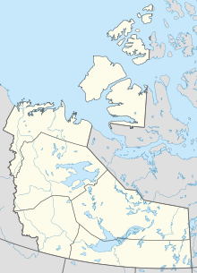
Map | |||||||||||
Runways | |||||||||||
| |||||||||||
Source: Canada Flight Supplement [1] |
Taltson River Airport( TC LID : CFW5) is located at Taltson River in the Northwest Territories, Canada. Prior permission is required to land except in the case of an emergency.
Great Slave Lake, known traditionally as Tıdeè in Tłı̨chǫ Yatıì, Tinde’e in Wıìlıìdeh Yatii / Tetsǫ́t’ıné Yatıé, Tu Nedhé in Dëne Sųłıné Yatıé, and Tucho in Dehcho Dene Zhatıé, is the second-largest lake in the Northwest Territories of Canada, the deepest lake in North America at 614 metres, and the tenth-largest lake in the world. It is 469 km (291 mi) long and 20 to 203 km wide. It covers an area of 27,200 km2 (10,502 sq mi) in the southern part of the territory. Its given volume ranges from 1,070 km3 (260 cu mi) to 1,580 km3 (380 cu mi) and up to 2,088 km3 (501 cu mi) making it the 10th or 12th largest by volume.
Łutselkʼe, also spelt Łutsel Kʼe, is a "designated authority" in the North Slave Region of the Northwest Territories, Canada. The community is located on the south shore near the eastern end of Great Slave Lake and until 1 July 1992, it was known as Snowdrift, as the community lies near the mouth of the Snowdrift River.