Terrytown, Nebraska

Last updated

Terrytown, Nebraska
Terrytown, NE.jpg
Terrytown viewed from Carpenter's Park over Terry's Lake, July 2017
Scotts Bluff County Nebraska Incorporated and Unincorporated areas Terrytown Highlighted.svg
Location of Terrytown, Nebraska
Coordinates: 41°50′47″N103°40′14″W / 41.84639°N 103.67056°W / 41.84639; -103.67056
Country United States
State Nebraska
County Scotts Bluff
Area
[1]
  Total0.51 sq mi (1.32 km2)
  Land0.47 sq mi (1.23 km2)
  Water0.04 sq mi (0.09 km2)
Elevation
[2]
3,878 ft (1,182 m)
Population
 (2020)
  Total1,057
  Density2,229.96/sq mi (861.14/km2)
Time zone UTC-7 (Mountain (MST))
  Summer (DST) UTC-6 (MDT)
ZIP code
69341
Area code 308
FIPS code 31-48585 [3]
GNIS feature ID2399961 [2]

Terrytown is a city in Scotts Bluff County, Nebraska, United States. The population was 1,198 at the 2010 census. It is part of the Scottsbluff, Nebraska Micropolitan Statistical Area. Terrytown is located on the bank of the North Platte River between the cities of Scottsbluff and Gering, Nebraska. Separated only by the river, Scottsbluff and Gering have grown together to form the 7th largest urban area in Nebraska, which incorporates the city of Terrytown as well.

Contents

History

Terrytown was founded in 1949 [4] by Terry Carpenter, a successful Scottsbluff businessman and Nebraska state senator in the 1950s and 1960s.

Geography

According to the United States Census Bureau, the city has a total area of 0.57 square miles (1.48 km2), of which 0.53 square miles (1.37 km2) is land and 0.04 square miles (0.10 km2) is water. [5]

Demographics

Historical population
CensusPop.Note
1950 228
1960 164−28.1%
1970 747355.5%
1980 727−2.7%
1990 656−9.8%
2000 646−1.5%
2010 1,19885.4%
2020 1,057−11.8%
U.S. Decennial Census [6]

2010 census

As of the census [7] of 2010, there were 1,198 people, 436 households, and 290 families residing in the city. The population density was 2,260.4 inhabitants per square mile (872.7/km2). There were 465 housing units at an average density of 877.4 per square mile (338.8/km2). The racial makeup of the city was 74.3% White, 0.4% African American, 4.3% Native American, 0.9% Asian, 17.4% from other races, and 2.8% from two or more races. Hispanic or Latino of any race were 42.2% of the population.

There were 436 households, of which 41.1% had children under the age of 18 living with them, 37.4% were married couples living together, 19.5% had a female householder with no husband present, 9.6% had a male householder with no wife present, and 33.5% were non-families. 25.2% of all households were made up of individuals, and 8.3% had someone living alone who was 65 years of age or older. The average household size was 2.74 and the average family size was 3.27.

The median age in the city was 28.4 years. 34.1% of residents were under the age of 18; 11.4% were between the ages of 18 and 24; 23.3% were from 25 to 44; 21.5% were from 45 to 64; and 9.5% were 65 years of age or older. The gender makeup of the city was 46.9% male and 53.1% female.

2000 census

As of the census [3] of 2000, there were 646 people, 246 households, and 150 families residing in the city. The population density was 1,521.0 inhabitants per square mile (587.3/km2). There were 271 housing units at an average density of 638.1 per square mile (246.4/km2). The racial makeup of the city was 73.22% White, 6.81% Native American, 17.18% from other races, and 2.79% from two or more races. Hispanic or Latino of any race were 44.12% of the population.

There were 246 households, out of which 42.7% had children under the age of 18 living with them, 34.6% were married couples living together, 19.9% had a female householder with no husband present, and 39.0% were non-families. 31.7% of all households were made up of individuals, and 13.0% had someone living alone who was 65 years of age or older. The average household size was 2.63 and the average family size was 3.39.

In the city, the population was spread out, with 36.7% under the age of 18, 11.1% from 18 to 24, 30.5% from 25 to 44, 13.5% from 45 to 64, and 8.2% who were 65 years of age or older. The median age was 26 years. For every 100 females, there were 91.7 males. For every 100 females age 18 and over, there were 88.5 males.

As of 2000 the median income for a household in the city was $16,536, and the median income for a family was $19,583. Males had a median income of $20,192 versus $13,393 for females. The per capita income for the city was $8,550. About 44.2% of families and 41.0% of the population were below the poverty line, including 46.7% of those under age 18 and 26.7% of those age 65 or over.

Transportation

Terrytown has been served by public transit since January 10, 2018, with two bus routes provided by Tri-City Roadrunner. [8]

See also

Related Research Articles

<span class="mw-page-title-main">Scotts Bluff County, Nebraska</span> County in Nebraska, United States

Scotts Bluff County is a county on the western border of the U.S. state of Nebraska. As of the 2020 United States Census, the population was 36,084. Its county seat is Gering, and its largest city is Scottsbluff.

<span class="mw-page-title-main">Louisville, Nebraska</span> City in Nebraska, United States

Louisville is a city in northern Cass County, Nebraska, United States. The population was 1,319 at the 2020 census.

<span class="mw-page-title-main">Sutton, Nebraska</span> City in Nebraska, United States

Sutton is a city in Clay County, Nebraska, United States. The population was 1,502 at the 2010 census. It is part of the Hastings, Nebraska Micropolitan Statistical Area.

<span class="mw-page-title-main">Bennington, Nebraska</span> City in Douglas County, Nebraska, United States

Bennington is a city in Douglas County, Nebraska, United States. The population was 2,026 at the 2020 U.S. Census.

<span class="mw-page-title-main">Burwell, Nebraska</span> City in Nebraska, United States

Burwell is a city in Garfield County, Nebraska, United States. The population was 1,210 at the 2010 census. It is the county seat of Garfield County.

<span class="mw-page-title-main">Creighton, Nebraska</span> City in Nebraska, United States

Creighton is a city in Knox County, Nebraska, United States. The population was 1,154 at the 2010 census.

<span class="mw-page-title-main">Crofton, Nebraska</span> City in Nebraska, United States

Crofton is a city in Knox County, Nebraska, United States. The population was 726 at the 2010 census.

<span class="mw-page-title-main">Nelson, Nebraska</span> Village in Nebraska, United States

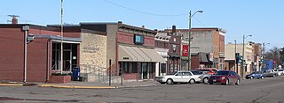
Nelson is a village and the county seat of Nuckolls County, Nebraska, United States. The population was 488 at the 2010 census. The city was named for C. Nelson Wheeler, the original owner of the town site.

<span class="mw-page-title-main">Syracuse, Nebraska</span> City in Nebraska, United States

Syracuse is a city in Otoe County, Nebraska, United States. The population was 1,941 at the 2020 census.

<span class="mw-page-title-main">Pawnee City, Nebraska</span> City in and county seat of Pawnee County, Nebraska, United States

Pawnee City is a city in and the county seat of Pawnee County, Nebraska, United States. The population was 878 at the 2010 census.

<span class="mw-page-title-main">Grant, Nebraska</span> City in Nebraska, United States

Grant is a city and county seat of Perkins County, Nebraska, United States. The population was 1,165 at the 2010 census.

<span class="mw-page-title-main">Pierce, Nebraska</span> City in Nebraska, United States

Pierce is a city in and county seat of Pierce County, Nebraska, United States. The population was 1,767 at the 2010 census.

<span class="mw-page-title-main">Gering, Nebraska</span> City in and county seat of Scotts Bluff County, Nebraska, United States

Gering is a city in and the county seat of Scotts Bluff County, Nebraska, United States, in the Panhandle region of the state. The population was 8,564 at the 2020 census.

<span class="mw-page-title-main">Henry, Nebraska</span> Village in Nebraska, United States

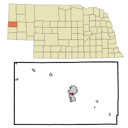
Henry is a village in Scotts Bluff County, Nebraska, United States. It is part of the Scottsbluff, Nebraska Micropolitan Statistical Area. The population was 106 at the 2010 census.

<span class="mw-page-title-main">McGrew, Nebraska</span> Village in Scotts Bluff County, Nebraska, United States

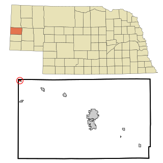
McGrew is a village in Scotts Bluff County, Nebraska, United States. It is part of the Scottsbluff, Nebraska Micropolitan Statistical Area. The population was 105 at the 2010 census.

<span class="mw-page-title-main">Melbeta, Nebraska</span> Village in Scotts Bluff County, Nebraska, United States

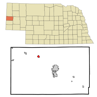
Melbeta is a village in Scotts Bluff County, Nebraska, United States. It is part of the Scottsbluff, Nebraska Micropolitan Statistical Area. The population was 112 at the 2010 census.

<span class="mw-page-title-main">Mitchell, Nebraska</span> City in Nebraska, United States

{[short description|City in Scotts Bluff County, Nebraska, United States}}

<span class="mw-page-title-main">Morrill, Nebraska</span> Village in Scotts Bluff County, Nebraska, United States

Morrill is a village located in Scotts Bluff County, Nebraska, United States, in the western Panhandle of the state. Morrill is part of the Scottsbluff, Nebraska Micropolitan Statistical Area. The population was 921 at the 2010 census.

<span class="mw-page-title-main">Scottsbluff, Nebraska</span> City in Scotts Bluff County, Nebraska, United States

Scottsbluff is a city in Scotts Bluff County, Nebraska, United States, in the Great Plains region. The population was 14,436 at the 2020 census. Scottsbluff is the largest city in the Nebraska Panhandle, and the 13th largest city in Nebraska.

<span class="mw-page-title-main">Stanton, Nebraska</span> Village in and county seat of Stanton County, Nebraska, United States

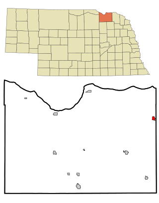
Stanton is a city in Stanton County, Nebraska, United States. The population was 1,577 at the 2010 census. It is the county seat of Stanton County. Stanton was platted in 1870. Both the city and county are named after Edwin Stanton, secretary of war for president Abraham Lincoln during the American Civil War.

References

  1. "ArcGIS REST Services Directory". United States Census Bureau. Retrieved September 18, 2022.
  2. 1 2 U.S. Geological Survey Geographic Names Information System: Terrytown, Nebraska
  3. 1 2 "U.S. Census website". United States Census Bureau . Retrieved January 31, 2008.
  4. Gering, Scottsbluff, and Terrytown. Arcadia Publishing. 2009. p. 8. ISBN   978-0-7385-6074-8.
  5. "US Gazetteer files 2010". United States Census Bureau. Archived from the original on January 25, 2012. Retrieved June 24, 2012.
  6. "Census of Population and Housing". Census.gov. Retrieved June 4, 2015.
  7. "U.S. Census website". United States Census Bureau . Retrieved June 24, 2012.
  8. Mark Gaschler. "Tri-City Roadrunner begins fixed route public transportation". Star Herald. Retrieved June 29, 2022.

Commons-logo.svg Media related to Terrytown, Nebraska at Wikimedia Commons