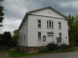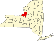
Oswego County is a county in the U.S. state of New York. As of the 2020 census, the population was 117,525. The county seat is Oswego. The county name is from a Mohawk language word meaning "the pouring out place", referring to the point at which the Oswego River feeds into Lake Ontario at the northern edge of the county in the city of Oswego.

Ava is a town in Oneida County, New York, United States. The population was 678 at the 2010 census..

Cicero is a town in northern Onondaga County, New York, United States. The population was 31,632 at the 2010 census. The name of the town was assigned by a clerk interested in the classics, honoring Cicero, a Roman statesman.

Albion is a town in the northeastern part of Oswego County, New York, United States. The population was 2,073 at the 2010 census.

Scriba is a town in Oswego County, New York, United States. The population was 6,840 at the 2010 census. The town is named after landowner George Scriba.

Williamstown is a town in Oswego County, New York, United States. The population was 1,277 at the 2010 census.

Oswego is a city in Oswego County, New York, United States. The population was 18,142 at the 2010 census. Oswego is located on Lake Ontario in north-central New York and promotes itself as "The Port City of Central New York." It is the county seat of Oswego County.

Oneida Lake is the largest lake entirely within New York state, with a surface area of 79.8 square miles (207 km2). The lake is located northeast of Syracuse and near the Great Lakes. It feeds the Oneida River, a tributary of the Oswego River, which flows into Lake Ontario. From the earliest times until the opening of the Erie Canal in 1825, the lake was part of an important waterway connecting the Atlantic seaboard of North America to the continental interior.

The Oswego River is a river in upstate New York in the United States. It is the second-largest river flowing into Lake Ontario. James Fenimore Cooper’s novel The Pathfinder, or The Inland Sea is set in the Oswego River valley.

The Salmon River is a small river north of Syracuse in Upstate New York, the United States. It is a popular and economically important sportfishing destination, and the most heavily fished of New York's Lake Ontario tributaries. From its headwaters in the Tug Hill region of New York, it flows 44 miles (71 km) westward through two hydroelectric dams and over the 110-foot (34 m) Salmon River Falls before it empties into eastern Lake Ontario at Port Ontario in Oswego County. The Salmon River watershed drains approximately 280 square miles (730 km2).
Jewell is a hamlet in Oneida County, New York, United States. It is a community in the Town of Vienna, on the northeastern corner of Oneida Lake, near the border of Oswego County. It lies on State Route 49, approximately 30 minutes from the City of Syracuse to its west and 30 minutes to the City of Utica on the east.

The Oneida Carry was an important link in the main 18th century trade route between the Atlantic seaboard of North America and interior of the continent. From Schenectady, near Albany, New York on the Hudson River, cargo would be carried upstream along the Mohawk River using boats known as bateaux. At the location at modern-day Rome, New York, the cargo and boats would be portaged one to four miles overland to Wood Creek. This portage, which the Haudenosaunee called De-o-Wain-Sta, was known as the Oneida Carry or The Great Carrying Place in English, and as Trow Plat in Dutch. After relaunching into Wood Creek, the bateaux would navigate downstream to Oneida Lake, the Oswego River, and ultimately Lake Ontario at Oswego. Lake Ontario was the gateway to all the Great Lakes stretching another thousand miles inland.

Pultneyville is a hamlet located in the Town of Williamson, Wayne County, New York, United States. The population was 698 at the 2010 census.
New York State Route 104B (NY 104B) is a 6.07-mile (9.77 km) east–west state highway located in central Oswego County, New York, in the United States. This highway provides a connection between NY 104, the principal highway along the southern shore of Lake Ontario, in New Haven and NY 3, the principal highway along the eastern shore of Lake Ontario, in the town of Mexico. It passes through mostly rural areas and acts as a two-lane bypass of the village of Mexico, located where NY 3 and NY 104 intersect southeast of NY 104B. All of NY 104B is part of the Seaway Trail, a National Scenic Byway. The route was originally New York State Route 3D in 1930. NY 3D was redesignated as New York State Route 3E c. 1932, and was redesignated NY 104B in April 1935.

The geography of New York state varies widely. Most of New York is dominated by farms, forests, rivers, mountains, and lakes. New York's Adirondack Park is larger than any U.S. National Park in the contiguous United States. Niagara Falls, on the Niagara River as it flows from Lake Erie to Lake Ontario, is a popular attraction. The Hudson River begins near Lake Tear of the Clouds and flows south through the eastern part of the state without draining lakes George or Champlain. Lake George empties at its north end into Lake Champlain, whose northern end extends into Canada, where it drains into the Richelieu River and then the St. Lawrence. Four of New York City's five boroughs are on the three islands at the mouth of the Hudson River: Manhattan Island, Staten Island, and Brooklyn and Queens on Long Island.

Wood Creek is a river in Central New York State that flows westward from the city of Rome, New York to Oneida Lake. Its waters flow ultimately to Lake Ontario, which is the easternmost of the five Great Lakes. Wood Creek is less than 20 miles (32 km) long, but has great historical importance. Wood Creek was a crucial, fragile link in the main 18th and early 19th century waterway connecting the Atlantic seaboard of North America and its interior beyond the Appalachian Mountains. This waterway ran upstream from the Hudson River along the Mohawk River. Near present day Rome, the Mohawk River is about one mile from Wood Creek across dry land. In the 18th century, cargo and boats were portaged between the Mohawk and Wood Creek; the crossing was called the "Oneida Carry". In 1797, the Rome Canal was completed and finally established an all-water route. The waterway then followed a downstream run along Wood Creek to the east end of Oneida Lake. After a 20 mile crossing to the west end of the lake, the waterway entered the Oswego River system. This system led either to the Lake Ontario port at Oswego, or further westward along the Seneca River.
Gayville is a hamlet lying five miles (8 km) north of the hamlet of Constantia in the town of Constantia in Oswego County, New York, United States.
Fish Creek is a moderately sized river emptying into the eastern end of Oneida Lake in Oneida County, New York. Formed by the confluence of its east and west forks near the hamlet of Blossvale, the creek flows southwest for 11 miles (18 km), through the towns of Annsville and Vienna. The last mile of the creek is channelized to form part of the Erie Canal, which joins the lake at Sylvan Beach. The creek drains approximately 528.9 square miles (1,370 km2) of the Tug Hill plateau country in Central New York.
Mexico Point State Park is a 122-acre (0.49 km2) park on the eastern shore of Lake Ontario in the town of Mexico in Oswego County, New York. The park is located at the mouth of the Little Salmon River.
The Little Salmon River is a tributary of Lake Ontario located in Oswego County, New York. The river enters Lake Ontario approximately four miles (6.4 km) southwest from the mouth of the Salmon River.


