
Litchfield is a town in Herkimer County, New York, United States. The population was 1,513 at the 2010 census. The town is named after Litchfield, Connecticut, the source of some early settlers of the city.

Schuyler is a town in Herkimer County, New York, United States. The population was 3,420 at the 2010 census. The town is in the western part of Herkimer County and is east of Utica.
Leyden is a town in Lewis County, New York, United States. The population was 1,785 at the 2010 census. The town is in the southern part of the county and is north of Rome.
Brookfield is a town in Madison County, New York, United States. The population was 2,403 at the 2000 census.

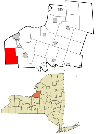
Florence is a town in Oneida County, New York, United States. The population was 1,025 at the 2010 census. The town is named after the city Florence in Italy.

Forestport is a town in Oneida County, New York, United States. The population was 1,477 at the 2020 census.

Kirkland is a town in Oneida County, New York, United States. The population was 10,075 at the 2020 census. The town is named after Samuel Kirkland, a missionary among the Oneidas.

Marshall is a town in Oneida County, New York, United States. The population was 2,131 at the 2010 census.
Paris is a town in Oneida County, New York, United States. The town is in the southeast part of the county and is south of Utica. The population was 4,332 at the 2020 census. The town was named after an early benefactor, Colonel Isaac Paris.

Sangerfield is a town in Oneida County, New York, United States. The population was 2,561 at the 2010 census. The town is named after Jedediah Sanger, an early settler.

Trenton is a town in Oneida County, New York, United States. The population was 4,297 at the 2020 census.

Verona is a town in southwestern Oneida County, New York, United States. The population was 6,293 at the 2010 census. The town was named after Verona, Italy.

Vienna is a town in Oneida County, New York, United States. The population was 5,440 at the 2010 census. The town is named after the capital of Austria.

Western is a town in Oneida County, New York, United States. The population was 1,951 at the 2010 census.

Westmoreland is a town in Oneida County, New York, United States. The population was 6,138 at the 2010 census.

Whitestown is a town in Oneida County, New York, United States. The population was 18,667 at the 2010 census. The name is derived from Judge Hugh White, an early settler. The town is immediately west of Utica and the New York State Thruway passes across the town. The offices of the town of Whitestown are in the Village of Whitesboro.

Hastings is a town in Oswego County, New York, United States. Its population was 9,450 at the 2010 census. It is named after Hastings Curtiss, a prominent citizen and member of the State Assembly in 1824.
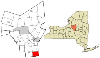
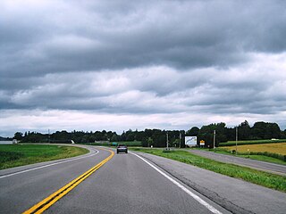
Bridgewater is a town in Oneida County, New York, United States. The population was 1,522 at the 2010 census.

Constantia is a town in Oswego County, New York, United States. The population was 4,973 at the 2010 census. The town is located in the southeastern part of the county. Within the town is a hamlet and census-designated place of the same name.
Hannibal is a town in Oswego County, New York, United States. The population was 4,854 at the 2010 census. The name is derived from the hero of ancient Carthage, Hannibal.

