Thallon, Queensland Last updated September 04, 2025 History Thallon State School group with teacher Thomas Douglas King, 1923 Gamilaraay (Gamilaroi, Kamilaroi, Comilroy) is a language from South-West Queensland and North-West New South Wales. The Gamilaraay language region includes the landscape within the local government boundaries of the Balonne Shire Council , including the towns of Dirranbandi , Thallon, Talwood and Bungunya as well as the border towns of Mungindi and Boomi extending to Moree , Tamworth and Coonabarabran in NSW. [ 9]
Explorer Thomas Mitchell was the first European in the Thallon district and his initials can still be found on a bloodwood tree near the Moonie River . [ 8]
In 1911, the area was set aside for closer settlement and 780 acres (3.2 km 2 ) were gazetted as a town reserve. The town's name comes from its railway station, which in turn was named on 17 January 1911 by the Queensland Railways Department after James Forsyth Thallon (1847-1911) who was the Queensland Commissioner for Railways from 1900 to 1911. [ 8] [ 2]
Pine St, Thallon, circa 1954, with the hotel on the left With the coming of the railway, the town developed and shops and a hotel were established. [ 8]
Thallon State School opened on 24 July 1911. [ 10] [ 11] [ 12]
St Joseph's Catholic Church was built in 1916 from timber using a "ready-to-erect" system. It was 30 by 25 feet (9.1 by 7.6 m) . It cost £268. It was officially opened by Archbishop James Duhig on Sunday 17 September 1916. It was in Garah Street ( 28°38′19″S 148°51′54″E / 28.638697°S 148.865°E / -28.638697; 148.865 (St Joseph's Catholic Church ) 0.5 acres (0.20 ha) site donated by F. McLoughlin. In 1980, it closed due to termite damage. [ 13] [ 14] [ 15] [ 16]
Myrtlemount Provisional School, Warrie Provisional School and Hollymount Provisional School (all named after local pastoral stations) opened on 29 September 1919 as a group of part-time schools (sharing a teacher between them). All three schools closed in 1922 due to low student numbers. [ 17]
Demographics In the 2011 census , the locality of Thallon and the surrounding area had a population of 382 people. [ 18]
In the 2016 census , the locality of Thallon had a population of 257 people. [ 19]
In the 2021 census , the locality of Thallon had a population of 231 people. [ 1]
Heritage listings Bullamon Homestead, 1995 Thallon has the following heritage-listed sites:
Facilities Thallon Post Office, 2008 Thallon Public Hall, 2008 Thallon has a post office, hotel, community hall, showground, park and sportsground. [ 26]
Balonne Shire Council operates a library in William Street. [ 27] [ 28]
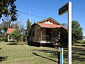
Country Women's Association rooms, 2008 The Thallon-Daymar branch of the Queensland Country Women's Association has its rooms at 47 William Street. [ 29] Daymar is a neighbouring town, 12 kilometres (7.5 mi) east of Thallon.
Gallery Northern entrance to the town (2021).
Pine Street (2021).
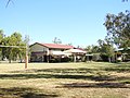
Thallon State School, Henry Street (2021).
Thallon State School oval, Henry Street (2021).
Francis Hotel, Pine Street (2008).
Anglican church (2021).
Town water tower (2021).
Fire station (2021).
Police station (2021).
Town cemetery (2021).
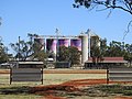
Painted murals on grain silos (2021).
Painted murals on grain silos (2021).
War memorial (2021).
Moonie River in flood downstream (2021).
Noondoo-Thallon Road (2021).
References 1 2 3 Australian Bureau of Statistics (28 June 2022). "Thallon (SAL)" . 2021 Census QuickStats . Retrieved 28 February 2023 . 1 2 "Thallon – town in Shire of Balonne (entry 33800)" . Queensland Place Names . Queensland Government . Retrieved 25 December 2018 . ↑ "Thallon – locality in Shire of Balonne (entry 42684)" . Queensland Place Names . Queensland Government . Retrieved 25 December 2018 . ↑ "Nindigully – town in Shire of Balonne (entry 24262)" . Queensland Place Names . Queensland Government . Retrieved 29 December 2017 . ↑ "Queensland Globe" . State of Queensland . Retrieved 25 December 2018 . ↑ "Thallon – railway station in the Shire of Balonne (entry 33801)" . Queensland Place Names . Queensland Government . Retrieved 25 December 2018 . ↑ "Layers: Locality; Protected areas and forests; Land use; Sugarcane areas" . Queensland Globe . Queensland Government . Retrieved 9 May 2025 . 1 2 3 4 "Thallon" . Western Downs - Places to visit . Tourism Queensland . Retrieved 25 May 2007 . ↑ "Indigenous Language map of Queensland" . State Library of Queensland . Retrieved 23 January 2020 . ↑ "Thallon State School" . Thallon State School. Retrieved 29 January 2017 . ↑ "Opening and closing dates of Queensland Schools" . Queensland Government . Retrieved 18 April 2019 . ↑ "History" . Thallon State School . 29 March 2019. Retrieved 29 September 2023 . ↑ Blake, Thom. "St Joseph's Catholic Church" . Queensland Religious Places . Retrieved 23 June 2023 . ↑ "LISMORE DISTRICT" . The Brisbane Courier . No. 18, 181. Queensland, Australia. 25 April 1916. p. 4. Retrieved 18 July 2023 – via National Library of Australia. ↑ "Thallon" . Balonne Beacon . Vol. X, no. 69. Queensland, Australia. 2 September 1916. p. 3. Retrieved 18 July 2023 – via National Library of Australia. ↑ "Thallon" . Balonne Beacon . Vol. X, no. 75. Queensland, Australia. 23 September 1916. p. 2. Retrieved 18 July 2023 – via National Library of Australia. ↑ Queensland Family History Society (2010), Queensland schools past and present (Version 1.01 ed.), Queensland Family History Society , ISBN 978-1-921171-26-0 ↑ Australian Bureau of Statistics (31 October 2012). "Thallon (State Suburb)" . 2011 Census QuickStats . Retrieved 4 June 2013 . ↑ Australian Bureau of Statistics (27 June 2017). "Thallon (SSC)" . 2016 Census QuickStats . Retrieved 20 October 2018 . ↑ "Bullamon Homestead (entry 601683)" . Queensland Heritage Register . Queensland Heritage Council. Retrieved 5 September 2016 . ↑ "State and non-state school details" . Queensland Government . 9 July 2018. Archived from the original on 21 November 2018. Retrieved 21 November 2018 . ↑ "Thallon State School" . Thallon State School . 24 August 2022. Retrieved 18 July 2023 . ↑ "ACARA School Profile 2017" . Archived from the original on 22 November 2018. Retrieved 22 November 2018 . ↑ "Annual Report 2022" (PDF) . Thallon State School . p. 2. Retrieved 18 July 2023 . ↑ "Layers: Locality; Schools and school catchments" . Queensland Globe . Queensland Government . Retrieved 9 May 2025 . ↑ "Thallon" . Balonne Shire Council. Archived from the original on 13 November 2013. Retrieved 12 November 2013 . ↑ "Library location and hours" . Balonne Shire Council. Archived from the original on 23 October 2017. Retrieved 8 May 2017 . ↑ "Thallon Library" . Public Libraries Connect . State Library of Queensland . Retrieved 29 January 2017 . ↑ "Branch locations" . Queensland Country Women's Association . Archived from the original on 26 December 2018. Retrieved 26 December 2018 . ↑ "William the Wombat" . Southern Queensland Country Tourism . Archived from the original on 26 March 2018. Retrieved 7 October 2018 . ↑ Amy-Lyne (19 October 2017). "William the Wombat to put town on map" . Toowoomba Chronicle . Archived from the original on 19 October 2017. Retrieved 7 October 2018 . ↑ "William the Wombat" . Google Street View . March 2024. Retrieved 9 May 2025 . ↑ Robinson, Lucy (6 May 2021). " . ABC News . Australian Broadcasting Corporation . Retrieved 21 May 2021 . Further reading Kershaw, Hilary (1986), 75th anniversary of Thallon , 75th Anniversary Committee, ISBN 978-1-86252-429-3 O'Flynn, Melanie A (2011), Before the line : the Thallon district before 1911 Trevethan, Jane (2011), Thallon centenary : 100 years down the line 1911-2011 This page is based on this
Wikipedia article Text is available under the
CC BY-SA 4.0 license; additional terms may apply.
Images, videos and audio are available under their respective licenses.


