
Vermont Route 133 (VT 133) is a 22.476-mile-long (36.172 km) north–south state highway in Rutland County, Vermont, United States. It runs from VT 30 in Pawlet in the south to VT 4A in West Rutland in the north.

Castleton is the primary village and a census-designated place (CDP) in the town of Castleton, Rutland County, Vermont, United States. As of the 2020 census, it had a population of 1,337, out of 4,458 in the entire town. A large portion of the village is part of the Castleton Village Historic District, listed on the National Register of Historic Places in 1979. It is also home to Castleton University, founded in 1787, and now part of the Vermont State Colleges system.

Vermont Route 140 (VT 140) is a state highway in the U.S. state of Vermont. The highway runs 25.059 miles (40.329 km) from VT 30 in Poultney east to VT 103 in Mount Holly. VT 140 connects the southern Rutland County towns of Poultney, Middletown Springs, Tinmouth, Wallingford, and Mount Holly.
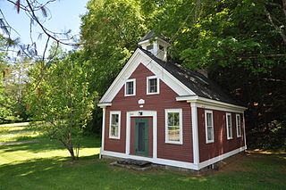
The Middletown Rural Historic District encompasses an area that was once the town center of Grafton, Vermont. Located northwest of Grafton Village along Middletown Road and adjacent roads, it includes nine well-preserved 19th-century properties, as well as the town's first cemetery and animal pound. The district was listed on the National Register of Historic Places in 2011.

The Whitingham Village Historic District encompasses much of the current village center of Whitingham, Vermont. It was developed mainly in the second half of the 19th century around industries powered by local water sources, and includes well-preserved architecture from that period. It was listed on the National Register of Historic Places in 2006.

Shaftsbury Center is an unincorporated village in the town of Shaftsbury in Bennington County, Vermont, United States. Located on Vermont Route 7A at West Mountain and Tunic Roads, near the town's geographic center, it was the town's main civic center through the middle of the 19th century. It is now a modest village with agricultural and tourist-oriented economic interests. Most of the village is listed on the National Register of Historic Places as the Center Shaftsbury Historic District.

Benson Village is the village center of the rural town of Benson, Vermont. The central portion of the village, stretching along Stage Road from Lake Road to Hulett Hill Road, is a historic district listed on the National Register of Historic Places as a well-preserved 19th-century village center.

The Clarendon House is a historic former hotel building on Clarendon Springs Lane in Clarendon, Vermont. Built about 1835 and enlarged in the 1850s, it is one of Vermont's finest examples of pre-Civil War resort architecture, and a rare little-altered survivor of that period. The building was listed on the National Register of Historic Places in 1976. It and adjacent buildings are vacant and for sale.

The Danby Village Historic District encompasses much of the town center of Danby, Vermont. It is centered on a stretch of Main Street, roughly between Depot Street and Brook Road. The village has a cohesive collection of mid-19th century architecture, mostly residential, with a modest number of later additions. The district was listed on the National Register of Historic Places in 1983.
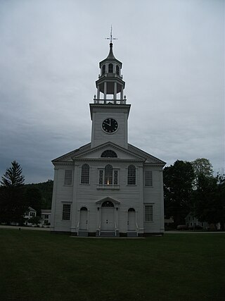
The East Poultney Historic District encompasses the historic center of the rural village of East Poultney, Vermont. The district is centered on the triangular green at the center of the village, and was developed mainly from the late 18th through mid-19th centuries, producing a village with strong Federal and Greek Revival architecture. It was listed on the National Register of Historic Places in 1978.
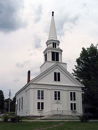
The Middletown Springs Historic District encompasses most of the village center of Middletown Springs, Vermont. Oriented around the crossroads junction of Vermont Routes 140 and 133, the village has a well-preserved collection of mainly mid-19th century architecture, including a significant number of Italianate buildings. The district was listed on the National Register of Historic Places in 1985.

Mountain View Stock Farm, now known as Tylord Farm, is a historic estate farm on Vermont Route 22A in Benson, Vermont. Developed in the early 20th century around a late 18th-century farmhouse, the farm was renowned in the state for its breeding of Kentucky saddle horses and Chester White hogs. The farm complex also has architecturally distinctive Colonial Revival styling. The property was listed on the National Register of Historic Places in 1989.

The Pittsford Green Historic District encompasses the heart of the traditional village center of Pittsford, Vermont. Centered on a stretch of United States Route 7, the village's development began in the late 18th century, and now consists almost entirely of buildings from the 19th century. The district was listed on the National Register of Historic Places in 1982.
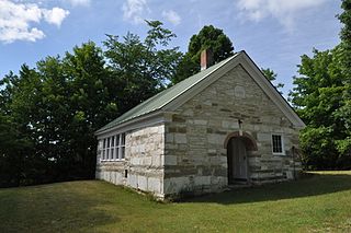
The Sudbury School No. 3, also known as the Hill School, is a historic district school building at the junction of Vermont Routes 30 and 73 in Sudbury, Vermont. Built in the 1820s, it is a well-preserved example of the period, executed in stone. It was listed on the National Register of Historic Places in 1978.
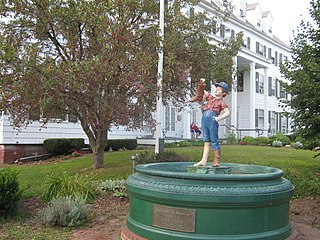
The Wallingford Main Street Historic District encompasses the historic portions of the village of Wallingford, Vermont. An essentially linear district extending along Main Street on either side of School Street, it has a well-preserved array of 19th and early-20th century residential, commercial, and civic buildings. It was listed on the National Register of Historic Places in 1984.
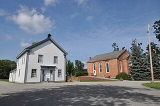
The School House and Town Hall is a historic municipal building on Schoolhouse Road, just west of United States Route 7 in the center of Leicester, Vermont. Built about 1858, it is a fine example of late Greek Revival architecture, and is the town's best-preserved district schoolhouse. Its upper floor has served as the town hall since its construction. It was listed on the National Register of Historic Places in 1988.
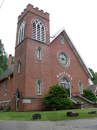
The Springfield Downtown Historic District encompasses the historic central business district of the town of Springfield, Vermont. Located in a narrow valley on the banks of the Black River, the town's architecture is primarily reflective of its importance as a manufacturing center in the late 19th and early-to-mid 20th centuries, with a cluster of commercial buildings surrounded by residential and industrial areas. It was listed on the National Register of Historic Places in 1983, and enlarged slightly in 1986.

The Stockbridge Common Historic District encompasses the central portion of a rural 19th-century village center in Stockbridge, Vermont. Including the town common as well as a few buildings and an adjacent cemetery, it is a well-preserved example of a village bypassed by economic development during the 19th century industrial period. It was listed on the National Register of Historic Places in 1990.
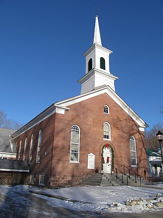
The Jericho Center Historic District encompasses much of the central village of Jericho, Vermont. Centered on the town green at the meeting point of Brown's Trace, Varney Road, and Bolger Hill Road, the center is a well-preserved Vermont country village developed mainly in the 19th and early 20th centuries. It was listed on the National Register of Historic Places in 1983.

The Stowe Village Historic District encompasses most of the village center of Stowe, Vermont. The village has since the 19th century been one of Vermont's major resort centers, and its center is architecturally reflective of this history, It was listed on the National Register of Historic Places in 1978.


