
The Waterville Village Historic District encompasses most of the history 19th and early 20th-century village center of Waterville, Vermont. The village grew from beginnings late in the 18th century to serve as a modest civic, commercial, and residential hub for the rural community. It was added to the National Register of Historic Places in 2007.

The Barre Downtown Historic District encompasses the historic commercial and civic heart of the city of Barre, Vermont. Extending along Main Street from City Park to Depot Square, this area was developed quite rapidly in the 1880s and 1890s, when the area experienced rapid growth due to the expansion of the nearby granite quarries. It was listed on the National Register of Historic Places in 1979.
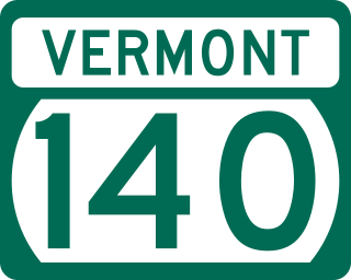
Vermont Route 140 (VT 140) is a state highway in the U.S. state of Vermont. The highway runs 25.059 miles (40.329 km) from VT 30 in Poultney east to VT 103 in Mount Holly. VT 140 connects the southern Rutland County towns of Poultney, Middletown Springs, Tinmouth, Wallingford, and Mount Holly.

The West Brattleboro Green Historic Districts encompasses the historic core of the village of West Brattleboro, Vermont. Centered in the triangular green at South Street and Western Avenue, it includes a modest collection of buildings constructed between about 1800 and 1910. It was listed on the National Register of Historic Places in 2002.

The Danby Village Historic District encompasses much of the town center of Danby, Vermont. It is centered on a stretch of Main Street, roughly between Depot Street and Brook Road. The village has a cohesive collection of mid-19th century architecture, mostly residential, with a modest number of later additions. The district was listed on the National Register of Historic Places in 1983.
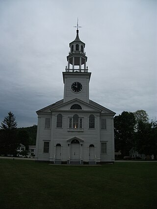
The East Poultney Historic District encompasses the historic center of the rural village of East Poultney, Vermont. The district is centered on the triangular green at the center of the village, and was developed mainly from the late 18th through mid-19th centuries, producing a village with strong Federal and Greek Revival architecture. It was listed on the National Register of Historic Places in 1978.

The Fair Haven Green Historic District encompasses the village green of Fair Haven, Vermont, and the heterogeneous collection of civic, commercial, and residential buildings that line it and adjacent streets. The area was developed mainly following the arrival of the railroad in 1848 and the subsequent expansion of marble and slate quarries in the area. The district was listed on the National Register of Historic Places in 1980.
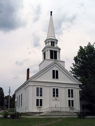
The Middletown Springs Historic District encompasses most of the village center of Middletown Springs, Vermont. Oriented around the crossroads junction of Vermont Routes 140 and 133, the village has a well-preserved collection of mainly mid-19th century architecture, including a significant number of Italianate buildings. The district was listed on the National Register of Historic Places in 1985.
The Poultney Central School is a historic former school building on Main Street in the village center of Poultney, Vermont. Built in 1885, it is a high quality example of Late Victorian Italianate architecture executed in brick. It was listed on the National Register of Historic Places in 1977, and has been converted into residential use.

The Rutland Courthouse Historic District encompasses an architecturally cohesive area of civic and residential buildings in Rutland, Vermont. Roughly bounded by Court, Washington, South Main, and West Streets, the district was principally developed between 1850 and 1875, and includes a number of prominent municipal and county buildings, including the Rutland County courthouse, the Rutland Free Library, and the Grace Congregational United Church. The district was listed on the National Register of Historic Places in 1976.

The Wallingford Main Street Historic District encompasses the historic portions of the village of Wallingford, Vermont. An essentially linear district extending along Main Street on either side of School Street, it has a well-preserved array of 19th and early-20th century residential, commercial, and civic buildings. It was listed on the National Register of Historic Places in 1984.

The Bethel Village Historic District encompasses the historic core of the village of Bethel in the town of Bethel, Vermont, USA. The L-shaped district extends along Main and Church Streets, including many of the village's commercial and civic buildings, as well as a significant number of 19th and early 20th-century residences. The district was listed on the National Register of Historic Places in 1976, and was slightly enlarged in 1990.

The South Royalton Historic District encompasses the central portion of the village of South Royalton, Vermont. Now the town of Royalton's principal commercial center, it developed in the second half of the 19th century around the depot of the Vermont Central Railroad. The district includes fine examples of Greek Revival and Victorian architecture, and is home to the Vermont Law School. It was listed on the National Register of Historic Places in 1976.

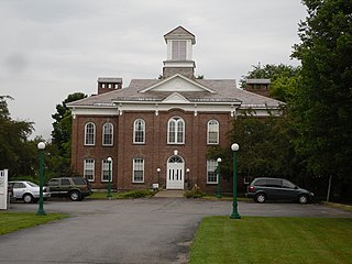
The Randolph Center Historic District encompasses the historic early town center of Randolph, Vermont. Established in 1783, it was later eclipsed by Randolph Village, which developed around the town's main railroad depot. The village now has a distinguished array of late 18th and early 19th-century architecture and is home to an academic campus now housing Vermont State University. It was listed on the National Register of Historic Places in 1974.

The Weston Village Historic District encompasses the town center and principal village of Weston, Vermont. Centered on Farrar Park, which serves as the town green, it includes a diversity of architectural styles from the late 18th century to about 1935, and includes residential, civic, commercial, industrial and religious buildings. It was listed on the National Register of Historic Places in 1985.

The Plainfield Village Historic District encompasses a significant portion of the village of Plainfield, Vermont. Located in northernmost Plainfield on United States Route 2, the village grew in the 19th century as a mill town and service community for the surround agricultural areas, and has a well-preserved collection of Greek Revival and Italianate architecture. It was listed on the National Register of Historic Places in 1983.

The St. Albans Historic District encompasses most of the historic commercial core of the city of St. Albans, Vermont. The district includes the historic town common, which acts as its focal center, and commercial and civic architecture dating from the early 19th to early 20th centuries. The district was listed on the National Register of Historic Places in 1980.

The Shelburne Village Historic District encompasses the central portion of the main village of Shelburne, Vermont. Centered on the junction of United States Route 7 with Harbor and Falls Roads, the district's architecture traces the town's history from the 18th to early 20th century. It was listed on the National Register of Historic Places in 1990.

The Morrisville Historic District encompasses most of the historic commercial downtown area of the village of Morrisville in Morristown, Vermont. Developed in the early 19th century as a service town for the surrounding agricultural areas, it was transformed into a major service regional commercial center by the arrive of the railroad in 1872. Its surviving architecture is largely reflective of these two time periods. It was listed on the National Register of Historic Places in 1983, and enlarged in 2007.

The St. Johnsbury Historic District encompasses much of the historic civic and commercial center of St. Johnsbury, Vermont. Representing a significant expansion of the Railroad Street Historic District and the St. Johnsbury Main Street Historic District, it captures the historical tension and competition between Main Street and Railroad Street for primacy as the town's most important civic and commercial areas. The district was listed on the National Register of Historic Places in 1980.


