
The Main Street Historic District encompasses the historic commercial center of Middletown, Connecticut, United States. Middletown was one of the most important ports on the Connecticut River during the colonial period, and Main Street "has been the center of community life since the earliest period of settlement". Today Main Street is home to a number of 19th century buildings, maintaining the bulk of its historic character. It was listed on the National Register of Historic Places in 1983.

The East Blackstone Village Historic District is a historic district roughly along Elm Street at the junction with Summer Street in eastern Blackstone, Massachusetts. It encompasses a small 19th-century mill village center that developed along what was once a major roadway connecting Worcester with Providence, Rhode Island. The district was added to the National Register of Historic Places in 1995.

The South Britain Historic District encompasses the core of the unincorporated village of South Britain in Southbury, Connecticut, United States. The village arose in the 18th century as an industrial center serving the surrounding agricultural community, powered by the Pomperaug River, and rivalled the town center of Southbury in importance. The district was listed on the National Register of Historic Places in 1987.

The Village of Monroe Historic District, also known as the Smith's Mill Historic District, is located in Monroe, New York, United States. It is an irregularly shaped 81-acre (33 ha) area containing 36 properties, primarily residential but with some churches and commercial buildings, in the center of the village, just east of its downtown. In 1998 it was listed on the National Register of Historic Places.

The Waterville Village Historic District encompasses most of the history 19th and early 20th-century village center of Waterville, Vermont. The village grew from beginnings late in the 18th century to serve as a modest civic, commercial, and residential hub for the rural community. It was added to the National Register of Historic Places in 2007.

The North Charlestown Historic District encompasses a 19th-century rural village in Charlestown, New Hampshire. Located about 5 miles (8 km) north of the town's center, the district includes a small cluster of buildings along New Hampshire Route 12A that is a remnant portion of a larger agricultural village. First settled in the 1750s, the oldest buildings in the district date to the 1790s, and most of the major buildings were built in the 19th century. Its economy was based on lumber and farming. The village was once considered a much larger, dispersed settlement, but construction of New Hampshire Route 11 in the 1960s separated some of the more remote parts of the village from its nucleus, which was bypassed by that construction.
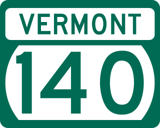
Vermont Route 140 (VT 140) is a state highway in the U.S. state of Vermont. The highway runs 25.059 miles (40.329 km) from VT 30 in Poultney east to VT 103 in Mount Holly. VT 140 connects the southern Rutland County towns of Poultney, Middletown Springs, Tinmouth, Wallingford, and Mount Holly.

The Grafton Village Historic District encompasses the historic village center of the town of Grafton, Vermont. The village was developed in the early-to-mid 19th century, and has retained the character of that period better than many small communities in the state. The district was listed on the National Register of Historic Places in 2010.

The Mechanicsville Historic District encompasses a cluster of residential properties that are all that remain of one of the early industrial areas of Grafton, Vermont. Located a short way east of Grafton Village on Vermont Route 121, it includes ten well-preserved 19th-century properties, some located on properties where early mills once stood. The district was listed on the National Register of Historic Places in 2010.
The Middletown Rural Historic District encompasses an area that was once the town center of Grafton, Vermont. Located northwest of Grafton Village along Middletown Road and adjacent roads, it includes nine well-preserved 19th-century properties, as well as the town's first cemetery and animal pound. The district was listed on the National Register of Historic Places in 2011.

The Danby Village Historic District encompasses much of the town center of Danby, Vermont. It is centered on a stretch of Main Street, roughly between Depot Street and Brook Road. The village has a cohesive collection of mid-19th century architecture, mostly residential, with a modest number of later additions. The district was listed on the National Register of Historic Places in 1983.
The East Poultney Historic District encompasses the historic center of the rural village of East Poultney, Vermont. The district is centered on the triangular green at the center of the village, and was developed mainly from the late 18th through mid-19th centuries, producing a village with strong Federal and Greek Revival architecture. It was listed on the National Register of Historic Places in 1978.

The Poultney Main Street Historic District encompasses the commercial and residential historic core of the village of Poultney, Vermont. Centered on Main Street and East Main Street, between College Avenue and St. Raphael's Catholic Church, the district includes a diversity of architectural styles, as well as civic, religious, and commercial functions spanning a period of more than 100 years. The district was listed on the National Register of Historic Places in 1988.

The Wallingford Main Street Historic District encompasses the historic portions of the village of Wallingford, Vermont. An essentially linear district extending along Main Street on either side of School Street, it has a well-preserved array of 19th and early-20th century residential, commercial, and civic buildings. It was listed on the National Register of Historic Places in 1984.

The South Royalton Historic District encompasses the central portion of the village of South Royalton, Vermont. Now the town of Royalton's principal commercial center, it developed in the second half of the 19th century around the depot of the Vermont Central Railroad. The district includes fine examples of Greek Revival and Victorian architecture, and is home to the Vermont Law School. It was listed on the National Register of Historic Places in 1976.

The Stockbridge Common Historic District encompasses the central portion of a rural 19th-century village center in Stockbridge, Vermont. Including the town common as well as a few buildings and an adjacent cemetery, it is a well-preserved example of a village bypassed by economic development during the 19th century industrial period. It was listed on the National Register of Historic Places in 1990.

The Weston Village Historic District encompasses the town center and principal village of Weston, Vermont. Centered on Farrar Park, which serves as the town green, it includes a diversity of architectural styles from the late 18th century to about 1935, and includes residential, civic, commercial, industrial and religious buildings. It was listed on the National Register of Historic Places in 1985.

The Tunbridge Village Historic District encompasses the early 19th-century village center of Tunbridge, Vermont. Stretched linearly along Vermont Route 110, the largely agricultural village reached its peak population around 1820, and was bypassed by the railroads, limiting later development. It was listed on the National Register of Historic Places in 1994.

The Plainfield Village Historic District encompasses a significant portion of the village of Plainfield, Vermont. Located in northernmost Plainfield on United States Route 2, the village grew in the 19th century as a mill town and service community for the surround agricultural areas, and has a well-preserved collection of Greek Revival and Italianate architecture. It was listed on the National Register of Historic Places in 1983.

The Warren Village Historic District encompasses the village center of Warren, Vermont, United States. Stretched mainly along Main Street east of the Mad River, it is a well-preserved 19th-century mill village, although most of its period mill infrastructure has been lost. The district has good examples of Greek Revival, Italianate, and Second Empire architecture. It was listed on the National Register of Historic Places in 1992.


