Tojo Una-Una Regency

Last updated
Tojo Una-Una Regency
Kabupaten Tojo Una-Una
Lambang Kabupaten Tojo Una-Una.png
Motto(s): 
Sivia Patuju
(One Purpose)
Locator Kabupaten Tojo Una-Una.svg
Location within Central Sulawesi
Sulawesi location map plain.svg
Red pog.svg
Tojo Una-Una Regency
Location in Sulawesi and Indonesia
Indonesia location map.svg
Red pog.svg
Tojo Una-Una Regency
Tojo Una-Una Regency (Indonesia)
Coordinates: 0°52′32″S121°37′47″E / 0.87556°S 121.62972°E / -0.87556; 121.62972
Country Indonesia
Province Central Sulawesi
Capital Ampana
Government
  RegentMuhammad Lahay
  Vice RegentAdmin A.S Lasimpala
Area
  Total5,721.51 km2 (2,209.09 sq mi)
Population
 (mid 2021 estimate) [1]
  Total166,339
  Density29/km2 (75/sq mi)
Time zone UTC+8 (ICST)
Area code (+62) 464
Website tojounaunakab.go.id

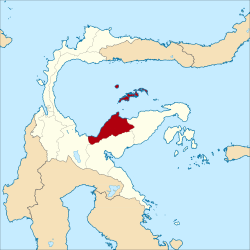
Tojo Una-Una Regency is a regency of Central Sulawesi, Indonesia. The administrative centre is at Ampana town, on the Sulawesi 'mainland'. While the Regency includes a considerable area on the eastern peninsula of Sulawesi, it also includes the Togian Islands in the Gulf of Tomini. The total area covers 5,721.51 km2 and the population was 134,945 at the 2010 Census and 163,829 at the 2020 Census; [2] the official estimate as at mid 2021 was 166,339. [3]

Contents

History

In 1999, Tojo Una-Una Regency was created out of the eastern portion of Poso Regency. [4]

Administration

At the time of the 2010 Census, the Tojo Una-Una Regency was divided into nine districts (kecamatan). Subsequent to 2010, three additional districts have been created - Batudaka, Ratolindo and Talatako. These are tabulated below with their areas and their 2010 and 2020 Census populations, [5] together with the official estimate as at mid 2021. [6] The table also includes the locations of the district administrative centres, the number of villages (rural desa and urban kelurahan) in each district, and its post code.

NameArea in
km2
Population
Census
2010
Population
Census
2020
Population
Estimate
mid 2021
Administrative
centre
No. of
villages
Post
code
Tojo Barat
(West Tojo)
1,092.2711,35812,99213,141Tombiano1394680
Tojo 1,065.4812,48813,92814,056Uekuli1694681
Ulubongka 1,767.1114,66918,27218,517Marowo1894682
Ampana Tete 796.0221,61027,61428,136Tete A2094684
Ampana Kota
(Ampana Town)
175.4239,28920,85421,364Ampana1094683
Ratolindo61.88(a)28,73529,153Sumoli1094683
- 94695
Total Sulawesi mainland4,958.1899,414122,395124,36787
Una-Una 146.1612,4558,2368,315Wakai1194690
Batudaka151.91(b)5,7965,858Molowagu994690
& 94691
Togean 229.519,16010,73410,889Lebitii1694686
Walea Kepulauan
(Walea Islands)
67.6010,0655,5685,608Popoliii994694
Walea Besar
(Great Walea)
84.513,8514,6294,705Pasokani894693
Talatako83.64(c)6,4716,597Kaliai694692
Total Togean Islands 763.3335,53141,43441,97259

Notes:
(a) The 2010 Census population of Ratolindo district is included in the figure for Ampana Kota district, from which it was cut out.
(b) The 2010 Census population of Batudaka district is included in the figure for Una-Una district, from which it was cut out.
(c) The 2010 Census population of Talatako district is included in the figure for Walea Kepulauan district, from which it was cut out.

Dive sites

The best place to do diving is Una Una volcano island.

Based on Badan Koordinasi Survei dan Pemetaan Nasional (Bakosurtanal) or Coordinating Agency for Surveys and Mapping, there are 33 dive sites disperses from north to south beaches of the Togian Islands with fringing reefs, barrier reefs, patch reefs and atolls. The area has the third most biodiversity in the world and is a series of Bunaken National Marine Park and Raja Ampat Islands. [7]

Related Research Articles

<span class="mw-page-title-main">Central Sulawesi</span> Province of Indonesia

Central Sulawesi is a province of Indonesia located at the centre of the island of Sulawesi. The administrative capital and largest city is located in Palu. The 2010 census recorded a population of 2,635,009 for the province, and the 2020 Census recorded 2,985,734, of whom 1,534,706 were male and 1,451,028 were female. The official estimate as at mid 2022 was 3,066,143. Central Sulawesi has an area of 61,605.72 km2 (23,786 sq mi), the largest area among all provinces on Sulawesi Island, and has the second-largest population on Sulawesi Island after the province of South Sulawesi. It is bordered by the provinces of Gorontalo to the north, West Sulawesi, South Sulawesi and South East Sulawesi to the south, by Maluku to the east, and by the Makassar Strait to the west. The province is inhabited by many ethnic groups, such as the Kaili, Tolitoli, etc. The official language of the province is Indonesian, which is used for official purposes and inter-ethnic communication, while there are several indigenous language spoken by the Indigenous peoples of Central Sulawesi. Islam is the dominant religion in the province, followed by Christianity which is mostly adhered to by the people in the eastern part of the province.

<span class="mw-page-title-main">Anambas Islands Regency</span> Regency in Riau Islands, Indonesia

Anambas Islands Regency is a small archipelago of Indonesia, located 150 nautical miles northeast of Batam Island in the North Natuna Sea between the Malaysian mainland to the west and the island of Borneo to the east. Geographically part of the Tudjuh Archipelago, it is administratively a regency within the Riau Islands Province. It covers a land area of 590.14 square kilometres (227.85 sq mi) and had a population of 37,411 at the 2010 Census and 47,402 at the 2020 Census. The administrative centre is at Tarempa on Siantan Island.

<span class="mw-page-title-main">Banggai Regency</span> Regency in Sulawesi, Indonesia

The Banggai Regency is a regency located at the eastern end of Central Sulawesi Province of Indonesia. It makes up a re-established regency (kabupaten), created in 1999 by splitting the existing Banggai Regency into this smaller Banggai Regency situated on the mainland of Sulawesi and a new Banggai Islands Regency comprising the offshore islands which are separated from mainland Sulawesi by the Peleng Straits. The residual Banggai Regency covers an area of 9,672.70 km2 and had a population of 323,626 at the 2010 census and 362,275 at the 2020 census; the official estimate as at mid 2021 was 366,224.

<span class="mw-page-title-main">Togian Islands</span> Island group in Indonesia

The Togian Islands are an archipelago of 56 islands and many offshore islets, situated in the Gulf of Tomini, off the coast of Central Sulawesi, in Indonesia. The largest islands are Batudaka, Togean, Talatako and Una-Una. There are 59 villages on the islands, with one settled by the Bajau people, more commonly known as the sea gypsies.

<span class="mw-page-title-main">Gorontalo Regency</span> Regency in Indonesia

Gorontalo is a regency of Gorontalo Province, Indonesia, on the island of Sulawesi. It was established in 1959 under Law Number 29/1959, but has subsequently been reduced in area as additional regencies have been cut out of it. It now has an area of 2,125.47 km2 and had a population of 355,988 at the 2010 Census and 393,107 at the 2020 Census; the official estimate as at mid 2021 was 395,635. The administrative headquarters of the regency is in the town of Limboto.

<span class="mw-page-title-main">Bone Bolango Regency</span> Regency in Indonesia

Bone Bolango is a regency of Gorontalo Province, Indonesia, on the island of Sulawesi. It was established in 2003 under Law Number 6/2003from the former eastern districts of Gorontalo Regency. It has an area of 1,915.44 km2 and had a population of 141,915 at the 2010 Census and 162,778 at the 2020 Census; the official estimate as at mid 2021 was 164,277. The administrative centre of the regency is the town of Suwawa.

<span class="mw-page-title-main">Pohuwato Regency</span> Regency in Indonesia

Pohuwato is a regency of Gorontalo Province, Indonesia. It is located on the island of Sulawesi. It was established in 2003 under Law Number 6/2003 by splitting off from the western part of Boalemo Regency. It has an area of 4,244.31 km2, and had a population of 128,748 at the 2010 Census and 146,432 at the 2020 Census; the official estimate as at mid 2021 was 147,689. The seat of the regency administration is in the town of Marisa.

<span class="mw-page-title-main">North Gorontalo Regency</span> Regency in Indonesia

North Gorontalo is a regency of Gorontalo Province, Indonesia, stretching along the entire northern coast of the province. It is located on the northern peninsula of the island of Sulawesi. It was established in 2007 under Law Number 11/2007 from the former northern districts of Gorontalo Regency. The new regency has an area of 1,777.02 km2, and it had a population of 104,133 at the 2010 Census and 124,957 at the 2020 Census; the official estimate as at mid 2021 was 126,521. Its regency seat is the town of Moluo in Kwandang District.

<span class="mw-page-title-main">Mamuju Regency</span> Regency in Sulawesi, Indonesia

Mamuju Regency is a regency of West Sulawesi province, Indonesia. The regency capital is at Karema, while Mamuju town is the capital of West Sulawesi. The population of the regency was 336,879 at the 2010 Census, but it was substantially reduced by the creation of the new Central Mamuju Regency which was cut out of it in 2012. The reduced Mamuju Regency covers an area of 4,954.57 km2 and had a population of 278,764 at the 2020 Census. The official estimate as at mid 2021 was 281,854.

<span class="mw-page-title-main">Bombana Regency</span> Regency in Southeast Sulawesi, Indonesia

Bombana Regency is a regency of Southeast Sulawesi Province of Indonesia. It consists of part of the southeast peninsula of Sulawesi, together with most of the substantial offshore island of Kabaena to the south. It covers an area of 3,316.16 km2, and had a population on 139,235 at the 2010 Census and 150,706 at the 2020 Census; the official estimate as at mid 2021 was 151,910. The administrative centre lies at the town of Rumbia.

<span class="mw-page-title-main">Buton Regency</span> Regency in Southeast Sulawesi, Indonesia

Buton Regency is a regency of Indonesia's Southeast Sulawesi Province, lying entirely on Buton Island. Until 2014 it had an area of 2,681.22 km2, and a population estimated at 276,944. However, in 2014 it was divided into three regencies, with two new regencies being cut out of it; the residual area now is 1,648.04 km2, and the districts in that area contained a population of 94,388 at the 2010 Census while the 2020 Census produced a total of 115,207; the official estimate as at mid 2021 was 117,040.

<span class="mw-page-title-main">Kolaka Regency</span> Regency in Southeast Sulawesi, Indonesia

Kolaka Regency is a regency of Southeast Sulawesi Province, Indonesia. It covers an area of 2,958.69 km2 and had a population of 208,817 at the 2010 Census, rising to 237,587 at the 2020 Census. The principal town lies at Kolaka.

<span class="mw-page-title-main">North Kolaka Regency</span> Regency in Southeast Sulawesi, Indonesia

North Kolaka Regency is a regency in the northwest part of Southeast Sulawesi province of Indonesia. It covers an area of 2,924.46 km2, and had a population of 121,476 at the 2010 Census, and 137,700 at the 2020 Census. The principal town lies at Lasusua.

<span class="mw-page-title-main">Morowali Regency</span> Regency in Central Sulawesi, Indonesia

Morowali Regency is a regency of Central Sulawesi Province of Indonesia. It covers an area of 5,472 km2 and the districts now within the regency had a combined population of 102,228 at the 2010 Census; the regency population at the 2020 Census was 161,727; the official estimate as at mid 2021 was 167,810. The administrative centre is at the town of Bungku. The Regency includes the far-flung Menui Islands, lying to the southwest of the rest of the province.

<span class="mw-page-title-main">Poso Regency</span> Regency in Central Sulawesi, Indonesia

Poso Regency is a regency of Central Sulawesi Province of Indonesia. It covers an area of 7,112.25 km2, and had a population of 209,228 at the 2010 Census and 244,875 at the 2020 Census; the official estimate as at mid 2021 was 248,345. The principal town lies at Poso.

<span class="mw-page-title-main">Sigi Regency</span> Regency in Central Sulawesi, Indonesia

Sigi Regency is a regency of Central Sulawesi, Indonesia. It lies upstream on the Palu River, and immediately south of Palu city, the provincial capital. It covers an area of 5,196.02 km2 and had a population of 215,030 at the 2010 Census and 239,421 at the 2020 Census; the official estimate as at mid 2021 was 261,676. The principal town lies at Sigi Biromaru.

<span class="mw-page-title-main">East Bolaang Mongondow Regency</span> Regency in North Sulawesi, Indonesia

East Bolaang Mongondow Regency is a regency of North Sulawesi Province of Indonesia. It covers an area of 910.18 sq km and had a population of 63,654 at the 2010 Census, rising to 87,241 at the 2020 Census. The principal town lies at Tutuyan.

<span class="mw-page-title-main">South Bolaang Mongondow Regency</span> Regency in North Sulawesi, Indonesia

South Bolaang Mongondow Regency is a regency of North Sulawesi Province of Indonesia. It covers an area of 1,932.30 km2, and had a population of 57,001 at the 2010 Census, which rose to 69,791 at the 2020 Census. The principal town lies at Molibagu.

<span class="mw-page-title-main">North Morowali Regency</span> Regency in Sulawesi, Indonesia

North Morowali Regency is a regency in the province of Central Sulawesi, Indonesia. The regency was established on 12 April 2013, partitioned from the northwestern districts of Morowali Regency. It covers an area of 10,004.28 km2 and the component districts had a combined population of 104,094 at the 2010 Census. The new regency had 120,789 inhabitants at the 2020 Census - comprising 62,965 male and 57,824 female; the official estimate as at mid 2021 was 122,240. The principal town lies at Kolonodale.

<span class="mw-page-title-main">Togean Island</span> Indonesian island in the Gulf of Tomini, part of Togean Archipelago

Togean is an Indonesian island in the Gulf of Tomini, part of the Togean Archipelago. It is administratively part of the Tojo Una-Una Regency of Central Sulawesi, consisting largely of the Togean District with the Tanjung Pude village, part of the Una Una District, sitting on the western part of the island.

References

  1. Badan Pusat Statistik, Jakarta, 2022.
  2. Badan Pusat Statistik, Jakarta, 2021.
  3. Badan Pusat Statistik, Jakarta, 2022.
  4. Sangadji, Ruslan (21 February 2007). "Residents say a divided Poso could be a more peaceful place". The Jakarta Post.
  5. Badan Pusat Statistik, Jakarta, 2021.
  6. Badan Pusat Statistik, Jakarta, 2022.
  7. "Surga Dasar Laut yang Memukau Perairan Togean". May 13, 2012.

Coordinates: 0°52′32″S121°37′47″E / 0.87556°S 121.62972°E / -0.87556; 121.62972