Sigi Regency

Last updated
Sigi Regency
Kabupaten Sigi
Lambang Kabupaten Sigi.png
Motto(s): 
Mareso Masagena (Kaili)
(Difficult and Happy to be Together)
Locator Kabupaten Sigi.svg
Location within Central Sulawesi
Sulawesi location map plain.svg
Red pog.svg
Sigi Regency
Location in Sulawesi and Indonesia
Indonesia location map.svg
Red pog.svg
Sigi Regency
Sigi Regency (Indonesia)
Coordinates: 1°23′06″S119°58′01″E / 1.38500°S 119.96694°E / -1.38500; 119.96694
Country Indonesia
Province Central Sulawesi
Capital Sigi Biromaru
Government
  RegentMohamad Irwan, S.Sos., M.Si
  Vice RegentDr. Samuel Yansen Pongi, SE., M.Si
Area
  Total5,196.02 km2 (2,006.19 sq mi)
Population
 (mid 2023 estimate) [1]
  Total266,656
  Density51/km2 (130/sq mi)
Time zone UTC+8 (ICST)
Area code (+62) 451
Website sigikab.go.id

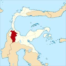
Sigi Regency is a regency of Central Sulawesi, Indonesia. It was created on 21 July 2008 by splitting off the southern districts from Donggala Regency. It lies upstream on the Palu River, and immediately south of Palu city, the provincial capital. It covers an area of 5,196.02 km2 and had a population of 215,030 at the 2010 Census [2] and 239,421 at the 2020 Census; [3] the official estimate as at mid 2023 was 266,656 (comprising 136,510 males and 130,140 females). [1] The principal town lies at Sigi Biromaru.

Contents

Sigi Regency was one of the areas in northwest Sulawesi most affected by the 2018 earthquake and tsunami in Sulawesi. Dozens of people were reported to have been killed by the earthquake and there were reports of "massive liquification" which caused homes to be swept away.

Prince and princess of Kulawi COLLECTIE TROPENMUSEUM De vorst en vorstin van Kulawi Celebes TMnr 10001615.jpg
Prince and princess of Kulawi
Marego dancers in Kulawi COLLECTIE TROPENMUSEUM De 'Marego' dans te Kulawi Donggala Celebes TMnr 10003457.jpg
Marego dancers in Kulawi
Woman in traditional dress in Kulawi COLLECTIE TROPENMUSEUM Portret van een vrouw uit Koelawie in traditionele kleding TMnr 10005916.jpg
Woman in traditional dress in Kulawi

Conflicts

Following religious conflicts in the neighbouring Poso Regency, the Indonesia government mounted Operation Tinombala in early 2016 to combat local terrorist activities carried out by the East Indonesia Mujahiddin (Mujahiddin Indonesian Timur, or MIT) in the province. [4] In late November 2020, there were indications that the conflict had spread into Sigi Regency when four residents of remote Lembantongoa village were killed in an apparent terrorist attack attributed to MIT. [5] Indonesia's senior Coordinating Political, Legal and Security Minister Mahfud MD issued a statement saying that the government was committed to tracking down those responsible for the murders and the accompanying destruction.

Administrative Districts

The Sigi Regency was divided at 2010 and at 2020 into fifteen districts (kecamatan), but on 14 September 2020 a sixteenth district (Sigi Kota) was formed from parts of Sigi Biromaru (7 desa), Dolo (2 desa) and Palolo (1 desa) Districts. The districts are tabulated below with their areas and their populations at the 2010 Census [2] and 2020 Census, [3] together with the official estimates as at mid 2023. [1] The table also includes the locations of the district administrative centres, and the numbers of villages (all rated as rural desa) in each district.

Kode
Wilayah
Name of
District
(kecamatan)
Area
in
km2
Pop'n
Census
2010
Pop'n
Census
2020
Pop'n
Estimate
mid 2023
Admin
centre
No.
of
desa
72.10.07Pipikoro956.137,8178,7208,615Peana19
72.10.06Kulawi Selatan
(South Kulawi)
418.128,4739,4409,772Lawua12
72.10.05Kulawi1,053.5614,17215,81016,305Bolapopo16
72.10.04 Lindu 552.034,6905,2505,557Tomado5
72.10.03 Nokilalaki 75.195,6266,2605,731Kamarora5
72.10.02Palolo581.4827,38530,44029,983Makmur21
73.10.08Gumbasa176.4911,68213,01013,578Pakuli7
72.10.10Tanambulava56.337,8668,7709,895Sibalaya Utara5
72.10.09Dolo Selatan
(South Dolo)
584.7114,44816,08017,284Baluase12
72.10.11Dolo Barat
(West Dolo)
112.1812,57614,01015,183Kalele12
72.10.12Dolo21.7920,59122,93023,206Kota Pulu9
72.10.01Sigi Biromaru175.2942,85747,71048,775Mpanau10
72.10.14Marawola38.6520,99123,36030,068Binangga11
72.10.15Marawola Barat
(West Marawola)
150.516,3827,1005,789Dombu12
72.10.13Kinovaro70.389,47410,54010,794Porame10
72.10.16Sigi Kota
(Sigi Town)
173.10(a)(a)16,121Bora10
Totals5,196.02215,030239,421266,656Sigi Biromaru177

Note (a) the population of the new Sigi Kota District in 2010 and 2020 is included in the figures for Sigi Biromaru, Dolo and Palolo Districts, from parts of which it was created on 14 September 2020.

Related Research Articles

<span class="mw-page-title-main">Central Sulawesi</span> Province of Indonesia

Central Sulawesi is a province of Indonesia located at the centre of the island of Sulawesi. The administrative capital and largest city is located in Palu. The province borders the provinces of Gorontalo to the east, Southeast Sulawesi, South Sulawesi, and West Sulawesi to the south, and sharing maritime borders with East Kalimantan to the west, North Maluku to the east, and Malaysia and the Philippines to the north.

<span class="mw-page-title-main">Palu</span> Capital and largest city of Central Sulawesi, Indonesia

Palu, officially known as the City of Palu, is the capital and largest city of Central Sulawesi Province in Indonesia. Palu is located on the northwestern coast of Sulawesi and borders Donggala Regency to the north and west, Parigi Moutong Regency to the east, and Sigi Regency to the south. The city boundaries encompass a land area of 395.06 km2 (152.53 sq mi). According to the 2020 Indonesian census, Palu had a population of 373,218, making it the third-most populous city on the island after Makassar and Manado; the official estimate as at mid 2023 was 387,493 - comprising 194,340 males and 193,150 females. Palu is the center of finance, government, and education in Central Sulawesi, as well as one of several major cities on the island. The city hosts the province's main port, its biggest airport, and most of its public universities.

<span class="mw-page-title-main">Donggala Regency</span> Regency in Central Sulawesi, Indonesia

Donggala Regency is a regency in the Central Sulawesi Province of Indonesia. It lies between 0° 30" north and 2°20" south latitude, and between 119° 45°" and 121° 45" east longitude, and covers a land area of 5,126.59 km2. It had a population of 277,236 at the 2010 Census and 300,436 at the 2020 Census; the official estimate as at mid 2023 was 308,301. The administrative capital of Donggala Regency is the town of Banawa, located a 30-minute drive (34 km) northwest from the city of Palu, the capital of the province.

<span class="mw-page-title-main">Soppeng Regency</span> Regency in South Sulawesi, Indonesia

Soppeng Regency is a landlocked regency in South Sulawesi province of Indonesia. Soppeng Regency has its seat of government (capital) in the town of Watansoppeng, located 180 km from Makassar. The regency covers an area of 1,557 km2, and had a population of 223,826 at the 2010 Census and 235,167 at the 2020 Census. The official estimate of population as of mid-2022 was 236,049.

<span class="mw-page-title-main">Polewali Mandar Regency</span> Regency in West Sulawesi, Indonesia

Polewali Mandar is one of the five regencies in West Sulawesi province of Indonesia. It borders on the regencies of Mamasa in the North, Majene in the West and Pinrang regency of South Sulawesi in the East. It covers an area of 2,074.76 km2 and had a population of 396,120 at the 2010 Census and 478,534 at the 2020 Census; the official estimate as at mid 2023 was 495,371. The regency is inhabited by various ethnic groups such as the Mandar, Buginese, Javanese and Toraja.

<span class="mw-page-title-main">Pinrang Regency</span> Regency in South Sulawesi, Indonesia

Pinrang Regency is one of the twenty-one regencies in South Sulawesi Province of Indonesia. Pinrang town is the administrative capital of Pinrang Regency. The regency covers 1,961.77 km2 and had a population of 351,161 at the 2010 Census and 403,994 at the 2020 Census; the official estimate as at mid 2022 was 411,795.

<span class="mw-page-title-main">Pasangkayu Regency</span> Regency in West Sulawesi, Indonesia

Pasangkayu Regency is one of the six regencies which comprise West Sulawesi Province, Indonesia, on the island of Sulawesi. It covers an area of 3,043.75 km2 and had a population of 134,303 at the 2010 Census and 188,861 at the 2020 Census. The official estimate as at mid 2023 was 204,216. The town of Pasangkayu is the capital and chief town of the regency.

<span class="mw-page-title-main">Mamasa Regency</span> Regency in West Sulawesi, Indonesia

Mamasa Regency is one of the six regencies that make up the West Sulawesi Province, Indonesia, on the island of Sulawesi. It covers a land area of 3,005.88 km2. The population was 140,082 at the 2010 Census and 163,383 at the 2020 Census; the official estimate as at mid 2023 was 170,354. Its capital is the town of Mamasa. The Mamasa people - which is a sub-group of the Toraja people - form the most common ethnic group.

<span class="mw-page-title-main">Bantaeng Regency</span> Regency in South Sulawesi, Indonesia

Bantaeng Regency is a regency of South Sulawesi Province in Indonesia. It covers an area of 395.83 km2 and had a population of 176,984 at the 2010 Census, rising to 196,716 at the 2020 Census. The official estimate as at mid 2022 was 199,399. The administrative centre is the town of Bantaeng, which lies on the south coast of the southern peninsula of Sulawesi island.

<span class="mw-page-title-main">Barru Regency</span> Regency in South Sulawesi, Indonesia

Barru Regency is a regency of South Sulawesi province of Indonesia. It covers an area of 1,174.72 km2 and had a population of 165,983 at the 2010 Census and 184,452 at the 2020 Census. The official estimate of population as of mid-2022 was 186,910. The principal town lies at Barru.

<span class="mw-page-title-main">Enrekang Regency</span> Regency in South Sulawesi, Indonesia

Enrekang Regency is an inland regency of South Sulawesi Province of Indonesia. It covers an area of 1,821.53 km2 and had a population of 190,175 at the 2010 census and 225,172 at the 2020 census; the official estimate as at mid 2022 was 228,554. The principal town lies at Enrekang.

<span class="mw-page-title-main">Jeneponto Regency</span> Regency in South Sulawesi, Indonesia

Jeneponto Regency is a regency of South Sulawesi Province of Indonesia. It covers most of the south coast of the southern peninsula of Sulawesi, with a total area of 749.79 km2 and a population of 342,222 at the 2010 Census and 401,610 at the 2020 Census. The official estimate for mid 2022 was 410,639. The principal town lies at Bontosunggu. The northern part of the regency consists of a plateau with an altitude of 500 to 1400 metres above sea level, the middle part has an altitude of 100 to 500 metres, while the south includes lowland areas with an altitude of 0 to 150 metres, including a coastline of 114 km on the Flores Sea.

<span class="mw-page-title-main">North Buton Regency</span> Regency in Southeast Sulawesi, Indonesia

North Buton Regency is a regency of Indonesia's Southeast Sulawesi Province, which was separated from Buton Regency in accordance with Indonesia's Law Number 14 of 2007. The area of the regency, which covers the north part of Buton Island, is 1,923.03 km2. Its population was 54,736 at the 2010 Census and 66,653 at the 2020 Census; the official estimate as at mid 2023 was 72,757. The administrative capital of the regency is at the town of Buranga, in Bonegunu District.

<span class="mw-page-title-main">Banggai Islands Regency</span> Regency in Sulawesi, Indonesia

The Banggai Archipelago is a group of islands, which are located at the far eastern end of Central Sulawesi, Indonesia. It makes up a regency (kabupaten) of Central Sulawesi Province of Indonesia, created on 4 October 1999 by splitting the existing Banggai Regency into a residual Banggai Regency situated on the mainland of Sulawesi and a new Banggai Islands Regency then comprising the entire archipelago. On 14 December 2012 a splitting of the Banggai Islands archipelago took place with the removal of the more southerly seven districts from the 13-year-old regency to form a separate Banggai Laut Regency.

<span class="mw-page-title-main">Parigi Moutong Regency</span> Regency in Central Sulawesi, Indonesia

Parigi Moutong Regency is a regency of Central Sulawesi Province of Indonesia. The regency was created on 10 April 2002 by splitting off the eastern districts previously part of Donggala Regency. It covers an area of 5,877.47 km2 and had a population of 413,588 at the 2010 Census and 440,015 at the 2020 Census; the official estimate as at mid 2023 was 457,031. The principal town lies at Parigi in the south of the regency.

<span class="mw-page-title-main">Poso Regency</span> Regency in Central Sulawesi, Indonesia

Poso Regency is a regency of Central Sulawesi Province of Indonesia. It covers an area of 7,438.55 km2, and had a population of 209,228 at the 2010 Census and 244,875 at the 2020 Census; the official estimate as at mid 2023 was 251,654. The principal town lies at Poso.

<span class="mw-page-title-main">Tojo Una-Una Regency</span> Administrative area in Central Sulawesi, Indonesia

Tojo Una-Una Regency is a regency of Central Sulawesi, Indonesia. The administrative centre is at Ampana town, on the Sulawesi 'mainland'. While the Regency includes a considerable area on the eastern peninsula of Sulawesi, it also includes the Togian Islands in the Gulf of Tomini. The total area covers 5,721.51 km2 and the population was 134,945 at the 2010 Census and 163,829 at the 2020 Census; the official estimate as at mid 2023 was 169,002.

<span class="mw-page-title-main">Kotamobagu</span> City

Kotamobagu is a city in North Sulawesi, Indonesia. Having previously been a town within the Bolaang Mongondow Regency, Kotamobagu was separated from that regency on 2 January 2007 to become an autonomous city. It is the principal centre of the southern part of the province, the Bolaang Mongondow region, which is projected by the Indonesian government to be separated from the rest of North Sulawesi and formed into a separate province. The city covers an area of 108.89 km2, and had a population of 107,459 at the 2010 Census, rising to 123,722 at the 2020 Census; the official estimate as at mid 2022 was 123,146.

<span class="mw-page-title-main">North Toraja Regency</span> Regency in South Sulawesi, Indonesia

North Toraja is a landlocked regency (kabupaten) of South Sulawesi Province of Indonesia, and the home of the Toraja ethnic group. The local government seat is in Rantepao which is also the center of Toraja culture. Formerly this regency was the northern part of Tana Toraja Regency, but on 24 June 2008 the northeastern 36% of the latter's area was split off to form this separate North Toraja Regency. It covers an area of 1,151.47 km2 and had a population of 216,762 at the 2010 census and 261,086 at the 2020 census; the official estimate as at mid 2022 was 268,198, comprising 136,998 males and 131,200 females.

References

  1. 1 2 3 Badan Pusat Statistik, Jakarta, 28 February 2024, Kabupaten Sigi Dalam Angka 2024 (Katalog-BPS 1102001.7210)
  2. 1 2 Biro Pusat Statistik, Jakarta, 2011.
  3. 1 2 Badan Pusat Statistik, Jakarta, 2021.
  4. Marchio Irfan Gorbiano, 'Reevaluate Operation Tinambala after Sigi attack: Analysts', The Jakarta Post, 9 December 2020.
  5. Any Rufaedah and Idhamsyah Eka Putra, 'IS replication in Indonesia and counterterrism after the Sigi attack', East Asia Forum, Australian National University, 9 January 2012. See also Rizki Rachriansyah, 'Four killed in alleged MIT attack in Sigi, reigniting concerns over sectarian conflict', The Jakarta Post, 29 November 2020.

1°23′06″S119°58′01″E / 1.38500°S 119.96694°E / -1.38500; 119.96694