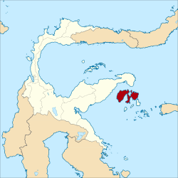
Banggai Islands Regency Kabupaten Banggai Kepulauan | |
---|---|
Coordinates: 1°24′31″S123°12′23″E / 1.408619°S 123.206363°E | |
Country | Indonesia |
Region | Sulawesi |
Province | Central Sulawesi |
Capital | Salakan |
Government | |
• In Order Regent | Rais D. Adam |
Area | |
• Total | 2,488.79 km2 (960.93 sq mi) |
Population (mid 2022 estimate) [1] | |
• Total | 123,580 |
• Density | 50/km2 (130/sq mi) |
Time zone | UTC+8 (ICST) |
Area code | (+62) 462 |
Website | banggaikep |
The Banggai Archipelago (Indonesian : Kepulauan Banggai) is a group of islands, which are located at the far eastern end of Central Sulawesi, Indonesia. It makes up a regency (kabupaten) of Central Sulawesi Province of Indonesia, created on 4 October 1999 by splitting the existing Banggai Regency into a new Banggai Regency situated on the mainland of Sulawesi (capital, Luwuk) and a Banggai Islands Regency then comprising the entire archipelago (with its capital at Banggai town). On 14 December 2012 a further splitting of the Regency was the removal of the more southerly seven districts (including Banggai Island itself, together with smaller islands to its southwest and southeast) to form a new Banggai Laut Regency.
The reduced Banggai Islands Regency thus consists of the main island of Peleng , together with various small offshore islands, of which the largest is Bangkalan Island off the north coast of Peleng. It covers an area of 2,488.79 km2 and had a population of 109,384 at the 2010 census [2] and 120,142 at the 2020 Census; [3] the official estimate as at mid 2022 was 123,580. [1] The archipelago is surrounded by the Banda Sea's Gulf of Tolo (Teluk Tolo), and the Molucca Sea. The Peleng Straits (Selat Peleng) separate Peleng from the mainland of Sulawesi.
The Banggai Islands Regency is divided into twelve districts (kecamatan), tabulated below with their areas and their populations at the 2010 Census [2] and the 2020 Census, [3] together with the official estimates as at mid 2021. [4] The table also includes the location of the district headquarters, the numbers of administrative villages (totalling 141 rural desa and 3 urban kelurahan) and of offshore islands in each district, and its postal codes.
Name of District (kecamatan) | Area in km2 | Pop'n Census 2010 | Pop'n Census 2020 | Pop'n Estimate mid 2021 | Admin centre | No. of villages | No. of islands | Post codes |
---|---|---|---|---|---|---|---|---|
Totikum | 155.45 | 9,869 | 10,473 | 10,568 | Sambiut | 11 | 4 | 94884 |
Totikum Selatan (South Totikum) | 95.19 | 8,036 | 8,499 | 8,574 | Kalumbatan | 8 | - | 94887 |
Tinangkung | 312.60 | 13,201 | 17,194 | 17,699 | Salakan | 11 (a) | 52 | 94885 |
Tinangkung Selatan (South Tinangkum) | 187.89 | 7,204 | 7,989 | 8,096 | Mansamat | 9 | - | 94885 (a) |
Tinangkung Utara (North Tinangkung) | 136.65 | 7,670 | 8,694 | 8,829 | Batulombo | 6 | - | 94886 |
Liang | 176.19 | 3,076 | 8,531 | 9,629 | Liang | 16 | 65 | 94883 |
Peling Tengah (Central Peling) | 140.00 | 9,244 | 10,397 | 10,551 | Patukuki | 11 | - | 94888 |
Bulagi | 275.66 | 9,529 | 9,493 | 9,524 | Bulagi Satu | 16 (b) | 2 | 94882 (b) |
Bulagi Selatan (South Bulagi) | 319.00 | 9,716 | 9,713 | 9,745 | Lolantang | 20 | 8 | 94882 |
Bulagi Utara (North Bulagi) | 318.00 | 8,890 | 9,640 | 9,748 | Sambulangan | 12 (c) | - | 94889 |
Buko | 184.84 | 9,376 | 9,880 | 9,965 | Tabata | 13 | 21 | 94881 |
Buko Selatan (South Buko) | 187.32 | 7,881 | 8,649 | 8,756 | Lumbi-lumbia | 11 | - | 94880 |
Totals | 2,488.79 | 109,384 | 120,142 | 121,684 | 144 | 224 |
Notes: (a) including kelurahan of Salakan. (b) including kelurahan of Bulagi (town). (c) including kelurahan of Sabang.
Merpati Nusantara Airlines served the islands from Palu (the capital of Central Sulawesi Province).[ citation needed ] There is also a bus service via Luwuk and thence by boat or ship to Banggai.
The Banggai Islands is home to the Banggai cardinalfish. [5] This species has an extremely limited geographic range (5,500 km2) and small total population size (estimated at 2.4 million). The Banggai cardinalfish is composed of isolated populations concentrated around the shallows of 17 large and 10 small islands within the Banggai Archipelago. It is threatened by extinction due to collection for the aquarium trade. [6]
Salakan has a tropical rainforest climate (Af) with moderate rainfall from August to January and heavy rainfall from February to July.
Climate data for Salakan | |||||||||||||
---|---|---|---|---|---|---|---|---|---|---|---|---|---|
Month | Jan | Feb | Mar | Apr | May | Jun | Jul | Aug | Sep | Oct | Nov | Dec | Year |
Average high °C (°F) | 30.8 (87.4) | 30.8 (87.4) | 31.0 (87.8) | 31.3 (88.3) | 31.0 (87.8) | 30.5 (86.9) | 30.1 (86.2) | 30.7 (87.3) | 31.4 (88.5) | 31.9 (89.4) | 32.2 (90.0) | 31.3 (88.3) | 31.1 (87.9) |
Daily mean °C (°F) | 26.9 (80.4) | 26.9 (80.4) | 27.0 (80.6) | 27.3 (81.1) | 27.2 (81.0) | 26.9 (80.4) | 26.4 (79.5) | 26.6 (79.9) | 26.8 (80.2) | 27.1 (80.8) | 27.8 (82.0) | 27.2 (81.0) | 27.0 (80.6) |
Average low °C (°F) | 23.0 (73.4) | 23.0 (73.4) | 23.1 (73.6) | 23.3 (73.9) | 23.5 (74.3) | 23.3 (73.9) | 22.7 (72.9) | 22.5 (72.5) | 22.3 (72.1) | 22.4 (72.3) | 23.4 (74.1) | 23.2 (73.8) | 23.0 (73.4) |
Average rainfall mm (inches) | 114 (4.5) | 135 (5.3) | 172 (6.8) | 203 (8.0) | 219 (8.6) | 266 (10.5) | 192 (7.6) | 117 (4.6) | 79 (3.1) | 71 (2.8) | 88 (3.5) | 94 (3.7) | 1,750 (69) |
Source: Climate-Data.org [7] |
Anambas Islands Regency is a small archipelago of Indonesia, located 150 nautical miles northeast of Batam Island in the North Natuna Sea between the Malaysian mainland to the west and the island of Borneo to the east. Geographically part of the Tudjuh Archipelago, it is administratively a regency within the Riau Islands Province. It covers a land area of 590.14 square kilometres (227.85 sq mi) and had a population of 37,411 at the 2010 Census and 47,402 at the 2020 Census; the official estimate as at mid 2022 was 50,296. The administrative centre is at Tarempa on Siantan Island.
The Banggai Regency is a regency located at the eastern end of Central Sulawesi Province of Indonesia. It makes up a re-established regency (kabupaten), created on 4 October 1999 by splitting the existing Banggai Regency into this smaller Banggai Regency situated on the mainland of Sulawesi and a new Banggai Islands Regency comprising the offshore islands which are separated from mainland Sulawesi by the Peleng Straits. The residual Banggai Regency covers an area of 9,672.70 km2 and had a population of 323,626 at the 2010 census and 362,275 at the 2020 census; the official estimate as at mid 2022 was 366,224.
Peleng is an island off the east coast of Sulawesi, Indonesia and is the largest island of the Banggai Islands. It is surrounded by the Banda Sea and Molucca Sea and has an area of 2,488.79 km2.
Bintan Regency is an administrative area in the Riau Islands Province of Indonesia. Bintan Regency includes all of Bintan Island and also includes many outlying islands including the Tambelan Archipelago and Badas Islands situated between Bintan and West Kalimantan.
South Bangka Regency is a regency (kabupaten) of Bangka Belitung Islands Province, Indonesia, with the town of Toboali as its regency seat. It also includes several small islands off the coast of Bangka in the Gaspar Strait, such as Lepar and Pongok. The regency covers an area of 3,607.08 km2 and had a population of 172,476 at the 2010 Census and 198,189 at the 2020 Census.
Yapen Islands Regency is a regency (kabupaten) in Papua Province of eastern Indonesia. It covers an area of 2,432.49 km2 (939.19 sq mi), and had a population of 82,951 at the 2010 Census and 112,676 at the 2020 Census; the official estimate as at mid 2022 was 116,107. It comprises an archipelago which lies in Cenderawasih Bay off the north coast of Western New Guinea.
Sitaro Islands Regency is a regency located off the northern extremity of Sulawesi Island in the southern Sangihe Islands, North Sulawesi Province, Indonesia. The regency was formed under Law Number 15 Year 2007 from 2 January 2007, by separation from the Sangihe Islands Regency of which it had previously formed the southern part. The short form of the name is formed from the those of the three principal islands — Siau, Tagulandang and Biaro.
Paser Regency is a Regency (kabupaten) within East Kalimantan province in Indonesia, it is the southernmost regency of the East Kalimantan province. Its administrative centre is Tana Paser. It covers an area of 7,730 km2, and it had a population of 230,316 at the 2010 Census and 275,452 at the 2020 Census; the official estimate as at mid 2022 was 280,065 . Before 2007, this regency was formerly named Pasir Regency.
Konawe Regency is one of the regencies in the province of Southeast Sulawesi, Indonesia. The capital of the regency is Unaaha. The regency was once known as the district of Kendari. The regency had a population of 241,428 at the 2010 Census, but was subsequently reduced by the separation of the offshore island districts as the new Konawe Islands Regency in 2013. It now covers 5,781.08 km2 and had a population of 257,011 at the 2020 Census; the official estimate as at mid 2022 was 266,299 - comprising 137,636 males and 128,663 females. Prior to its division in 2003, 2007 and 2013, Konawe was known as the rice granary of the province of Southeast Sulawesi because half of the province's rice production comes from Konawe.
Pasangkayu Regency is one of the six regencies which comprise West Sulawesi Province, Indonesia, on the island of Sulawesi. It covers an area of 3,043.75 km2 and had a population of 134,303 at the 2010 Census and 188,861 at the 2020 Census. The official estimate as at mid 2022 was 198,608. The town of Pasangkayu is the capital of the regency, and its only urban community (kelurahan).
Meranti Islands is an archipelago forming a regency (kabupaten) of Riau Province, and lies off the eastern coast of the island of Sumatra, Indonesia. It was created on 19 December 2008 by the separating of this archipelago from the mainland regency of Bengkalis. The regency comprises the islands of Tebing Tinggi, Rangsang, Padang and Merbau, together with minor offshore islands, but does not include Bengkalis Island which is geographically part of the archipelago but remains within Bengkalis Regency. The principal town is Selat Panjang on Tebing Tinggi Island. The regency covers an area of 3,623.93 km2, and had a population of 176,290 at the 2010 Census and 206,116 at the 2020 Census; the official estimate as at mid 2022 was 213,532.
Bantaeng Regency is a regency of South Sulawesi Province in Indonesia. It covers an area of 395.83 km2 and had a population of 176,984 at the 2010 Census, rising to 196,716 at the 2020 Census. The official estimate as at mid 2022 was 199,399. The administrative centre is the town of Bantaeng, which lies on the south coast of the southern peninsula of Sulawesi island.
The Pangkajene and Islands Regency, is a regency of South Sulawesi Province of Indonesia. The regency lies primarily on the mainland of Sulawesi's southern peninsula, but also includes the Spermonde Islands off the west coast of that peninsula, as well as other small islands further west and southwest. The principal town lies at Pangkajene on Sulawesi, but there are a series of further small towns like Lejang, Labakkang, Bonto-Bonto and Segeri proceeding northwards from Pangkajene along the Trans-Sulawesi Highway. The total land area is 1,112.29 km2, and the population was 305,737 at the 2010 Census and 345,775 at the 2020 Census; the official estimate as at mid 2022 was 351,426.
Bombana Regency is a regency of Southeast Sulawesi Province of Indonesia. It consists of part of the southeast peninsula of Sulawesi, together with most of the substantial offshore island of Kabaena to the south. It covers an area of 3,316.16 km2, and had a population on 139,235 at the 2010 Census and 150,706 at the 2020 Census; the official estimate as at mid 2022 was 153,304 - comprising 77,396 males and 75,906 females. The administrative centre lies at the town of Rumbia.
Buton Regency is a regency of Indonesia's Southeast Sulawesi Province, lying entirely on Buton Island. Until 2014 it had an area of 2,681.22 km2, and a population estimated at 276,944. However, in 2014 it was divided into three regencies, with two new regencies being cut out of it; the residual area now is 1,648.04 km2, and the districts in that area contained a population of 94,388 at the 2010 Census while the 2020 Census produced a total of 115,207; the official estimate as at mid 2022 was 119,353.
Kolaka Regency is a regency of Southeast Sulawesi Province, Indonesia. It covers an area of 2,958.69 km2 and had a population of 208,817 at the 2010 Census, rising to 237,587 at the 2020 Census; the official estimate as at mid 2022 was 246,137. The principal town lies at Kolaka.
North Buton Regency is a regency of Indonesia's Southeast Sulawesi Province, which was separated from Buton Regency in accordance with Indonesia's Law Number 14 of 2007. The area of the regency, which covers the north part of Buton Island, is 1,923.03 km2. Its population was 54,736 at the 2010 Census and 66,653 at the 2020 Census; the official estimate as at mid 2022 was 69,051. The administrative capital of the regency is at the town of Buranga.
Tolitoli Regency is a regency of Central Sulawesi Province of Indonesia. It was previously part of a larger Buol Tolitoli Regency, but this was split into two on 4 October 1999 after rapid decentralization of the Indonesian government. The present Tolitoli Regency covers an area of 3,701.54 km2 and had a population of 211,296 at the 2010 Census and 225,154 at the 2020 Census; the official estimate as at mid 2022 was 228,641, comprising 116,514 male and 112,127 female inhabitants. Its regency seat is located at the town of Tolitoli, which is a port town and where its population is concentrated.
Tanimbar Islands Regency is a regency of Maluku province, Indonesia, consisting primarily of the Tanimbar Islands. The Regency covers a land area of 10,102 km2, and it had a population of 105,341 at the 2010 Census and 123,572 at the 2020 Census; the official estimate as at mid 2022 was 124,787. The principal town and administrative centre lies at Saumlaki in Tanimbar Selatan District.
Banggai Sea Regency is a regency in the province of Central Sulawesi, Indonesia. The regency was established on 14 December 2012, partitioned from the Banggai Islands Regency. It comprises southern part of the Banggai Islands archipelago, including the main island of Banggai itself, the islands of Labobo and Bangkurung to the southwest of Banggai Island, and the numerous small Bokan Islands to the southeast. It covers a land area of 725.67 km2, and the districts now comprising the new Regency had a population of 62,183 at the 2010 Census and 70,435 at the 2020 Census; the official estimate as at mid 2022 was 71,350.
{{cite journal}}
: Cite journal requires |journal=
(help)