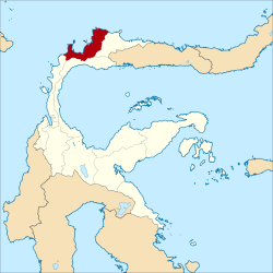
Tolitoli Regency is a regency of Central Sulawesi Province of Indonesia. It was previously part of a larger Buol Tolitoli Regency (including the current Buol Regency), but this was split into two on 4 October 1999 after rapid decentralization of the Indonesian government. The present Tolitoli Regency covers an area of 3,700.37km2 and had a population of 211,296 at the 2010 Census[2] and 225,154 at the 2020 Census;[3] the official estimate as at mid 2024 was 233,898, comprising 119,221 males and 114,677 females.[1] Its regency seat is located at the town of Tolitoli (in Baolan District), which is a port town and where the regency's population is concentrated.
The Tolitoli Regency was divided in 2020 into ten districts (kecamatan), which are tabulated below with their areas[1] and their populations at the 2010 Census[2] and the 2020 Census,[3] together with the official estimates as at mid 2024.[1] The table also includes the location of the district administrative centres, the number of administrative villages in each district (totalling 103 rural desa and 6 urban kelurahan in total), and its post code.
Kode Wilayah
Name of District (kecamatan)
Area in km2(a)
Pop'n Census 2010
Pop'n Census 2020
Pop'n Estimate mid 2024
Admin centre
No. of villages
Post code
72.04.01
Dampal Selatan (South Dampal)
377.95
21,394
21,617
21,970
Bangkir
13
94554
72.04.02
Dampal Utara (a) (North Dampal)
169.97
14,390
13,897
14,070
Ogotua
12
94553
72.04.03
Dondo
418.20
21,358
22,650
23,460
Tinabogan
16
94551
72.04.05
Ogodeide (b)
250.26
11,682
12,270
12,660
Bilo
11
94516
72.04.04
Basidondo
556.52
10,458
10,748
11,000
Kayulompa
10
94552
72.04.07
Baolan
330.78
63,072
67,603
70,300
Baru
(c) 10
94511 - 94517
72.04.06
Lampasio
556.47
11,875
12,847
13,410
Sibea
9
94517 & 94518
72.04.08
Galang
419.63
31,701
35,715
37,860
Lalos
14
94561
72.04.09
Tolitoli Utara (North Toli-Toli)
464.50
16,940
18,180
18,910
Laulalang
10
94560
72.04.10
Dako Pemean
156.09
8,426
9,627
10,260
Galumpang
4
94562
Totals
3,700.37
211,296
225,154
233,898
Tolitoli
109
Notes: (a) including 7 offshore islands, the largest being Pulau Simatang off the north coast of the district. (b) including 29 offshore islands, the largest being Pulau Kabetan off the northwest coast of the district. (c) including all six kelurahan (urban villages) in the regency, namely Baru, Nalu, Panasakan, Sidoarjo, Tambun and Tuweley.
Climate
Tolitoli has a tropical rainforest climate (Af) with moderate rainfall in March and April and heavy rainfall in the remaining months.
This page is based on this Wikipedia article Text is available under the CC BY-SA 4.0 license; additional terms may apply. Images, videos and audio are available under their respective licenses.