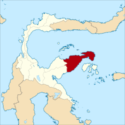
The Banggai Regency (Indonesian: Kabupaten Banggai) is a regency located at the eastern end of Central Sulawesi Province of Indonesia. It makes up a re-established regency (kabupaten), created on 4 October 1999 by splitting the existing Banggai Regency into this smaller Banggai Regency situated on the mainland of Sulawesi (capital, Luwuk) and a new Banggai Islands Regency comprising the offshore islands to the southeast (capital, Banggai town) which are separated from mainland Sulawesi by the Peleng Straits (Selat Peleng). The residual Banggai Regency covers an area of 9,672.70km2 and had a population of 323,626 at the 2010 census[2] and 362,275 at the 2020 census;[3] the official estimate as at mid 2024 was 377,804 (comprising 191,889 males and 185,915 females).[1]
At the 2010 census, the Banggai regency was divided into eighteen districts (kecamatan). Subsequently, another five districts have been created by the division of four existing districts in 2012 and 2015; a further (24th) district - Toili Jaya (with its administrative centre at Toilsu) - has been created in 2023-24 from part of Toili District (taking in 10 of the 24 desa from that district), but no separate figures are yet available for it.
The statistics for twenty-three districts are tabulated below with their areas and their 2010[2] and 2020[3] Census populations, together with the official estimates as at mid 2024.[1] The table also includes the locations of the district administrative centres, the number of villages in each district (291 rural desa and 46 urban kelurahan in total), and its post code.
Notes: (a) the kelurahan is the town of Cendana, rather than the administrative centre in the desa of Cendana Pura. (b) the kelurahan are Bakung, Balantang, Batui, Bugis, Lamo, Sisipan and Tolando. (c) Bunta I, Bunta II, Kalaka and Salabenda. (d) Kintom, Lontio and Mendono. (e) Baru, Bungin, Bungin Timur, Kaleke, Karaton, Luwuk, Mangkio Baru and Soho. (f) The 2010 populations of Luwuk Utara and Luwuk Selatan Districts are included in the figure for Luwuk District, from which they were split away in 2015 and 2012 respectively. (g) Kilongan and Kilongan Permai. (h) Bukit Mambual, Hanga-Hanga, Hanga-Hanga Permai, Jole, Kompo, Maahas, Simpong, Tanjung Tuwis and Tombang Permai. (i) The 2010 population of Nambo District is included in the figure for Kintom District, from which it was split away in 2012. (j) Lontio, Lontio Baru, Nambo Bosaa, Nambo Lempek, Nambo Lempek Baru and Nambo Padang. (k) Basabungan, Pagimana and Pakowa. (l) The 2010 population of Mantoh District is included in the figure for Lamala District, from which it was split away in 2012. (m) Balantak, Dale-Dale and Talang Batu. (n) The 2010 population of Balantak Utara District is included in the figure for Balantak District, from which it was split away in 2012.
References
123Badan Pusat Statistik, Jakarta, 28 February 2025, Kabupaten Banggai Dalam Angka 2025 (Katalog-BPS 1102001.7202)
This page is based on this Wikipedia article Text is available under the CC BY-SA 4.0 license; additional terms may apply. Images, videos and audio are available under their respective licenses.