Tollette, Arkansas | |
---|---|
Coordinates: 33°49′9″N93°53′45″W / 33.81917°N 93.89583°W | |
Country | United States |
State | Arkansas |
County | Howard |
Area | |
• Total | 0.96 sq mi (2.49 km2) |
• Land | 0.96 sq mi (2.49 km2) |
• Water | 0.00 sq mi (0.00 km2) |
Elevation | 360 ft (110 m) |
Population (2020) | |
• Total | 185 |
• Density | 192.11/sq mi (74.21/km2) |
Time zone | UTC-6 (Central (CST)) |
• Summer (DST) | UTC-5 (CDT) |
FIPS code | 05-69500 |
GNIS feature ID | 0058751 [2] |
Tollette is a town in southern Howard County, Arkansas, United States. The population was 240 at the 2010 census, [3] down from 324 in 2000.
Tollette was established as an all-African American town by Sanford Tollette and his wife Caldonia Crofton Tollette in the 1800s. They built a church, a store, and a public school. Caldonia Tollette was postmistress of the United States Post Office in 1893. Their daughter, Mattye Tollette Bond began a teaching career at the age of fifteen. She married Ollie Seahorn Bond and resided in his hometown of Brownsville, Tennessee where they organized the first NAACP chapter in Haywood County in 1939. Sanford and Caldonia's granddaughter Mildred Bond Roxborough began working for the NAACP in Tennessee at the age of nine in 1935 and continued her distinguished service to the organization in New York from 1954 through 1997 rising to executive positions including Director of Operations. [4]
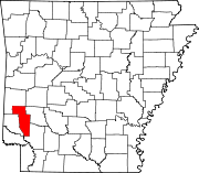
Tollette is located in southern Howard County. Arkansas Highway 355 passes through the town, leading north 4 miles (6 km) to Mineral Springs and south 17 miles (27 km) to Fulton and Interstate 30.
According to the United States Census Bureau, the town has a total area of 0.97 square miles (2.5 km2), all land. [3]
Census | Pop. | Note | %± |
---|---|---|---|
1980 | 407 | — | |
1990 | 316 | −22.4% | |
2000 | 324 | 2.5% | |
2010 | 240 | −25.9% | |
2020 | 185 | −22.9% | |
U.S. Decennial Census [5] |
Race | Number | Percentage |
---|---|---|
White (non-Hispanic) | 5 | 2.7% |
Black or African American (non-Hispanic) | 173 | 93.51% |
Other/Mixed | 4 | 2.16% |
Hispanic or Latino | 3 | 1.62% |
As of the 2020 United States census, there were 185 people, 108 households, and 72 families residing in the town.
As of the census [7] of 2000, there were 324 people, 136 households, and 90 families residing in the town. The population density was 133.1/km2 (343.0/mi2). There were 149 housing units at an average density of 61.2/km2 (157.7/mi2). The racial makeup of the town was 0.62% White, 98.46% Black or African American, and 0.93% from two or more races.
There were 136 households, out of which 24.3% had children under the age of 18 living with them, 33.8% were married couples living together, 29.4% had a female householder with no husband present, and 33.1% were non-families. 31.6% of all households were made up of individuals, and 16.9% had someone living alone who was 65 years of age or older. The average household size was 2.38 and the average family size was 3.01.
In the town, the population was spread out, with 24.1% under the age of 18, 10.5% from 18 to 24, 24.7% from 25 to 44, 22.5% from 45 to 64, and 18.2% who were 65 years of age or older. The median age was 37 years. For every 100 females, there were 90.6 males. For every 100 females age 18 and over, there were 86.4 males.
The median income for a household in the town was $24,688, and the median income for a family was $31,250. Males had a median income of $19,063 versus $18,295 for females. The per capita income for the town was $10,589. About 11.7% of families and 18.5% of the population were below the poverty line, including 17.5% of those under age 18 and 40.0% of those age 65 or over.
Howard County is a county located in the U.S. state of Arkansas. As of the 2020 census, the population was 12,785. The county seat is Nashville. Howard County is Arkansas's 74th county, formed on April 17, 1873, and named for James Howard, a state senator. It is a dry county.
Big Flat is a town in Baxter and Searcy counties in the U.S. state of Arkansas. The population was 88 at the 2020 census.
Everton is a town in Boone County, Arkansas, United States. The population was 133 at the 2010 census. It is part of the Harrison Micropolitan Statistical Area.
South Lead Hill is a town in Boone County, Arkansas, United States. The population was 102 at the 2010 census. It is part of the Harrison Micropolitan Statistical Area.
McDougal is a city in Clay County, Arkansas, United States. The population was 186 at the 2010 census.
Anthonyville is a town in Crittenden County, Arkansas, United States. The population was 161 at the 2010 census, down from 250 in 2000.
Edmondson is a town in Crittenden County, Arkansas, United States. The population was 427 at the 2010 census.
Wooster is a city in Faulkner County, Arkansas, United States. The population was 860 at the 2010 census, up from 516 at the 2000 census. It is part of the Central Arkansas region.
McNab is a town in Hempstead County, Arkansas, United States. The population was 68 at the 2010 census, up from 37 in 2000. It is part of the Hope Micropolitan Statistical Area.
Moro is a town in Lee County, Arkansas, United States. The population was 216 at the 2010 census.
Cale is a town in Nevada County, Arkansas, United States. The population was 75 at the 2000 census. It is part of the Hope Micropolitan Statistical Area.
Daisy is a town in Pike County, Arkansas, United States. Its population is 88 as of the 2020 census. Daisy is also the home of Daisy State Park.
Fredonia (Biscoe) is a city in Prairie County, Arkansas, United States. The population was 363 at the 2010 census.
Traskwood is a city in Saline County, Arkansas, United States. The population was 518 at the 2010 census. It is part of the Little Rock–North Little Rock–Conway Metropolitan Statistical Area.
Gillham is a town in Sevier County, Arkansas, United States. The population was 188 at the 2000 census. It is located six miles from Gillham Lake.
Caldwell is a town in St. Francis County, Arkansas, United States. The population was 555 at the 2010 census, an increase from 465 in 2000.
Widener is a town in St. Francis County, Arkansas, United States. The population was 212 at the 2020 census, a decline from 273 in 2010.
Felsenthal is a town in Union County, Arkansas, United States. The population was 152 at the 2000 census and 150 at the 2010 census. It lays adjacent to the Ouachita River in the southeastern corner of Union County.
Patterson is a city in Woodruff County, Arkansas, United States. The population was 452 at the 2010 census.
Corinth is a town in Yell County, Arkansas, United States. The population was 65 at the 2000 census. It is part of the Russellville Micropolitan Statistical Area.