Sirarakhong also called as Kampha is a village located west of Ukhrul in Ukhrul district, Manipur state, India. As per 2011 census, the village has a total of 202 households with 1243 persons of which 620 are male while 623 are female. Of the total population, 10.86% are in the age group of 0–6 years. The average sex ratio of the village is 1015 female per 1000 male which is higher thaln the state's average of 930. The literacy rate of the village is 95.22%.Neighbouring villages of Teinem are Tungou, Lambui, Sinakeithei Tushen and Tanrui.
Phungcham is a village located north of Ukhrul in Ukhrul district, Manipur state, India. The village is approximately 28 kilometers from Ukhrul and is connected by inter village road constructed under PMGSY. Phungcham is flanked by Longpi and Lunghar in the east, Peh in the north, Ukhrul and Halang in the south and Talui in the west.
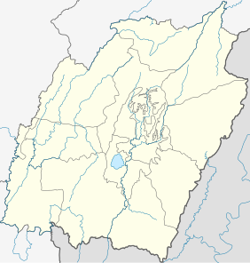
Poi is a village located north of Ukhrul in Ukhrul district, Manipur state, India. The village is partially connected by National Highway 150, Imphal-Kohima road via Jessami. Poi is 68 kilometers away from Ukhrul via Awangkasom and about 3 kilometers and 5 kilometers away from Indo-Myanmar border pillar number 126 and 130 respectively. Poi is flanked by Challou in the North, Chingai in the north west, Ngahui, Kuirei and Marem in the west, Huishu and Khamasom in the south. MK Preshow Shimray, the Ex- MLA from Chingai Assembly Constituency and also the Deputy Speaker of the present Manipur Legislative Assembly hails from this village.
Kalhang is a village located north of Ukhrul in Ukhrul district, Manipur state, India. The village is approximately 39 kilometers from Ukhrul. National Highway 150 Imphal-Kohima via Jessami passes through the village. Kalhang is one of the villages that used to make indigenous salt from natural salt springs and supply to other Tangkhul villages before the introduction of common salt. The village is flanked by Phungcham and Peh in the west, Khamasom in the east, Longpi in the south and Kuirei in the North. Locally inhabitants speak Kansang dialect which belongs to the Tibeto-Burman language family.
Kuirei is a village located north of Ukhrul in Ukhrul district, Manipur state, India. The village is approximately 41 kilometers from Ukhrul. National Highway 150 Imphal-Kohima via Jessami passes through the village. Kuirei is one of the villages that used to make indigenous salt from salt springs and supply to other Tangkhul villages before the advent of common salt. The village is flanked by Phungcham and Peh in the west, Huishu and Khamasom in the east, Kalhang in the south and Ngahui and Marem in the North. Locally inhabitants speak Kuirei dialect which belongs to the Tibeto-Burman language family.
Langdang is a village located north of Ukhrul in Ukhrul district, Manipur state, India. The village is 13 kilometers from Ukhrul. National Highway 150 Imphal-Kohima via Jessami passes through the village. The village is divided into two major parts, Langdang Khullen and Langdang Phungthar; however, both the parts are under one chief. The village is famous for largescale plum cultivation. The village is flanked by Mapum in the east, Shirui in the north, Ukhrul in the west and Choithar in the south.
Choithar (Rithar) is a village located east of Ukhrul in Ukhrul district, Manipur state, India. The village is 12 kilometers from Ukhrul. National Highway 150 Imphal-Kohima via Jessami partially connects the village. The village is about 6 kilometers from the National highway connected earlier by an old British road. There was a proposal to construct a new road under PMGSY for which there were reports of discrepancies on the part of the executing agencies. Choithar is flanked by Ukhrul in the west, Choithar in the north, Nungshong in the south and Khangkhui in the east.
Nungshong is a generic reference to two villages viz. Nungshong Khullen and Nungshong Khunou located south of Ukhrul in Ukhrul district, Manipur state, India. The village is about 30 kilometers from Ukhrul via the state highway that connects Ukhrul-Kamjong via Shangshak. The shorter un-metalled road from Ukhrul to Nungshong is about 15 kilometers. Construction of a new road under PMGSY to connect the neighboring villages with Ukhrul is underway for which there were reports of irregularities on the part of the executing agencies. Nungshong is flanked by Hungpung in the west, Shangching in the south, Choithar and Khangkhui in the north. Locally, the residents speak Nungshong dialect which belongs to the Tibeto-Burman language family.
Shangshak is a generic reference to two villages viz. Shangshak Khullen and Shangshak Khunou located south of Ukhrul in Ukhrul district, Manipur state, India. The village is about 15 kilometers from Ukhrul via National Highway 150 and the state highway that connects Ukhrul-Kamjong via Shangshak. Shangshak is flanked by Hungpung in the north, Koso in the south, Ramva in the west and Gamnom and Yengtem in the east. The first battle in Indian soil during the Second World War between the Japanese and the allied forces was fought in Shangshak. The battle of Shangshak fought for two weeks from 21 to 26 March 1944 is considered as one of the bloodiest battles of the Second World War. Locally, the residents speak Shangshak dialect which belongs to the Tibeto-Burman language family.
Tashar also called as Tushar is a generic reference to two villages viz. Tashar and Tashar Chanhong located south-west of Ukhrul in Ukhrul district, Manipur state, India. The village is about 18 kilometers from Ukhrul via National Highway that connects Imphal and Kohima via Ukhrul and Jessami. Tashar is flanked by Pharung in the north, Ramva in the south, Shangshak in the east and Sirarakhong in the West. The village is divided into two major parts, Tashar main and Tashar Chanhong. Locally, the inhabitants speak Tashar tui which belongs to the Tibeto-Burman language family.
Hatha is a small hamlet located south-west of Ukhrul in Ukhrul district, Manipur state, India. The village is about 10 kilometers from Ukhrul via National Highway 150 that connects Imphal and Kohima via Ukhrul and Jessami. Hatha is flanked by Hungpung in the north, Ramva in the south, Shangshak in the east and Sirarakhong in the West. Locally, the inhabitants speak Hatha tui which belongs to the Tibeto-Burman language family.
Ramva also misnomerly called as Lambui is a village located south of Ukhrul in Ukhrul district, Manipur state, India. The village is about 25 kilometers from Ukhrul via National Highway 150 that connects Imphal and Kohima via Ukhrul and Jessami. Ramva is flanked by Hatha in the north, Shangshak in the east, Lungpha in the south and Tungou in the West. Locally, the inhabitants speak Ramva dialect which belongs to the Tibeto-Burman language family.
Lungpha is a village located south of Ukhrul in Ukhrul district, Manipur state, India. The village is about 15 kilometers from Ukhrul via National Highway 150 that connects Imphal and Kohima via Ukhrul and Jessami. Lungpha is flanked by Ramva in the north, Tungou in the west, Litan in the south and Shangshak in the east. Locally, the inhabitants speak Lungpha tui which belongs to the Tibeto-Burman language family.
Shingkap is a village located south of Ukhrul in Ukhrul district, Manipur state, India. The village is about 35 kilometers from Ukhrul via National Highway 150 that connects Imphal and Kohima via Ukhrul and Jessami. Shingkap is flanked by Lungpha in the north, Riha in the west, Tangkhul Hundung in the south and Alang in the east. Locally, the inhabitants speak Shingkap tui which belongs to the Tibeto-Burman language family.
Ringui Ramhon is a small village located west of Ukhrul in Ukhrul district, Manipur state, India. The village is about 35 kilometers from Ukhrul partially connected by National Highway 150 that connects Imphal and Kohima via Ukhrul and Jessami. Ringui Ramhon is flanked by Ramva in the east, Tashar in the north, Sinakeithei in the west and Lungpha in the south. Locally, the inhabitants speak Ringui tui which belongs to the Tibeto-Burman language family.
Lungshang is a small village located south of Ukhrul in Ukhrul district, Manipur state, India. The village is about 20 kilometers from Ukhrul partially connected by National Highway 150 that connects Imphal and Kohima via Ukhrul and Jessami. Lungshang is divided into two major parts, Lungshang Azing and Lungshang Ato and is flanked by Shangshak in the south, Nungshong in the west, Yengtem in the east and Khangkhui in the north. Locally, the inhabitants speak Lungshang tui which belongs to the Tibeto-Burman language family.
Sarkaphung, also called Shikiphung or Sikiphung, is a village south of Ukhrul in Ukhrul district, Manipur state, India. The village is about 45 kilometers (28 mi) from Ukhrul and about 35 kilometers (22 mi) from Imphal. The village is partially connected by National Highway 150, which connects Imphal and Kohima via Ukhrul and Jessami. The village is flanked by Litan in the north, Thoyee in the south, Sinakeithei in the west, and Marao Shingkap in the east. The inhabitants speak Sarkaphung Tui, which belongs to the Tibeto-Burman language family.
Tangkhul Hundung is a village south of Ukhrul in Ukhrul district, Manipur, India. The village is about 65 kilometres (40 mi) from Ukhrul and about 45 kilometres (28 mi) from Imphal and is partially connected by National Highway 150 that connects Imphal and Kohima via Ukhrul and Jessami. Tangkhul Hundung is divided into two major parts, Tangkhul Hundung Khullen and Tangkhul Hundung Khunou. The village is flanked by Thoyee in the west, Shingkap in the north, Itham in the south and Alang in the east. Locally, the inhabitants speak Tangkhul Hundung tui, which belongs to the Tibeto-Burman language family.
Langli is a village located southeast of Ukhrul in Ukhrul district, Manipur state, India. The village is about 60 kilometers from Ukhrul and is partially connected by Ukhrul-Kamjong State highway. The village is flanked by Maku in the north, Kamjong village in the south, the Chatric in the east and Apong in the west. The village is divided into two major parts with separate settlements; Langli K and R Langli.
Seikhor is a village located west of Ukhrul in Ukhrul district, Manipur state, India. The village falls under Ukhrul sub division. Seikhor is partially connected by the old Imphal-Ukhrul road and is about 18 kilometers from Ukhrul. Seikhor is flanked by Pharung in the east, Teinem in the west, Tashar in the south and Ngainga in the north. Locally, the inhabitants speak Seikhor dialect that belongs to the Tibeto-Burman language family.


