Shirui, initially called Shiroy/Shiroi, is a village located north of Ukhrul in Ukhrul district, Manipur state, India. The village is 15 kilometers from Ukhrul. National Highway 150 Imphal-Kohima via Jessami passes through the village. The village is divided into two parts, Shirui ato and Shirui aze; however, both the parts are under one chief. Shirui is famous for the rich and flora found on Shirui Kashong or Shirui peak and especially for blooming of the rare Lilium mackliniae during the start of Monsoon. The village is flanked by Ukhrul in the west, Langdang in the south, Mapum in the east, Sihai in the North east and Lunghar in the north. Locally inhabitants speak Shirui dialect which belongs to the Tibeto-Burman language family.
Nungshong Khullen is located south of Ukhrul in Ukhrul district, Manipur state, India. The village is about 30 kilometers from Ukhrul via the state highway that connects Ukhrul-Kamjong via Shangshak. The shorter un-metalled road from Ukhrul to Nungshong khullen is about 15 kilometers. Construction of a new road under PMGSY to connect the neighboring villages with Ukhrul is underway for which there were reports of irregularities on the part of the executing agencies. Nungshong is flanked by Hungpung in the west, Shangching in the south, Choithar and Khangkhui in the north. Locally, the residents speak Nungshong dialect which belongs to the Tibeto-Burman language family.
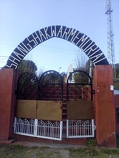
Shangshak is a generic reference to two villages viz. Shangshak Khullen and Shangshak Khunou located south of Ukhrul in Ukhrul district, Manipur state, India. The village is about 15 kilometers from Ukhrul via National Highway 150 and the state highway that connects Ukhrul-Kamjong via Shangshak. Shangshak is flanked by Hungpung in the north, Koso in the south, Ramva in the west and Gamnom and Yengtem in the east. The Battle of Shangshak fought for two weeks from 21 to 26 March 1944 is considered one of the bloodiest battles of the Second World War. Locally, the residents speak Shangshak dialect which belongs to the Tibeto-Burman language family.
Tashar, also known as Tushar or Tushen, is a generic reference to two villages viz. Tashar and Tashar Chanhong located south-west of Ukhrul in Ukhrul district, Manipur state, India. The village is about 18 kilometers from Ukhrul via National Highway that connects Imphal and Kohima via Ukhrul and Jessami. Tashar is flanked by Pharung in the north, Ramva in the south, Shangshak in the east and Sirarakhong in the West. The village is divided into two major parts, Tashar main and Tashar Chanhong. Locally, the inhabitants speak Tashar tui which belongs to the Tibeto-Burman language family.
Hatha is a small hamlet located south-west of Ukhrul in Ukhrul district, Manipur state, India. The village is about 20 kilometers from Ukhrul via National Highway 150 that connects Imphal and Kohima via Ukhrul and Jessami. Hatha is flanked by Hungpung in the north, Ramva in the south, Shangshak in the east and Sirarakhong in the West. Locally, the inhabitants speak Hatha tui which belongs to the Tibeto-Burman language family.
Ramva also misnomerly called as Lambui is a village located south of Ukhrul in Ukhrul district, Manipur state, India. The village is about 25 kilometers from Ukhrul via National Highway 150 that connects Imphal and Kohima via Ukhrul and Jessami. Ramva is flanked by Hatha in the north, Shangshak in the east, Lungpha in the south and Tungou in the West. Locally, the inhabitants speak Ramva dialect which belongs to the Tibeto-Burman language family.
Lungpha is a village located south of Ukhrul in Ukhrul district, Manipur state, India. The village is about 15 kilometers from Ukhrul via National Highway 150 that connects Imphal and Kohima via Ukhrul and Jessami. Lungpha is flanked by Ramva in the north, Tungou in the west, Litan in the south and Shangshak in the east. Locally, the inhabitants speak Lungpha tui which belongs to the Tibeto-Burman language family.
Tungou also misnomerly referred to as Ringui is a village located south of Ukhrul in Ukhrul district, Manipur state, India. The village is about 35 kilometers from Ukhrul via National Highway 150 that connects Imphal and Kohima via Ukhrul and Jessami. Tungou is flanked by Ramva in the east, Tashar in the north, Sinakeithei in the west and Lungpha in the south. Locally, the inhabitants speak Tungou tui which belongs to the Tibeto-Burman language family.
Tangkhul Hundung is a village south of Ukhrul in Ukhrul district, Manipur, India. The village is about 65 kilometres (40 mi) from Ukhrul and about 45 kilometres (28 mi) from Imphal and is partially connected by National Highway 150 that connects Imphal and Kohima via Ukhrul and Jessami. Tangkhul Hundung is divided into two major parts, Tangkhul Hundung Khullen and Tangkhul Hundung Khunou. The village is flanked by Thoyee in the west, Shingkap in the north, Itham in the south and Alang in the east. Locally, the inhabitants speak Tangkhul Hundung tui, which belongs to the Tibeto-Burman language family.
Maku is a village located south east of Ukhrul in Ukhrul district, Manipur state, India. The village is about 32 kilometers from Ukhrul and is partially connected by National Highway 150 that connects Imphal and Kohima via Ukhrul and Jessami and Kamjong-Imphal state highway. The village is flanked by Shingcha in the north, Langli in the south, Chatric in the east and Yengtem in the west. Maku is a major and strategic junction for the neighboring remote village as the state highway and Inter Village Roads (IVR) converges in the vicinity of the village. Locally, the inhabitants speak Maku tui which belongs to the Tibeto-Burman language family.
Langli is a village located southeast of Ukhrul in Ukhrul district, Manipur state, India. The village is about 60 kilometers from Ukhrul and is partially connected by Ukhrul-Kamjong State highway. The village is flanked by Maku in the north, Kamjong village in the south, the Chatric in the east and Apong in the west. The village is divided into two major parts with separate settlements; Langli K and R Langli.
Shingcha is a village located southeast of Ukhrul in Ukhrul district, Manipur state, India. The village is about 45 kilometers from Ukhrul and is partially connected by Ukhrul-Kamjong State highway. The village is flanked by Pushing in the north, Maku in the south, the Langkhe in the east and Shangshak in the west.
Pharung also called as Shimtang is a village located west of Ukhrul in Ukhrul district, Manipur state, India. The village falls under Ukhrul sub division. Pharung borders with Hunphun (Ukhrul) village and Hungpung. The village is connected by the old National highway road route. Pharung is flanked by Ukhrul in the east, Seikhor in the west, Tashar in the south and Ngainga in the north. Locally the inhabitants speak Pharung tou which belongs to the Tibeto-Burman language family.
Seikhor is a village located west of Ukhrul in Ukhrul district, Manipur state, India. The village falls under Ukhrul sub division. Seikhor is partially connected by the old Imphal-Ukhrul road and is about 18 kilometers from Ukhrul. Seikhor is flanked by Pharung in the east, Teinem in the west, Tashar in the south and Ngainga in the north. Locally, the inhabitants speak Seikhor dialect that belongs to the Tibeto-Burman language family.
Lamlang also popularly referred as Lamlang Gate is a village located west of Ukhrul in Ukhrul district, Manipur state, India. The village falls under Ukhrul sub division. The old Imphal-Ukhrul road passes through the village and is about 19 kilometers from Ukhrul. Lamlang is flanked by Seikhor in the north, Pharung in the east, Tashar in the south and Sirarakhong in the west. Locally, the inhabitants speak Lamlang dialect that belongs to the Tibeto-Burman language family.
Grihang is a village located south of Ukhrul in Ukhrul district, Manipur state, India. The village falls under Kamjong sub division. The village is connected by Ukhrul-Kamjong state highway. Grihang is flanked by Tusom in the west, Ningchou in the south, Molvailup in the east and Bungpa in the north. Locally, the inhabitants speak Grihang dialect that belongs to the Tibeto-Burman language family.
Kangpat is a generic reference to two villages, Kangpat Khullen and Kangpat Khunou located south of Ukhrul in Ukhrul district, Manipur state, India. The village falls under Kamjong sub division. The two villages are connected by Ukhrul-Kamjong state highway. Kangpat is flanked by Sorbung and Punge in the west, Choro in the south, Skipe in the east and Nambisha in the north. Locally, the inhabitants speak Kangpat dialect that belongs to the Tibeto-Burman language family. Some researchers are of the view that the dialect spoken by the inhabitants has some affinity to that of the Koireng tribe.
Awang Kasom is a village located north of Ukhrul in Ukhrul district, Manipur state, India. The village falls under Chingai sub division. National Highway 150 that connect Imphal-Kohima via Ukhrul and Jessami passes through the village. Awang Kasom is about 50 kilometers from Ukhrul; and is flanked by kuirei in the south, Peh in the west, Chingai in the north and poi in the east. Locally, the inhabitants speak Awang Kasom dialect that belongs to the Tibeto-Burman language family.
Razai is a generic reference two villages, Razai Khullen and Razai Khunou Ukhrul in Ukhrul district, Manipur state, India. The village falls under Chingai sub division. National Highway 150 that connects Imphal-Kohima via Ukhrul and Jessami passes through the village. Razai is about 50 kilometers from Ukhrul; and is flanked by Peh in the west, Awang Kasom in the south, Chingai in the east and Maremphung in the north. Locally, the inhabitants speak Razai dialect that belongs to the Tibeto-Burman language family.
Shokvao is a village located south of Ukhrul district, Manipur. National Highway 150 that connects Imphal and Ukhrul passes through the village. Shokvao is about 75 kilometers from Imphal and about 7 kilometers from Ukhrul. The village is flanked by Ramva in the north, Shangshak in the east, Lungpha in the south and Songphel Kuki village in the west. The inhabitants talk Shokvao dialect which belongs to the Tibeto-Burman language family. The name 'Shokvao' means come out and shout in Tangkhul dialect. The origin of the village name is attributed to a myth that the Tangkhuls in the process of migration were lost and that their leader stood at the present location of the village shouted to all to get together there.

