
The 2004 Pacific typhoon season was an extremely active season that featured the second-highest ACE ever recorded in a single season, second only to 1997, which featured 29 named storms, nineteen typhoons, and six super typhoons. It was an event in the annual cycle of tropical cyclone formation, in which tropical cyclones form in the western Pacific Ocean. The season ran throughout 2004, though most tropical cyclones typically develop between May and October. The season's first named storm and also the first typhoon, Sudal, developed on April 4, later was reached typhoon status two days later, and became the first super typhoon of the year three days later. The season's last named storm, Noru, dissipated on December 22.

The 1992 Pacific typhoon season was the fourth consecutive above-average season, producing 31 tropical storms, 16 typhoons and five super typhoons. It had no official bounds; it ran year-round in 1992. Despite this, most tropical cyclones tend to form in the northwestern Pacific Ocean between May and November. These dates conventionally delimit the period of each year when most tropical cyclones form in the northwestern Pacific Ocean.

This timeline documents all the storm formations, strengthening, weakening, landfalls, extratropical transitions, as well as dissipation during the 2008 Pacific typhoon season. The 2008 Pacific typhoon season officially started on January 1, 2008 and ended on January 1, 2009.
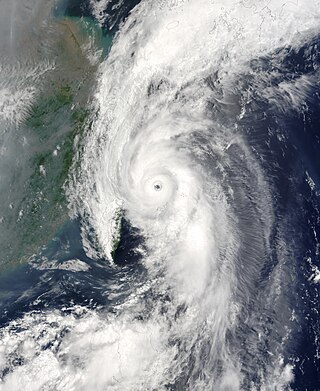
Typhoon Soudelor, known in the Philippines as Typhoon Egay, was a powerful typhoon that underwent rapid deepening east of Taiwan in the 2003 Pacific typhoon season. It was the sixth named storm by the Japan Meteorological Agency (JMA) of the season, as well as the third typhoon. It formed on June 12 from a disturbance in the monsoon trough, located east of the Philippines. The system moved generally to the northwest after its genesis, gradually intensifying into a tropical storm. While offshore the Philippines, Soudelor dropped heavy rainfall that caused flooding and left thousands homeless. The storm caused $2.46 million in damage, and 12 deaths.
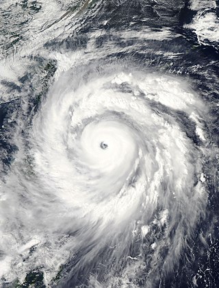
Typhoon Jangmi, known in the Philippines as Super Typhoon Ofel, was the most intense tropical cyclone in the Northwest Pacific Ocean during the 2000s, tied with Nida in 2009, and the most intense tropical cyclone worldwide in 2008. Jangmi, which means rose in Korean, formed in a low pressure area south of Guam on September 22. After undergoing serious consolidating with convective banding, the low pressure area was upgraded to a Joint Typhoon Warning Center late the same data. Undergoing the same process, the storm developed into a tropical storm on September 24. Undergoing rapid deepening on September 26–27, the storm, now a Super Typhoon entered the Philippine Area of Responsibility, and was named Ofel. The next day, Jangmi made impact in Taiwan, thousands were evacuated, rainfall, up to 994mm were recorded, and thousands of acres of farmland were destroyed. Jangmi was significantly weakened as it interacted with Taiwan, as being downgraded to tropical storm status after leaving Taiwan on September 29. After undergoing an extratropical transition, Jangmi became a remnant low on October 1. After slowly moving eastward, until finally dissipating near Iwo Jima on October 5.

Typhoon Prapiroon, known in the Philippines as Tropical Storm Henry, was a minimal typhoon which caused deadly flooding in southern China in August 2006. Prapiroon developed out of a persistent area of convection accompanied by an area of low pressure on July 25 about 120 km (75 mi) west-southwest of Yap. Two days later, both the Japan Meteorological Agency (JMA) and PAGASA classified the system as a tropical depression, with PAGASA giving it the local name 'Henry'. By July 31, the Joint Typhoon Warning Center (JTWC) classified the system as Tropical Depression 07W. A strong subtropical ridge located to the north of the depression led to a west-northwest movement for most of the storm existence.
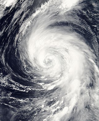
Typhoon Tingting was a destructive tropical cyclone that produced record-breaking rains in Guam. The eighth named storm of the 2004 Pacific typhoon season, Tingting originated from a tropical depression over the open waters of the western Pacific Ocean. The storm gradually intensified as it traveled northwest, becoming a typhoon on June 28 and reaching its peak the following day while passing through the Mariana Islands. After maintaining typhoon intensity for three days, a combination of dry air and cooler sea surface temperatures caused the storm to weaken as it traveled northward. On July 1, the storm passed by the Bonin Islands, off the coast of Japan, before moving out to sea. By July 4, Tinting had transitioned into an extratropical cyclone. The remnants were last reported by the Japan Meteorological Agency, the Regional Specialized Meteorological Center for the western Pacific basin, near the International Date Line on July 13.
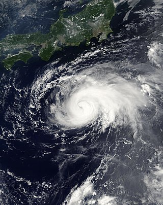
Typhoon Maria was a minimal typhoon which brushed the southeastern coast of Japan during early August 2006. The seventh named storm of the 2006 Pacific typhoon season, Maria formed out of a tropical depression over the open waters of the western Pacific Ocean. On August 5, the Japan Meteorological Agency (JMA) classified the depression as a tropical storm while the Joint Typhoon Warning Center (JTWC) kept it as a depression. The storm quickly strengthened into a typhoon the next day, reaching its peak intensity with winds of 130 km/h early on August 6. The storm gradually weakened as it began to recurve, causing it to parallel the southeastern coast of Japan. On August 9, Maria weakened into a tropical depression and later into an extratropical cyclone before dissipating on August 15. Maria had only minor effects in Japan, mainly heavy rains which were estimated to have peaked over 400 mm (15.7 in) on the Izu Peninsula. One person was killed after being struck by lightning and six others were injured.

Typhoon Yagi was an intense typhoon, the strongest of the 2006 Pacific typhoon season, which reached the equivalence of Category 5 on the Saffir–Simpson scale. Forming out of a tropical depression on September 16, Yagi quickly strengthened as it executed a slow clockwise loop over the open waters of the western Pacific Ocean. On September 19, Yagi strengthened into a typhoon as a subtropical ridge steered the storm towards the west. Two days later, the storm reached its peak intensity with winds of 195 km/h (121 mph) 10-minute winds with a minimum pressure of 910 hPa (mbar). The typhoon gradually weakened as it recurved towards the northeast and was downgraded to a severe tropical storm on September 24 and became extratropical the next day. The storm was last noted near the Aleutian Islands on September 27. The typhoon caused severe damage on the island of Chichijima but no injuries were reported as a result of the storm.

Severe Tropical Storm Faxai, known in the Philippines as Tropical Storm Juaning, was a short-lived tropical storm that had minor effects on land. The twentieth named storm of the 2007 Pacific typhoon season, Faxai originated from a tropical depression over the open waters of the western Pacific Ocean in late October. The storm quickly strengthened, becoming a severe tropical storm on October 26 as it rapidly traveled toward the northeast. The storm became extratropical the following day as it brushed Japan. The remnants dissipated on October 28.

Typhoon Kirogi, known in the Philippines as Typhoon Ditang, was a large typhoon that caused severe damage in Japan during early July 2000. Forming out of an area of disturbed weather on June 30, Kirogi initially tracked slowly towards the north. On July 3, the storm underwent rapid intensification and attained Category 4 status on the Saffir–Simpson Hurricane Scale the next day, according to the JTWC. On July 5, the Japan Meteorological Agency (JMA) assessed the storm to have reached its peak intensity with 10-minute sustained winds of 155 km/h (100 mph) and a barometric pressure of 940 hPa (27.76 inHg). Over the following several days, the storm tracked towards the northeast and accelerated towards Japan. Early on July 8, Kirogi brushed eastern Japan before transitioning into an extratropical cyclone.
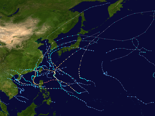
This timeline documents all of the events of the 2010 Pacific typhoon season. Most of the tropical cyclones forming between May and November. The scope of this article is limited to the Pacific Ocean, north of the equator between 100°E and the International Date Line. Tropical storms that form in the entire Western Pacific basin are assigned a name by the Japan Meteorological Agency. Tropical depressions that form in this basin are given a number with a "W" suffix by the United States' Joint Typhoon Warning Center. In addition, the Philippine Atmospheric, Geophysical and Astronomical Services Administration (PAGASA) assigns names to tropical cyclones that enter or form in the Philippine area of responsibility. These names, however, are not in common use outside of the Philippines.

Typhoon Abby, known in the Philippines as Typhoon Diding, was an extremely powerful tropical cyclone which was the second typhoon to strike Japan within a span of a few days in August 1983. First noted southeast of Guam on July 31, development of this system was initially slow to occur; it was first classified on August 5, and was upgraded into a tropical storm the next day. Intensification was rapid as Abby slowly recurved northward on August 7 and 8. After reaching peak intensity with winds of 140 mph (225 km/h) early on August 9, Abby slowly weakened, though the storm briefly re-intensified on August 11. By August 14, winds had diminished to 100 mph (160 km/h). Abby finally weakened back into a tropical storm on August 17 not long after making landfall in Japan. The following day, Abby completed the transition to an extratropical cyclone after moving through central Japan. However, meteorologists continued monitoring the storm for six more days.

Typhoon Dolphin was a powerful tropical cyclone that produced the first typhoon-force winds on Guam since Typhoon Pongsona in 2002. The seventh named storm of the 2015 Pacific typhoon season, Dolphin formed on May 6 in the vicinity of the Federated States of Micronesia (FSM). Moving eastward at first, the storm slowly organized before beginning a north and west-northwest trajectory. Dolphin intensified into a typhoon before passing between Guam and Rota on May 15, producing typhoon-force winds on both islands. It later rapidly intensified as it curved to the north. The American-based Joint Typhoon Warning Center (JTWC) designated Dolphin as a super typhoon, while the Japan Meteorological Agency (JMA) estimated 10 minute sustained winds of 185 km/h (115 mph). Dolphin turned to the northeast and weakened, becoming extratropical on May 20 and exiting the western Pacific basin on May 24.
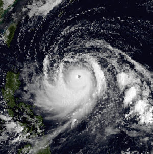
Typhoon Dinah, known as Typhoon Luding in the Philippines, was the costliest tropical cyclone to form in the 1987 Pacific typhoon season. It also was the fourth typhoon to form during August 1987. An area of low pressure developed near Guam on August 19, and two days later, the low reached tropical storm intensity as it moved generally west. Intensification was initially gradual, with Dinah becoming a typhoon early on August 24, before it subsequently intensified at a faster pace. Dinah reached its highest strength on August 26 before turning northward on August 28 and into a less favorable conditions aloft, which prompted weakening. Dinah entered the Sea of Japan after passing near Okinawa on August 29, where Dinah leveled off in intensity. The system then began to recurve towards southwestern Japan, and after tracking through the area, Dinah transitioned into an extratropical cyclone on August 31, although the remnants could be traced for four more days as it approached the International Date Line.

Typhoon Abby, known as Typhoon Norming in the Philippines, was the second typhoon to affect Taiwan in a month during September 1986. A tropical depression developed on September 13 and the next day attained tropical storm status, upon which it was named Abby. Continuing to intensify, Abby moved west-northwest and became a typhoon on September 16. Two days later, the typhoon attained maximum intensity. On September 19, the typhoon made landfall in Taiwan as it turned towards the northwest. Rapid weakening occurred due to land interaction, and on September 20, Typhoon Abby transitioned into an extratropical cyclone. Its extratropical remnants were last noted on September 24 as they raced off to the northeast.

Tropical Storm Winona struck Japan during August 1990. An area of disturbed weather developed within the monsoon trough, located over the East China Sea, on August 4. Despite the presence of strong wind shear, a tropical depression developed later that day. The depression initially tracked northeast, bypassing the southern tip of Kyushu. Thereafter, the depression turned southeast, and on August 6, was believed to have obtained tropical storm intensity. In response to a building subtropical ridge to its southeast, Winona veered north while gradually intensifying. On August 9, Winona peaked in intensity, and while near peak intensity, made landfall in Shizuoka Prefecture early the following morning. Winona transitioned into an extratropical cyclone on August 11, and was last observed on August 14.
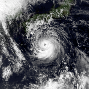
Typhoon Zola struck Japan during August 1990. An area of disturbed weather developed during mid-August to the west of Guam. The disturbance developed into a tropical depression on August 16 while tracking eastward. Decreased wind shear aided in intensification, and it is estimated that the depression strengthened into a tropical storm on August 17. Continuing to intensify, Zola turned northwest in response to a subtropical ridge to its east before obtaining typhoon intensity on August 20. Typhoon Zola reached its peak intensity the next day. After weakening slightly, the storm moved ashore on Honshu. On August 23, the system transitioned into an extratropical cyclone over the Sea of Japan.
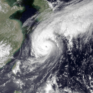
Typhoon Kinna, known in the Philippines as Typhoon Neneng, was a mid-season typhoon that struck Japan during 1991. An area of disturbed weather formed within the Western Pacific monsoon trough during early September 1991. The disturbance was upgraded into a tropical depression on September 10 after an increase in organization. Tracking northwest due to a weak subtropical ridge to its north, the depression strengthened into a tropical storm at 00:00 UTC on September 11. Later that day, Kinna was upgraded into a severe tropical storm. Following the development of a poorly defined eye, Kinna was upgraded into a typhoon on September 12. The cyclone turned north in response to a trough and passed through Okinawa as a minimal typhoon. Typhoon Kinna obtained peak intensity on September 13, but thereafter, Kinna accelerated north-northeastward toward Kyushu, passing over the island that day at peak intensity. Typhoon Kinna rapidly transitioned into an extratropical low as it tracked along the northern coast of Honshu. Its extratropical remnants were last noted on the evening of September 16.

Typhoon Janis, known in the Philippines as Typhoon Gloring, was an early-season typhoon that struck Japan during August 1992. An area of disturbed weather formed near Pohnpei in late-July 1992, and after an increase in thunderstorm activity, a tropical depression developed on August 3. After passing near Guam, Janis tracked generally westward, and on August 5, the storm was believed to have attained typhoon intensity. After intensifying at a brisk pace, Janis attained peak intensity on August 6 near Okinawa. Thereafter, the typhoon began to weaken and accelerate as it recurved towards Kyushu, where it made landfall on the next day. Land interaction took its toll on the typhoon as it tracked northeast, paralleling the western coast of Honshu. On August 9, Janis transitioned into an extratropical low over Hokkaido.


