 Typhoon Fitow at peak intensity on August 31 | |
| Meteorological history | |
|---|---|
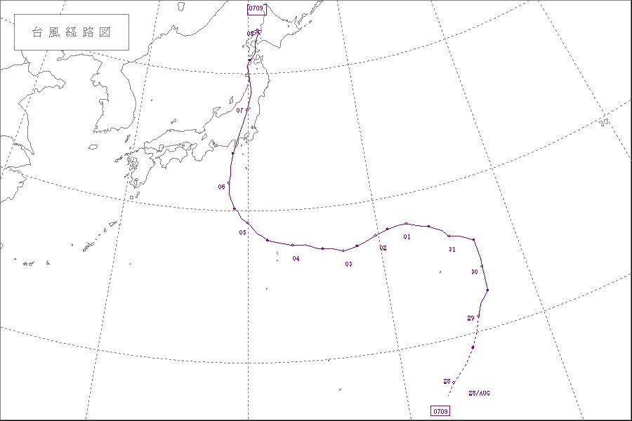
| Formed | August 26,2007 |
| Extratropical | September 8,2007 |
| Dissipated | September 11,2007 |
| Typhoon | |
| 10-minute sustained (JMA) | |
| Highest winds | 130 km/h (80 mph) |
| Lowest pressure | 965 hPa (mbar);28.50 inHg |
| Category 1-equivalent typhoon | |
| 1-minute sustained (SSHWS/JTWC) | |
| Highest winds | 150 km/h (90 mph) |
| Lowest pressure | 963 hPa (mbar);28.44 inHg |
| Overall effects | |
| Fatalities | 3 direct |
| Damage | $1 billion (2007 USD) |
| Areas affected | Japan and Russian Far East |
| IBTrACS | |
Part of the 2007 Pacific typhoon season | |
Typhoon Fitow was the ninth named tropical storm of the 2007 Pacific typhoon season that made landfall in Japan during early September. At its peak,it was thought to have been a minimal Category 2 typhoon by the JTWC,but was,in post-storm analysis,downgraded to a Category 1-equivalent typhoon by the Joint Typhoon Warning Center. The name Fitow was contributed by the Federated States of Micronesia,and is Yapese for a beautiful fragrant flower. [1] The typhoon killed at least 2 people in Tokyo and was the first typhoon to hit the city since Typhoon Mawar in 2005. Damage from Fitow totaled to around 1 billion (2007 USD).


