 Lekima at peak intensity near Hainan | |
| Meteorological history | |
|---|---|
| Formed | September 28,2007 |
| Dissipated | October 4,2007 |
| Severe tropical storm | |
| 10-minute sustained (JMA) | |
| Highest winds | 110 km/h (70 mph) |
| Lowest pressure | 975 hPa (mbar);28.79 inHg |
| Category 1-equivalent typhoon | |
| 1-minute sustained (SSHWS/JTWC) | |
| Highest winds | 130 km/h (80 mph) |
| Lowest pressure | 970 hPa (mbar);28.64 inHg |
| Overall effects | |
| Fatalities | 110 total |
| Damage | $131 million (2007 USD) |
| Areas affected | Philippines,China,Vietnam |
| IBTrACS | |
Part of the 2007 Pacific typhoon season | |
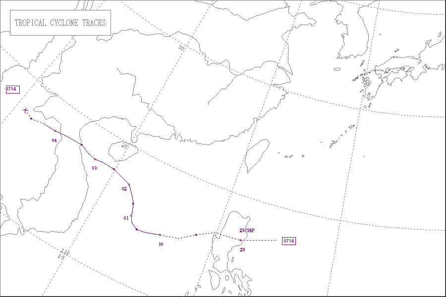
Severe Tropical Storm Lekima,known in the Philippines as Tropical Depression Hanna was a deadly tropical storm that affected both Philippines and Vietnam in late September and early October 2007. The fourteenth named storm of the 2007 Pacific typhoon season,Lekima formed from a quick-moving tropical depression on the Philippine Sea in late September. After crossing Luzon and leaving Philippine Area of Responsibility,the tropical depression organized into a tropical storm. The storm quickly strengthened into a severe tropical storm and reached a peak intensity of 110 km/h (70 mph) [nb 1] ,while slowly tracking west-northwest on September 30. Lekima would stay at peak intensity for the remainder of its life until the cyclone made a final landfall over Central Vietnam on October 3. The remnants dissipated over land later that day.
Contents
- Meteorological history
- Preparations and impact
- Philippines
- China
- Vietnam
- See also
- Notes
- References
- External links
In the Philippines,Hanna brought heavy torrential rains to Luzon that caused landslides which killed eight people in the province of Ifugao,as well as flooding,infrastructure damage,agricultural damage and disruption of transportation service in other parts of the Philippines. In China,over 100,000 people were evacuated,six flights were cancelled and more than 20,000 fishing boats were recalled back to the harbors. Greatest impacts were reported in Vietnam,as the associated rains caused hundreds of homes to be destroyed. More than 6,000 houses were washed away by the storm and 52,000 others were damaged in Vietnam. Extensive regions were affected causing heavy damage to the local agriculture. Ultimately,86 people were killed (of which 15 people were from the Thanh Hóa Province),and total damages were estimated to be at $131 million (2007 USD).

