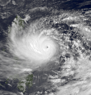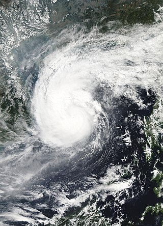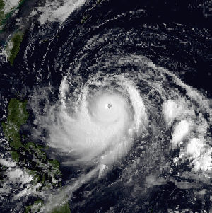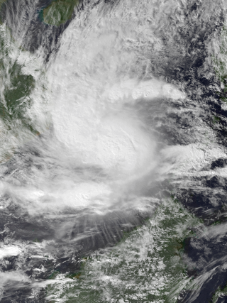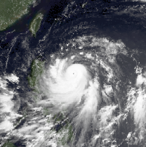
The 2003 Pacific typhoon season was a slightly below average yearlong period of tropical cyclogenesis exhibiting the development of 45 tropical depressions, of which 21 became named storms; of those, 14 became typhoons. Though every month with the exception of February and March featured tropical activity, most storms developed from May through October. During the season, tropical cyclones affected the Philippines, Japan, China, the Korean Peninsula, Indochina, and various islands in the western Pacific.

Typhoon Dot, known in the Philippines as Typhoon Saling, was the strongest storm of the 1985 season. Dot originated from a small area of thunderstorm activity in early to mid October. The system was first classified on October 11, and steadily intensified over the next few days. Dot attained typhoon strength on October 15, and subsequently entered a period of explosive deepening, which was not anticipated by forecasters. The next day the intensification rate slowed, but that evening, Dot attained its maximum intensify. A steady weakening trend began on October 17, though the system maintained typhoon intensity through the passage of the Philippines. After entering the South China Sea late on October 18, Dot briefly re-intensified, only to weaken as it approached Vietnam. On October 21, Dot struck Vietnam while still a typhoon, but dissipated the next day over the high terrain of the nation.

Typhoon Dan, known in the Philippines as Typhoon Saling, was the third of a series of tropical cyclones that impacted the Philippines and Vietnam in October 1989. The storm developed on October 6, and tracked generally westward throughout its course. After crossing Luzon, the typhoon emerged into the South China Sea and reached its peak intensity, with sustained 10-minute winds of 140 km/h (85 mph), 1-minute winds of 130 km/h (80 mph), and a minimum barometric pressure of 960 millibars. The storm moved ashore in central Vietnam and dissipated after moving inland. The storm caused extensive damage throughout its course. In the Philippines, Dan left hundreds of thousands homeless and killed 58 people. Power outages were extensive in the Manila region. In Vietnam, the storm's high winds and heavy rains caused extensive damage and loss of life. More than 500,000 structures were damaged or destroyed and at least 43 people were killed across the country.

Typhoon Alex, known in the Philippines as Typhoon Etang, affected the Taiwan, China, and South Korea during July 1987. Typhoon Alex developed from the monsoon trough that spawned a tropical disturbance late on July 21 southwest of Guam which organized into a tropical depression shortly thereafter. The system steadily became better organized, and the next day, a tropical depression had developed. Satellite intensity estimates gradually increased, and on July 23, the depression intensified into Tropical Storm Alex. After initially tracking west-northwest, Tropical Storm Alex started tracking northwest. An eye developed on July 24, and on the next day, Alex was classified as a typhoon, when Alex attained its peak intensity of 120 km/h (75 mph) and a minimum barometric pressure of 970 mbar (29 inHg). Alex weakened while tracking more northward, though interaction with Taiwan resulted in a more westward track starting on July 27. The storm struck near Shanghai as a tropical storm, and weakened over land, although it remained identifiable through August 2.

Typhoon Amy, known in the Philippines as Typhoon Gening, was the second typhoon to strike China in a week during mid-July 1991. An area of convection was first observed on July 13 within the vicinity of Yap. A tropical depression developed the next day. While initially tracking westward, the system slowly deepened, becoming Tropical Storm Amy on July 16. After briefly turning northwestward, Amy intensified into a typhoon on July 17. Continuing to intensify as it tracked through the Luzon Strait, Amy reached its peak intensity of 175 km/h (110 mph) on July 18. That evening, the typhoon began to show signs of weakening, although it was still believed to have been a typhoon when it made landfall in the province of Guangdong on July 19, becoming the strongest tropical cyclone to hit the province in 22 years. Once inland, the storm rapidly weakened, and by late on July 20, had dissipated completely.

Typhoon Brian was the first in a series of tropical cyclones to impact southern China and northern Vietnam in October 1989. Originating from an area of low pressure associated with a monsoon trough in late-September, Brian quickly organized into a tropical storm over the South China Sea on September 30. Tracking along a general west-southwest to westerly course, the storm attained typhoon status on October 1 before making landfall along the southern coast of Hainan Island the following day. Slight weakening occurred during Brian's brief passage of Hainan Island before the system entered the Gulf of Tonkin. The storm ultimately struck Vietnam on October 3 before dissipating the next day over Laos.

Typhoon Cecil, known in the Philippines as Tropical Storm Rubing, was one of two typhoons to strike Vietnam within a week in 1985. Cecil originated from an area of convection that tracked west-northwest and passed south of Palau late on October 9. The disturbance became increasingly defined as it moved through the southern Philippines. On October 12, a tropical depression developed, and the next day, the depression was upgraded into a tropical storm. Cecil turned northwest over the open waters of the South China Sea as it steadily strengthened, and was classified as a typhoon on October 14. After unexpectedly slowing down, Cecil continued to intensify and at noon of October 14, reached its peak intensity of 145 km/h (90 mph). Land interaction with Vietnam triggered a weakening trend. After turning west, Cecil moved onshore just north of Huế at 22:00 UTC on October 15. After tracking into Laos, the typhoon dissipated 39 hours later.

Severe Tropical Storm Luke, known in the Philippines as Tropical Storm Pepang, was a short-lived tropical storm that brushed Japan during September 1991. Tropical Storm Luke formed from a disturbance that moved through the Northern Marianas and became a tropical depression on September 14 just to the west of the islands. The depression began to slowly intensify as it moved towards the west-northwest and Tropical Storm Luke was named on September 15. Luke reached peak intensity prior to recurving to the northeast and weakening due to increased shear. Tropical Storm Luke then paralleled the southeastern Japan coastline before transitioning into an extratropical cyclone. Overall, 12 people were killed and 23 others were injured. A total of 225 houses were destroyed while 52,662 others were flooded. There were reports of 644 landslides and roads were damaged at 418 locations. Rivers crested at 18 spots and six bridges were washed away. Greater than 40 domestic flights were cancelled. A total of 103 bullet trains were cancelled and 160 others delayed between Tokyo and Osaka, which left 315,000 people stranded. Additionally, 11,999 trains were halted in eastern and northern Japan, stranding 750,000 passengers. Two ships as well as 4,973 ha of farmland were damaged. Monetary damage totaled ¥24.2 billion yen (US$179 million).

Tropical Storm Vongfong affected China after a deadly flood season. The 14th named storm of the 2002 Pacific typhoon season, Vongfong developed as a tropical depression on August 10. Initially it was disorganized due to hostile conditions, and it failed to intensify significantly before crossing the Philippine island of Luzon. There, flooding forced 3,500 people to evacuate their homes. In the Philippines, the storm killed 35 people and caused $3.3 million in damage.

Typhoon Nepartak, known in the Philippines as Typhoon Weng, was a modest tropical cyclone that struck the central Philippines and the southern China island of Hainan in November 2003. Forming as a tropical depression on November 11 between Yap and Guam, the system moved westward and slowly intensified. It received the name Nepartak midday on November 12 from the Japan Meteorological Agency, becoming the 20th named storm of the 2003 Pacific typhoon season. On November 13, Napartak struck Samar in the Philippines and bisected the island chain. Up to four million people lost power, and transportation ground to a halt; over 5,000 individuals became stranded on ships forced to stay in port during the tropical storm. It was reported that 13 individuals died in the storm in the Philippines.

Severe Tropical Storm Tess known in the Philippines as Tropical Storm Welpring was the second of three tropical cyclones to directly impact the Philippines in a two-week time frame in 1988. An area of disturbed weather near the Philippines was first observed on November 1. Following an increase in organization, the disturbance was designated as a tropical cyclone on November 4. Moving west, Tess steadily strengthened due to favorable conditions aloft. During the evening of November 5, Tess was estimated to have achieved its highest intensity, with winds of 115 km/h (70 mph). Rapid weakening then ensured as Tess neared Vietnam, and after making landfall in the country on November 6, Tess dissipated the next day.

Typhoon Dinah, known as Typhoon Luding in the Philippines, was the costliest tropical cyclone to form in the 1987 Pacific typhoon season. It also was the fourth typhoon to form during August 1987. An area of low pressure developed near Guam on August 19, and two days later, the low reached tropical storm intensity as it moved generally west. Intensification was initially gradual, with Dinah becoming a typhoon early on August 24, before it subsequently intensified at a faster pace. Dinah reached its highest strength on August 26 before turning northward on August 28 and into a less favorable conditions aloft, which prompted weakening. Dinah entered the Sea of Japan after passing near Okinawa on August 29, where Dinah leveled off in intensity. The system then began to recurve towards southwestern Japan, and after tracking through the area, Dinah transitioned into an extratropical cyclone on August 31, although the remnants could be traced for four more days as it approached the International Date Line.

Typhoon Cary, known as Typhoon Ising in the Philippines, was the second of two tropical cyclones to affect Vietnam in a week. An area of disturbed weather developed southwest of Pohnpei on August 6, 1987. The system initially remained disorganized, but by August 14, Cary had attained tropical storm intensity. After initially moving north-northwest, Cary turned west-northwest, although intensification was slow to occur. On August 15, Cary was upgraded into a typhoon, and on August 17, the typhoon peaked in intensity. Typhoon Cary then made landfall in northern Luzon while at peak intensity. Across the Philippines, 954 houses were damaged and an additional 89 were destroyed, which left 55,567 people, or 13,247 families that were either homeless or otherwise sought shelter. Five people died in the country while damage totaled $5.58 million (1987 USD), including $1.45 million from agriculture and $4.13 million from infrastructure. The storm weakened over land, but re-intensified into a typhoon over the South China Sea. On August 21, Typhoon Cary passed just south of Hainan, where hundreds of homes were damaged but no fatalities occurred, and subsequently entered the Gulf of Tonkin. The storm weakened as it approached Vietnam, and on August 23, the storm dissipated inland over Laos. Across Vietnam, almost 40,000 ha of land were flooded or destroyed. Twenty people were killed and many others were injured.

Severe Tropical Storm Gladys in August 1991 was a large tropical cyclone that affected Japan and South Korea. An area of disturbed weather first formed within the Western Pacific monsoon trough on August 15. Slowly organizing, the disturbance developed into a tropical depression on August 15. Heading northwest, Gladys became a tropical storm the following day. Despite forecasts of significant strengthening, its large size only enabled slow intensification. After turning west, Gladys attained peak intensity on August 21 near Okinawa. After turning north and bypassing Kyushu, Gladys began to encounter significant wind shear, which caused weakening. Gladys veered west, interacting with land. Gladys weakened to a tropical depression on August 24, and dissipated the next day.

Typhoon Faith, known in the Philippines as Typhoon Norming, struck both the Philippines and Vietnam during December 1998. A tropical disturbance developed within the vicinity of the western Caroline Islands during early December. At midday on December 8, the system developed into a tropical depression. Tracking northwest at a brisk pace, the depression gradually intensified, and was upgraded into a tropical storm at noon on December 9. Quickly intensifying, Faith turned to the west-northwest, and after tracking near Samar Island on the evening of December 10, Faith attained typhoon intensity. After clipping the northern tip of Palawan Island, the typhoon entered the South China Sea at peak intensity. Across the Philippines, 33 people were killed, with 30 others wounded and 36 others listed missing. A total of 6,423 homes were damaged and 3,234 houses were destroyed, leaving more than 20,000 homeless. Damage was estimated at $25.9 million, with $6.82 million from crops, $15.9 million from public infrastructure, and $3.37 million from private infrastructure.

Typhoon Irving, known in the Philippines as Tropical Storm Ruping, was a mid-season tropical cyclone that affected the Philippines and China during September 1982. An area of disturbed weather developed within the monsoon trough during early September 1982 near Guam. Following an increase in organization, a tropical depression developed on the morning of September 5. Later that day, the depression intensified into Tropical Storm Irving. Irving tracked westward, nearly becoming a typhoon before hitting the central Philippines. There, Irving uprooted trees, downed power and telephone lines, triggered landslides, and forced the cancellation of several domestic airline flights. Irving damaged 7,890 houses in Albay and Sorsogon provinces alone, resulting in 138,500 people homeless. Nation-wide, 65 people were killed, 26 others were hurt, and 29 were rendered missing. A total of 44,383 families or 248,040 residents sought shelter. Moreover, 18,488 homes were damaged and 5,599 others were demolished. Damage in the country was assessed at US$23.3 million, including US$14.2 million in crops. While crossing the island chain, Irving turned northwestward. After entering the South China Sea, Irving continued generally northwest, and became a typhoon on September 11. After developing a well-defined eye, Irving attained its peak intensity of 160 km/h (100 mph) the following day. Land interaction with Hainan Island resulted in a weakening trend, and Irving was downgraded to a tropical storm before striking the southern coast of China on September 15. Across the Leizhou Peninsula, 90% of homes were damaged. Onshore, Irving rapidly weakened and the storm dissipated on September 16.

Typhoon Warren, known in the Philippines as Typhoon Huaning, struck the Philippines and China during July 1988. An area of disturbed weather developed within the vicinity of the Caroline Islands during the second week of July. A tropical depression developed southeast of Guam on July 12, and on the next day, intensified into a tropical storm. Tracking generally west-northwest, Warren deepened into a typhoon on July 14. The storm subsequently entered a period of rapid intensification, commencing with Warren reaching its highest intensity on July 16. The following evening, the typhoon brushed Luzon, resulting in a weakening trend, although Warren was still a typhoon when it made landfall near Shantou. Warren rapidly dissipated inland.

Typhoon Ofelia, known as Typhoon Bising in the Philippines, was the first of two typhoons in 1990 to directly affect the Philippines within a week. Typhoon Ofelia originated from an area of disturbed weather embedded in the monsoon trough situated near the Caroline Islands. Slowly organizing, the disturbance tracked westward, and was designated a tropical depression on June 15. After an increase in convection, the depression was upgraded into a tropical storm on June 17. On June 19, Ofelia turned northwest and after development of a central dense overcast, Ofelia was upgraded into a typhoon late on June 20. After turning north, Ofelia obtained its maximum intensity following the development of an eye. The typhoon skirted past the northeastern tip of Luzon and near the east coast of Taiwan, commencing a rapid weakening trend. On the evening on June 23, Ofelia struck the southern portion of Zhejiang. The storm then began to track north, recurving towards the Korean Peninsula. The storm tracked through the province of Jiangsu, and at 00:00 UTC on June 24, transitioned into an extratropical cyclone, only to merge with a frontal zone on June 25.

Typhoon Percy, known in the Philippines as Typhoon Klaring, was the third tropical cyclone to affect the country in 1990. The fourth and the last tropical cyclone to be formed in June of the 1990 Pacific typhoon season, Typhoon Percy originated from an area of disturbed weather spawned by the Western Pacific monsoon trough on June 20. That same day, the disturbance was classified as a tropical depression as it slowly organized and on June 21, the depression obtained tropical storm intensity. After initially tracking westward, Percy turned towards the southwest while slowly deepening. During this time, Percy affected several of the Carolina Islands. Thirty homes were damaged and airline services were halted in and out of Yap. Farther south-southwest, seven homes were destroyed on the Ngulu Atoll. Furthermore, one boy was killed on Koror, where numerous homes lost their roofs and communication lines were downed. Percy then turned back to the west-northwest and became a typhoon on June 23. It then began to deepen at a faster rate, with Percy attaining its maximum intensity of 145 km/h (90 mph) on June 25. Two days later, on June 27, increased wind shear began to induce a weakening trend and the typhoon brushed Luzon, where eight people were killed and over 30,000 lost their homes. Despite that however, damages in the country was minor.

Typhoon Eli, known in the Philippines as Typhoon Konsing, struck the Philippines and Hainan during mid-July 1992. A weak low pressure system developed in the Philippine Sea on July 7, which became a tropical depression on the next day. The depression tracked west-northwest and strengthened into a tropical storm on July 10. After turning more westward, Eli steadily intensified, and obtained typhoon intensity that evening. The storm attained its highest intensity of 130 km/h (80 mph) early on July 11 before striking northern Luzon. After entering the South China Sea, the storm maintained most of its intensity as it approached Hainan, although agencies disagree on how precisely strong it was. After passing through Hainan late on July 13, Eli passed through the Gulf of Tonkin on the next day before striking Vietnam, where Eli quickly dissipated.


