Aleutians East Borough is a 2nd class borough in the U.S. state of Alaska. As of the 2010 census the borough's population was 3,141. The borough seat is Sand Point.
Aleutians West Census Area is a census area located in the U.S. state of Alaska. As of the 2010 census, the population was 5,561. It is part of the Unorganized Borough and therefore has no borough seat. Its largest city is Unalaska. It contains most of the Aleutian Islands, from Attu Island in the west to Unalaska Island in the east, as well as the Pribilof Islands, which lie north of the Aleutians in the Bering Sea.

Akutan (ACK-oo-tan) is a city on Akutan Island in the Aleutians East Borough of the Aleutian Islands in Alaska, United States. The population was 1,027 at the 2010 census, up from 713 in 2000. Akutan Harbor is adjacent.

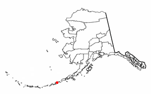
Sand Point, also known as Qagun Tayagungin, is a city in Aleutians East Borough, Alaska, United States. At the 2010 census the population was 976, up from 952 in 2000. It is on northwestern Popof Island, one of the Shumagin Islands, off the Alaska Peninsula. It is the borough seat of Aleutians East Borough, and is near the entrance to the Bering Sea.

Unimak Island is the largest island in the Aleutian Islands chain of the U.S. state of Alaska.

Umnak is one of the Fox Islands of the Aleutian Islands. With 686.01 square miles (1,776.76 km2) of land area, it is the third largest island in the Aleutian archipelago and the 19th largest island in the United States. The island is home to a large volcanic caldera on Mount Okmok and the only field of geysers in Alaska. It is separated from Unalaska Island by Umnak Pass. In 2000, Umnak was permanently inhabited by only 39 people.
Atka Island is the largest island in the Andreanof Islands of the Aleutian Islands of Alaska. The island is 50 miles (80 km) east of Adak Island. It is 65 miles (105 km) long and 2–20 miles (3–30 km) wide with a land area of 404.6 square miles (1,048 km2), making it the 22nd largest island in the United States. The northeast of Atka Island contains the Korovin volcano which reaches a peak of 5,030 feet (1,533 m). Oglodak Island is located 3.4 miles off Cape Kigun, Atka's westernmost point.
Amaknak Island or Umaknak Island is the most populated island in the Aleutian Islands.
Amak Island is an uninhabited island in Aleutians East Borough, Alaska, United States. The island lies north of the western tip of the Alaska Peninsula, and northwest of the mainland city of Cold Bay. The island's land area is 5.828 square miles (15.09 km2) and its maximum elevation is 1,601 feet (488 m). The island's volcano, Mount Amak, last erupted in 1796.
The Delarof Islands are a group of small islands at the extreme western end of the Andreanof Islands group in the central Aleutian Islands, Alaska. The Delarofs consist of 11 named islands: Amatignak, Gareloi, Ilak, Kavalga (Qavalĝa), Ogliuga (Aglaga), Skagul (Sxaĝulax̂), the Tags (Tagachaluĝis), Tanadak (Tanaadax̂), Ugidak (Qagan-tanax̂), Ulak, and Unalga (Unalĝa).

Sedanka Island is an island in the Fox Islands group of the eastern Aleutian Islands, Alaska. It is 10.3 miles (16.6 km) long and is situated off the northeast coast of Unalaska Island. It has a land area of 39.889 square miles (103.31 km2) and no permanent population.
Yunaska is the largest of the Islands of Four Mountains group in the Aleutian Islands of southwestern Alaska, United States. It has a land area of 66.834 square miles and no population at the 2000 census.
Akun Island is one of the Fox Islands subgroup of the Aleutian Islands in the Aleutians East Borough of southwestern Alaska.
Korovin Island is one of the Shumagin Islands in the Gulf of Alaska south of the Alaska Peninsula in the Aleutians East Borough of Alaska, United States. The island lies northeast of Popof Island and across the Unga Strait from the mainland peninsula. To its southeast are Andronica Island, and further southeast, Nagai Island. Korovin island has a land area of 67.85 km² and is uninhabited by humans.
Andronica Island is one of the Shumagin Islands in the Gulf of Alaska south of the Alaska Peninsula in Aleutians East Borough of Alaska, United States. It lies east of Popof Island, southeast of Korovin Island, and northwest of Nagai Island. The island has a land area of 14.661 km² and is uninhabited.
Egg Island is a small island in the Fox Islands subgroup of the Aleutian Islands in the U.S. state of Alaska. It lies off the eastern end of Unalaska Island and just off the northeastern tip of Sedanka Island. It is the easternmost island in the Aleutians West Census Area of Alaska. The island has a land area of 311.12 acres (1.259 km²) and is uninhabited. It is 19.3 kilometres (12.0 mi) long and 12 kilometres (7.5 mi) wide.

Unalaska is an island in the Fox Islands group of the Aleutian Islands in the US state of Alaska located at 53°38′N167°00′W. The island has a land area of 1,051 square miles (2,720 km2). It measures 79.4 mi (127.8 km) long and 34.7 mi (55.8 km) wide. The city of Unalaska, Alaska, covers part of the island and all of neighboring Amaknak Island where the Port of Dutch Harbor is located. The population of the island excluding Amaknak as of the 2000 census was 1,759 residents.
The Baby Islands are a group of small islands located about 1.2 miles (1.9 km) northeast of Unalga Island in the Fox Islands group of the Aleutian Islands of southwestern Alaska. The group consists of five islands ranging from 980 to 3280 feet long and several smaller islets. The islands are uninhabited and none of them rise more than a few metres above sea level. Large numbers of birds, notably the whiskered auklet, nest on the islands, making them a frequent stop for nature tours in the area. However, the ocean near the islands is extremely hazardous for ships because of the shallow water and numerous rocks that lie just below water's surface.
Akutan Island is an island in the Fox Islands group of the eastern Aleutian Islands in the Aleutians East Borough of Alaska.