
In physical geography, tundra is a type of biome where tree growth is hindered by frigid temperatures and short growing seasons. There are three regions and associated types of tundra: Arctic tundra, alpine tundra, and Antarctic tundra.

The Pribilof Islands are a group of four volcanic islands off the coast of mainland Alaska, in the Bering Sea, about 200 miles (320 km) north of Unalaska and 200 miles (320 km) southwest of Cape Newenham. The islands are part of the Alaska Maritime National Wildlife Refuge. The Siberian coast is roughly 500 miles (800 km) northwest. About 77 square miles (200 km2) in total area, they are mostly rocky and are covered with tundra, with a population of 572 as of the 2010 census.

The Bering Sea is a marginal sea of the Northern Pacific Ocean. It forms, along with the Bering Strait, the divide between the two largest landmasses on Earth: Eurasia and the Americas. It comprises a deep water basin, which then rises through a narrow slope into the shallower water above the continental shelves. The Bering Sea is named after Vitus Bering, a Danish-born Russian navigator, who, in 1728, was the first European to systematically explore it, sailing from the Pacific Ocean northward to the Arctic Ocean.
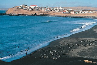
St. Paul is a city in the Aleutians West Census Area, Alaska, United States. It is the main settlement of Saint Paul Island in the Pribilofs, a small island group in the Bering Sea. The population was 413 at the 2020 census, down from 479 in 2010. Saint Paul Island is known as a birdwatching haven.

The reindeer or caribou is a species of deer with circumpolar distribution, native to Arctic, subarctic, tundra, boreal, and mountainous regions of Northern Europe, Siberia, and North America. It is the only representative of the genus Rangifer. More recent studies suggest the splitting of reindeer and caribou into six distinct species over their range.

The red knot or just knot is a medium-sized shorebird which breeds in tundra and the Arctic Cordillera in the far north of Canada, Europe, and Russia. It is a large member of the Calidris sandpipers, second only to the great knot. Six subspecies are recognised.
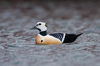
Steller's eider is a migrating Arctic diving duck that breeds along the coastlines of eastern Russia and Alaska. It is the rarest, smallest, and fastest flying of the eider species.

The little auk (Europe) or dovekieAlle alle is a small auk, the only member of the genus Alle. Alle is the Sami name of the long-tailed duck; it is onomatopoeic and imitates the call of the drake duck. Linnaeus was not particularly familiar with the winter plumages of either the auk or the duck, and appears to have confused the two species. Other old names include rotch, rotche, bullbird, and sea dove, although the latter sometimes refers to a relative, the black guillemot.

The ivory gull is a small gull, the only species in the genus Pagophila. It breeds in the high Arctic and has a circumpolar distribution through Greenland, northernmost North America, and Eurasia.

St. Lawrence Island is located west of mainland Alaska in the Bering Sea, just south of the Bering Strait. The village of Gambell, located on the northwest cape of the island, is 50 nautical miles from the Chukchi Peninsula in the Russian Far East. The island is part of Alaska, but closer to Russia and Asia than to the Alaskan and North American mainland. St. Lawrence Island is thought to be one of the last exposed portions of the land bridge that once joined Asia with North America during the Pleistocene period. It is the sixth largest island in the United States and the 113th largest island in the world. It is considered part of the Bering Sea Volcanic Province. The Saint Lawrence Island shrew is a species of shrew endemic to St. Lawrence Island. The island is jointly owned by the predominantly Siberian Yupik villages of Gambell and Savoonga, the two main settlements on the island.

The Commander Islands, Komandorski Islands, or Komandorskie Islands are a series of islands in the Russian Far East, a part of the Aleutian Islands, located about 175 km (109 mi) east of the Kamchatka Peninsula in the Bering Sea. Treeless and sparsely populated, the islands consist of Bering Island, Medny Island and fifteen islets and rocks. The largest of the latter are Tufted Puffin Rock (Kamen Toporkov or Ostrov Toporkov), 15 ha, and Kamen Ariy, which are between 3 km (1.9 mi) and 13 km (8.1 mi) west of the only settlement, Nikolskoye. Administratively, the Commanders compose the Aleutsky District of the Kamchatka Krai in Russia.
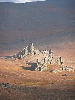
The Bering Land Bridge National Preserve is one of the most remote Protected areas of the United States, located on the Seward Peninsula. The National Preserve protects a remnant of the Bering Land Bridge that connected Asia with North America more than 13,000 years ago during the Pleistocene ice age. The majority of this land bridge now lies beneath the waters of the Chukchi and Bering Seas. During the glacial epoch this bridge was a migration route for people, animals, and plants whenever ocean levels fell enough to expose the land bridge. Archeologists disagree whether it was across this Bering Land Bridge, also called Beringia, that humans first migrated from Asia to populate the Americas, or whether it was via a coastal route.
Polar ecology is the relationship between plants and animals in a polar environment. Polar environments are in the Arctic and Antarctic regions. Arctic regions are in the Northern Hemisphere, and it contains land and the islands that surrounds it. Antarctica is in the Southern Hemisphere and it also contains the land mass, surrounding islands and the ocean. Polar regions also contain the subantarctic and subarctic zone which separate the polar regions from the temperate regions. Antarctica and the Arctic lie in the polar circles. The polar circles are imaginary lines shown on maps to be the areas that receives less sunlight due to less radiation. These areas either receive sunlight or shade 24 hours a day because of the earth's tilt. Plants and animals in the polar regions are able to withstand living in harsh weather conditions but are facing environmental threats that limit their survival.

The rock sandpiper is a small shorebird in the sandpiper family Scolopacidae. This is a hardy sandpiper that breeds in the arctic and subarctic regions of Alaska and the Chukotka and Kamchatka Peninsulas. It is closely related to the purple sandpiper that breeds in arctic regions of northeast Canada and the northwest Palearctic.
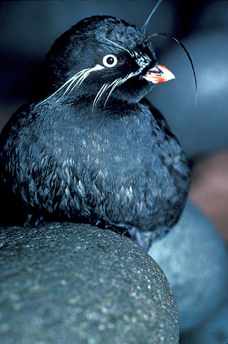
Aethia is a genus of four small (85–300g) auklets endemic to the North Pacific Ocean, Bering Sea and Sea of Okhotsk and among some of North America's most abundant seabirds. The relationships between the four true auklets remains unclear. Auklets are threatened by invasive species such as Norway rats because of their high degree of coloniality and crevice-nesting.
The wildlife of Alaska is both diverse and abundant. The Alaskan Peninsula provides an important habitat for fish, mammals, reptiles, and birds. At the top of the food chain are the bears. Alaska contains about 70% of the total North American brown bear population and the majority of the grizzly bears, as well as black bears and Kodiak bears. In winter, polar bears can be found in the Kuskokwim Delta, St. Matthew Island, and at the southernmost portion of St. Lawrence Island. Other major mammals include moose and caribou, bison, wolves and wolverines, foxes, otters and beavers. Fish species are extensive, including: salmon, graylings, char, rainbow and lake trout, northern pike, halibut, pollock, and burbot. The bird population consists of hundreds of species, including: bald eagles, owls, falcons, ravens, ducks, geese, swans, and the passerines. Sea lions, seals, sea otters, and migratory whales are often found close to shore and in offshore waters. The Alaskan waters are home to two species of turtles, the leatherback sea turtle and the green sea turtle. Alaska has two species of frogs, the Columbia spotted frog and wood frog, plus two introduced species, the Pacific tree frog and the red-legged frog. The only species of toad in Alaska is the western toad. There are over 3,000 recorded species of marine macroinvertebrates inhabiting the marine waters, the most common being the various species of shrimp, crab, lobster, and sponge.
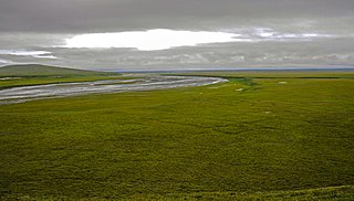
The Arctic coastal tundra is an ecoregion of the far north of North America, an important breeding ground for a great deal of wildlife.

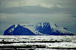
Glory of Russia Cape is the northernmost point of St. Matthew Island in the Bering Sea in the US state of Alaska. The cape is hilly, with the peak 1.3 miles (2.1 km) south of the cape being 1,475 feet (450 m) high, while at its coastline the cape is 5 m above mean sea level.

Taymyr Nature Reserve is a Russian 'zapovednik' located in the northern lowlands of Siberia, on the Taimyr Peninsula, and on the coast of the Laptev Sea of the Arctic Ocean. The reserve includes the most northern forest of Dahurian larch in the world, and also the most northern mainland mountain range in the world. The protected area was established to protect the breeding grounds of the Red-breasted goose as well as the summer residences of wild reindeer and the biodiversity of the Lake Taymyr. The reserve is situated about 120 km east of the town of Norilsk, and 3,000 km northeast of Moscow, in the Taymyrsky Dolgano-Nenetsky District of Krasnoyarsk Krai. In 1995, the site was designated a UNESCO MAB Reserve. The reserve was formally established in 1979, and covers an area of 1,781,928 ha (6,880.06 sq mi).

The wildlife of Iceland is the wild plant and animal life found on the island of Iceland, located in the north Atlantic Ocean just south of the Arctic Circle. The flora, fauna, and funga is limited by the geography and climate of the island. The habitats on the island include high mountains, lava fields, tundras, rivers, lakes and a coastal plain of varying width. There is a long coastline, much dissected by fjords, especially in the west, north and east, with many offshore islets. The entire country is a single ecoregion, the Iceland boreal birch forests and alpine tundra.


![Reindeer introduced to St. Matthew Island in 1944 increased from 29 animals at that time to 6,000 in the summer of 1963, a drastic overshoot of the island's carrying capacity causing a crash die-off the following winter to 42 animals. Based on the size of the island, recent estimates put the carrying capacity at about 1,670 animals [Klein, D. R. (n.d.). The Introduction, Increase, and Crash of Reindeer on St. Matthew Island. Retrieved May 25, 2016, from https://web.archive.org/web/20110709032911/http://dieoff.org/page80.htm]. St. Matthew Island Reindeer Population.svg](http://upload.wikimedia.org/wikipedia/commons/thumb/7/7a/St._Matthew_Island_Reindeer_Population.svg/220px-St._Matthew_Island_Reindeer_Population.svg.png)


