Union Township | |
|---|---|
 Union Township | |
| Coordinates: 39°31′30″N100°22′47″W / 39.52500°N 100.37972°W | |
| Country | United States |
| State | Kansas |
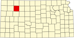
| County | Sheridan |
| Area | |
• Total | 35.70 sq mi (92.5 km2) |
| • Land | 35.70 sq mi (92.5 km2) |
| • Water | 0 sq mi (0 km2) 0% |
| Elevation | 2,625 ft (800 m) |
| Population (2010) | |
• Total | 42 |
| • Density | 1.2/sq mi (0.45/km2) |
| GNIS ID | 471109 [2] |
Union Township is a township in Sheridan County, Kansas, United States. As of the 2010 Census, it had a population of 42. [3]