Mystic, Kansas | |
|---|---|
 | |
 Mystic  Mystic | |
| Coordinates: 39°22′50″N100°43′12″W / 39.38056°N 100.72000°W | |
| Country | United States |
| State | Kansas |
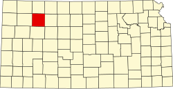
| County | Sheridan |
| Elevation | 2,986 ft (910 m) |
| Population | |
• Total | 0 |
| Time zone | UTC-6 (CST) |
| • Summer (DST) | UTC-5 (CDT) |
| Area code | 785 |
| GNIS ID | 482590 [1] |
Mystic is a ghost town in Sheridan County, Kansas, United States.