Sheridan County is a county located in the U.S. state of Kansas. Its county seat is Hoxie. As of the 2020 census, the county population was 2,447. The county was named in honor of Philip Sheridan, a Union general during the Civil War.

Rooks County is a county located in the U.S. state of Kansas. Its county seat is Stockton, and its largest city is Plainville. As of the 2020 census, the county population was 4,919. The county was named for John Rooks, a private in Company I of the 11th Kansas Cavalry Regiment, who died at the Battle of Prairie Grove during the American Civil War.
Sheridan Lake is a statutory town located in Kiowa County, Colorado, United States. The population was 55 at the 2020 census.
Plainville is a town in Hartford County, Connecticut, United States. The town is part of the Capitol Planning Region. The population was 17,525 at the 2020 census.

Palco is a city in Rooks County, Kansas, United States. As of the 2020 census, the population of the city was 208.

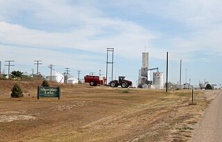
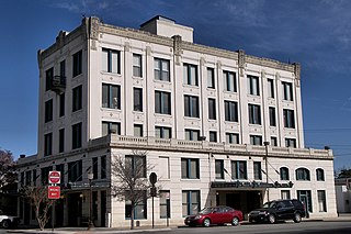
Plainville is a city in Rooks County, Kansas, United States. As of the 2020 census, the population of the city was 1,746. It was named from its setting upon the plains.

Zurich is a city in Rooks County, Kansas, United States. As of the 2020 census, the population of the city was 89.

Paradise is a city in Russell County, Kansas, United States. As of the 2020 census, the population of the city was 35.

Hoxie is a city in and the county seat of Sheridan County, Kansas, United States. As of the 2020 census, the population of the city was 1,211.
Plainville is a town in Norfolk County, Massachusetts, United States. The population was 9,945 at the time of the 2020 census. Plainville is part of the Boston and Providence metropolitan areas.
Seguin is a city in and the county seat of Guadalupe County, Texas, United States. The population was 29,433 at the 2020 census, and according to 2023 census estimates, the city is estimated to have a population of 36,013.
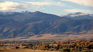
Sheridan is a city in the U.S. state of Wyoming and the county seat of Sheridan County. The city is located halfway between Yellowstone Park and Mount Rushmore by U.S. Route 14 and 16. It is the principal town of the Sheridan, Wyoming, Micropolitan Statistical Area which encompasses all of Sheridan County. The 2020 census put the city's population at 18,737, making it the 6th most populous city in Wyoming.

Codell is a census-designated place (CDP) in Rooks County, Kansas, United States. As of the 2020 census, the population was 49.
Angelus is an unincorporated community in Sheridan County, Kansas, United States. It is located in Solomon Township, approximately 20 miles southwest of Hoxie. Also, it is located northwest of Grinnell and Interstate 70.
Studley is an unincorporated community in Sheridan County, Kansas, United States, approximately 16 miles east of Hoxie along U.S. Route 24. It is on the eastern edge of the county in Valley Township, bordering Graham County. It was named after the Studley Royal Park, in England.
Lucerne is a ghost town in Adell Township, Sheridan County, Kansas, United States. It is approximately 18 miles northeast of the county seat of Hoxie.
Motor is a ghost town in Paradise Township, Rooks County, Kansas, United States.
Tasco is an unincorporated community in Sheridan County, Kansas, United States. It is located approximately seven miles east of Hoxie and south of U.S. Route 24, adjacent to an abandoned railroad.

Township 12 is a township in Rooks County, Kansas, United States. Codell is the largest population center in Township 12.
Hoxie USD 412 is a public unified school district headquartered in Hoxie, Kansas, United States. The district includes the communities of Hoxie, Jennings, Leoville, Seguin, Studley, Tasco, Allison, Dresden, rural areas southwest of the Clayton, and other nearby rural areas.