Valdez | |
---|---|
Coordinates: 28°50′43″N081°19′20″W / 28.84528°N 81.32222°W | |
Country | United States |
State | Florida |
County | Volusia |
Elevation | 16 ft (5 m) |
Time zone | UTC-5 (Eastern (EST)) |
• Summer (DST) | UTC-4 (EDT) |
enter ZIP code | 32713 |
Area code | 386 |
GNIS feature ID | 292722 [1] |
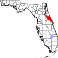
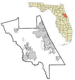
Valdez is an unincorporated community [2] located in southwest Volusia County, Florida, within the city limits of DeBary. Valdez is located along U.S. Highway 17-92 (Charles Richard Beall Blvd.) where it intersects with Barwick Road, just north of the St. Johns River.
Valdez was named in honor of Antonio Valdez, the secretary of the Spanish navy in 1787, when the Spanish explored the area. [3] He chose one of his protégés, Lt. Jose del Rio Cossa, to conduct an exploratory survey of Florida's naval store resources. In this survey, Cossa created an enormous map in which he renamed Lake George (now Lake Monroe) to Laguna Valdez. Although this name did not persist, pre-American land deeds referred to what is now Lake Monroe as Valdez. [4]
In 1928, Florida Power & Light began constructing a power plant in Valdez on the north shore of the St. Johns river. [3]
Volusia County is located in the east-central part of the U.S. state of Florida between the St. Johns River and the Atlantic Ocean. As of the 2020 census, the county was home to 553,543 people, an increase of 11.9% from the 2010 census. It was founded on December 29, 1854, from part of Orange County, and was named for the community of Volusia, located in northwestern Volusia County. Its first county seat was Enterprise. Since 1887, its county seat has been DeLand.
Astor is an unincorporated community and census-designated place (CDP) in Lake County, Florida, United States, located on the west side of the St. Johns River between Lake George and Lake Dexter. The community straddles State Road 40, with the community of Volusia in Volusia County across the St. Johns to the east and Astor Park to the west. The population was 1,556 at the 2010 census. It is part of the Orlando–Kissimmee–Sanford Metropolitan Statistical Area.
DeBary is a city in Volusia County, Florida, United States, on the eastern shore of the St. Johns River near Lake Monroe. According to the 2020 U.S. Census, the city had a population of 20,696. It is part of the Deltona–Daytona Beach–Ormond Beach, FL metropolitan statistical area, which was home to 553,284 people in 2019.
DeLand is a city in and the county seat of Volusia County, Florida, United States. The city sits approximately 34 miles (55 km) north of the central business district of Orlando, and approximately 23 miles (37 km) west of the central business district of Daytona Beach. As of the 2020 U.S. census, the population was 37,351. It is a part of the Deltona–Daytona Beach–Ormond Beach metropolitan area, which was home to 590,289 people as of the 2010 census.
Deltona is a city in Volusia County, Florida, United States. It is located on the northern shore of Lake Monroe. As of the 2020 census, the city population was 93,692. It is a principal city of the Deltona–Daytona Beach–Ormond Beach metropolitan area, which was home to an estimated 685,344 people in 2021. It is the third largest city in the Greater Orlando combined statistical area.
New Smyrna Beach is a city in Volusia County, Florida, United States, located on the central east coast of the state, with the Atlantic Ocean to the east. Its population is 30,142 in 2020 by the United States Census Bureau. The downtown section of the city is located on the west side of the Indian River and the Indian River Lagoon system. The Coronado Beach Bridge crosses the Intracoastal Waterway just south of Ponce de Leon Inlet, connecting the mainland with the beach on the coastal barrier island.
The St. Johns River is the longest river in the U.S. state of Florida and it is the most significant one for commercial and recreational use. At 310 miles (500 km) long, it flows north and winds through or borders twelve counties. The drop in elevation from headwaters to mouth is less than 30 feet (9 m); like most Florida waterways, the St. Johns has a very slow flow speed of 0.3 mph (0.13 m/s), and is often described as "lazy".
Lake George or Lake Welaka is a broad and shallow brackish lake on the St. Johns River in the U.S. state of Florida.
Central Florida is a region of the U.S. state of Florida. Different sources give different definitions for the region, but as its name implies it is usually said to comprise the central part of the state, including the Tampa Bay area and the Greater Orlando area, though in recent times the Tampa Bay area has often been described as its own region, with "Central Florida" becoming more synonymous with the Orlando area.
State Road 40 is a 91.832-mile-long (147.789 km) east–west route across northern and east-central Florida, running from U.S. Route 41 in Rainbow Lakes Estates eastwards through Ocala over the Ocklawaha River and bridge and through the heart of the Ocala National Forest to State Road A1A in Ormond Beach. Names of the road include Silver Springs Boulevard in Ocala, Fort Brooks Road from Silver Springs through Astor, Butler Road in Astor, and Granada Boulevard in Ormond Beach. Former sections in Ormond Beach are named "Old Tomoka Road" and "Old Tomoka Avenue."
The Halifax River is part of the Atlantic Intracoastal Waterway, located in northeast Volusia County, Florida. The waterway was originally known as the North Mosquito River, but was renamed after George Montagu-Dunk, 2nd Earl of Halifax, during the British occupation of Florida (1763–1784).
Enterprise is an unincorporated community in Volusia County, in the U.S. state of Florida, and its former county seat. Situated on the northern shore of Lake Monroe, it is flanked by the cities of DeBary and Deltona. Enterprise was once the head of navigation on the St. Johns River and at various times, the county seat for three different counties: Mosquito, which was renamed as Orange; and lastly, for Volusia, which was formed from part of Orange County.
U.S. Highway 1 (US 1) in Florida runs 545 miles (877 km) along the state's east coast from Key West to its crossing of the St. Marys River into Georgia north of Boulogne and south of Folkston. US 1 was designated through Florida when the U.S. Numbered Highway System was established in 1926. With the exception of Monroe County, the highway runs through the easternmost tier of counties in the state, connecting numerous towns and cities along its route, including nine county seats. The road is maintained by the Florida Department of Transportation (FDOT).
Lake Monroe is one of the lakes that make up the St. Johns River system. The port city of Sanford is situated along the southern shore, while DeBary and Deltona are located along the northern shore. Two major central Florida roadways that run near the lake are State Road 415 and Interstate 4. It forms the border of Seminole County and Volusia County It is the 8th largest lake in the Orlando metropolitan area, after Lake Jesup, 7 miles (11 km) to the south.
Volusia is an unincorporated community in Volusia County, Florida, United States, on the eastern shore of the St. Johns River. It is about three miles south of Lake George and across the river from the town of Astor in Lake County. Established by Spanish missionaries, Volusia is one of the oldest European settlements in Florida. The main route through the town is State Road 40, which crosses the St. Johns on the Astor Bridge.
Osteen is an unincorporated community in southwest Volusia County, Florida, United States. Osteen is near the St. Johns River as well as typical swamps, forests and wildlife of Florida. Osteen attracts a number of visitors for these qualities. There are numerous camping areas and preserves such as the Hickory Bluff Preserve, a 150-acre nature preserve with hiking and horse trails.
Benson Junction is located in southwest Volusia County, Florida, within the city limits of DeBary. It is the former location of the Ox Fibre Brush Company and presently an industrial location. Benson Junction is located just west of U.S. Highway 17-92, along Benson Junction Road.
Lemon Bluff is an unincorporated community located in south Volusia County, Florida, United States. It is located along the St. Johns River southeast of Osteen, Florida near the Lake Monroe Conservation Area.
Pennichaw is a rural unincorporated community located in south Volusia County, Florida, United States. It located on Lake Harney Road, approximately 1.8 miles south of Maytown Road.
Glenwood is a small unincorporated community in West Volusia County, Florida. It developed as an orange growing agricultural and lumber industry community. It is now home to a trail and a group home residential community. It is popular for birding and borders Lake Woodruff National Wildlife Refuge.