Vanoss, Oklahoma

Last updated

Vanoss
USA Oklahoma location map.svg
Red pog.svg
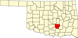
Vanoss
Location within the state of Oklahoma
Usa edcp location map.svg
Red pog.svg
Vanoss
Vanoss (the United States)
Coordinates: 34°45′27″N96°52′39″W / 34.75750°N 96.87750°W / 34.75750; -96.87750
Country United States
State Oklahoma
County Pontotoc
Area
[1]
  Total1.21 sq mi (3.14 km2)
  Land1.21 sq mi (3.14 km2)
  Water0.00 sq mi (0.00 km2)
Elevation
[2]
1,034 ft (315 m)
Population
 (2020)
  Total146
  Density120.46/sq mi (46.49/km2)
Time zone UTC-6 (Central (CST))
  Summer (DST) UTC-5 (CDT)
FIPS code 40-76850
GNIS feature ID2805359 [2]

Vanoss is an unincorporated community in Pontotoc County, Oklahoma, United States. [2] The community is located 10 miles west of Ada. [3] The town was originally named Midland and was located a few miles away from its present location. [4] When the Oklahoma Central Railroad was built, the townspeople moved the town so it would be next to the railroad, [4] and they changed its name to Vanoss in honor of Salomon Frederik van Oss  [ nl ] (S.F. Vanoss), who was a Dutch director and financier of the Oklahoma Central Railroad. [4] [3] [5] Though little remains of the community, Vanoss Public Schools, including an elementary school, a middle school, and Vanoss High School, continue to serve the surrounding area. [4]

Demographics

Historical population
CensusPop.Note
2020 146
U.S. Decennial Census [6]

Related Research Articles

<span class="mw-page-title-main">Pontotoc County, Oklahoma</span> County in Oklahoma, United States

Pontotoc County is in the south central part of Oklahoma. As of the 2020 census, the population was 38,065. Its county seat is Ada. The county was created at statehood from part of the Chickasaw Nation in Indian Territory. It was named for a historic Chickasaw tribal area in Mississippi. According to the Encyclopedia of Oklahoma History and Culture, Pontotoc is usually translated "cattail prairie" or "land of hanging grapes."

<span class="mw-page-title-main">Conway, Arkansas</span> City in Arkansas, United States

Conway is a city in the U.S. state of Arkansas and the county seat of Faulkner County, located in the state's most populous Metropolitan Statistical Area, Central Arkansas. Although considered a suburb of Little Rock, Conway is unusual in that the majority of its residents do not commute out of the city to work. The city also serves as a regional shopping, educational, work, healthcare, sports, and cultural hub for Faulkner County and surrounding areas. Conway's growth can be attributed to its jobs in technology and higher education; among its largest employers being Acxiom, the University of Central Arkansas, Hendrix College, Insight Enterprises, and many technology start-up companies. Conway is home to three post-secondary educational institutions, earning it the nickname "The City of Colleges".

<span class="mw-page-title-main">Cherokee, Oklahoma</span> City in Oklahoma, United States

Cherokee is the largest city within, and county seat of, Alfalfa County, Oklahoma, United States. The population was 1,476 at the 2020 census, a decline of 1.5 percent from 2010.

<span class="mw-page-title-main">Sayre, Oklahoma</span> City in Oklahoma, United States

Sayre is a city in, and the county seat of, Beckham County, in western Oklahoma, United States. It is halfway between Oklahoma City and Amarillo, Texas on Interstate 40 and the former U.S. Route 66. The population was 4,809 at the time of the 2020 census, an increase over the 4,375 figure from the 2010 census, and the largest population ever recorded by a census since Sayre's founding.

<span class="mw-page-title-main">Calera, Oklahoma</span> Town in Oklahoma, United States

Calera is a town in Bryan County, Oklahoma, United States, located five miles south of Durant and 10 miles north of the Oklahoma-Texas state line. The population was 2,906 at the 2020 census, an increase of 34.2 percent over the figure of 2,164 recorded in 2010 indicating that Calera is experiencing larger growth than Durant and other surrounding areas. It is part of the Durant Micropolitan Area, as well as being part of the Texoma region.

<span class="mw-page-title-main">Yukon, Oklahoma</span> City in Oklahoma, United States

Yukon is a city in eastern Canadian County, Oklahoma, United States. The population was 23,630 at the 2020 census. Founded in the 1890s, the town was named in reference to a gold rush in Yukon Territory, Canada, at the time. Historically, Yukon served as an urban center for area farmers and the site of a milling operation. Currently, it is primarily a residential community for people who work in the Oklahoma City Metropolitan Area.

<span class="mw-page-title-main">Grove, Oklahoma</span> City in Oklahoma, United States

Grove is a city in Delaware County, Oklahoma, United States. The population was 6,623 at the 2010 census, an increase of 27.6 percent over the figure of 5,131 recorded in 2000. Grove is surrounded by Grand Lake o’ the Cherokees, a professional bass fishing tournament lake and recreational hotspot during the travel season of Memorial Day to Labor Day.

<span class="mw-page-title-main">Pauls Valley, Oklahoma</span> City in Oklahoma, United States

Pauls Valley is a city in and the county seat of Garvin County, Oklahoma, United States. The population was 5,992 at the 2020 census, a decline of 3.2 percent from the figure of 6,187 in 2010. It was settled by and named for Smith Paul, a North Carolina native who married a Chickasaw woman and became a citizen of the Chickasaw Nation before the Civil War. The town economy is largely based on agriculture and oil production.

<span class="mw-page-title-main">Wilburton, Oklahoma</span> City in Oklahoma, United States

Wilburton is a city in Latimer County, Oklahoma, United States. It is the county seat of Latimer County. The city had a population of 2,285 as of the 2020 Census. Robbers Cave State Park is 5 miles (8.0 km) north of Wilburton.

<span class="mw-page-title-main">Wister, Oklahoma</span> Town in Oklahoma, United States

Wister is a town in Le Flore County, Oklahoma, United States. It is part of the Fort Smith metropolitan area. The population was 1,102 at the 2010 census. Wister is named for Gutman G. Wister, an official with the Choctaw, Oklahoma and Gulf Railroad.

<span class="mw-page-title-main">Idabel, Oklahoma</span> City in Oklahoma, United States

Idabel is a city in and county seat of McCurtain County, Oklahoma, United States. The population was 7,010 at the 2010 census. It is in Oklahoma's southeast corner, a tourist area known as Choctaw Country.

<span class="mw-page-title-main">Hartshorne, Oklahoma</span> City in Oklahoma, United States

Hartshorne is a city in Pittsburg County, Oklahoma, United States. It is the second largest city in the county. The population was 2,125 at the 2010 census.

<span class="mw-page-title-main">McAlester, Oklahoma</span> City in Oklahoma, United States

McAlester is the county seat of Pittsburg County, Oklahoma. The population was 18,363 at the time of the 2010 census, a 3.4 percent increase from 17,783 at the 2000 census. The town gets its name from James Jackson McAlester, an early white settler and businessman who later became lieutenant governor of Oklahoma. Known as "J. J.", McAlester married Rebecca Burney, the daughter of a full-blood Chickasaw family, which made him a citizen of the Chickasaw Nation.

<span class="mw-page-title-main">McLoud, Oklahoma</span> City in Oklahoma, United States

McLoud is a city in northwestern Pottawatomie County, Oklahoma, United States, and is part of the Oklahoma City Consolidated Metropolitan Area. The population was 4,044 at the 2010 census, a 14.0 percent increase from the figure of 3,548 in 2000. The city was founded in 1895 and named for John W. McLoud, attorney for the Choctaw, Oklahoma and Gulf Railroad.

<span class="mw-page-title-main">Sallisaw, Oklahoma</span> City in Oklahoma, United States

Sallisaw is a city and county seat in Sequoyah County, Oklahoma, United States. As of the 2010 Census, it had a population of 8,880, an 11.2 percent increase over the figure of 7,891 recorded in 2000. Sallisaw is part of the Fort Smith, Arkansas–Oklahoma Metropolitan Statistical Area.

<span class="mw-page-title-main">Frederick, Oklahoma</span> City in Oklahoma, United States

Frederick is a city and county seat of Tillman County, Oklahoma, United States. The population was 3,940 at the 2010 census. It is an agriculture-based community that primarily produces wheat, cotton, and cattle. Frederick is home to three dairies, a 1400-acre industrial park, and Frederick Regional Airport, which includes restored World War II hangars which house the World War II Airborne Demonstration Team.

<span class="mw-page-title-main">Purcell, Oklahoma</span> City in Oklahoma, United States

Purcell is a city in and the county seat of McClain County, Oklahoma, United States. As of the 2020 census, the city population was 6,651, a 13% increase from 2010.

<span class="mw-page-title-main">Blanchard, Oklahoma</span> City in Oklahoma, United States

Blanchard is a city in McClain and Grady counties in the U.S. state of Oklahoma. The population was 8,879 at the 2020 census, up from 7,670 at the 2010 census. Blanchard is part of a rapidly growing area of northern McClain and Grady counties known as the "Tri-City Area" with Newcastle and Tuttle.

<span class="mw-page-title-main">Owasso, Oklahoma</span> City in Oklahoma, United States

Owasso is a city in Rogers and Tulsa Counties in the U.S. state of Oklahoma, and the largest northern suburb of Tulsa. The population was 39,328 persons as of the 2022 census estimate, compared to 28,915 at the 2010 census, a gain of 36 percent. Originally settled in 1881 in Indian Territory, the town was incorporated in 1904 just before Oklahoma statehood and was chartered as a city in 1972.

<span class="mw-page-title-main">Broken Arrow, Oklahoma</span> City in Oklahoma, United States

Broken Arrow is a city in Tulsa and Wagoner counties in the U.S. state of Oklahoma. It is the largest suburb of Tulsa. According to the 2020 census, Broken Arrow has a population of 113,540 residents and is the 4th most populous city in the state. The city is part of the Tulsa Metropolitan Area, which has a population of 1,023,988 residents.

References

  1. "ArcGIS REST Services Directory". United States Census Bureau. Retrieved September 20, 2022.
  2. 1 2 3 U.S. Geological Survey Geographic Names Information System: Vanoss, Oklahoma
  3. 1 2 Shirk, George H. Oklahoma Place Names, Norman, Oklahoma: University of Oklahoma Press, 2nd ed., 1987, p.108-109.
  4. 1 2 3 4 Marks, Linda. "Vanoss History". Vanoss Public Schools. Vanoss Public Schools. Retrieved October 10, 2016.
  5. Veenendaal, Jr., Augustus J. "Oklahoma Central Railroad,", Encyclopedia of Oklahoma History and Culture, Oklahoma Historical Society. Accessed October 10, 2016.
  6. "Census of Population and Housing". Census.gov. Retrieved June 4, 2016.