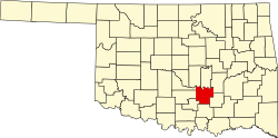
Francis, Oklahoma | |
---|---|
Coordinates: 34°52′28″N96°35′33″W / 34.87444°N 96.59250°W | |
Country | United States |
State | Oklahoma |
County | Pontotoc |
Area | |
• Total | 0.56 sq mi (1.45 km2) |
• Land | 0.56 sq mi (1.45 km2) |
• Water | 0.00 sq mi (0.00 km2) |
Elevation | 951 ft (290 m) |
Population (2020) | |
• Total | 244 |
• Density | 436.49/sq mi (168.51/km2) |
Time zone | UTC-6 (Central (CST)) |
• Summer (DST) | UTC-5 (CDT) |
ZIP code | 74844 |
Area code | 580 |
FIPS code | 40-27650 [3] |
GNIS feature ID | 2412651 [2] |
Francis is a town in Pontotoc County, Oklahoma, United States. The population was 332 at the 2000 census.
According to the United States Census Bureau, the town has a total area of 0.6 square miles (1.6 km2), all land.
Climate data for Francis, Oklahoma | |||||||||||||
---|---|---|---|---|---|---|---|---|---|---|---|---|---|
Month | Jan | Feb | Mar | Apr | May | Jun | Jul | Aug | Sep | Oct | Nov | Dec | Year |
Mean daily maximum °F (°C) | 50.4 (10.2) | 55.8 (13.2) | 65.3 (18.5) | 74.7 (23.7) | 81 (27) | 87.9 (31.1) | 93.6 (34.2) | 93.5 (34.2) | 85.7 (29.8) | 76.1 (24.5) | 63.7 (17.6) | 53.5 (11.9) | 73.4 (23.0) |
Mean daily minimum °F (°C) | 27.5 (−2.5) | 31.6 (−0.2) | 40.4 (4.7) | 50.1 (10.1) | 58.1 (14.5) | 65.9 (18.8) | 70.6 (21.4) | 69.1 (20.6) | 61.9 (16.6) | 51.1 (10.6) | 40.5 (4.7) | 30.8 (−0.7) | 49.8 (9.9) |
Average precipitation inches (mm) | 1.5 (38) | 2.2 (56) | 3.3 (84) | 3.5 (89) | 5.6 (140) | 4.1 (100) | 2.4 (61) | 2.9 (74) | 4.5 (110) | 4.2 (110) | 2.8 (71) | 2.0 (51) | 38.9 (990) |
Source 1: weather.com | |||||||||||||
Source 2: Weatherbase.com [4] |
Census | Pop. | Note | %± |
---|---|---|---|
1910 | 931 | — | |
1920 | 911 | −2.1% | |
1930 | 607 | −33.4% | |
1940 | 370 | −39.0% | |
1950 | 271 | −26.8% | |
1960 | 286 | 5.5% | |
1970 | 283 | −1.0% | |
1980 | 365 | 29.0% | |
1990 | 346 | −5.2% | |
2000 | 332 | −4.0% | |
2010 | 315 | −5.1% | |
2020 | 244 | −22.5% | |
U.S. Decennial Census [5] |
As of the census [3] of 2000, there were 332 people, 139 households, and 97 families residing in the town. The population density was 567.1 inhabitants per square mile (219.0/km2). There were 155 housing units at an average density of 264.8 per square mile (102.2/km2). The racial makeup of the town was 81.93% White, 12.65% Native American, 0.30% Asian, and 5.12% from two or more races. Hispanic or Latino of any race were 1.51% of the population.
There were 139 households, out of which 30.9% had children under the age of 18 living with them, 51.1% were married couples living together, 15.8% had a female householder with no husband present, and 30.2% were non-families. 28.1% of all households were made up of individuals, and 10.8% had someone living alone who was 65 years of age or older. The average household size was 2.39 and the average family size was 2.89.
In the town, the population was spread out, with 23.5% under the age of 18, 8.7% from 18 to 24, 27.1% from 25 to 44, 26.5% from 45 to 64, and 14.2% who were 65 years of age or older. The median age was 40 years. For every 100 females, there were 88.6 males. For every 100 females age 18 and over, there were 85.4 males.
The median income for a household in the town was $25,083, and the median income for a family was $26,094. Males had a median income of $25,417 versus $18,393 for females. The per capita income for the town was $12,826. About 13.9% of families and 17.1% of the population were below the poverty line, including 6.8% of those under age 18 and 16.2% of those age 65 or over.
Steele is a town in northeastern St. Clair County, Alabama, United States. It was incorporated in 1952. At the 2010 census the population was 1,043, down from 1,093. The town is a part of the Birmingham–Hoover–Cullman Combined Statistical Area. It was initially known as Steel's Station or Steele's Depot in the late 19th century.
St. Francis is a town in Aroostook County, Maine, United States on the Canada–United States border at the junction of the St. Francis River and the Saint John River. The population was 438 at the 2020 census. First settled by English speakers from southern Maine, the original population has been supplanted by French-speaking Acadians.
Burnham is a town in Waldo County, Maine, United States. The population was 1,096 at the 2020 census.
Charlotte is a town in Washington County, Maine, United States. The town was named for the wife of legislator William Vance. The population was 337 at the 2020 census.
Carter is a town in Beckham County, Oklahoma, United States. The population was 183 at the time of the 2020 census.
Hunter is a town in Garfield County, Oklahoma, United States. The population was 165 at the 2010 census, a 4.6 percent decline from the figure of 173 in 2000.
Amber is a town in Grady County, Oklahoma, United States. The population was 413 at the 2020 census, a 1.4% decrease from 2010.
Bradley is a town in Grady County, Oklahoma, United States. The population was 78 at the 2020 United States census.
Ninnekah is a town in Grady County, Oklahoma, United States. The population was 775 at the 2020 census, a 22.7% decrease from 2010.
Norge is a town in Grady County, Oklahoma, United States. The population was 129 at the 2020 census, a 11% decrease from 2010.
Pocasset is a town in Grady County, Oklahoma, United States. The population was 183 at the 2020 census, a 17.3% increase from 2010.
Carney is a town in Lincoln County, Oklahoma, United States. As of the 2020 census, the population of the town was 545.
Davenport is a town in Lincoln County, Oklahoma, United States. The population was 814 at the 2010 census.
Kendrick is a town in Lincoln County, Oklahoma, United States. The population was 139 at the 2010 census.
Meeker is a town in Lincoln County, Oklahoma, United States. The population was 1,145 at the 2010 census.
Lake Aluma is a town in Oklahoma County, Oklahoma, United States, and a part of the Oklahoma City Metropolitan Area. The population was 88 at the 2010 census.
Johnson is a town in north-central Pottawatomie County, Oklahoma, United States. The population was 247 at the 2010 census, a 10.8 percent increase from the figure of 223 in 2000.
Tribbey is a town in Pottawatomie County, Oklahoma, United States.The community was named for Alpheus M. Tribbey, landowner. The population was 337 by the 2020 United States census.
Bray is a town in Stephens County, Oklahoma, United States. The population was 1,209 at the 2010 census.
Oakvale is a town in Mercer County, West Virginia, United States, along the East River. The population was 137 at the 2020 census. It is part of the Bluefield, WV-VA micropolitan area which has a population of 107,578.