Byng, Oklahoma

Last updated

Byng, Oklahoma
OKMap-doton-Byng.PNG
Location of Byng, Oklahoma
Coordinates: 34°51′56″N96°40′04″W / 34.86556°N 96.66778°W / 34.86556; -96.66778
Country United States
State Oklahoma
County Pontotoc
Area
[1]
  Total6.52 sq mi (16.89 km2)
  Land6.52 sq mi (16.89 km2)
  Water0.00 sq mi (0.00 km2)
Elevation
[2]
997 ft (304 m)
Population
 (2020)
  Total1,393
  Density213.58/sq mi (82.46/km2)
Time zone UTC-6 (Central (CST))
  Summer (DST) UTC-5 (CDT)
FIPS code 40-10600 [3]
GNIS feature ID2413143 [2]

Byng is a town in Pontotoc County, Oklahoma, United States. The population was 1,175 at the 2010 census.

Contents

History

The beginnings of the town of Byng were established in 1917 with the building of a post office and power plant (about five miles north of Ada). The post office and power plant were named to honor the World War I exploits of British General Julian Byng who commanded the Canadian Corps and was later Governor General of Canada. [4] The town was not formally formed until 1922 when the remains of two other communities were merged into Byng. Tyrola, about a mile north of Byng was almost wiped out by a flooding of the South Canadian River in 1914. New Bethel, also approximately a mile north of present-day Byng, but lying east of Tyrola, had also been formed. The school at New Bethel and the school at Tyrola were combined to create New Bethel Consolidated Number 3 in 1925, and the name was changed to Byng in 1929. The town incorporated in 1972. [5]

Geography

According to the United States Census Bureau, the town has a total area of 6.5 square miles (17 km2), all land.

The town is on U.S. Route 377. Ada is to the south, while the town of Konawa, as well as Lake Konawa, are to the north-northwest. [6]

Demographics

Historical population
CensusPop.Note
1980 833
1990 755−9.4%
2000 1,09044.4%
2010 1,1757.8%
2020 1,39318.6%
U.S. Decennial Census [7]

As of the census [3] of 2000, there were 1,090 people, 389 households, and 310 families residing in the town. The population density was 167.1 inhabitants per square mile (64.5/km2). There were 434 housing units at an average density of 66.5 per square mile (25.7/km2). The racial makeup of the town was 74.50% White, 2.02% African American, 16.15% Native American, 1.65% from other races, and 5.69% from two or more races. Hispanic or Latino of any race were 3.30% of the population.

There were 389 households, out of which 39.8% had children under the age of 18 living with them, 63.8% were married couples living together, 12.1% had a female householder with no husband present, and 20.3% were non-families. 17.2% of all households were made up of individuals, and 6.4% had someone living alone who was 65 years of age or older. The average household size was 2.80 and the average family size was 3.14.

In the town, the population was spread out, with 29.8% under the age of 18, 8.0% from 18 to 24, 27.9% from 25 to 44, 23.9% from 45 to 64, and 10.5% who were 65 years of age or older. The median age was 36 years. For every 100 females, there were 93.3 males. For every 100 females age 18 and over, there were 96.2 males.

The median income for a household in the town was $33,229, and the median income for a family was $38,906. Males had a median income of $27,596 versus $19,868 for females. The per capita income for the town was $15,028. About 11.8% of families and 15.4% of the population were below the poverty line, including 22.4% of those under age 18 and 9.4% of those age 65 or over.

Notable person

Related Research Articles

<span class="mw-page-title-main">Seminole County, Oklahoma</span> County in Oklahoma, United States

Seminole County is a county located in the U.S. state of Oklahoma. As of the 2020 census, the population was 23,556. Its county seat is Wewoka. Most of the county was a reservation for the Seminole Nation of Oklahoma which still retains jurisdiction over some land in the county. A small portion of land at the eastern end of the county belonged to the Muscogee (Creek) Nation.

<span class="mw-page-title-main">Pottawatomie County, Oklahoma</span> County in Oklahoma, United States

Pottawatomie County is a county located in the U.S. state of Oklahoma. As of the 2020 census, the population was 72,454. Its county seat is Shawnee.
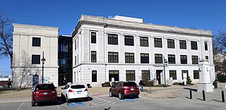
<span class="mw-page-title-main">Pontotoc County, Oklahoma</span> County in Oklahoma, United States

Pontotoc County is in the south central part of Oklahoma. As of the 2020 census, the population was 38,065. Its county seat is Ada. The county was created at statehood from part of the Chickasaw Nation in Indian Territory. It was named for a historic Chickasaw tribal area in Mississippi. According to the Encyclopedia of Oklahoma History and Culture, Pontotoc is usually translated "cattail prairie" or "land of hanging grapes."
<span class="mw-page-title-main">Union County, Mississippi</span> County in Mississippi, United States

Union County is a county located in the U.S. state of Mississippi. It was formed in 1870 from Tippah and Pontotoc counties, and in 1874 a portion of Lee County was added. As of the 2020 census, the population was 27,777. Its county seat is New Albany. According to most sources, the county received its name by being a union of pieces of several large counties, like other Union counties in other states. However, other sources say that the name was meant to mark the re-union of Mississippi and the other Confederate states after the Civil War.

<span class="mw-page-title-main">Algoma, Mississippi</span> Town in Mississippi, United States

Algoma is a town in Pontotoc County, Mississippi. The population was 705 at the 2020 census, up from 590 at the 2010 census.

<span class="mw-page-title-main">Ecru, Mississippi</span> Town in Mississippi, United States

Ecru is a town in Pontotoc County, Mississippi. The population was 895 at the 2010 census. Ecru is home to the largest upholstered furniture plant in the world which manufactures Ashley Furniture.

<span class="mw-page-title-main">Thaxton, Mississippi</span> Town in Mississippi, United States

Thaxton is a town in Pontotoc County, Mississippi, United States. The population was 643 at the 2010 census.
<span class="mw-page-title-main">Bethel, Ohio</span> Village in Ohio, United States

Bethel is a village in Tate Township, Clermont County, Ohio, United States. The population was 2,620 at the 2020 census. Bethel was founded in 1798 by Obed Denham as Denham Town, in what was then the Northwest Territory. Bethel is the home of the first movie theater in Ohio which was founded in 1908 by Aaron Little.

<span class="mw-page-title-main">Hunter, Oklahoma</span> Town in Oklahoma, United States

Hunter is a town in Garfield County, Oklahoma, United States. The population was 165 at the 2010 census, a 4.6 percent decline from the figure of 173 in 2000.

<span class="mw-page-title-main">Eldorado, Oklahoma</span> Town in Oklahoma, United States

Eldorado is a town in Jackson County, Oklahoma, United States. The population was 446 at the 2010 census.
<span class="mw-page-title-main">Wellston, Oklahoma</span> Town in Oklahoma, United States

Wellston is a town in Lincoln County, Oklahoma, United States. The population was 788 at the 2010 census.

<span class="mw-page-title-main">Fitzhugh, Oklahoma</span> Town in Pontotoc County, Oklahoma, United States

Fitzhugh is a town in Pontotoc County, Oklahoma, United States. The population was 204 at the 2000 census.

<span class="mw-page-title-main">Francis, Oklahoma</span> Town in Oklahoma, United States

Francis is a town in Pontotoc County, Oklahoma, United States. The population was 332 at the 2000 census.

<span class="mw-page-title-main">Roff, Oklahoma</span> Town in Oklahoma, United States

Roff is a town in Pontotoc County, Oklahoma, United States. The population was 725 at the 2010 census.

<span class="mw-page-title-main">Stonewall, Oklahoma</span> Town in Oklahoma, United States

Stonewall is a town in Pontotoc County, Oklahoma, United States. Named for Confederate General Stonewall Jackson, the settlement's post office was established in December, 1874.

<span class="mw-page-title-main">Bethel Acres, Oklahoma</span> Town in Oklahoma, United States

Bethel Acres is a town in Pottawatomie County, Oklahoma. The population was 2,895 at the time of the 2010 census, an increase of 5.9 percent from the figure of 2,735 in 2000. It is primarily a bedroom community for people who work in the three nearby larger cities of Shawnee, Tecumseh and Oklahoma City.

St. Louis is a town in Pottawatomie County, Oklahoma, United States. The population was 158 at the 2010 census, a 23.3 percent decline from the figure of 206 in 2000.

<span class="mw-page-title-main">Konawa, Oklahoma</span> City in Oklahoma, United States

Konawa is a city in Seminole County, Oklahoma, United States. The population was 1,288 at the time of the 2020 census. Konawa is a Seminole word meaning, "string of beads."

<span class="mw-page-title-main">Sasakwa, Oklahoma</span> Town in Oklahoma, United States

Sasakwa is a town in Seminole County, Oklahoma, United States. The population was 80 as of the 2020 census.

Allen is a town in Hughes and Pontotoc counties in the U.S. state of Oklahoma. The population was 932 at the 2010 census.

References

  1. "ArcGIS REST Services Directory". United States Census Bureau. Retrieved September 20, 2022.
  2. 1 2 U.S. Geological Survey Geographic Names Information System: Byng, Oklahoma
  3. 1 2 "U.S. Census website". United States Census Bureau . Retrieved January 31, 2008.
  4. "Pontotoc County, Oklahoma Town History" . Retrieved June 1, 2015.
  5. Milligan, Dorothy. - "BYNG". - Encyclopedia of Oklahoma History & Culture. - Oklahoma Historical Society.
  6. "Byng, Oklahoma". Google Maps. Retrieved July 10, 2020.
  7. "Census of Population and Housing". Census.gov. Retrieved June 4, 2015.