Old photograph of Black Rock School, in Allen, 1896
The town was founded in 1883[5] by a group of white settlers who had arrived in Choctaw Nation, Indian Territory in 1882 from Gainesville, Texas, led by Confederate Army veteran Doctor John Trigg Gilmore, his wife, Elizabeth Louise Oliveaux, their children, and relatives William and George McCall, with their respective families. They first settled in Cold Springs, northwest of the present town site, where other settlers soon joined them. The first log cabin was built in Allen in 1883, and this building was used as both a school and church. The town was named after the son of deputy United States marshal William McCall.[6]
In 1892, Dr. Gilmore became Allen's first postmaster and founded the town's first Masonic Lodge two years later.
The Missouri, Oklahoma, and Gulf Railway built a line through the area in 1909, although it bypassed Allen, by a half-mile.
Allen became a boomtown in 1913, when an oil well was drilled west of the town.[7] The population rose from 645 in 1910 to 1,389 in 1930, but dropped to 907 in 1970.[6] Its principal industries besides petroleum are ranching and agriculture.
The Ku Klux Klan held weekly meetings in Allen as late as 1923 according to the Allen Democrat, a former local newspaper.[8]
The Allen Advocate is a weekly newspaper published on Thursday in Allen.[9] The newspaper is published by the Robinson Publishing Company, founded in 1982, by Bill and Dayna Robinson.[10] The company also publishes the Coalgate Record Register and the Holdenville Tribune.[10]
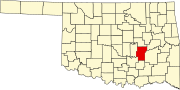
Geography
Allen is located on State Highway 1, approximately 19 miles (31km) northeast of Ada, which is the county seat of Pontotoc County.
According to the United States Census Bureau, the town has a total area of 0.9square mile (2.4km2), all land.
As of the census of 2010, there were 932 people living in the town.[4] The population density was 1,042.1 inhabitants per square mile (402.4/km2). There were 430 housing units at an average density of 487.6 per square mile (188.3/km2).[4] The racial makeup of the town was 77.29% White, 0.42% African American, 14.30% Native American, 0.11% Asian, 0.95% from other races, and 6.94% from two or more races. Hispanic or Latino of any race were 2.00% of the population.
There were 384 households, out of which 28.9% had children under the age of 18 living with them, 51.6% were married couples living together, 9.4% had a female householder with no husband present, and 35.4% were non-families. 32.3% of all households were made up of individuals, and 19.8% had someone living alone who was 65 years of age or older. The average household size was 2.39 and the average family size was 3.03.
In the town, the population was spread out, with 26.2% under the age of 18, 6.9% from 18 to 24, 25.9% from 25 to 44, 20.3% from 45 to 64, and 20.7% who were 65 years of age or older. The median age was 39 years. For every 100 females, there were 86.8 males. For every 100 females age 18 and over, there were 81.9 males.
The median income for a household in the town was $22,632, and the median income for a family was $26,845. Males had a median income of $21,739 versus $17,500 for females. The per capita income for the town was $10,928. About 16.6% of families and 20.4% of the population were below the poverty line, including 24.2% of those under age 18 and 23.4% of those age 65 or over.
↑ Encyclopedia of Oklahoma History and Culture- Allen, retrieved on February 9, 2010
1 2 Encyclopedia of Oklahoma History and Culture- Allen
↑ Welsh, Louise; Townes, Willa Mae; Morris, John W. (1981). A History of The Greater Seminole Oil Field. Oklahoma Heritage Association. pp.14–15. ISBN0865460310.
This page is based on this Wikipedia article Text is available under the CC BY-SA 4.0 license; additional terms may apply. Images, videos and audio are available under their respective licenses.