You can help expand this article with text translated from the corresponding article in French. (February 2020)Click [show] for important translation instructions.
View a machine-translated version of the French article.
Machine translation, like DeepL or Google Translate, is a useful starting point for translations, but translators must revise errors as necessary and confirm that the translation is accurate, rather than simply copy-pasting machine-translated text into the English Wikipedia.
Do not translate text that appears unreliable or low-quality. If possible, verify the text with references provided in the foreign-language article.
You must provide copyright attribution in the edit summary accompanying your translation by providing an interlanguage link to the source of your translation. A model attribution edit summary is Content in this edit is translated from the existing French Wikipedia article at [[:fr:Monts de Vaucluse]]; see its history for attribution.
You may also add the template {{Translated|fr|Monts de Vaucluse}} to the talk page.
The highest peak is Signal de Saint-Pierre, which reaches the height of 1,256 metres (4,121ft).[2]
Location and topography
Oriented east-west, the Toulourenc river and the Jabron torrent border the mountain range to the north, to the south by the Calavon valley and beyond the Luberon, to the west and north-west by the Comtat Venaissin plain, and to the east it extends nearly all the way to the Durance.
The northern part constitutes the secondary range of Ventoux – the highest point of the massif with an altitude of 1,910m (6,270ft) – and of the Lure (1,825m (5,988ft)), separated by the plateau of Albion (1,393m (4,570ft)).
The eastern part is a plateau of medium altitude which fluctuates between 800 and 1,000m (2,600 and 3,300ft) and culminates at the signal of Saint-Pierre at 1,256m (4,121ft) above sea level.
The western part is made up of a secondary range that travels from the region of Sault to the plain. The altitude varies between 300 and 1,000m (980 and 3,280ft). West of Mont Ventoux, Les Dentelles de Montmirail (The Laces of Montmirail), which has an altitude of 722m (2,369ft), take their name from the shape obtained by the erosion of the rock.[3]
The Luberon regional natural park extends to the southern part of the massif.[4]
Main mountain peaks
Mont Ventoux, 1,910m (6,270ft), highest point of the massif
First trace of occupation date from the Neolithic period. The territory was occupied by several Celtic-Ligurian tribes. Numerous oppidums can be found on the foothills of the massif. The Romans used the Fontaine de Vaucluse.
In the 11th century, “castrums” were created (perched fortifications around which villages developed).
With the arrival of the popes in Avignon, the culture of silk was introduced to the region. Gradually, the culture of mulberry developed, and its leaves served as food for the silkworms.
The religious wars affected some of the villages on the southern foothills of the massif. Cabrières-d'Avignon thus got razed during the massacre of the Vaudois of the Luberon.
Between 1720 and 1722 the papal army tried to prevent the Marseilles plague from invading the Papal States by building plague walls south of the Vaucluse mountains, in Lagnes, Cabrières-d'Avignon, and Murs.
On August 12 1793, the department of Vaucluse was created, consisting of the districts of Avignon and Carpentras, but also those of Orange and Apt, which previously belonged to the Bouches-du-Rhône department, as well as the canton of Sault, which belonged to the Basses-Alpes.
The mountainous area helped early resistance and many households during the German occupation. On November 11 1948, several municipalities in the Vaucluse mountains, such as Gordes (silver star degree) or Sault (silver-gilt star degree) received the Croix de Guerre 1939–1945.
In April 1965, due to its low population density and its soil, the Albion plateau was chosen for the installation of nuclear silos. Only 18 silos and 2 fire control stations (PCT) were built (budget restriction) out of the 27 silos and 3 fire control stations that were initially planned (early 1966), i.e. air base (BA200). The construction work ended in 1971.
In September 1996, President Jacques Chirac announced the closure and dismantling of the Albion facilities, due to the evolution of the European geostrategy (fall of the Eastern bloc). Furthermore the aging of missiles were too expensive to maintain, and it was judged unnecessary to upgrade them.
Activities
Very well known for its cultivation of lavender, the economy of the plateau is essentially oriented towards agriculture (lavender, spelt and other types of cereals, goat breeding, etc.) and tourism (eco-friendly camping, hiking, mountain biking, caving, the Lavender Route...).
Related Research Articles
Vaucluse is a department in the southeastern French region of Provence-Alpes-Côte d'Azur. It had a population of 561,469 as of 2019. The department's prefecture is Avignon.
Mont Ventoux is a mountain in the Provence region of southern France, located some 20 km northeast of Carpentras, Vaucluse. On the north side, the mountain borders the department of Drôme. At 1,910 m (6,270 ft), it is the highest mountain in the region and has been nicknamed the "Beast of Provence", the "Giant of Provence", or "The Bald Mountain". It has gained fame through its inclusion in the Tour de France cycling race; in 2009 it was the scene of the first penultimate-day mountain top finish in the Tour de France, with Alberto Contador sealing his yellow jersey.
The Dentelles de Montmirail are a small chain of mountains in Provence in France, in the département of Vaucluse, located just to the south of the village of Vaison-la-Romaine.
The Luberon is a massif in central Provence in Southern France, part of the French Prealps. It has a maximum elevation of 1,256 metres (4,121 ft) and an area of about 600 square kilometres (230 sq mi). It is composed of three mountain ranges : Lesser Luberon, Greater Luberon and Eastern Luberon. The valleys north and south of them contain a number of towns and villages as well as agricultural land; the northern part is marked by the Calavon, while the southern part is characterised by the Durance.
Ventoux AOC is a wine-growing AOC in the southeastern region of the Rhône wine region of France, where the wines are produced in 51 communes of the Vaucluse département along the lower slopes of the Ventoux mountain and at the foot of the Vaucluse Mountains. The neighbouring appellation of Luberon AOC stretches along its southern border and is separated from it by the Calavon river.
Luberon is a French wine-growing AOC in the southeastern extreme of the Rhône wine region of France, where the wines are produced in 36 communes of the Vaucluse département. The neighbouring appellation of Ventoux AOC stretches along its northern border and is separated by the Calavon river. The southern limit of the region is marked by the Durance river.
Roussillon is a commune in the Vaucluse department of the Provence-Alpes-Côte d'Azur region in Southeastern France. Roussillon lies within the borders of the Natural Regional Park of Luberon. In the French natural regional parks system, new economic activities may be developed only if they are sustainable.
Gordes is a commune in the Vaucluse département in the Provence-Alpes-Côte d'Azur region in southeastern France. The residents are known as Gordiens. The nearest big city is Avignon; smaller cities nearby include Cavaillon, L'Isle-sur-la-Sorgue and Apt.
The arrondissement of Apt is an arrondissement of France in the Vaucluse department in the Provence-Alpes-Côte d'Azur region. It has 57 communes. Its population is 128,793 (2016), and its area is 1,390.6 km2 (536.9 sq mi).
The arrondissement of Avignon is an arrondissement of France in the Vaucluse department in the Provence-Alpes-Côte d'Azur region. It has 17 communes. Its population is 214,340 (2016), and its area is 369.7 km2 (142.7 sq mi).
The arrondissement of Carpentras is an arrondissement of France in the Vaucluse department in the Provence-Alpes-Côte d'Azur region. It has 77 communes. Its population is 215,881 (2016), and its area is 1,807.0 km2 (697.7 sq mi).
Cucuron is a village (commune) in the Vaucluse department, of the Provence-Alpes-Côte d'Azur region, in southeastern France. Its inhabitants are called Cucuronnais.
Goult is a commune in the Vaucluse department in the Provence-Alpes-Côte d'Azur region in Southeastern France. In 2021, it had a population of 1,080. The village is perched on a hill with a solitary road to the peak. Near the end of the road is a 12th-century castle, the Château de Goult.
Mirabeau is a commune in the Vaucluse department in the Provence-Alpes-Côte d'Azur region in southeastern France.
Monteux is a commune in the Vaucluse department in the Provence-Alpes-Côte d'Azur region in southeastern France.
Muscat du Ventoux is a French black table grape, protected by an AOC, produced from the grape variety Muscat Hamburg on the slopes of Mont Ventoux, in the department of Vaucluse.
The Fontaine de Vaucluse (French pronunciation:[fɔ̃tɛndəvoklyz]) is a karst spring in the commune of Fontaine-de-Vaucluse, France. It is the largest karst spring in metropolitan France by flow and fifth largest in the world, with annual output of 630,000,000 to 700,000,000 cubic metres (2.2×10¹⁰ to 2.5×10¹⁰ cu ft) of water. The spring is the prime example in hydrogeology of a "Vaucluse spring". It is the source of the Sorgue.
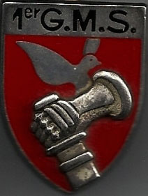
The 1st Strategic Missiles Groupment is a former unit of the Strategic Air Forces of the French Air and Space Force.
Communauté d'agglomération Luberon Monts de Vaucluse is the communauté d'agglomération, an intercommunal structure, centred on the town of Cavaillon. It is located in the Vaucluse department, in the Provence-Alpes-Côte d'Azur region, southeastern France. Created in 2014, its seat is in Cavaillon. Its name refers to the Luberon and Vaucluse Mountains. Its area is 356.4 km2. Its population was 55,034 in 2019, of which 26,236 in Cavaillon proper.
This page is based on this Wikipedia article Text is available under the CC BY-SA 4.0 license; additional terms may apply. Images, videos and audio are available under their respective licenses.