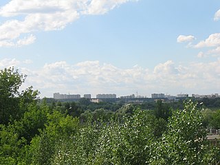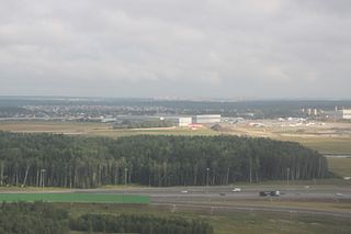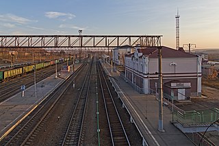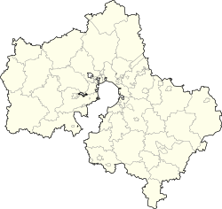
Solnechnogorsky District is an administrative and municipal district (raion), one of the thirty-six in Moscow Oblast, Russia. It is located in the northwest of the oblast. The area of the district is 1,135.04 square kilometers (438.24 sq mi). Its administrative center is the town of Solnechnogorsk. Population: 128,580 ; 124,369 (2002 Census); 71,832 (1989 Soviet census). The population of Solnechnogorsk accounts for 41.2% of the district's total population.

Pavlovo-Posadsky District is an administrative and municipal district (raion), one of the thirty-six in Moscow Oblast, Russia. It is located in the east of the oblast. The area of the district is 566.34 square kilometers (218.67 sq mi). Its administrative center is the town of Pavlovsky Posad. Population: 83,520 ; 102,311 (2002 Census); 40,173 (1989 Soviet census). The population of Pavlovsky Posad accounts for 76.3% of the district's total population.

Lyuberetsky District is an administrative and municipal district (raion), one of the thirty-six in Moscow Oblast, Russia. It is located in the central part of the oblast east of the federal city of Moscow. The area of the district is 122.31 square kilometers (47.22 sq mi). Its administrative center is the city of Lyubertsy. Population: 265,113 ; 255,720 (2002 Census); 139,730 (1989 Soviet census). The population of Lyubertsy accounts for 65.1% of the district's total population.

Lytkarino is a town in Moscow Oblast, Russia, located on the left bank of the Moskva River 6 kilometers (3.7 mi) southeast of Moscow. Population: 65,212 (2021 Census); 55,237 (2010 Census); 50,798 (2002 Census); 50,968 (1989 Soviet census).

Molodyozhny, formerly known as Naro-Fominsk-5 (Наро-Фоминск-5) is a closed urban locality in Moscow Oblast, Russia. Population: 2,920 (2010 Census); 2,599 (2002 Census).

Chekhovsky District is an administrative and municipal district (raion), one of the thirty-six in Moscow Oblast, Russia. It is located in the south of the oblast. The area of the district is 865.85 square kilometers (334.31 sq mi). Its administrative center is the town of Chekhov. Population: 115,301 (2010 Census); 109,668 ; 39,448 (1989 Soviet census). The population of Chekhov accounts for 52.7% of the district's total population.

Istrinsky District is an administrative and municipal district (raion), one of the thirty-six in Moscow Oblast, Russia. It is located in the western central part of the oblast. The area of the district is 1,268.97 square kilometers (489.95 sq mi). Its administrative center is the town of Istra. Population: 119,641 (2010 Census); 115,753 ; 90,572 (1989 Soviet census). The population of Istra accounts for 29.3% of the district's total population.

Kashirsky District is an administrative and municipal district (raion), one of thirty-six in Moscow Oblast, Russia. It is located in the south of the oblast.

Lotoshinsky District is an administrative and municipal district (raion), one of the thirty-six in Moscow Oblast, Russia. It is located in the northwest of the oblast and borders with Tver Oblast in the north and west, Volokolamsky District in the southeast, Shakhovskoy District in the southwest, and with Klinsky District in the east. The area of the district is 979.57 square kilometers (378.21 sq mi). Its administrative center is the urban locality of Lotoshino. Population: 17,859 ; 18,337 (2002 Census); 18,290 (1989 Soviet census). The population of Lotoshino accounts for 31.1% of the district's total population.

Naro-Fominsky District is an administrative and municipal district (raion), one of the thirty-six in Moscow Oblast, Russia. It is located in the southwest of the oblast. The area of the district is 1,547.44 square kilometers (597.47 sq mi). Its administrative center is the town of Naro-Fominsk. Population: 189,763 ; 191,596 (2002 Census); 112,685 (1989 Soviet census). The population of Naro-Fominsk accounts for 34.1% of the district's total population.

Orekhovo-Zuyevsky District is an administrative and municipal district (raion), one of the thirty-six in Moscow Oblast, Russia. It is located in the east of the oblast. The area of the district is 1,821.28 square kilometers (703.20 sq mi). Its administrative center is the city of Orekhovo-Zuyevo. Population: 121,916 ; 119,803 (2002 Census); 132,446 (1989 Soviet census).

Pushkinsky District is an administrative and municipal district (raion), one of the thirty-six in Moscow Oblast, Russia. It is located in the northern central part of the oblast. The area of the district is 571.47 square kilometers (220.65 sq mi). Its administrative center is the city of Pushkino. Population: 177,510 ; 163,439 (2002 Census); 123,630 (1989 Soviet census). The population of Pushkino accounts for 58.0% of the district's total population.

Ruzsky District is an administrative and municipal district (raion), one of the thirty-six in Moscow Oblast, Russia. It is located in the west of the oblast. The area of the district is 1,567.56 square kilometers (605.24 sq mi). Its administrative center is the town of Ruza. Population: 61,673 ; 63,685 (2002 Census); 67,533 (1989 Soviet census). The population of Ruza accounts for 21.9% of the district's total population.

Serebryano-Prudsky District is an administrative and municipal district (raion), one of the thirty-six in Moscow Oblast, Russia. It is located in the south of the oblast. The area of the district is 877.38 square kilometers (338.76 sq mi). Its administrative center is the urban locality of Serebryanye Prudy. Population: 25,843 ; 24,689 (2002 Census); 24,415 (1989 Soviet census). The population of Serebryanye Prudy accounts for 37.6% of the district's total population.

Serpukhovsky District is an administrative and municipal district (raion), one of the thirty-six in Moscow Oblast, Russia. It is located in the south of the oblast. The area of the district is 1,012.714 square kilometers (391.011 sq mi). Its administrative center is the city of Serpukhov. Population: 35,173 ; 34,565 (2002 Census); 67,425 (1989 Soviet census).

Shakhovskoy District is an administrative and municipal district (raion), one of the thirty-six in Moscow Oblast, Russia. It is located in the west of the oblast. The area of the district is 1,218.88 square kilometers (470.61 sq mi). Its administrative center is the urban locality of Shakhovskaya. Population: 25,372 ; 23,061 (2002 Census); 23,783 (1989 Soviet census). The population of Shakhovskaya accounts for 42.3% of the district's total population.

Shchyolkovsky District is an administrative and municipal district (raion), one of the thirty-six in Moscow Oblast, Russia. It is located in the northeast of the oblast. The area of the district is 704.88 square kilometers (272.16 sq mi). Its administrative center is the city of Shchyolkovo. Population: 193,629 ; 211,560 (2002 Census); 101,216 (1989 Soviet census). The population of Shchyolkovo accounts for 57.0% of the district's total population.

Voskresensky District is an administrative and municipal district (raion), one of the thirty-six in Moscow Oblast, Russia. It is located in the east of the oblast. The area of the district is 812.480 square kilometers (313.700 sq mi). Its administrative center is the town of Voskresensk. Population: 153,600 ; 152,761 (2002 Census); 77,573 (1989 Soviet census). The population of Voskresensk accounts for 59.5% of the district's total population.

Zaraysky District is an administrative and municipal district (raion), one of the thirty-six in Moscow Oblast, Russia. It is located in the southeast of the oblast. The area of the district is 967.68 square kilometers (373.62 sq mi). Its administrative center is the town of Zaraysk. Population: 41,912 ; 41,974 (2002 Census); 18,104 (1989 Soviet census). The population of Zaraysk accounts for 58.8% of the district's total population.
Andreyevka is an urban locality in Solnechnogorsky District of Moscow Oblast, Russia. Population: 10,008 (2010 Census); 8,465 (2002 Census);


