Pavlovo-Posadsky District is an administrative and municipal district (raion), one of the thirty-six in Moscow Oblast, Russia. It is located in the east of the oblast. The area of the district is 566.34 square kilometers (218.67 sq mi). Its administrative center is the town of Pavlovsky Posad. Population: 83,520 ; 102,311 (2002 Census); 40,173 (1989 Census). The population of Pavlovsky Posad accounts for 76.3% of the district's total population.
Taldom is a town and the administrative center of Taldomsky District in Moscow Oblast, Russia, located 110 kilometers (68 mi) north of Moscow, on a suburban railway connecting Moscow to Savyolovo. Population: 13,819 (2010 Census); 13,334 (2002 Census); 14,410 (1989 Census).
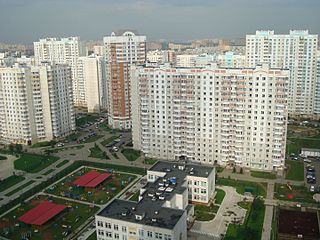
Lyubertsy is a city and the administrative center of Lyuberetsky District in Moscow Oblast, Russia. Population: 172,525 (2010 Census); 156,691 (2002 Census); 165,478 (1989 Census).

Shchyolkovo is a city and the administrative center of Shchyolkovsky District in Moscow Oblast, Russia, located on the Klyazma River, 20 kilometers (12 mi) northeast of Moscow. Population: 110,411 (2010 Census); 112,865 ; 109,255 ; 91,000 (1977).
Kolomensky District is an administrative and municipal district (raion), one of the thirty-six in Moscow Oblast, Russia. It is located in the southeast of the oblast and borders with Lukhovitsky, Ozyorsky, Stupinsky, Voskresensky, and with Yegoryevsky Districts and the territory of the City of Kolomna. The area of the district is 1,112.28 square kilometers (429.45 sq mi). Its administrative center is the city of Kolomna. Population: 44,856 (2010 Census); 40,780 ; 44,477 (1989 Census).

Malakhovka, a Moscow suburb renowned for its historic dachas, is an urban locality in Lyuberetsky District of Moscow Oblast, Russia. Population: 24,004 (2010 Census); 18,552 (2002 Census); 26,454 (1989 Census).

Lytkarino is a town in Moscow Oblast, Russia, located on the left bank of the Moskva River 6 kilometers (3.7 mi) southeast of Moscow(from MKAD). Population: 55,237 (2010 Census); 50,798 (2002 Census); 50,968 (1989 Census).

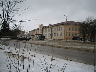
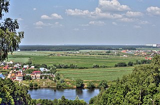
Ozyory is a town in Moscow Oblast, Russia, located on the left bank of the Oka River, 157 kilometers (98 mi) southeast of Moscow. Population: 25,800 (2010 Census); 25,704 (2002 Census); 28,215 (1989 Census).
Ramensky District is an administrative and municipal district (raion), one of the thirty-six in Moscow Oblast, Russia. It is located in the southeastern central part of the oblast. The area of the district is 1,397.46 square kilometers (539.56 sq mi). Its administrative center is the town of Ramenskoye. Population: 256,375 ; 217,939 (2002 Census); 153,215 (1989 Census). The population of Ramenskoye accounts for 66.2% of the district's total population.

Chekhovsky District is an administrative and municipal district (raion), one of the thirty-six in Moscow Oblast, Russia. It is located in the south of the oblast. The area of the district is 865.85 square kilometers (334.31 sq mi). Its administrative center is the town of Chekhov. Population: 115,301 (2010 Census); 109,668 ; 39,448 (1989 Census). The population of Chekhov accounts for 52.7% of the district's total population.

Istrinsky District is an administrative and municipal district (raion), one of the thirty-six in Moscow Oblast, Russia. It is located in the western central part of the oblast. The area of the district is 1,268.97 square kilometers (489.95 sq mi). Its administrative center is the town of Istra. Population: 119,641 (2010 Census); 115,753 ; 90,572 (1989 Census). The population of Istra accounts for 29.3% of the district's total population.

Kashirsky District is an administrative and municipal district (raion), one of the thirty-six in Moscow Oblast, Russia. It is located in the south of the oblast. The area of the district is 646.09 square kilometers (249.46 sq mi). Its administrative center is the town of Kashira. Population: 70,269 (2010 Census); 70,774 ; 35,300 (1989 Census). The population of Kashira accounts for 59.6% of the district's total population.

Lukhovitsky District is an administrative and municipal district (raion), one of the thirty-six in Moscow Oblast, Russia. It is located in the southeast of the oblast. The area of the district is 1,340.52 square kilometers (517.58 sq mi). Its administrative center is the town of Lukhovitsy. Population: 58,802 ; 63,235 (2002 Census); 65,534 (1989 Census). The population of Lukhovitsy accounts for 50.8% of the district's total population.

Noginsky District is an administrative and municipal district (raion), one of the thirty-six in Moscow Oblast, Russia. It is located in the east of the oblast. The area of the district is 893.90 square kilometers (345.14 sq mi). Its administrative center is the town of Noginsk. As of the 2010 Census, the total population of the district was 203,609, with the population of Noginsk accounting for 49.1% of that number.

Ozyorsky District was an administrative and municipal district (raion) in Moscow Oblast, Russia. It was located in the south of the oblast. The area of the district was 549.06 square kilometers (211.99 sq mi). Its administrative center was the town of Ozyory. Population: 35,752 ; 35,623 (2002 Census); 11,783 (1989 Census). The population of Ozyory accounted for 72.2% of the district's total population.

Ruzsky District is an administrative and municipal district (raion), one of the thirty-six in Moscow Oblast, Russia. It is located in the west of the oblast. The area of the district is 1,567.56 square kilometers (605.24 sq mi). Its administrative center is the town of Ruza. Population: 61,673 ; 63,685 (2002 Census); 67,533 (1989 Census). The population of Ruza accounts for 21.9% of the district's total population.
Serebryano-Prudsky District is an administrative and municipal district (raion), one of the thirty-six in Moscow Oblast, Russia. It is located in the south of the oblast. The area of the district is 877.38 square kilometers (338.76 sq mi). Its administrative center is the urban locality of Serebryanye Prudy. Population: 25,843 ; 24,689 (2002 Census); 24,415 (1989 Census). The population of Serebryanye Prudy accounts for 37.6% of the district's total population.

Serpukhovsky District is an administrative and municipal district (raion), one of the thirty-six in Moscow Oblast, Russia. It is located in the south of the oblast. The area of the district is 1,012.714 square kilometers (391.011 sq mi). Its administrative center is the city of Serpukhov. Population: 35,173 ; 34,565 (2002 Census); 67,425 (1989 Census).

Taldomsky District is an administrative and municipal district (raion), one of the thirty-six in Moscow Oblast, Russia. It is located in the north of the oblast and borders with Tver Oblast in the north, Vladimir Oblast in the northeast, and with Dmitrovsky and Sergiyevo-Posadsky Districts in the south and west. The area of the district is 1,340.52 square kilometers (517.58 sq mi). Its administrative center is the town of Taldom. Population: 48,553 ; 46,302 (2002 Census); 52,619 (1989 Census). The population of Taldom accounts for 28.5% of the district's total population.

Voskresensky District is an administrative and municipal district (raion), one of the thirty-six in Moscow Oblast, Russia. It is located in the east of the oblast. The area of the district is 812.480 square kilometers (313.700 sq mi). Its administrative center is the town of Voskresensk. Population: 153,600 ; 152,761 (2002 Census); 77,573 (1989 Census). The population of Voskresensk accounts for 59.5% of the district's total population.