Serpukhovsky District

Last updated
Serpukhovsky District
Серпуховский район(Russian)
Location of Serpuhov Region (Moscow Oblast).svg
Location of Serpukhovsky District in Moscow Oblast (before July 2012)
Coordinates: 54°55′N37°26′E / 54.917°N 37.433°E / 54.917; 37.433 Coordinates: 54°55′N37°26′E / 54.917°N 37.433°E / 54.917; 37.433
Serpukhov. Cherez Oku-reku - panoramio.jpg
Oka River, Serpukhovsky District
Coat of Arms of Serpukhov rayon (Moscow oblast).png
Flag of Serpukhov rayon (Moscow oblast).png
Coat of arms
Flag
Location
Country Russia
Federal subject Moscow Oblast [1]
Administrative structure (as of January 2013)
Administrative center city of  Serpukhov [1]
Administrative divisions: [2]
Work settlements 2
Rural settlements 5
Inhabited localities: [2]
Urban-type settlements [3] 2
Rural localities 139
Municipal structure (as of October 2012)
Municipally incorporated asSerpukhovsky Municipal District [4]
Municipal divisions: [4]
Urban settlements2
Rural settlements5
Statistics
Area (municipal district) (October 2012) 1,012.714 km2 (391.011 sq mi) [4]
Population (2010 Census) 35,173 inhabitants [5]
 Urban25.9%
 Rural74.1%
Density 34.73/km2 (90.0/sq mi) [6]
Time zone MSK (UTC+03:00) [7]
Official website
Serpukhovsky District on WikiCommons

Serpukhovsky District (Russian : Серпухо́вский райо́н) is an administrative [1] and municipal [4] district (raion), one of the thirty-six in Moscow Oblast, Russia. It is located in the south of the oblast. The area of the district is 1,012.714 square kilometers (391.011 sq mi). [4] Its administrative center is the city of Serpukhov (which is not administratively a part of the district). [1] Population: 35,173 (2010 Census); [5] 34,565(2002 Census); [8] 67,425(1989 Census). [9]

Russian language East Slavic language

Russian is an East Slavic language, which is official in the Russian Federation, Belarus, Kazakhstan and Kyrgyzstan, as well as being widely used throughout Eastern Europe, the Baltic states, the Caucasus and Central Asia. It was the de facto language of the Soviet Union until its dissolution on 25 December 1991. Although, nowadays, over two decades after the breakup of the Soviet Union, Russian is used in official capacity or in public life in all the post-Soviet nation-states, as well as in Israel and Mongolia, the rise of state-specific varieties of this language tends to be strongly denied in Russia, in line with the Russian World ideology.

A raion is a type of administrative unit of several post-Soviet states. The term is from the French "rayon", which is both a type of a subnational entity and a division of a city, and is commonly translated in English as "district".

This is a list of the administrative and municipal divisions of Moscow Oblast, a federal subject of Russia.

Contents

Administrative and municipal status

Within the framework of administrative divisions, Serpukhovsky District is one of the thirty-six in the oblast. [1] The city of Serpukhov serves as its administrative center, despite being incorporated separately as a city under oblast jurisdiction—an administrative unit with the status equal to that of the districts. [1]

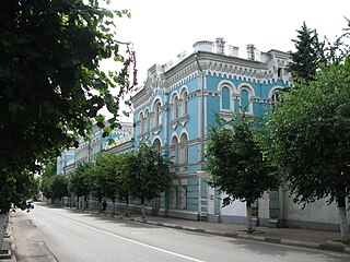
Serpukhov City in Moscow Oblast, Russia

Serpukhov is a city in Moscow Oblast, Russia, located at the confluence of the Oka and the Nara Rivers, 99 kilometers (62 mi) south from Moscow on the Moscow—Simferopol highway. The Moscow—Tula railway passes through Serpukhov. Population: 127,041 (2010 Census); 131,097 (2002 Census); 143,618 (1989 Census).

City of federal subject significance is an umbrella term used to refer to a type of an administrative division of a federal subject of Russia which is equal in status to a district but is organized around a large city; occasionally with surrounding rural territories.

As a municipal division, the district is incorporated as Serpukhovsky Municipal District. [4] Serpukhov City Under Oblast Jurisdiction is incorporated separately from the district as Serpukhov Urban Okrug. [10]

Related Research Articles

Pavlovo-Posadsky District District in Moscow Oblast, Russia

Pavlovo-Posadsky District is an administrative and municipal district (raion), one of the thirty-six in Moscow Oblast, Russia. It is located in the east of the oblast. The area of the district is 566.34 square kilometers (218.67 sq mi). Its administrative center is the town of Pavlovsky Posad. Population: 83,520 ; 102,311 (2002 Census); 40,173 (1989 Census). The population of Pavlovsky Posad accounts for 76.3% of the district's total population.

Protvino Town in Moscow Oblast, Russia

Protvino is a town in Moscow Oblast, Russia, located about 100 kilometers (62 mi) south of Moscow and 15 kilometers (9.3 mi) west of Serpukhov, on the left bank of the Protva River. Population: 37,308 (2010 Census); 36,175 (2002 Census); 34,520 (1989 Census).
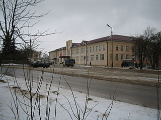
Taldom Town in Moscow Oblast, Russia

Taldom is a town and the administrative center of Taldomsky District in Moscow Oblast, Russia, located 110 kilometers (68 mi) north of Moscow, on a suburban railway connecting Moscow to Savyolovo. Population: 13,819 (2010 Census); 13,334 (2002 Census); 14,410 (1989 Census).
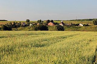
Kolomensky District District in Moscow Oblast, Russia

Kolomensky District is an administrative and municipal district (raion), one of the thirty-six in Moscow Oblast, Russia. It is located in the southeast of the oblast and borders with Lukhovitsky, Ozyorsky, Stupinsky, Voskresensky, and with Yegoryevsky Districts and the territory of the City of Kolomna. The area of the district is 1,112.28 square kilometers (429.45 sq mi). Its administrative center is the city of Kolomna. Population: 44,856 (2010 Census); 40,780 ; 44,477 (1989 Census).
Krasnoarmeysk, Moscow Oblast Town in Moscow Oblast, Russia

Krasnoarmeysk is a town in Moscow Oblast, Russia, on the Vorya River 51 kilometers (32 mi) northeast of Moscow. Population: 26,294 (2010 Census); 26,051 (2002 Census); 27,460 (1989 Census).
Ramensky District District in Moscow Oblast, Russia

Ramensky District is an administrative and municipal district (raion), one of the thirty-six in Moscow Oblast, Russia. It is located in the southeastern central part of the oblast. The area of the district is 1,397.46 square kilometers (539.56 sq mi). Its administrative center is the town of Ramenskoye. Population: 256,375 ; 217,939 (2002 Census); 153,215 (1989 Census). The population of Ramenskoye accounts for 66.2% of the district's total population.

Chekhovsky District District in Moscow Oblast, Russia

Chekhovsky District is an administrative and municipal district (raion), one of the thirty-six in Moscow Oblast, Russia. It is located in the south of the oblast. The area of the district is 865.85 square kilometers (334.31 sq mi). Its administrative center is the town of Chekhov. Population: 115,301 (2010 Census); 109,668 ; 39,448 (1989 Census). The population of Chekhov accounts for 52.7% of the district's total population.

Istrinsky District District in Moscow Oblast, Russia

Istrinsky District is an administrative and municipal district (raion), one of the thirty-six in Moscow Oblast, Russia. It is located in the western central part of the oblast. The area of the district is 1,268.97 square kilometers (489.95 sq mi). Its administrative center is the town of Istra. Population: 119,641 (2010 Census); 115,753 ; 90,572 (1989 Census). The population of Istra accounts for 29.3% of the district's total population.

Kashirsky District, Moscow Oblast District in Moscow Oblast, Russia

Kashirsky District is an administrative and municipal district (raion), one of the thirty-six in Moscow Oblast, Russia. It is located in the south of the oblast. The area of the district is 646.09 square kilometers (249.46 sq mi). Its administrative center is the town of Kashira. Population: 70,269 (2010 Census); 70,774 ; 35,300 (1989 Census). The population of Kashira accounts for 59.6% of the district's total population.

Klinsky District District in Moscow Oblast, Russia

Klinsky District is an administrative and municipal district (raion), one of the thirty-six in Moscow Oblast, Russia. It is located in the northwest of the oblast and borders with Tver Oblast in the north, Lotoshinsky District in the northwest, Volokolamsky District in the west, Istrinsky District in the south, Solnechnogorsky District in the southeast, and with Dmitrovsky District in the east. The area of the district is 2,019.62 square kilometers (779.78 sq mi). Its administrative center is the town of Klin. Population: 127,779 (2010 Census); 127,938 ; 48,658 (1989 Census). The population of Klin accounts for 63.1% of the district's total population.

Lukhovitsky District District in Moscow Oblast, Russia

Lukhovitsky District is an administrative and municipal district (raion), one of the thirty-six in Moscow Oblast, Russia. It is located in the southeast of the oblast. The area of the district is 1,340.52 square kilometers (517.58 sq mi). Its administrative center is the town of Lukhovitsy. Population: 58,802 ; 63,235 (2002 Census); 65,534 (1989 Census). The population of Lukhovitsy accounts for 50.8% of the district's total population.

Ozyorsky District, Moscow Oblast District in Moscow Oblast, Russia

Ozyorsky District was an administrative and municipal district (raion) in Moscow Oblast, Russia. It was located in the south of the oblast. The area of the district was 549.06 square kilometers (211.99 sq mi). Its administrative center was the town of Ozyory. Population: 35,752 ; 35,623 (2002 Census); 11,783 (1989 Census). The population of Ozyory accounted for 72.2% of the district's total population.

Orekhovo-Zuyevsky District District in Moscow Oblast, Russia

Orekhovo-Zuyevsky District is an administrative and municipal district (raion), one of the thirty-six in Moscow Oblast, Russia. It is located in the east of the oblast. The area of the district is 1,821.28 square kilometers (703.20 sq mi). Its administrative center is the city of Orekhovo-Zuyevo. Population: 121,916 ; 119,803 (2002 Census); 132,446 (1989 Census).

Podolsky District District in Moscow Oblast, Russia

Podolsky District is an administrative and municipal district (raion), one of the thirty-six in Moscow Oblast, Russia. It is located in the southwest of the oblast just south of the federal city of Moscow. The area of the district is 281.45 square kilometers (108.67 sq mi). Its administrative center is the city of Podolsk. Population: 82,488 ; 78,076 (2002 Census); 103,925 (1989 Census).

Ruzsky District District in Moscow Oblast, Russia

Ruzsky District is an administrative and municipal district (raion), one of the thirty-six in Moscow Oblast, Russia. It is located in the west of the oblast. The area of the district is 1,567.56 square kilometers (605.24 sq mi). Its administrative center is the town of Ruza. Population: 61,673 ; 63,685 (2002 Census); 67,533 (1989 Census). The population of Ruza accounts for 21.9% of the district's total population.

Taldomsky District District in Moscow Oblast, Russia

Taldomsky District is an administrative and municipal district (raion), one of the thirty-six in Moscow Oblast, Russia. It is located in the north of the oblast and borders with Tver Oblast in the north, Vladimir Oblast in the northeast, and with Dmitrovsky and Sergiyevo-Posadsky Districts in the south and west. The area of the district is 1,340.52 square kilometers (517.58 sq mi). Its administrative center is the town of Taldom. Population: 48,553 ; 46,302 (2002 Census); 52,619 (1989 Census). The population of Taldom accounts for 28.5% of the district's total population.

Voskresensky District, Moscow Oblast District in Moscow Oblast, Russia

Voskresensky District is an administrative and municipal district (raion), one of the thirty-six in Moscow Oblast, Russia. It is located in the east of the oblast. The area of the district is 812.480 square kilometers (313.700 sq mi). Its administrative center is the town of Voskresensk. Population: 153,600 ; 152,761 (2002 Census); 77,573 (1989 Census). The population of Voskresensk accounts for 59.5% of the district's total population.

Zaraysky District District in Moscow Oblast, Russia

Zaraysky District is an administrative and municipal district (raion), one of the thirty-six in Moscow Oblast, Russia. It is located in the southeast of the oblast. The area of the district is 967.68 square kilometers (373.62 sq mi). Its administrative center is the town of Zaraysk. Population: 41,912 ; 41,974 (2002 Census); 18,104 (1989 Census). The population of Zaraysk accounts for 58.8% of the district's total population.

Andreyevka, Solnechnogorsky District, Moscow Oblast Work settlement in Moscow Oblast, Russia

Andreyevka is an urban locality in Solnechnogorsky District of Moscow Oblast, Russia. Population: 10,008 (2010 Census); 8,465 (2002 Census);

References

Notes

  1. 1 2 3 4 5 6 Law #11/2013-OZ
  2. 1 2 Resolution #123-PG
  3. The count of urban-type settlements may include the work settlements, the resort settlements, the suburban (dacha) settlements, as well as urban-type settlements proper.
  4. 1 2 3 4 5 6 Law #78/2005-OZ
  5. 1 2 Russian Federal State Statistics Service (2011). "Всероссийская перепись населения 2010 года. Том 1" [2010 All-Russian Population Census, vol. 1]. Всероссийская перепись населения 2010 года (2010 All-Russia Population Census) (in Russian). Federal State Statistics Service . Retrieved June 29, 2012.
  6. The value of density was calculated automatically by dividing the 2010 Census population by the area specified in the infobox. Please note that this value is only approximate as the area specified in the infobox does not necessarily correspond to the area of the entity proper or is reported for the same year as the population.
  7. Правительство Российской Федерации. Федеральный закон №107-ФЗ от 3 июня 2011 г. «Об исчислении времени», в ред. Федерального закона №271-ФЗ от 03 июля 2016 г. «О внесении изменений в Федеральный закон "Об исчислении времени"». Вступил в силу по истечении шестидесяти дней после дня официального опубликования (6 августа 2011 г.). Опубликован: "Российская газета", №120, 6 июня 2011 г. (Government of the Russian Federation. Federal Law #107-FZ of June 31, 2011 On Calculating Time , as amended by the Federal Law #271-FZ of July 03, 2016 On Amending Federal Law "On Calculating Time". Effective as of after sixty days following the day of the official publication.).
  8. Russian Federal State Statistics Service (May 21, 2004). "Численность населения России, субъектов Российской Федерации в составе федеральных округов, районов, городских поселений, сельских населённых пунктов – районных центров и сельских населённых пунктов с населением 3 тысячи и более человек" [Population of Russia, Its Federal Districts, Federal Subjects, Districts, Urban Localities, Rural Localities—Administrative Centers, and Rural Localities with Population of Over 3,000](XLS). Всероссийская перепись населения 2002 года [All-Russia Population Census of 2002] (in Russian). Retrieved August 9, 2014.
  9. Demoscope Weekly (1989). "Всесоюзная перепись населения 1989 г. Численность наличного населения союзных и автономных республик, автономных областей и округов, краёв, областей, районов, городских поселений и сёл-райцентров" [All Union Population Census of 1989: Present Population of Union and Autonomous Republics, Autonomous Oblasts and Okrugs, Krais, Oblasts, Districts, Urban Settlements, and Villages Serving as District Administrative Centers]. Всесоюзная перепись населения 1989 года [All-Union Population Census of 1989] (in Russian). Институт демографии Национального исследовательского университета: Высшая школа экономики [Institute of Demography at the National Research University: Higher School of Economics]. Retrieved August 9, 2014.
  10. Law #11/2005-OZ

Sources