Dubna

Last updated • 6 min readFrom Wikipedia, The Free Encyclopedia

Dubna
Дубна
Dubna (31586384855).jpg
House in Dubna
Flag of Dubna (Moscow oblast) (2003).png
Coat of arms of Dubna.svg
Location of Dubna
Dubna
Russia administrative location map.svg
Red pog.svg
Dubna
Location of Dubna
Russia Moscow oblast location map.svg
Red pog.svg
Dubna
Dubna (Moscow Oblast)
Coordinates: 56°44′11″N37°9′45″E / 56.73639°N 37.16250°E / 56.73639; 37.16250
Country Russia
Federal subject Moscow Oblast [1]
Founded1956 OOjs UI icon edit-ltr-progressive.svg
Government
  MayorMaxim Tikhomirov
Elevation
125 m (410 ft)
Population
  Total
70,663
  Estimate 
(2012) [3]
72,357
  Rank 223rd in 2010
  Subordinated toDubna Town Under Oblast Jurisdiction [1]
   Capital ofDubna Town Under Oblast Jurisdiction [1]
  Urban okrugDubna Urban Okrug [4]
   Capital ofDubna Urban Okrug [4]
Time zone UTC+3 (MSK   OOjs UI icon edit-ltr-progressive.svg [5] )
Postal code(s) [6]
141980
Dialing code(s) +7 49621
OKTMO ID46718000001
Website www.naukograd-dubna.ru

Dubna (Russian:Дубна́,IPA: [dʊbˈna] ) is a town in Moscow Oblast, Russia. It has a status of naukograd (i.e. town of science), being home to the Joint Institute for Nuclear Research, an international nuclear physics research center and one of the largest scientific foundations in the country. It is also home to MKB Raduga, a defense aerospace company specializing in design and production of missile systems, as well as to the Russia's largest satellite communications center owned by Russian Satellite Communications Company. [7] The modern town was developed in the middle of the 20th century and town status was granted to it in 1956. Population: 70,663(2010 Census); [2] 60,951(2002 Census); [8] 65,805(1989 Soviet census). [9]

Contents

Geography

The town is 120 meters (390 ft) above sea level, situated approximately 125 kilometers (78 mi) north of Moscow, on the Volga River, just downstream from the Ivankovo Reservoir. The reservoir is formed by a hydroelectric dam across the Volga situated within the town borders. The town lies on both banks of the Volga. The western boundary of the town is defined by the Moscow Canal joining the Volga, while the eastern boundary is defined by the Dubna River joining the Volga.[ citation needed ]

Dubna is the northernmost town of Moscow Oblast.[ citation needed ]

History

Pre-World War II

Fortress Dubna (Russian : Дубна) belonging to Rostov-Suzdal Principality was built in the area in 1132 by the order of Yuri Dolgoruki and existed until 1216. The fortress was destroyed during the feudal war between the sons of Vsevolod the Big Nest. The village of Gorodishche (Городище) was located on the right bank of the Volga River and was a part of the Kashin Principality. Dubna customs post (Дубненское мыто) was located in the area and was a part of the Principality of Tver.

Before the October Revolution, few villages were in the area: Podberezye was on the left bank of the Volga, and Gorodishche, Alexandrovka, Ivankovo, Yurkino, and Kozlaki (Russian : Козлаки) were on the right bank.

Right after the Revolution one of the first collective farms was organized in Dubna area.

In 1931, the Orgburo of the Communist Party made a decision to build the Volga-Moscow Canal. Genrikh Yagoda, then the leader of the State Political Directorate, was put in charge of construction. The Canal was completed in 1937. Ivankovo Reservoir and Ivankovo hydroelectrical plant were also created as a part of the project. Many villages and the town Korcheva were submerged under water. Dubna is mentioned in Aleksandr Solzhenitsyn's book The Gulag Archipelago as the town built by Gulag prisoners.

Science

The decision to build a proton accelerator for nuclear research was taken by the Soviet government in 1946. An impractical place where the current town is situated was chosen due to remoteness from Moscow and the presence of the Ivankovo power plant nearby. The scientific leader was Igor Kurchatov. The general supervisor of the project including construction of a settlement, a road and a railway connecting it to Moscow (largely involving penal labour of Gulag inmates) was the NKVD chief Lavrentiy Beria. After three years of intensive work, the accelerator was commissioned on 13 December 1949.

The town of Dubna was officially inaugurated in 1956, together with the Joint Institute for Nuclear Research (JINR), which has developed into a large international research laboratory involved mainly in particle physics, heavy ion physics, synthesis of transuranium elements, and radiobiology. In 1960, a town of Ivankovo situated on the opposite (left) bank of the Volga was merged into Dubna. In 1964, Dubna hosted the prestigious International Conference on High Energy Physics.

Currently, a construction of the NICA particle collider, a megascience project is underway in Dubna.

Outstanding physicists of the 20th century including Nikolay Bogolyubov, Georgy Flyorov, Vladimir Veksler, and Bruno Pontecorvo used to work at the institute. A number of elementary particles and nuclei of transuranium elements (most recently, element 117) have been discovered and investigated there, leading to the honorary naming of chemical element 105 dubnium (Db) for the town.

Administrative and municipal status

Within the framework of administrative divisions, it is incorporated as Dubna Town Under Oblast Jurisdiction —an administrative unit with the status equal to that of the districts. [1] As a municipal division, Dubna Town Under Oblast Jurisdiction is incorporated as Dubna Urban Okrug. [4]

Demographics

Historical population
YearPop.±%
195914,000    
197043,700+212.1%
197954,900+25.6%
198965,800+19.9%
200361,000−7.3%
200862,500+2.5%
2010 [2] 70,663+13.1%
2012 [3] 72,357+2.4%
Source: [10] unless indicated otherwise

Economics

Before the dissolution of the Soviet Union, JINR and MKB Raduga were the main employers in the town. Since then their role has decreased significantly. Several small industrial enterprises have emerged, however the town still experiences some employment difficulties. Proximity to Moscow allows many to commute and work there. Plans by AFK Sistema and other investors including government structures have been announced to build a Russian analogue of Silicon Valley in Dubna. As of the beginning of 2007, nothing has commenced.[ citation needed ]

Transport

Dubna is the starting point of the Moscow Canal. [11] [12] In addition to the canal, Dubna is connected to Moscow with the А104 highway, and the Savyolovsky suburban railway line provides access to Moscow. Public transport connections to Moscow include express trains, suburban trains, and bus shuttles departing from the Savyolovsky Rail Terminal.[ citation needed ]

Culture

Among the city's cultural facilities are: the Mir House of Culture, the Oktyabr Palace of Culture, a movie theater, 21 libraries, 4 music schools and a school of arts. In 1990, the Dubna Symphony Orchestra was established. [13]

Museums

Cinema

A variety of movies and miniseries were filmed in the city, such as:

Sports

Dubna is located on the Moscow Canal and the Ivankovo Reservoir, making it a good destination for water sports such as windsurfing, kitesurfing, and water skiing.[ citation needed ]. In 2004, for the first time, a stage of the Water Ski World Cup took place in the city. [19] In 2011, Dubna hosted the World Waterskiing Championships. [20] [21] Dubna's sports facilities include two stadiums, a waterskiing stadium on the Volga River, four swimming pools, tennis courts, and five sports complexes.[ citation needed ]

Trivia

One of the world's tallest statues of Vladimir Lenin, 25 meters (82 ft) high, built in 1937, is located at Dubna at the confluence of the Volga River and the Moscow Canal. The accompanying statue of Joseph Stalin of similar size was demolished in 1961 during the period of de-stalinization. [22]

Twin towns and sister cities

Dubna is twinned with: [23]

Related Research Articles

<span class="mw-page-title-main">Pavlovo-Posadsky District</span> District in Moscow Oblast, Russia

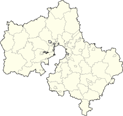
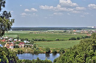
Pavlovo-Posadsky District is an administrative and municipal district (raion), one of the thirty-six in Moscow Oblast, Russia. It is located in the east of the oblast. The area of the district is 566.34 square kilometers (218.67 sq mi). Its administrative center is the town of Pavlovsky Posad. Population: 83,520 ; 102,311 (2002 Census); 40,173 (1989 Soviet census). The population of Pavlovsky Posad accounts for 76.3% of the district's total population.

<span class="mw-page-title-main">Protvino</span> Town in Moscow Oblast, Russia

Protvino is a town in Moscow Oblast, Russia, located about 100 kilometers (62 mi) south of Moscow and 15 kilometers (9.3 mi) west of Serpukhov, on the left bank of the Protva River. Population: 37,308 (2010 Census); 36,175 (2002 Census); 34,520 (1989 Soviet census).

<span class="mw-page-title-main">Dmitrov</span> Town in Moscow Oblast, Russia

Dmitrov is a town and the administrative center of Dmitrovsky District in Moscow Oblast, Russia, located 65 kilometers (40 mi) to the north of Moscow on the Yakhroma River and the Moscow Canal. Population: 65,574 (2021 Census); 61,305 (2010 Census); 62,219 (2002 Census); 65,237 (1989 Soviet census).

<span class="mw-page-title-main">Lytkarino</span> Town in Moscow Oblast, Russia

Lytkarino is a town in Moscow Oblast, Russia, located on the left bank of the Moskva River 6 kilometers (3.7 mi) southeast of Moscow. Population: 65,212 (2021 Census); 55,237 (2010 Census); 50,798 (2002 Census); 50,968 (1989 Soviet census).

<span class="mw-page-title-main">Ramensky District</span> District in Moscow Oblast, Russia

Ramensky District is an administrative and municipal district (raion), one of the thirty-six in Moscow Oblast, Russia. It is located in the southeastern central part of the oblast. The area of the district is 1,397.46 square kilometers (539.56 sq mi). Its administrative center is the town of Ramenskoye. Population: 256,375 ; 217,939 (2002 Census); 153,215 (1989 Soviet census). The population of Ramenskoye accounts for 66.2% of the district's total population.

<span class="mw-page-title-main">Chekhovsky District</span> District in Moscow Oblast, Russia

Chekhovsky District is an administrative and municipal district (raion), one of the thirty-six in Moscow Oblast, Russia. It is located in the south of the oblast. The area of the district is 865.85 square kilometers (334.31 sq mi). Its administrative center is the town of Chekhov. Population: 115,301 (2010 Census); 109,668 ; 39,448 (1989 Soviet census). The population of Chekhov accounts for 52.7% of the district's total population.

<span class="mw-page-title-main">Dmitrovsky District, Moscow Oblast</span> District in Moscow Oblast, Russia

Dmitrovsky District is an administrative and municipal district (raion), one of the thirty-six in Moscow Oblast, Russia. It is located in the north of the oblast and borders with Tver Oblast in the northwest, Klinsky District in the west, Solnechnogorsky District in the southwest, Taldomsky District in the north, Sergiyevo-Posadsky District in the east, Pushkinsky District in the southeast, and with Mytishchinsky District in the south. The area of the district is 2,182.02 square kilometers (842.48 sq mi). Its administrative center is the town of Dmitrov. Population: 151,448 (2010 Census); 149,793 ; 92,080 (1989 Soviet census). The population of Dmitrov accounts for 40.5% of the district's total population.

<span class="mw-page-title-main">Klinsky District</span> District in Moscow Oblast, Russia

Klinsky District is an administrative and municipal district (raion), one of the thirty-six in Moscow Oblast, Russia. It is located in the northwest of the oblast and borders with Tver Oblast in the north, Lotoshinsky District in the northwest, Volokolamsky District in the west, Istrinsky District in the south, Solnechnogorsky District in the southeast, and with Dmitrovsky District in the east. The area of the district is 2,019.62 square kilometers (779.78 sq mi). Its administrative center is the town of Klin. Population: 127,779 (2010 Census); 127,938 ; 48,658 (1989 Soviet census). The population of Klin accounts for 63.1% of the district's total population.

<span class="mw-page-title-main">Leninsky District, Moscow Oblast</span> District in Moscow Oblast, Russia

Leninsky District is an administrative and municipal district (raion), one of the thirty-six in Moscow Oblast, Russia. It is located in the center of the oblast just south of the federal city of Moscow. The area of the district is 202.83 square kilometers (78.31 sq mi). Its administrative center is the town of Vidnoye. Population: 172,171 (2010 Census); 145,251 ; 74,490 (1989 Soviet census). The population of Vidnoye accounts for 33.0% of the district's total population.

<span class="mw-page-title-main">Lotoshinsky District</span> District in Moscow Oblast, Russia

Lotoshinsky District is an administrative and municipal district (raion), one of the thirty-six in Moscow Oblast, Russia. It is located in the northwest of the oblast and borders with Tver Oblast in the north and west, Volokolamsky District in the southeast, Shakhovskoy District in the southwest, and with Klinsky District in the east. The area of the district is 979.57 square kilometers (378.21 sq mi). Its administrative center is the urban locality of Lotoshino. Population: 17,859 ; 18,337 (2002 Census); 18,290 (1989 Soviet census). The population of Lotoshino accounts for 31.1% of the district's total population.

<span class="mw-page-title-main">Mozhaysky District, Moscow Oblast</span> District in Moscow Oblast, Russia

Mozhaysky District is an administrative and municipal district (raion), one of the thirty-six in Moscow Oblast, Russia. It is located in the west of the oblast and borders with Smolensk Oblast in the west, Kaluga Oblast in the south, Shakhovskoy District in the north, Volokolamsky District in the northeast, Ruzsky District in the east, and with Naro-Fominsky District in the southeast. The area of the district is 2,627.28 square kilometers (1,014.40 sq mi). Its administrative center is the town of Mozhaysk. Population: 72,745 ; 70,303 (2002 Census); 42,593 (1989 Soviet census). The population of Mozhaysk accounts for 43.1% of the district's total population.

<span class="mw-page-title-main">Noginsky District</span> District in Moscow Oblast, Russia

Noginsky District is an administrative and municipal district (raion), one of the thirty-six in Moscow Oblast, Russia. It is located in the east of the oblast. The area of the district is 893.90 square kilometers (345.14 sq mi). Its administrative center is the town of Noginsk. As of the 2010 Census, the total population of the district was 203,609, with the population of Noginsk accounting for 49.1% of that number.

<span class="mw-page-title-main">Ruzsky District</span> District in Moscow Oblast, Russia

Ruzsky District is an administrative and municipal district (raion), one of the thirty-six in Moscow Oblast, Russia. It is located in the west of the oblast. The area of the district is 1,567.56 square kilometers (605.24 sq mi). Its administrative center is the town of Ruza. Population: 61,673 ; 63,685 (2002 Census); 67,533 (1989 Soviet census). The population of Ruza accounts for 21.9% of the district's total population.

<span class="mw-page-title-main">Serebryano-Prudsky District</span> District in Moscow Oblast, Russia

Serebryano-Prudsky District is an administrative and municipal district (raion), one of the thirty-six in Moscow Oblast, Russia. It is located in the south of the oblast. The area of the district is 877.38 square kilometers (338.76 sq mi). Its administrative center is the urban locality of Serebryanye Prudy. Population: 25,843 ; 24,689 (2002 Census); 24,415 (1989 Soviet census). The population of Serebryanye Prudy accounts for 37.6% of the district's total population.

<span class="mw-page-title-main">Shchyolkovsky District</span> District in Moscow Oblast, Russia

Shchyolkovsky District is an administrative and municipal district (raion), one of the thirty-six in Moscow Oblast, Russia. It is located in the northeast of the oblast. The area of the district is 704.88 square kilometers (272.16 sq mi). Its administrative center is the city of Shchyolkovo. Population: 193,629 ; 211,560 (2002 Census); 101,216 (1989 Soviet census). The population of Shchyolkovo accounts for 57.0% of the district's total population.

<span class="mw-page-title-main">Stupinsky District</span> District in Moscow Oblast, Russia

Stupinsky District is an administrative and municipal district (raion), one of the thirty-six in Moscow Oblast, Russia. It is located in the south of the oblast. The area of the district is 1,707.73 square kilometers (659.36 sq mi). Its administrative center is the town of Stupino. Population: 119,282 ; 116,007 (2002 Census); 49,439 (1989 Soviet census). The population of Stupino accounts for 56.0% of the district's total population.

<span class="mw-page-title-main">Taldomsky District</span> District in Moscow Oblast, Russia

Taldomsky District was an administrative and municipal district (raion) in Moscow Oblast, Russia. At 2019, it was located in the north of the oblast and bordered with Tver Oblast in the north, Vladimir Oblast in the northeast, and with Dmitrovsky and Sergiyevo-Posadsky Districts in the south and west. The area of the district is 1,340.52 square kilometers (517.58 sq mi). Its administrative center is the town of Taldom. Population: 48,553 ; 46,302 (2002 Census); 52,619 (1989 Soviet census). As of 2010, the population of Taldom accounted for 28.5% of the district's total population.

<span class="mw-page-title-main">Voskresensky District, Moscow Oblast</span> District in Moscow Oblast, Russia

Voskresensky District is an administrative and municipal district (raion), one of the thirty-six in Moscow Oblast, Russia. It is located in the east of the oblast. The area of the district is 812.480 square kilometers (313.700 sq mi). Its administrative center is the town of Voskresensk. Population: 153,600 ; 152,761 (2002 Census); 77,573 (1989 Soviet census). The population of Voskresensk accounts for 59.5% of the district's total population.

<span class="mw-page-title-main">Krasnozavodsk</span> Town in Moscow Oblast, Russia

Krasnozavodsk is a town in Sergiyevo-Posadsky District of Moscow Oblast, Russia, located on the Kunya River 88 kilometers (55 mi) northeast of Moscow and 15 kilometers (9.3 mi) north of Sergiyev Posad, the administrative center of the district. Population: 13,392 (2010 Census); 13,549 (2002 Census); 29,786 (1989 Soviet census).

<span class="mw-page-title-main">Zaprudnya</span> Urban settlement in Moscow Oblast, Russia

Zaprudnya is an urban locality under the administrative jurisdiction of the town of oblast significance of Taldom in Moscow Oblast, Russia. As a municipal division, Zaprudnya, together with the town of Taldom, another two urban-type settlements, and a number of rural localities is incorporated as Taldom Urban Okrug. Population: 12,855 (2010 Census); 12,621 (2002 Census); 14,457 (1989 Soviet census).

References

Notes

  1. 1 2 3 4 5 Law #11/2013-OZ
  2. 1 2 3 Russian Federal State Statistics Service (2011). Всероссийская перепись населения 2010 года. Том 1 [2010 All-Russian Population Census, vol. 1]. Всероссийская перепись населения 2010 года [2010 All-Russia Population Census] (in Russian). Federal State Statistics Service.
  3. 1 2 "2012 population in Russia by city". Archived from the original on 23 September 2015. Retrieved 17 March 2013.
  4. 1 2 3 Law #84/2005-OZ
  5. "Об исчислении времени". Официальный интернет-портал правовой информации (in Russian). 3 June 2011. Retrieved 19 January 2019.
  6. Почта России. Информационно-вычислительный центр ОАСУ РПО. (Russian Post). Поиск объектов почтовой связи (Postal Objects Search) (in Russian)
  7. "Ground infrastructure". Russian Satellite Communications Company .
  8. Federal State Statistics Service (21 May 2004). Численность населения России, субъектов Российской Федерации в составе федеральных округов, районов, городских поселений, сельских населённых пунктов – районных центров и сельских населённых пунктов с населением 3 тысячи и более человек [Population of Russia, Its Federal Districts, Federal Subjects, Districts, Urban Localities, Rural Localities—Administrative Centers, and Rural Localities with Population of Over 3,000](XLS). Всероссийская перепись населения 2002 года [All-Russia Population Census of 2002] (in Russian).
  9. Всесоюзная перепись населения 1989 г. Численность наличного населения союзных и автономных республик, автономных областей и округов, краёв, областей, районов, городских поселений и сёл-райцентров [All Union Population Census of 1989: Present Population of Union and Autonomous Republics, Autonomous Oblasts and Okrugs, Krais, Oblasts, Districts, Urban Settlements, and Villages Serving as District Administrative Centers]. Всесоюзная перепись населения 1989 года [All-Union Population Census of 1989] (in Russian). Институт демографии Национального исследовательского университета: Высшая школа экономики [Institute of Demography at the National Research University: Higher School of Economics]. 1989 via Demoscope Weekly.
  10. "Народная энциклопедия "Мой город". Дубна (Московская область)". www.mojgorod.ru. Archived from the original on 26 March 2022. Retrieved 5 March 2023.
  11. "The Moscow Canal opened". Presidential Library. Archived from the original on 2 January 2023. Retrieved 5 March 2023.
  12. "Dubna | Russia | Britannica". www.britannica.com. Archived from the original on 29 June 2024. Retrieved 5 March 2023.
  13. "Дубненский симфонический оркестр". 18 December 2014. Archived from the original on 18 December 2014. Retrieved 30 August 2023.
  14. "Музей Дубны". Archived from the original on 30 August 2023. Retrieved 30 August 2023.
  15. "О музее". Archived from the original on 29 June 2024. Retrieved 30 August 2023.
  16. "Музей естественной истории". Archived from the original on 30 August 2023. Retrieved 30 August 2023.
  17. "Музей замка". Archived from the original on 30 August 2023. Retrieved 30 August 2023.
  18. "Музей спорта". Archived from the original on 30 August 2023. Retrieved 30 August 2023.
  19. ""Спасибо, Дубна!"". jinrmag.jinr.ru. Archived from the original on 9 October 2021. Retrieved 5 March 2023.
  20. "World Meets in Dubna, RUS | IWGA". www.theworldgames.org. Archived from the original on 27 December 2022. Retrieved 5 March 2023.
  21. The Organizing Committee of the 2011 World Waterski Championships official web site Archived 24 April 2011 at the Wayback Machine
  22. Salys, Rimgaila (2009). The Musical Comedy Films of Grigorii Aleksandrov: Laughing Matters. Intellect Books. p. 271.
  23. "Торгово-промышленная палата города Дубны". www.tpp.dubna.ru. Archived from the original on 14 October 2012. Retrieved 5 March 2023.

Sources