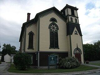
East Douglas is a census-designated place (CDP) in the town of Douglas in Worcester County, Massachusetts, United States. The population was 2,557 at the 2010 census.
South Shaftsbury is a census-designated place (CDP) in the town of Shaftsbury in Bennington County, Vermont, United States. The population was 681 at the 2020 census.

South Barre is a census-designated place (CDP) in the town of Barre in Washington County, Vermont, United States. The population was 1,242 at the 2000 census.

West Brattleboro is a census-designated place (CDP) in the town of Brattleboro, Vermont, United States. The population was 3,222 at the 2000 census.

Chester is a census-designated place (CDP) in Windsor County, Vermont, United States. The population was 1,005 at the 2010 census. The CDP is a statistical area encompassing three distinct places: the urbanized center of the town of Chester; a locale known as Chester Depot, which is separated from the town center by the tracks of the former Rutland Railroad; and the village of North Chester.

Bridgewater was a census-designated place (CDP) in the town of Bridgewater in Plymouth County, Massachusetts, United States. The CDP ceased to exist when Bridgewater was given de facto city status in 2010. The population was 7,841 at the 2010 census.

Hingham is a census-designated place (CDP) in the town of Hingham in Plymouth County, Massachusetts, United States. The population was 5,650 at the 2010 census.

Kingston is a census-designated place (CDP) in the town of Kingston in Plymouth County, Massachusetts, United States. The population was 5,591 at the 2010 census.

Athol is a census-designated place (CDP) in the town of Athol in Worcester County, Massachusetts, United States. The population was 8,265 at the 2010 census.

Lunenburg is a census-designated place (CDP) in the town of Lunenburg in Worcester County, Massachusetts, United States. The population was 1,760 at the 2010 census.

Westborough is a census-designated place (CDP) in the town of Westborough in Worcester County, Massachusetts, United States. The population was 4,045 at the 2010 census.

Middlebury is the main settlement in the town of Middlebury in Addison County, Vermont, United States, and a census-designated place (CDP). The population was 7,304 at the 2020 census, out of a total population of 9,152 in the town of Middlebury. Most of the village is listed on the National Register of Historic Places as the Middlebury Village Historic District.
Bennington is a census-designated place (CDP) in Bennington County, Vermont, United States. It is located entirely within the town of Bennington. The population of the CDP was 9,074 at the 2010 census, or 57.6% of the population of the entire town.

Milton is an unincorporated village within the town of Milton in Chittenden County, Vermont, United States. The village disincorporated in 2003 and became a census-designated place (CDP) in 2008. As of the 2020 census the population was 3,804, out of a population of 10,723 for the entire town.

Brandon is an unincorporated village and census-designated place (CDP) in the town of Brandon, Rutland County, Vermont, United States. As of the 2020 census, the population was 1,727.
Fair Haven is a census-designated place (CDP) in the town of Fair Haven, Vermont in Rutland County, Vermont, United States. The population was 2,269 at the 2010 census.

Brattleboro is a census-designated place (CDP) corresponding to the densely populated core of the town of Brattleboro in Windham County, Vermont, United States. The population was 8,289 at the 2000 census.

Springfield is a census-designated place (CDP) comprising the main settlement within the town of Springfield, Windsor County, Vermont, United States. The population of the CDP was 3,979 at the 2010 census, compared with 9,373 for the town as a whole.
Seymour is a census-designated place (CDP) in Eau Claire County, Wisconsin, United States. The population was 1,501 at the 2020 census, up from 1,418 at the 2010 census. It is located within the town of Seymour and is part of the Eau Claire urban area.

Arlington is a census-designated place (CDP) in the towns of Arlington and Sunderland, Bennington County, Vermont, United States. The population was 1,213 at the 2010 census.


