Westminster is the main settlement of the City of Westminster in London, England. It extends from the River Thames to Oxford Street and has many famous landmarks, including the Palace of Westminster, Buckingham Palace, Westminster Abbey, Westminster Cathedral, Trafalgar Square and much of the West End cultural centre including the entertainment precinct of West End Theatre.

The City of Westminster is a London borough with city status in Greater London, England. It is the site of the United Kingdom's Houses of Parliament and much of the British government. It contains a large part of central London, including most of the West End, such as the major shopping areas around Oxford Street, Regent Street, Piccadilly and Bond Street, and the entertainment district of Soho. Many London landmarks are within the borough, including Buckingham Palace, Westminster Abbey, Whitehall, Westminster Cathedral, 10 Downing Street, and Trafalgar Square.
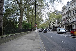
Bayswater is an area in the City of Westminster in West London. It is a built-up district with a population density of 17,500 per square kilometre, and is located between Kensington Gardens to the south, Paddington to the north-east, and Notting Hill to the west.

Notting Hill is a district of West London, England, in the Royal Borough of Kensington and Chelsea. Notting Hill is known for being a cosmopolitan and multicultural neighbourhood, hosting the annual Notting Hill Carnival and the Portobello Road Market. From around 1870, Notting Hill had an association with artists.

Paddington is an area in the City of Westminster, in central London, England. A medieval parish then a metropolitan borough of the County of London, it was integrated with Westminster and Greater London in 1965. Paddington station, designed by the engineer Isambard Kingdom Brunel opened in 1847. It is also the site of St Mary's Hospital and the former Paddington Green Police Station.

The Westway is a 2.5-mile (4 km) elevated dual carriageway section of the A40 trunk road in West London running from Paddington in the east to North Kensington in the west. It connects the London Inner Ring Road to the West London suburbs.
Paddington was a civil parish and metropolitan borough in London, England. It was an ancient parish in the county of Middlesex, governed by an administrative vestry. The parish was included in the area of responsibility of the Metropolitan Board of Works in 1855 and became part of the County of London in 1889. The parish of Paddington became a metropolitan borough in 1900, following the London Government Act 1899, with the parish vestry replaced by a borough council. In 1965 the borough was abolished and its former area became part of the City of Westminster in Greater London.

The Westbourne or Kilburn, also known as the Ranelagh Sewer, is a culverted small River Thames tributary in London, rising in Hampstead and Brondesbury Park and which as a drain unites and flows southward through Kilburn and Bayswater to skirt underneath the east of Hyde Park's Serpentine lake then through central Chelsea under Sloane Square. It passes centrally under the south side of Royal Hospital Chelsea's Ranelagh Gardens before discharging into Inner London's old-fashioned, but grandiose combined sewer system, with exceptional discharges into the Inner London Tideway. Since the latter 19th century, the population of its catchment has risen further but to reduce the toll it places on the Beckton Sewage Treatment Works and related bills its narrow basin has been assisted by private soakaways, and public surface water drains. Its depression has been replaced with and adopted as a reliable route for a gravity combined sewer. The formation of the Serpentine relied on the water, a lake with a long, ornate footbridge and various activities associated, which today uses little-polluted water from a great depth.

Royal Oak is a station of the London Underground, on the Hammersmith & City and Circle lines, between Westbourne Park and Paddington stations. The station is on Lord Hill's Bridge and is in Travelcard Zone 2 for the London Underground. Although not heavily used at other times, the station is extremely busy during the annual Notting Hill Carnival. There is no wheelchair access to the platform. It is classed as a "local station" in Transport for London's "Fit for the Future" development outline.
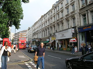
Westbourne Grove is a retail road running across Notting Hill, an area of west London. Its western end is in the Royal Borough of Kensington and Chelsea and its eastern end is in the City of Westminster; it runs from Kensington Park Road in the west to Queensway in the east, crossing over Portobello Road. It contains a mixture of independent and chain retailers, and has been termed both "fashionable" and "up-and-coming".

Ossington Street is a quiet one-way street in London, W2, leading from Moscow Road at its north end to the Bayswater Road / Notting Hill Gate at its south end.

Westminster City Council is the local authority for the City of Westminster in Greater London, England. It is a London borough council, one of 32 in London. The council has been under Labour majority control since 2022. Full council meetings are generally held at Westminster Council House, also known as Marylebone Town Hall, and the council has its main offices at Westminster City Hall on Victoria Street.

Regent's Park and Kensington North was a constituency in Central and West London represented in the House of Commons of the UK Parliament. It elected one Member of Parliament (MP) by the first past the post system of election from 1997 to 2010.
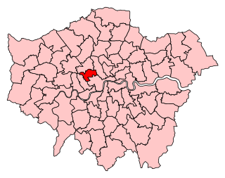
Westminster North was a constituency in Greater London represented in the House of Commons of the UK Parliament. It existed for the periods 1983–1997 and 2010–2024.

Harrow Road is an ancient route in North West London which runs from Paddington in a northwesterly direction towards Harrow. It is also the name given to the immediate surrounding area of Queens Park and Kensal Green, straddling the NW10, W10, W2 and W9 postcodes. With minor deviations in the 19th and 20th centuries, the route remains otherwise unaltered.

Leinster Gardens is a street in Bayswater, London. It is lined with tall, ornate, mid-Victorian terraced houses, many of which are listed buildings.

The A40 is a major trunk road connecting London to Fishguard, Wales. The A40 in London starts in the City of London and passes through six London Boroughs: Camden, Westminster, Kensington & Chelsea, Hammersmith & Fulham, Ealing and Hillingdon, to meet the M40 motorway junction 1 at Denham, Buckinghamshire.

Porchester Square is an archetypal-format, narrow London garden square in Bayswater on the cusp of inter-related Westbourne. It is lined with tall white Victorian classical architecture residential buildings.

Cleveland Square is a private and gated garden square in the predominantly classically conserved Bayswater district of the City of Westminster, north of Central London's Hyde Park. The housing is in tall, tree-shaded rows, stuccoed and with pillared porches, with some discreet infilling of other housing behind.