Whitehill-Gleason Motors | |
 | |
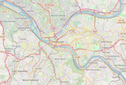   | |
| Location | 5815 Baum Boulevard (East Liberty), Pittsburgh, Pennsylvania, USA |
|---|---|
| Coordinates | 40°27′35″N79°55′49″W / 40.45972°N 79.93028°W |
| Built | circa 1920s on the site of the first Drive-In Filling Station (1913) |
| Architect | Maximilian Nirdlinger |
| Architectural style | Early Commercial, Art Deco |
| NRHP reference No. | 99000878 [1] |
| Significant dates | |
| Added to NRHP | July 22, 1999 [1] |
| Designated PAHMDB | July 11, 2000 [2] |
Whitehill-Gleason Motors at 5815 Baum Boulevard in the East Liberty neighborhood of Pittsburgh, Pennsylvania, was built in the 1920s on the site of the first drive-in filling station in the United States (1913). [3] [4] [5]
It was added to the National Register of Historic Places on July 22, 1999, [1] and was granted a Pennsylvania Historical Marker on July 11, 2000. [6]
