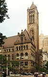
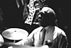
Marker title Image Date dedicated Location Marker type Topics 1909 McKee's Rocks Strike October 14, 2000 812 Island Avenue at McKees Rocks Bridge, Stowe Township 40°28′25″N 80°03′45″W / 40.47372°N 80.06258°W / 40.47372; -80.06258 (1909 McKee's Rocks Strike ) Roadside Labor 1st Drive-In Filling Station July 11, 2000 Near intersection of Baum Boulevard & St. Clair Streets, East Liberty/Friendship (Pittsburgh) 40°27′34″N 79°55′50″W / 40.45934°N 79.93066°W / 40.45934; -79.93066 (1st Drive-In Filling Station ) City Business & Industry, Oil & Gas, Transportation Allegheny Arsenal June 1, 1967 40th Street near Davidson at Arsenal Park, opposite #257, Lawrenceville 40°28′02″N 79°57′38″W / 40.46719°N 79.9605°W / 40.46719; -79.9605 (Allegheny Arsenal ) City Civil War, French & Indian War, Military Allegheny Cotton Mill Strikes October 1, 2007 Allegheny Landing, near Allegheny River between Roberto Clemente (6th Street) & Andy Warhol (7th Street) Bridges, North Shore (Pittsburgh) 40°26′49″N 80°00′09″W / 40.44706°N 80.00258°W / 40.44706; -80.00258 (Allegheny Cotton Mill Strikes ) City Government & Politics 19th Century, Labor, Mills Allegheny County December 30, 1982 County Courthouse (courtyard) , Grant Street between 5th & Forbes Avenues, Pittsburgh 40°26′19″N 79°59′47″W / 40.438673°N 79.996396°W / 40.438673; -79.996396 (Allegheny County ) City Business & Industry, Government & Politics, Government & Politics 18th Century, Iron, Steel Allegheny Observatory November 2, 1979 Riverview Avenue in Riverview Park (off US 19) near Observatory, Observatory Hill, Pittsburgh 40°28′58″N 80°01′06″W / 40.48274°N 80.01831°W / 40.48274; -80.01831 (Allegheny Observatory ) City Education, Medicine & Science, Transportation Andrew Carnegie (1835-1919) April 18, 1996 Carnegie Museum of Natural History, 4400 Forbes Avenue (Schenley Drive Extension), Oakland (Pittsburgh) 40°26′34″N 79°57′06″W / 40.44277°N 79.95168°W / 40.44277; -79.95168 (Andrew Carnegie ) City Business & Industry, Education, Ethnic & Immigration, Professions & Vocations, Steel Art Blakey (1919-1990) August 26, 2007 617 Chauncey Street, Hill District (Pittsburgh) 40°26′52″N 79°58′25″W / 40.4479°N 79.97358°W / 40.4479; -79.97358 (Art Blakey ) City African American, Music & Theater, Performers Arthur J. Rooney (1901-1988) June 3, 2005 Tourman Street & Coulterville Road, Coulter 40°17′45″N 79°47′57″W / 40.295967°N 79.799300°W / 40.295967; -79.799300 (Arthur J. Rooney ) Roadside Ethnic & Immigration, Football, Sports August Wilson (1945-2005) May 30, 2007 1727 Bedford Ave., Hill District (Pittsburgh) 40°26′43″N 79°59′08″W / 40.44521°N 79.98542°W / 40.44521; -79.98542 (August Wilson ) Roadside African American, Music & Theater, Writers Avery College January 1, 1968 621 East Ohio Street, North Side (Pittsburgh) 40°27′14″N 79°59′54″W / 40.453833°N 79.998363°W / 40.453833; -79.998363 (Avery College ) City African American, Education, Religion Barney Dreyfuss (1865-1932) June 30, 2005 Posvar Hall , Roberto Clemente & Schenley Drives, University of Pittsburgh , Oakland section 40°26′30″N 79°57′11″W / 40.4416°N 79.95296°W / 40.4416; -79.95296 (Barney Dreyfuss ) City Baseball, Entrepreneurs, Sports Bethel A.M.E. Church September 24, 1995 405 1st Avenue, at Smithfield Street, Pittsburgh 40°26′14″N 80°00′02″W / 40.43716°N 80.0005°W / 40.43716; -80.0005 (Bethel A.M.E. Church ) City African American, Civil Rights, Education, Religion Bethel Presbyterian Church August 21, 1951 2999 Bethel Church Road between PA 88 & US 19, Bethel Park 40°20′11″N 80°02′53″W / 40.336476°N 80.047926°W / 40.336476; -80.047926 (Bethel Presbyterian Church ) Roadside Buildings, Education, Religion Billy Eckstine (1914-1993) July 31, 1994 5917 Bryant Street, Highland Park (Pittsburgh) 40°28′32″N 79°55′09″W / 40.475567°N 79.919250°W / 40.475567; -79.919250 (Billy Eckstine ) City African American, Performers Bost Building July 7, 1992 617-623 East 8th Avenue near Heisel Street, Homestead 40°24′33″N 79°54′16″W / 40.409039°N 79.904394°W / 40.409039; -79.904394 (Bost Building ) City Buildings, Iron, Labor, Publishing, Steel Bouquet Camp December 21, 1946 Saltsburg Road (PA 380) & Frankstown Avenue (Petermans Corner), Penn Hills Twp 40°29′03″N 79°49′09″W / 40.48414°N 79.81905°W / 40.48414; -79.81905 (Bouquet Camp ) Roadside Forts, French & Indian War, Military, Roads Bower Hill August 23, 1996 292 Kane Boulevard, Scott Twp., NE of Bridgeville 40°22′28″N 80°05′10″W / 40.37434°N 80.08614°W / 40.37434; -80.08614 (Bower Hill ) Roadside African American, American Revolution, George Washington, Mansions & Manors, Military, Whiskey Rebellion Braddock's Crossing August 24, 1964 Hoffman & Kennywood (PA 837) Boulevards at Kennywood Park, West Mifflin 40°23′07″N 79°51′47″W / 40.38524°N 79.86292°W / 40.38524; -79.86292 (Braddock's Crossing ) Roadside French & Indian War, Military, Native American Braddock's Defeat February 28, 1948 549 Jones Avenue, Washington Statue Park, Braddock 40°24′11″N 79°51′48″W / 40.40296°N 79.86343°W / 40.40296; -79.86343 (Braddock's Defeat ) Roadside Forts, French & Indian War, Military, Native American Braddock's Defeat February 28, 1948 US 30, north side, S of I-376 exit 10, Forest Hills (Missing) Roadside French & Indian War, Military, Native American Braddock's Field September 12, 1994 549 Jones Avenue, Washington Statue Park, Braddock 40°24′11″N 79°51′48″W / 40.403006°N 79.863265°W / 40.403006; -79.863265 (Braddock's Field ) Roadside Government & Politics, Military, Whiskey Rebellion Carnegie Hero Fund Commission 1995 301 Pittsburgh Street (SR 1001, old PA 28), across from Washington Street, Springdale 40°32′28″N 79°47′26″W / 40.54106°N 79.79061°W / 40.54106; -79.79061 (Carnegie Hero Fund Commission ) Roadside Business & Industry Carnegie Library of Homestead Swim Team August 14, 2004 Homestead Library, 510 East 10th Avenue, Munhall 40°24′26″N 79°54′11″W / 40.40733°N 79.90314°W / 40.40733; -79.90314 (Carnegie Library of Homestead Swim Team ) City Sports, Women Charles "Chuck" Cooper March 14, 2021 Forbes Ave. & Magee St., Pittsburgh at UPMC Cooper Fieldhouse 40°26′16″N 79°59′18″W / 40.43779°N 79.98835°W / 40.43779; -79.98835
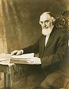
City African American, Sports & Recreation Charles Martin Hall (1863-1914) March 1, 1998 3200 Smallman St., Pittsburgh 40°27′42″N 79°58′15″W / 40.461581°N 79.9707°W / 40.461581; -79.9707 (Charles Martin Hall ) City Business & Industry, Electricity, Entrepreneurs, Invention Charles Taze Russell (1852-1916) May 8, 2000 Allegheny Center , East Commons, at New Hazlett Theater (formerly Carnegie Hall), Pittsburgh 40°27′10″N 80°00′18″W / 40.45274°N 80.00488°W / 40.45274; -80.00488 (Charles Taze Russell ) City Buildings, Houses & Homesteads, Religion Chartier's Town December 19, 1946 PA 28 at Tarentum (Missing) City Business & Industry, Cities & Towns, Early Settlement, Native American Chartier's Old Town November 13, 2015 At marina off E 1st Ave. at bridge, Tarentum 40°35′54″N 79°45′26″W / 40.59844°N 79.75711°W / 40.59844; -79.75711
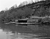
Roadside Business & Industry, Cities & Towns, Early Settlement, Native American, Professions & Vocations Clinton Furnace September 2, 2004 Bessemer Court at Station Square , Pittsburgh 40°26′03″N 80°00′16″W / 40.434284°N 80.004582°W / 40.434284; -80.004582 (Clinton Furnace ) Roadside Business & Industry, Furnaces, Iron Crawford Grill April 7, 2001 Wylie Avenue at Elmore Street, Pittsburgh 40°26′44″N 79°58′41″W / 40.445503°N 79.977943°W / 40.445503; -79.977943 (Crawford Grill ) City African American, Music & Theater D. T. Watson Home for Crippled Children October 19, 2018 301 Camp Mtg. Rd., Leet Twp. 40°34′22″N 80°12′05″W / 40.57281°N 80.20136°W / 40.57281; -80.20136
Roadside Science & Medicine Daisy E. Lampkin August 8, 1993 2519 Webster Avenue at Watt Lane, Hill District (Pittsburgh) 40°27′00″N 79°58′19″W / 40.44991°N 79.97201°W / 40.44991; -79.97201 (Daisy E. Lampkin ) City African American, Government & Politics, Government & Politics 20th Century, Women David L. Lawrence February 28, 1985 Point State Park, Pittsburgh (Missing) City Government & Politics, Government & Politics 19th Century, Governors Davis Island Lock & Dam July 4, 1987 1050 Ohio River Blvd. (PA 65) at E borough line, at Eat 'n' Park, Avalon 40°29′38″N 80°03′51″W / 40.494°N 80.06416°W / 40.494; -80.06416 (Davis Island Rock & Dam ) Roadside Environment Dorothy Mae Richardson (1922-1991) October 16, 2019 1419 Arch St., Pittsburgh 40°27′28″N 80°00′35″W / 40.45782°N 80.00961°W / 40.45782; -80.00961
City African American, Civil Rights, Government & Politics 20th Century, Women Dravo Corporation Shipyard August 18, 1995 5500 Grand Avenue, at Memorial Park, beside fire station, Neville Island 40°30′43″N 80°07′47″W / 40.51182°N 80.12971°W / 40.51182; -80.12971 (Dravo Corporation Shipyard ) Roadside Business & Industry, Entrepreneurs Duquesne Steel Works October 12, 1997 East Grant Avenue & Linden Street (PA 837), Duquesne 40°22′27″N 79°50′33″W / 40.37407°N 79.84241°W / 40.37407; -79.84241 (Duquesne Steel Works ) City Business & Industry, Entrepreneurs Duquesne University October 5, 1978 Bluff Street at University Administration Building, Pittsburgh 40°26′08″N 79°59′34″W / 40.4355°N 79.99285°W / 40.4355; -79.99285 (Duquesne University ) City Education, Ethnic & Immigration, Religion Elizabeth December 20, 1946 Between exit ramp of PA 51 and Elizabeth Bridge, Elizabeth 40°16′21″N 79°53′06″W / 40.2724°N 79.88489°W / 40.2724; -79.88489 (Elizabeth ) Roadside Business & Industry, Transportation Ethelbert Nevin May 7, 1948 Ohio River Boulevard (PA 65) at Edgeworth Lane, east side, Edgeworth 40°32′57″N 80°11′48″W / 40.54917°N 80.19664°W / 40.54917; -80.19664 (Ethelbert Nevin ) Roadside Music & Theater, Writers Ethelbert Nevin May 7, 1948 Ohio River Boulevard (PA 65), west side, at Edgeworth Lane (MISSING) Roadside Music & Theater Ferris Wheel Inventor 1967 West Commons, Arch Street near South Diamond (MARKER NOT YET REINSTALLED) City George Washington, Invention, Professions & Vocations, Sports First Aluminum Observatory Dome June 27, 1998 Between West View Avenue & McKnight Road (Truck US 19), Ross Township 40°29′59″N 80°00′46″W / 40.499846°N 80.012819°W / 40.499846; -80.012819 (First Aluminum Observatory Dome ) Roadside Education, Environment, Invention, Medicine & Science First Mining of Pittsburgh Coal April 18, 1985 Grandview Avenue between Ulysses & Bertha Streets, Mt. Washington (Pittsburgh) 40°26′04″N 80°00′41″W / 40.43438°N 80.01127°W / 40.43438; -80.01127 (First Mining of Pittsburgh Coal ) City Business & Industry, Coal First Professional Football Game November 3, 1992 North Shore Drive & Art Rooney Drive, near Heinz Field , North Shore (Pittsburgh) 40°26′44″N 80°00′49″W / 40.44546°N 80.0137°W / 40.44546; -80.0137 (First Professional Football Game ) Roadside Football, Sports First World Series September 18, 1998 Riverwalk near PNC Park and the water steps, North Shore (Pittsburgh) 40°26′43″N 80°00′33″W / 40.445401°N 80.009171°W / 40.445401; -80.009171 (First World Series ) Roadside Baseball, Sports Forbes Field July 7, 2006 3950 Roberto Clemente Drive near South Bouquet Street, by remaining Forbes Field wall, Pitt campus , Oakland (Pittsburgh) 40°26′29″N 79°57′10″W / 40.44146°N 79.95282°W / 40.44146; -79.95282 (Forbes Field ) Roadside Baseball, Football, Sports Forbes Road (Bouquet's Breastworks) July 9, 1952 Old Frankstown Road, at Boyce Park Administration Building, Monroeville 40°27′36″N 79°45′10″W / 40.45997°N 79.7528°W / 40.45997; -79.7528 (Forbes Road Bouquet's Breastworks ) Roadside French & Indian War, Military Forbes Road, 1758, Fort Bedford to Fort Duquesne - Fort Duquesne End (PLAQUE) 1930 Point State Park, between Fort Pitt Museum & Blockhouse, Pittsburgh 40°26′28″N 80°00′35″W / 40.44109°N 80.00967°W / 40.44109; -80.00967 (Forbes Road, 1758, Fort Bedford to Fort Duquesne - Fort Duquesne End ) Plaque Forts, French & Indian War, Military, Roads Forbes Road, 1758, Fort Bedford to Fort Duquesne - The Bouquet Encampment (PLAQUE) 1930 PA 380 (Saltsburg & Frankstown Roads), Petermans Corner, Penn Hills Township 40°29′03″N 79°49′09″W / 40.4842°N 79.81918°W / 40.4842; -79.81918 (Forbes Road, 1758, Fort Bedford to Fort Duquesne - The Bouquet Encampment ) Plaque French & Indian War, Military, Roads Fort Duquesne May 8, 1959 Point State Park , main entrance at Commonwealth Place, Pittsburgh (MISSING) City Forts, French & Indian War, Military Fort Lafayette December 1, 1958 9th Street just north of Penn Avenue, Pittsburgh 40°26′37″N 79°59′54″W / 40.4437°N 79.99834°W / 40.4437; -79.99834 (Fort Lafayette ) City Forts, Military, Native American, War of 1812 Fort Pitt May 8, 1959 Point State Park , main entrance Commonwealth Place, Pittsburgh (MISSING) City Forts, French & Indian War, Military Fort Pitt Blockhouse May 8, 1959 Point State Park, main entrance Commonwealth Place, Pittsburgh (MISSING) City Forts, French & Indian War, Military Fort Prince George May 8, 1959 Point State Park, main entrance Commonwealth Place, Pittsburgh (MISSING) City Forts, French & Indian War, George Washington, Military Founding Convention of the AFL September 24, 1997 Northwest corner of Mellon Park , between 5th & 6th Streets, opposite William Penn Hotel, Pittsburgh 40°26′27″N 79°59′51″W / 40.4409°N 79.9975°W / 40.4409; -79.9975 (Founding Convention of the AFL ) City Labor Founding Convention of the CIO September 23, 1997 North Commons Drive, at MLK Elementary, near Allegheny Center, Pittsburgh 40°27′16″N 80°00′16″W / 40.45433°N 80.00448°W / 40.45433; -80.00448 (Founding Convention of the CIO ) City Labor Founding of Ironworkers Union May 22, 1999 At Firstside Park, Grant Street, between Boulevard of the Allies and 1st Avenue, Pittsburgh 40°26′12″N 79°59′55″W / 40.43665°N 79.99854°W / 40.43665; -79.99854 (Founding of Ironworkers Union ) City Iron, Labor Frances Perkins October 4, 2003 Southwest corner of 9th Avenue & Amity Street, at police station, Homestead 40°24′23″N 79°54′37″W / 40.40628°N 79.91019°W / 40.40628; -79.91019 (Frances Perkins ) City Government & Politics 20th Century, Labor, Steel, Women Frank Conrad (1874-1941) December 1, 1990 PA 8 (Penn Avenue) & South Trenton Avenue, Wilkinsburg 40°26′45″N 79°53′29″W / 40.445818°N 79.891436°W / 40.445818; -79.891436 (Frank Conrad ) City Business & Industry, Entrepreneurs Frank E. Bolden (1912-2003) September 30, 2004 2621 Centre Avenue, across from YMCA, Hill District (Pittsburgh) 40°26′48″N 79°58′04″W / 40.4468°N 79.96774°W / 40.4468; -79.96774 (Frank E. Bolden ) City African American, Military Post-Civil War, Publishing, Writers Frank Vittor (1888-1968) October 12, 2008 At Columbus statue in Schenley Park , Schenley Drive & Frew Street Extension, Oakland (Pittsburgh) 40°26′26″N 79°56′54″W / 40.440433°N 79.948300°W / 40.440433; -79.948300 (Frank Vittor ) Roadside Artists, Ethnic & Immigration Frederick Ingersoll (1874-1927) April 27, 2019 At Kennywood Park, 4800 Kennywood Blvd., West Mifflin 40°23′07″N 79°51′49″W / 40.38517°N 79.86372°W / 40.38517; -79.86372
Roadside Invention, Professions & Vocations, Sports & Recreation Gen. Matthew B. Ridgway (1895-1993) November 6, 1999 Fox Chapel High School, 611 Field Club Road, Fox Chapel 40°31′04″N 79°52′03″W / 40.51775°N 79.86756°W / 40.51775; -79.86756 (Gen. Matthew B. Ridgway ) Roadside Military, Military Post-Civil War George Westinghouse May 7, 1948 US 30 at west end of George Westinghouse Bridge over Turtle Creek , Turtle Creek 40°23′42″N 79°50′20″W / 40.39487°N 79.83875°W / 40.39487; -79.83875 (George Westinghouse ) Roadside Business & Industry, Electricity, Entrepreneurs, Invention George Westinghouse December 23, 1946 US 30 at east end of George Westinghouse Bridge over Turtle Creek , Turtle Creek (MISSING) Roadside Business & Industry, Electricity, Entrepreneurs, Invention Great Steel Strike of 1919, The September 23, 1994 Braddock Avenue at 14th Street, across from Edgar Thompson Works, Braddock 40°23′55″N 79°51′44″W / 40.39852°N 79.8622°W / 40.39852; -79.8622 (Great Steel Strike of 1919, The ) City Government & Politics, Labor, Steel Greenlee Field July 17, 2009 Bedford Avenue & Junilla Street, Hill District (Pittsburgh) 40°27′02″N 79°58′23″W / 40.4506°N 79.973°W / 40.4506; -79.973 (Greenlee Field ) City African American, Football, Sports Hand's Hospital December 24, 1946 PA 60 (West Steuben Street) at Linden Street, across from Crafton Park, Crafton 40°26′21″N 80°04′24″W / 40.43913°N 80.07339°W / 40.43913; -80.07339 (Hand's Hospital ) Roadside French & Indian War, Military Heidelberg Raceway and Sports Arena July 15, 2012 Washington Pike (PA 50), in front of King's Restaurant, Heidelberg 40°23′15″N 80°05′29″W / 40.387450°N 80.091450°W / 40.387450; -80.091450 (Allegheny Cotton Mill Strikes ) City Performers, Railroads, Sports & Recreation Helen Richey (1909-1947) October 1, 2002 Renzie Park, Eden Park Boulevard & Tulip Drive, McKeesport 40°20′26″N 79°49′38″W / 40.34063°N 79.82724°W / 40.34063; -79.82724 (Helen Richey ) Roadside Education, Military, Military Post-Civil War, Professions & Vocations, Transportation, Women Henry Clay Frick (1848-1919) December 10, 1946 Grant Street near 5th Avenue, in median at Frick Bldg. , Pittsburgh 40°26′21″N 79°59′49″W / 40.43928°N 79.996884°W / 40.43928; -79.996884 (Henry Clay Frick ) City Business & Industry, Coal Henry J. Heinz (1844-1919) September 14, 1994 Chestnut & Progress Streets, North Side (Pittsburgh) 40°27′12″N 79°59′34″W / 40.453317°N 79.992673°W / 40.453317; -79.992673 (Henry J. Heinz ) City Business & Industry, Entrepreneurs Homestead Grays , The September 27, 2000 Amity Street at The Waterfront, at parking lot and railroad tracks, Homestead 40°24′33″N 79°54′44″W / 40.409218°N 79.912121°W / 40.409218; -79.912121 (Homestead Grays ) Roadside African American, Baseball, Sports Homestead Strike July 1, 1992 880 East Waterfront Drive, Munhall 40°24′46″N 79°53′50″W / 40.41285°N 79.89711°W / 40.41285; -79.89711 (Homestead Strike ) City Government & Politics, Labor Homestead Strike Victims July 11, 1993 At Cemetery, 102 East 22nd & Dewey Streets, Munhall 40°23′51″N 79°54′07″W / 40.39762°N 79.9019°W / 40.39762; -79.9019 (Homestead Strike Victims ) Roadside Labor Honus Wagner (1874-1955) August 29, 1998 Mansfield Boulevard & Chartiers Street, Carnegie 40°24′26″N 80°05′20″W / 40.407281°N 80.088843°W / 40.407281; -80.088843 (Honus Wagner ) Roadside Baseball, Ethnic & Immigration, Sports James Hay Reed December 1, 1958 Carnegie Science Center (south of North Commons), North Side (Pittsburgh) 40°27′12″N 80°00′21″W / 40.45321°N 80.00587°W / 40.45321; -80.00587 (James Hay Reed ) City Business & Industry, Professions & Vocations Jane Grey Swisshelm September 14, 1959 South Braddock Avenue & New Street, Edgewood, just north of I-376 exit 77 40°25′43″N 79°53′29″W / 40.42867°N 79.89134°W / 40.42867; -79.89134 (Jane Grey Swisshelm ) Roadside Civil Rights, Civil War, Medicine & Science, Women, Writers Jane Holmes (1805-1885) May 29, 2007 Western PA School for Blind Children, Bayard Street at North Bellefield Avenue, Schenley Farms (Pittsburgh) 40°26′54″N 79°57′11″W / 40.44823°N 79.95295°W / 40.44823; -79.95295 (Jane Holmes ) City Women John A. Roebling (1806-1869) 1996 Smithfield Street Bridge , Station Square (Pittsburgh) 40°26′00″N 80°00′12″W / 40.43335°N 80.00328°W / 40.43335; -80.00328 (John A. Roebling ) City Bridges, Transportation John M. Phillips (1861-1953) October 31, 2009 St. Pius X Byzantine Catholic Church, 2336 Brownsville Road, Pittsburgh 40°23′18″N 79°59′07″W / 40.3884°N 79.9852°W / 40.3884; -79.9852 (John M. Phillips ) City Government & Politics 19th Century, Government & Politics 20th Century, Professions & Vocations John Scull (1765-1828) December 1, 1958 Boulevard of the Allies, just west of Market Street, Pittsburgh 40°26′20″N 80°00′14″W / 40.43902°N 80.00376°W / 40.43902; -80.00376 (John Scull ) City Business & Industry, Professions & Vocations, Publishing John T. Comès (1873-1922) January 27, 2013 St. Agnes Center at Carlow University, 3219 5th Avenue, Oakland (Pittsburgh) 40°21′02″N 79°52′04″W / 40.350572°N 79.86764°W / 40.350572; -79.86764 (John T. Comès (1873-1922) ) City Buildings & Architecture, Professions & Vocations, Religion, Writers Johnny Unitas (1933-2002) September 4, 2004 Arsenal Middle School Field, Butler & 40th Streets, Lawrenceville 40°28′06″N 79°57′46″W / 40.46827°N 79.96268°W / 40.46827; -79.96268 (Johnny Unitas ) City Football, Sports Joshua (Josh) Gibson (1911-1947) September 23, 1996 2217 Bedford Avenue, Hill District (Pittsburgh) 40°26′55″N 79°58′39″W / 40.44861°N 79.97754°W / 40.44861; -79.97754 (Joshua "Josh" Gibson ) City African American, Baseball, Sports Joshua Meeks (1731-1818) May 7, 2008 Beaver Grade Road at entrance to Forest Glen Condos, Moon Township 40°30′35″N 80°12′44″W / 40.509622°N 80.212178°W / 40.509622; -80.212178 (Joshua Meeks ) Roadside American Revolution, Early Settlement, Education, Government & Politics 18th Century, Military K. Leroy Irvis (1916-2006) April 3, 2008 2170 Centre Avenue, Hill District (Pittsburgh)(MISSING) Roadside African American, Civil Rights, Education, Government & Politics 20th Century, Labor Kennedy-Nixon Taft-Hartley Debate June 23, 2012 5th Avenue at Market Street (PA 148), McKeesport 40°21′02″N 79°52′04″W / 40.350572°N 79.86764°W / 40.350572; -79.86764 (Kennedy-Nixon Taft-Hartley Debate ) City Politics, Labor Unions Kennywood Park August 5, 1992 Just outside North Gate Entrance from parking lot, West Mifflin 40°23′09″N 79°51′56″W / 40.3857°N 79.86564°W / 40.3857; -79.86564 (Kennywood Park ) Roadside Sports Kier Refinery March 16, 1959 Small park near Chatham/Bigelow Square, between Bigelow Boulevard & 7th Avenue, Pittsburgh 40°26′29″N 79°59′39″W / 40.44145°N 79.99405°W / 40.44145; -79.99405 (Kier Refinery ) City Business & Industry, Entrepreneurs Kuskusky Path August 24, 2008 2500 Brandt School Road, at Trinity Lutheran Church, Wexford (Franklin Park) 40°36′07″N 80°04′49″W / 40.601906°N 80.080242°W / 40.601906; -80.080242 (Kuskusky Path ) Roadside Early Settlement, Military, Native American, Paths & Trails, Transportation Lewis and Clark Expedition August 28, 2008 1 block north of 10th Street Bypass & Waterfront Drive intersection, Pittsburgh 40°26′49″N 79°59′43″W / 40.447°N 79.9952°W / 40.447; -79.9952 (Lewis and Clark Expedition ) City Exploration Lois Weber (1879-1939) June 13, 2019 1230 Federal St., Pittsburgh 40°27′23″N 80°00′24″W / 40.4563°N 80.0068°W / 40.4563; -80.0068
City Invention, Motion Pictures & Television, Performers, Professions & Vocations, Women, Writers Martha Graham (1894-1991) June 7, 2008 California Avenue & Brighton Road North Side (Pittsburgh) (Pittsburgh) 40°27′34″N 80°01′01″W / 40.459427°N 80.016865°W / 40.459427; -80.016865 (Martha Graham ) City Education, Music & Theater, Performers, Women Martin R. Delany (1812-1885) May 11, 1995 5 PPG Place, 3rd Avenue & Market Street, Pittsburgh 40°26′22″N 80°00′12″W / 40.43948°N 80.00325°W / 40.43948; -80.00325 (Martin R. Delany ) City African American, Civil War, Military, Professions & Vocations, Publishing Mary Cassatt (1844-1926) May 22, 2004 Allegheny and Ridge Avenues, in park, Allegheny Avenue & I-376 on-ramp, North Side (Pittsburgh) 40°26′58″N 80°01′05″W / 40.44937°N 80.01809°W / 40.44937; -80.01809 (Mary Cassatt ) City Artists, Women Mary Harris "Mother" Jones October 4, 2003 Northeast corner of 9th and Amity Streets, (at former municipal building), Homestead 40°24′24″N 79°54′37″W / 40.40654°N 79.91016°W / 40.40654; -79.91016 (Mary Harris "Mother" Jones ) City Government & Politics 20th Century, Labor, Steel, Women Mary Lou Williams (1910-1981) November 30, 1996 Lincoln Elementary School, Frankstown Road, Larimer (Pittsburgh) 40°27′36″N 79°54′44″W / 40.46°N 79.91209°W / 40.46; -79.91209 (Mary Lou Williams ) City African American, Music & Theater, Performers, Women McClurg Iron Foundry May 16, 2016 Fifth Avenue, just west of Smithfield Street (Pittsburgh) 40°26′25″N 79°59′56″W / 40.440252°N 79.998955°W / 40.440252; -79.998955 (McClurg Iron Foundry ) City Buildings, Business & Industry, Military, War of 1812 McKees Rocks Mound May 18, 2002 Rangers Field, Shingiss & Sproul Streets. The Bottoms, McKees Rocks 40°28′23″N 80°03′06″W / 40.47301°N 80.05156°W / 40.47301; -80.05156 (McKees Rocks Mound ) City Native American Mercy Hospital May 27, 1994 1400 Locust Street, Pittsburgh 40°26′12″N 79°59′06″W / 40.43665°N 79.98489°W / 40.43665; -79.98489 (Mercy Hospital ) City Education, Professions & Vocations, Religion, Women Michael A. Musmanno (1897-1968) October 11, 1993 1321 Island Avenue (PA 51), Stowe Township 40°28′57″N 80°04′12″W / 40.48241°N 80.06998°W / 40.48241; -80.06998 (Michael A. Musmanno ) Roadside Government & Politics, Government & Politics 20th Century, Writers Monongahela River Navigation System June 18, 2012 Elizabeth Lock & Dam, Bunola River Road, Elizabeth 40°15′45″N 79°54′01″W / 40.262597°N 79.900161°W / 40.262597; -79.900161 (Monongahela River Navigation System ) Roadside Business & Industry, Coal, Government & Politics 19th Century, Iron & Steel, Navigation, Transportation Mooncrest April 15, 2004 Mooncrest Drive at Old Thorn Run Road, Moon Twp. 40°31′18″N 80°11′28″W / 40.521625°N 80.191103°W / 40.521625; -80.191103 (Mooncrest ) City Business & Industry, Government & Politics 20th Century, Labor, Military, Military Post-Civil War National Negro Opera Company September 25, 1994 7101 Apple Street, Homewood (Pittsburgh) 40°27′51″N 79°53′45″W / 40.4642°N 79.89571°W / 40.4642; -79.89571 (National Negro Opera Company ) City African American, Music & Theater National Tube Works January 15, 1991 575 Lysle Boulevard (PA 148), at subway entrance to plant, McKeesport 40°21′08″N 79°51′37″W / 40.35215°N 79.8604°W / 40.35215; -79.8604 (National Tube Works ) City Business & Industry, Oil & Gas Neville House August 12, 1947 PA 50 just south of Woodville, Heidelberg 40°22′46″N 80°05′46″W / 40.37939°N 80.09621°W / 40.37939; -80.09621 (Neville House ) Roadside American Revolution, Houses & Homesteads, Military, Whiskey Rebellion Old St. Luke's Church July 14, 2001 330 Old Washington Pike & Church Street, Scott Township 40°23′04″N 80°05′26″W / 40.38449°N 80.09067°W / 40.38449; -80.09067 (Old St. Luke's Church ) Roadside Buildings, Early Settlement, French & Indian War, Military, Religion, Whiskey Rebellion Out of This Furnace September 28, 2023 Corner of Braddock Ave and 13th Street, Braddock 40°23′50″N 79°51′35″W / 40.397187°N 79.859715°W / 40.397187; -79.859715
City Ethnic & Immigration, Writers, Iron & Steel, Labor Pauline Hanauer Rosenberg (1863-1940) May 24, 2022 Rosenberg's former residence, 417 Lockhart St., Pittsburgh 40°27′08″N 80°00′02″W / 40.452245°N 80.000537°W / 40.452245; -80.000537
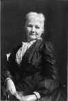
City Civil Rights, Ethnic & Immigration, Women Pennsylvania Canal December 1, 1958 Liberty Avenue at 11th Street (at the Pennsylvanian), Pittsburgh 40°26′38″N 79°59′34″W / 40.44398°N 79.99289°W / 40.44398; -79.99289 (Pennsylvania Canal ) City Canals, Navigation, Transportation Pioneer Short-Wave Station November 2, 1997 Barclay Avenue, off Greensburg Pike, Forest Hills 40°25′06″N 79°50′29″W / 40.41831°N 79.84138°W / 40.41831; -79.84138 (Pioneer Short-Wave Station ) City Business & Industry Pittsburgh December 21, 1946 PA 51 at south city line, near Stewart Avenue (MISSING) Roadside Cities & Towns, Early Settlement, Forts, Government & Politics, Steel Pittsburgh December 18, 1946 4675 Steubenville Pike (PA 60) at West Steuben Street, at bridge and Sharp Edge Creekhouse restaurant, Thornburg 40°26′25″N 80°04′50″W / 40.44041°N 80.08066°W / 40.44041; -80.08066 (Pittsburgh ) Roadside Cities & Towns, Early Settlement, Forts, Government & Politics, Steel Pittsburgh December 23, 1946 PA 65 (Ohio River Boulevard), north city line (MISSING) Roadside Cities & Towns, Early Settlement, Forts, Government & Politics, Steel Pittsburgh December 18, 1946 US 30 (Ardmore Boulevard) westbound at park, Forest Hills 40°25′26″N 79°51′27″W / 40.423907°N 79.857575°W / 40.423907; -79.857575 (Pittsburgh ) Roadside Cities & Towns, Early Settlement, Forts, Government & Politics, Steel Pittsburgh December 18, 1946 PA 8 & PA 28, Millvale (MISSING) Roadside Cities & Towns, Early Settlement, Forts, Government & Politics, Steel Pittsburgh December 21, 1946 Perrysville Road (US 19), near St. Benedict's Academy, north of city line (MISSING) Roadside Cities & Towns Pittsburgh December 18, 1946 PA 65 at north city line (MISSING) Roadside Cities & Towns Pittsburgh December 18, 1946 US 19 north of city line (MISSING) Roadside Cities & Towns Pittsburgh Agreement (The) May 31, 2001 Penn Avenue & 7th Street, Pittsburgh 40°26′35″N 80°00′01″W / 40.44312°N 80.000314°W / 40.44312; -80.000314 (Pittsburgh Agreement, The ) City Ethnic & Immigration, Government & Politics 20th Century Pittsburgh Chinatown April 16, 2022 520 3rd Ave., Pittsburgh City Asian Pacific American, Ethnic & Immigration Pittsburgh Glass Works October 2, 1997 Foot of Duquesne Incline, West Carson Street, Pittsburgh 40°26′23″N 80°01′03″W / 40.43986°N 80.0174°W / 40.43986; -80.0174 (Pittsburgh Glass Works ) City Business & Industry, Glass Pittsburgh Grease Plant September 18, 2000 33rd Street & Smallman Street, Strip District (Pittsburgh) 40°27′45″N 79°58′09″W / 40.46258°N 79.96909°W / 40.46258; -79.96909 (Pittsburgh Grease Plant ) City Business & Industry, Military, Military Post-Civil War, Oil & Gas, Transportation Pittsburgh Plate Glass Company October 19, 1983 Plaza of PPG Place , between 4th Avenue & Market Square, Pittsburgh 40°26′25″N 80°00′10″W / 40.44017°N 80.00288°W / 40.44017; -80.00288 (Pittsburgh Plate Glass Company ) City Business & Industry, Glass Pittsburgh Platform October 10, 2007 Stockton Avenue at Concordia Club, East Park (North Side), Pittsburgh 40°27′03″N 80°00′07″W / 40.4509°N 80.0019°W / 40.4509; -80.0019 (Pittsburgh Platform ) City Religion Polish Army April 3, 1960 Polish Falcons, 97 South 18th Street, South Side Flats (Pittsburgh) 40°25′41″N 79°58′49″W / 40.428158°N 79.980289°W / 40.428158; -79.980289 (Polish Army ) City Ethnic & Immigration, Military, Military Post-Civil War Presston August 22, 2009 Ohio & Center Streets, Presston, Stowe Township 40°28′58″N 80°03′46″W / 40.482711°N 80.062904°W / 40.482711; -80.062904 (Presston ) Roadside Ethnic & Immigration, Government & Politics 20th Century, Labor, Steel Queen Aliquippa October 26, 2003 2928 Highland Avenue, Highland Grove Park, near 2918 Bowman Avenue, McKeesport 40°21′35″N 79°50′00″W / 40.35983°N 79.83326°W / 40.35983; -79.83326 (Queen Aliquippa ) Roadside French & Indian War, George Washington, Government & Politics 18th Century, Military, Native American, Women Rachel Carson May 20, 1988 Pittsburgh Street at Colfax Street, Springdale 40°32′28″N 79°47′02″W / 40.54105°N 79.78399°W / 40.54105; -79.78399 (Rachel Carson ) City Environment, Medicine & Science, Women, Writers Radio Station KDKA November 30, 1990 KDKA Headquarters, 1 Gateway Center, Pittsburgh 40°26′33″N 80°00′20″W / 40.44255°N 80.00543°W / 40.44255; -80.00543 (Radio Station KDKA ) City Business & Industry Railroad Strike of 1877 September 23, 1997 Liberty Avenue at 28th Street (on traffic island), Strip District (Pittsburgh) 40°27′22″N 79°58′30″W / 40.45618°N 79.97491°W / 40.45618; -79.97491 (Railroad Strike of 1877 ) City Labor, Railroads, Transportation Richard L. "Dick" Thornburgh (1932-2020) September 2, 2023 Corner of Kings Highway and Rosslyn Road, Rosslyn Farms Borough 40°25′33″N 80°05′39″W / 40.425924°N 80.094183°W / 40.425924; -80.094183
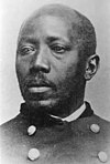
Roadside Governors, Government & Politics 20th Century Robert Lee Vann (1879-1940) July 13, 1997 Center Avenue, at Francis Street, Hill District (Pittsburgh) 40°26′49″N 79°58′03″W / 40.447057°N 79.967413°W / 40.447057; -79.967413 (Robert Lee Vann ) City African American, Government & Politics, Government & Politics 20th Century, Professions & Vocations, Publishing Salk Polio Vaccine April 12, 2005 Salk Hall , University of Pittsburgh , Terrace Street at Sutherland Drive (across from Peterson Events Ctr. ), Oakland (Pittsburgh) 40°26′34″N 79°57′44″W / 40.442763°N 79.96209°W / 40.442763; -79.96209 (Salk Polio Vaccine ) Roadside Invention, Medicine & Science Shadyside Iron Furnace December 1, 1958 Southeast corner of Bayard Street & Amberson Avenue, at Winchester-Thurston High School field, Shadyside (Pittsburgh) 40°27′08″N 79°56′30″W / 40.4521°N 79.94173°W / 40.4521; -79.94173 (Shadyside Iron Furnace ) City Business & Industry, Furnaces, Iron Shannopin's Town December 1, 1958 40th Street Bridge (west side), Lawrenceville (Pittsburgh) 40°28′10″N 79°57′49″W / 40.46953°N 79.96358°W / 40.46953; -79.96358 (Shannopin's Town ) City Early Settlement, Native American Shousetown Boatyard June 14, 1987 McGovern Boulevard (PA 51) near Spring Run Road, Honor Roll Park, across from fire department, Glenwillard/Crescent Township 40°33′26″N 80°13′15″W / 40.55716°N 80.22081°W / 40.55716; -80.22081 (Shousetown Boatyard ) City Business & Industry, Transportation Simon Girty (1741-1818) September 30, 2017 At Turner cemetery, next to Methodist church, 3424 Beechwood Blvd., Pittsburgh 40°25′15″N 79°55′38″W / 40.42086°N 79.92732°W / 40.42086; -79.92732
Roadside American Revolution, French & Indian War, Military, Native American Sisters of Mercy December 21, 1993 800 Penn Avenue, Cultural District, (Pittsburgh) 40°26′36″N 79°59′57″W / 40.443448°N 79.999158°W / 40.443448; -79.999158 (Sisters of Mercy ) City Ethnic & Immigration, Religion, Women Site of the Western Penitentiary - PLAQUE 1931 Eagle enclosure at the National Aviary , North Side (Pittsburgh) 40°27′12″N 80°00′37″W / 40.4532°N 80.01015°W / 40.4532; -80.01015 (Site of the Western Penitentiary - PLAQUE ) Plaque Civil War, Military, Police and Safety St. Nicholas Roman Catholic Croatian Church, North Side June 20, 2015 E Ohio St. (PA 28), just S of 31st St. bridge, Pittsburgh 40°27′31″N 79°59′12″W / 40.45861°N 79.98667°W / 40.45861; -79.98667
Roadside Buildings & Architecture, Ethnic & Immigration, Religion Standard Chemical Company January 1, 2018 Allen Hall, 3941 O'Hara St., at entrance across from Thackeray Ave., University of Pittsburgh 40°26′40″N 79°57′30″W / 40.44449°N 79.95828°W / 40.44449; -79.95828
City Business & Industry, Professions & Vocations, Science & Medicine Station WQED August 20, 1964 4802 5th Avenue, Oakland (Pittsburgh) 40°26′50″N 79°56′40″W / 40.44717°N 79.94453°W / 40.44717; -79.94453 (Station WQED ) City Business & Industry, Education, Motion Pictures & Television Steamboat "New Orleans" October 15, 2011 First Avenue at Try Street, Pittsburgh 40°26′08″N 79°59′47″W / 40.435567°N 79.996250°W / 40.435567; -79.996250 (Steamboat "New Orleans" ) City Business & Industry, Exploration, Navigation, Transportation Stephen C. Foster July 4, 1976 3600 Penn Avenue, at homestead (behind fence), Lawrenceville (Pittsburgh) 40°27′51″N 79°57′49″W / 40.46415°N 79.96374°W / 40.46415; -79.96374 (Stephen C. Foster ) Roadside Music & Theater Stephen C. Foster Memorial December 1, 1958 Forbes Avenue just east of Bigelow Boulevard, Oakland (Pittsburgh) 40°26′37″N 79°57′09″W / 40.44354°N 79.95256°W / 40.44354; -79.95256 (Stephen C. Foster Memorial ) City Music & Theater, Writers Three Rivers Stadium November 26, 2007 Art Rooney Avenue, near North Shore Drive, Heinz Field , North Shore (Pittsburgh) 40°26′46″N 80°00′50″W / 40.44602°N 80.01387°W / 40.44602; -80.01387 (Three Rivers Stadium ) Roadside Baseball, Football, Sports Union Local 471 American Federation of Musicians June 23, 2012 Crawford Avenue at Webster Avenue, Hill District (Pittsburgh) 40°26′35″N 79°59′15″W / 40.443100°N 79.987400°W / 40.443100; -79.987400 (Union Local 471 American Federation of Musicians ) Roadside African American, Labor, Music & Theater, Performers United Steelworkers of America June 17, 1986 4th Avenue & Grant Street, Pittsburgh 40°26′17″N 79°59′51″W / 40.437941°N 79.997501°W / 40.437941; -79.997501 (United Steelworkers of America ) City Government & Politics 20th Century, Labor, Steel University of Pittsburgh November 2, 1979 Southeast corner, 5th Avenue & Bigelow Boulevard, Oakland (Pittsburgh) 40°26′40″N 79°57′16″W / 40.44444°N 79.95452°W / 40.44444; -79.95452 (University of Pittsburgh ) City Education V.F.W. September 16, 1967 5th Avenue & Bigelow Boulevard, at Wm. Pitt Union by bus stop, Oakland, Pittsburgh 40°26′39″N 79°57′16″W / 40.44416°N 79.95458°W / 40.44416; -79.95458 (V.F.W. ) City Military, Military Post-Civil War Victor Herbert (1859-1924) August 28, 2010 4400 Forbes Avenue, at Carnegie Mus. near Shakespeare statue, Oakland (Pittsburgh) 40°26′37″N 79°57′05″W / 40.443587°N 79.951356°W / 40.443587; -79.951356 (Victor Herbert ) City Ethnic & Immigration, Performers Westinghouse Atom Smasher June 3, 2005 North Avenue at F Avenue, Forest Hills 40°24′38″N 79°50′32″W / 40.410474°N 79.842308°W / 40.410474; -79.842308 (Westinghouse Atom Smasher ) City Environment, Invention, Science & Medicine Westinghouse Electric Corporation October 1, 1986 Westinghouse Plaza by First Niagara Building, Pittsburgh 40°26′22″N 80°00′22″W / 40.439350°N 80.006217°W / 40.439350; -80.006217 (Westinghouse Electric Corporation ) City Business & Industry, Electricity Westinghouse Gas Wells November 30, 2016 Westinghouse Park, Thomas Blvd & N Murtland St., Pittsburgh 40°27′09″N 79°54′16″W / 40.45249°N 79.90436°W / 40.45249; -79.90436
Roadside Business & Industry, Environment, Invention, Oil & Gas Westinghouse Railroad Air Brake July 23, 2011 Liberty Avenue at 25th Street at Opera House, Strip District (Pittsburgh) 40°27′12″N 79°58′45″W / 40.45334°N 79.979277°W / 40.45334; -79.979277 (Westinghouse Railroad Air Brake ) City Invention, Railroads, Transportation William "Billy" Strayhorn (1915-1967) May 27, 1995 1101 North Murtland Street, at Westinghouse High School , Homewood (Pittsburgh) 40°27′38″N 79°54′01″W / 40.4606°N 79.9003°W / 40.4606; -79.9003 (William "Billy" Strayhorn ) City African American, Music & Theater William D. Boyce (1858-1929) June 11, 1960 595 Beatty Road, Boyce Campus of Community College of Allegheny County, Monroeville 40°27′15″N 79°45′13″W / 40.45407°N 79.75371°W / 40.45407; -79.75371 (William D. Boyce ) Roadside Education William T. Kerr (1868-1953) June 12, 1992 4 Columbia Avenue at Noblestown Road, at bus stop, Rennersdale 40°23′53″N 80°08′24″W / 40.39809°N 80.14012°W / 40.39809; -80.14012 (William T. Kerr ) Roadside Government & Politics, Government & Politics 20th Century Work Accidents and the Law (1910) April 28, 2008 Market Square , Pittsburgh 40°26′26″N 80°00′10″W / 40.440488°N 80.002669°W / 40.440488; -80.002669 (Work Accidents and the Law 1910 ) City Business & Industry, Government & Politics 20th Century, Labor, Women, Writers Yohogania Courthouse June 10, 1948 PA 837 southwest of West Elizabeth 40°15′41″N 79°54′42″W / 40.261517°N 79.911650°W / 40.261517; -79.911650 (Yohogania Courthouse ) Roadside Government & Politics, Government & Politics 18th Century