
Pietà is a small harbour town in the Eastern Region of Malta, located near the outskirts of the capital city Valletta.

Rabat is a town in the Northern Region of Malta, with a population of 11,497 as of March 2014. It adjoins the ancient capital city of Mdina, and a north-western area formed part of the Roman city of Melite until its medieval retrenchment.

Kalkara is a village in the South Eastern Region of Malta, with a population of 3,014 as of March 2014. The name is derived from the Latin word for lime (Calce), and it is believed that there was a lime kiln present there since Roman times. Kalkara forms part of the inner harbour area and occupies the area around Kalkara Creek. The town has its own Local Council and is bordered by the cities of Birgu and Żabbar, as well as the town of Xgħajra.

San Ġwann is a town in the Northern Region of Malta, with a population of 14,244 as of 2021. Prior to its establishment as a distinct municipality, it was a fragmented community comprising parts of Birkirkara and St. Julian's. San Ġwann emerged as a new parish in 1965 and was officially recognised as a town in 1968. The Local Councils Act of 1993 identified San Gwann as a separate district with its own statutory local government authority, marking its transition from being part of the neighbouring localities. With the first San Gwann Council was elected on 16 April 1994.

Kirkop is a village in the Southern Region of Malta. Located near the Malta International Airport, it has been inhabited since pre-history. The parish church is dedicated to Saint Leonard. The football team of the village is the Kirkop United Football Club.

Santa Venera is a town in the Southern Region of Malta, with a population of 8,834 (2021). It is located between the towns of Birkirkara and Ħamrun, and also borders Qormi and Msida.

Santa Luċija is a village in the Southern Region of Malta, with a population of 2,997 as of March 2014. It is one of the modern towns developed in Malta during the 20th century. By virtue of an article which appeared in Government Gazette of 7 July 1961 the area between Tal-Barrani and Luqa By-Pass. Santa Luċija was named after a 16th-century chapel located in the vicinity. The Parish Church is dedicated to Pope Pius X. It is home of the Chinese Garden of Serenity. Located there is a hypogeum which was discovered in 1973.

Għasri is a village and an administrative unit of Malta, in the western part of the island of Gozo, with a population of 525 people. By population, it is the smallest village in Gozo after San Lawrenz, and the third-smallest in the Maltese Islands, after Bidnija and Mdina. Għasri, however, has a relatively large area.

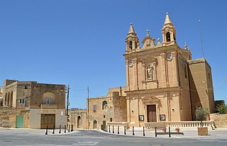
Għajnsielem, meaning "Spring of Sielem", is a municipality on the southeastern coast of the island of Gozo in Malta, including the entire island of Comino. It has a population of 3,200 residents, and is the first Gozitan village that greets the visitor on leaving Mġarr Harbour towards the Gozitan heartland. Its name originated from the water spring, around which in 1700, Grandmaster Perellos built an arcade containing public wash basins and fresh water spouts. Attractions include Lourdes Chapel with its sharp steeple and underlying niche of Our Lady of Lourdes, Fort Chambray and the towering of Ghajnsielem Parish Church.
Munxar is an administrative unit of Malta, which lies on the southern side of the island of Gozo. As of March 2014, its population was 1,454 people.

Qala is an administrative unit of Malta, on the island of Gozo, with a population of 1,929 as of September 2019. Nearby is Ħondoq ir-Rummien, a coastline with salt pans and caves.

San Lawrenz is an administrative unit of Malta, on the island of Gozo. Its name is derived from Lawrence of Rome who is the patron saint for the locality. It has a population of 748, as of March 2014.
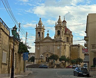
Sannat is an administrative unit of Malta, on the island of Gozo, with a population of 2,117 people. Ta' Sannat is in the south of Gozo, popular for its very high cliffs, ancient cart ruts, temples and dolmens, and rich fauna and flora. In 1951 The Duchess of Edinburgh of the United Kingdom visited a house called "The Lace house" located in a small square in Ta' Sannat called "Pjazza Tax-Xelina".

Marsaskala, sometimes written as Marsascala is a seaside town in the South Eastern Region of Malta. Originally a fishing village, it has grown into a tourist destination and a permanent hometown for an ever-growing population.

Malta is for non-local government purposes divided into districts as opposed to the local government localities. The three main types of such districts – statistical, electoral at national level, and policing – have no mainstream administrative effect as the local councils form the first-tier – moreover only administrative tier – divisions of the country.
This page list topics related to Malta.

The coastline of Malta consists of bays, sandy beaches, creeks, harbours, small villages, cities, cliffs, valleys, and other interesting sites. Here, there is a list of these different natural features that are found around the coast of Malta.

Santa Maria delle Grazie Tower, also known as Delle Grazie Tower, Madonna delle Gratie Tower or Blata Bajda Tower, was a watchtower in what is now Xgħajra, Malta. It was constructed in 1620, and was the last of six Wignacourt towers to be built. The tower was demolished in the late 19th century by the British military.

In Malta, most of the main roads are in the outskirts of the localities to connect one urban area with another urban area. The most important roads are those that connect the south of the island with the northern part, like Tal-Barrani Road, Aldo Moro Street in Marsa and Birkirkara Bypass.

Triq il-Wiesgħa Tower, originally known as Torre della Giddida and also called Mwejġel Tower, is a small watchtower near Żabbar, Malta. It was built in 1659 as the ninth of the thirteen De Redin towers. The tower suffered extensive damage in the 20th century, with parts of the structure being demolished, but it was restored in 2008 and 2009 and is now in good condition.


