Yaggy, Kansas | |
---|---|
Coordinates: 38°05′49″N98°00′32″W / 38.09694°N 98.00889°W [1] | |
Country | United States |
State | Kansas |
County | Reno |
Elevation | 1,562 ft (476 m) |
Time zone | UTC-6 (CST) |
• Summer (DST) | UTC-5 (CDT) |
Area code | 620 |
FIPS code | 20-80625 |
GNIS ID | 484759 [1] |
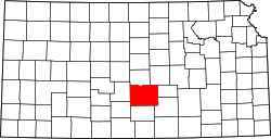
Yaggy is an unincorporated community in Reno County, Kansas, United States. [1] It is located northwest of Hutchinson, west of Willowbrook, near a railroad.
Yaggy had a short-lived post office ca. 1901. [2]
The community is served by Nickerson–South Hutchinson USD 309 public school district.
Reno County is a county located in the U.S. state of Kansas. Its county seat and largest city is Hutchinson. As of the 2020 census, the population was 61,898. The county is named for Jesse Reno, a general during the American Civil War.
Pratt County is a county located in the U.S. state of Kansas. Its county seat and largest city is Pratt. As of the 2020 census, the county population was 9,157. The county was named for Caleb Pratt, a U.S. soldier who died in the Battle of Wilson's Creek during the American Civil War and had previously been involved in Bleeding Kansas.
Hutchinson is the largest city and county seat in Reno County, Kansas, United States, and located on the Arkansas River. It has been home to salt mines since 1887, thus its nickname of "Salt City," but locals call it "Hutch." As of the 2020 census, the population of the city was 40,006.
South Hutchinson is a city in Reno County, Kansas, United States. As of the 2020 census, the population of the city was 2,521. It is a south suburb of Hutchinson.
K-96 is a 300-mile-long (480 km) state highway in central and southern Kansas. Its western terminus is at the Colorado state line east of Towner, Colorado, where it continues as Colorado State Highway 96; its eastern terminus since 1999 is at U.S. Route 54/U.S. Route 400 in eastern Wichita.
Kansas State Fair is a state fair held annually in Hutchinson, Kansas, United States. It starts the Friday following Labor Day in September, and lasts for 10 days. This fair is the largest single event in the state and attracts approximately 350,000 people annually. The fairgrounds is centered at 23rd Ave between Main and Plum Street in Hutchinson, and consists of over 70 buildings on 280 acres (110 ha). It has full-time year-round staff. The 2024 fair will be held from September 6 to 15.
Castleton is an unincorporated community in Reno County, Kansas, United States. It is located northeast of Pretty Prairie between Castleton Road and North Fork Ninnescah River.
Yoder is a census-designated place (CDP) in Reno County, Kansas, United States. As of the 2020 census, the population was 165. It is located approximately 10 miles southeast of the city of Hutchinson on K-96. Although Yoder is unincorporated, with no city government, it does have a U.S. Post Office and its own ZIP code (67585). Yoder is the hub of a local Amish community.
William Ripley Brown was a U.S. representative from Kansas.
Strataca is a salt mine museum in Hutchinson, Kansas, United States. It was previously known as the Kansas Underground Salt Museum. The museum is built within one of the world's largest deposits of rock salt, formed 275 million years ago, and provides the opportunity to go 650 feet (200 m) beneath the Earth’s surface. The museum is located in the Hutchinson Salt Company mine which began operation in 1923 as Carey Salt Company. There are 14 other salt mines in the United States, but Strataca is the only one accessible to tourists.
Brainerd is an unincorporated community in Butler County, Kansas, United States. It is located on the north side of K-196 highway between the cities of Whitewater and Potwin.
Sand Hills State Park is located north of the city of Hutchinson in Reno County, Kansas, United States.
Reno is an unincorporated community in Leavenworth County, Kansas, United States. Reno is located at 39°03′04″N95°07′12″W. It is part of the Kansas City metropolitan area.
Huntsville is an unincorporated community in Reno County, Kansas, United States. It is located north of Plevna along 4th Ave.
Lerado is an unincorporated community in Reno County, Kansas, United States. Early residents intended to name the community for Laredo, Texas, but a clerical error by the post office resulted in the E and A being swapped.
Medora is an unincorporated community in Reno County, Kansas, United States. It is located northeast of Hutchinson next to K-61 highway.
Kent is a ghost town in Reno County, Kansas, United States. It was located 7 miles southeast of Hutchinson at the intersection of Kent Road and the Atchison, Topeka and Santa Fe Railway. It is the site of a former post office; and a former station on the ATSF Railway.
Frances Garcia is a former American politician. She served as mayor of Hutchinson, Kansas, from 1985 to 1986 and again from 1989 to 1990, becoming the first Hispanic woman mayor in the Midwestern United States.
Nickerson–South Hutchinson USD 309 is a unified school district headquartered in South Hutchinson, Kansas, United States. The district includes the communities of Nickerson, South Hutchinson, Willowbrook, Yaggy, The Highlands, and nearby rural areas.
The Highlands is a city in Reno County, Kansas, United States. As of the 2020 census, the population of the city was 349. It is located north of the city of Hutchinson.