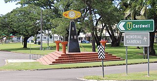
Ingham is a rural town and locality in the Shire of Hinchinbrook, Queensland, Australia. It is named after William Bairstow Ingham and is the administrative centre for the Shire of Hinchinbrook.

Lucinda is a coastal town and locality in the Shire of Hinchinbrook, Queensland, Australia. In the 2021 census, the locality of Lucinda had a population of 435 people.

Mutarnee is a rural town and coastal locality in the City of Townsville, Queensland, Australia. In the 2021 census, the locality of Mutarnee had a population of 120 people.

Abergowrie is a rural town and locality in the Shire of Hinchinbrook, Queensland, Australia. In the 2021 census, the locality of Abergowrie had a population of 305 people.
Taylors Beach is a coastal town and locality in the Shire of Hinchinbrook, Queensland, Australia. It takes its name from its beach. In the 2021 census, the locality of Taylors Beach had a population of 297 people.
Toobanna is a rural town and locality in the Shire of Hinchinbrook, Queensland, Australia. In the 2021 census, the locality of Toobanna had a population of 276 people.
Victoria Plantation is a rural locality in the Shire of Hinchinbrook, Queensland, Australia. In the 2021 census, Victoria Plantation had a population of 169 people.
Bambaroo is a rural locality in the Shire of Hinchinbrook, Queensland, Australia. In the 2021 census, Bambaroo had a population of 146 people.
Helens Hill is a rural locality in the Shire of Hinchinbrook, Queensland, Australia. In the 2021 census, Helens Hill had a population of 118 people.
Braemeadows is a rural locality in the Shire of Hinchinbrook, Queensland, Australia. In the 2021 census, Braemeadows had a population of 269 people.
Foresthome is a rural locality in the Shire of Hinchinbrook, Queensland, Australia. In the 2021 census, Foresthome had a population of 84 people.

Peacock Siding is a rural locality in the Shire of Hinchinbrook, Queensland, Australia. In the 2021 census, Peacock Siding had a population of 85 people.

Bemerside is a rural locality in the Shire of Hinchinbrook, Queensland, Australia. In the 2021 census, Bemerside had a population of 259 people.
Upper Stone is a rural locality in the Shire of Hinchinbrook, Queensland, Australia. In the 2021 census, Upper Stone had a population of 111 people.
Blackrock is a rural locality in the Shire of Hinchinbrook, Queensland, Australia. In the 2021 census, Blackrock had a population of 319 people.
Coolbie is a coastal locality in the Shire of Hinchinbrook, Queensland, Australia. In the 2021 census, Coolbie had a population of 110 people.
Dalrymple Creek is a locality in the Shire of Hinchinbrook, Queensland, Australia. In the 2021 census, Dalrymple Creek had a population of 51 people.
Rungoo is a coastal locality in the Cassowary Coast Region, Queensland, Australia. In the 2021 census, Rungoo had a population of 11 people.

Hawkins Creek is a rural locality in the Shire of Hinchinbrook, Queensland, Australia. In the 2021 census, Hawkins Creek had a population of 236 people.
Garrawalt is a rural locality in the Shire of Hinchinbrook, Queensland, Australia.


