Bent's New Fort

Last updated

Daniel Jenks traveled to the Colorado Territory in 1859 in search of gold. While there, he made this sketch of Bent's New Fort, which is one of the earliest known images of the fort. Photo courtesy Library of Congress, Prints and Photographs Dept. Bent's New Fort.jpg
Daniel Jenks traveled to the Colorado Territory in 1859 in search of gold. While there, he made this sketch of Bent's New Fort, which is one of the earliest known images of the fort. Photo courtesy Library of Congress, Prints and Photographs Dept.
Santa Fe Trail Mountain Route--Bent's New Fort
Safe trail map NPS1962.jpg
Map of the historic Santa Fe Trail in the southwestern United States around 1860
LocationAddress restricted [2] in the vicinity of Lamar, Colorado
Built1853
NRHP reference No. 16000666 [3]
CSRHP No.5BN.394 [4]
Significant dates
Added to NRHPSeptember 26, 2016
Designated CSRHP2016

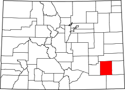
Bent's New Fort was a historic fort and trading post along the banks of the Arkansas River in what is now Bent County, Colorado, about nine miles west of Lamar, [5] [6] on the Mountain Route branch of the Santa Fe Trail. [7] William Bent operated a trading post with limited success at the site and in 1860 leased the fort to the United States government, which operated it as a military outpost until 1867. In 1862, it was named Fort Lyon. The fort was abandoned after a flood of the Arkansas River in 1867.

Contents

The ruins of the fort and a portion of the Santa Fe Trail were listed as Santa Fe Trail Mountain Route-Bent's New Fort on the U.S. National Register of Historic Places in 2016. [3]

Description

The only surviving daguerreotype from Solomon Nunes Carvalho's journey West in 1853 depicts a view of the Cheyenne village at Big Timbers. A pair of figures stand to the left; drying hides hang on the right. Courtesy of Library of Congress. Cheyenne Village at Big Timbers 1853.jpg
The only surviving daguerreotype from Solomon Nunes Carvalho's journey West in 1853 depicts a view of the Cheyenne village at Big Timbers. A pair of figures stand to the left; drying hides hang on the right. Courtesy of Library of Congress.

In 1849, William Bent built a wooden stockade for a fort and trading post. [8] [9] It was a U-shaped structure of three connected log cabins. The open side faced the Arkansas River. [9]

He then built a rectangular limestone [6] or sandstone trading post and fort in the summer and early fall of 1853. Built near the Cheyenne and Arapaho camping ground, Big Timbers, the fort was a little smaller than the adobe Bent's Old Fort, which had been destroyed by fire [5] [8] by Bent in 1849 during a severe cholera epidemic that decimated the southern Cheyenne. [10] [lower-alpha 1] [lower-alpha 2] The new building, with 16-foot walls, had twelve rooms built around a central courtyard. For defense, cannons sat in the corners of the roof and there were parapets. [8]

The new fort was built on a hill overlooking the Arkansas River with a view for miles of the Santa Fe Trail. In a defensive position, it was situated between a limestone cliff to the east and a rock bluff to the south. [6]

The fort was staffed by about ten Native American, French-Canadian, Mexican, and white American men. Described as a "motley crew", some of the men had been trappers. Most had at least one Native American wife. [6]

History

Little Raven, Southern Arapaho leader, some time between 1868 and 1874 Little Raven (Arapaho leader).jpg
Little Raven, Southern Arapaho leader, some time between 1868 and 1874

Sufficient merchandise had arrived so that Bent could resume trading with Native Americans. However, Bent had not been able to sustain trading to the same levels of the 1830s and 1840s at the Old Fort. The steady stream of westward travelers had reduced wildlife, including buffalo. [13] For example, cutting down cottonwood trees adversely affecting habitat for wildlife, reducing game available for hunting. [8] The fur trade had also declined significantly. [9] All of this resulted in hunger among Native Americans and fewer buffalo hides that could be traded for goods. [13] For instance, the Arapaho, led by Little Raven, who camped near the fort had difficulty sustaining life by 1857 and children had distended stomachs from starvation. Hunger, plans for a railroad to cut through Cheyenne and Arapaho hunting grounds, and the increased pressure of settlers resulted in apprehension among Native Americans. [6]

This new trading post was not profitable and in July 1857, Bent leased it briefly to the United States Army and ran it again as a trading post. [5] By 1860, an area near the fort was a distribution point for annuity goods for the Cheyenne and Arapaho, who were starving and in need of the provisions as they headed east for a buffalo hunt; "their women and children had become very faint and hungry." Bent refused to use the fort as storage facilities because it would become a potential area of conflict and theft. [14] Annuity goods were provided by treaties in exchange for reduced access to ancestral land, such as hunting grounds. [15]

In July 1860, the Army rented the facility and used it for storage of annuity goods for the Cheyenne and Arapaho. [14] [lower-alpha 3] Barracks were built around the fort [5] and additional defensive features were added, like diamond-shaped gun emplacements on newly-erected earthenworks that surrounded the fort. [8] It was initially named Fort Flaunteroy. It was then named Fort Wise, and finally Fort Lyon. The Army was located at the fort until 1867 when it moved to the new Fort Lyon fort following flooding of the Arkansas River. The site was not used after the Army relocated. [5] [9]

When Bent leased the fort to the Army, he moved to south side of the Arkansas River at the mouth of the Purgatoire River near Boggsville and built a stockade called Purgatory Stockade. He lived there until his death in 1869. [8] [9] All that remains are ruins of the foundation of the former fort. The fort is on private land. [8]

Notes

  1. There are two alternative theories. One is that he destroyed the fort rather that have Native Americans used it as a stronghold against the United States Army. Alternatively, it was destroyed to prevent the Army from taking the fort without paying him. [11]
  2. It was also in 1849 that the Bent, St. Vrain & Company trading organization was dissolved. [12]
  3. There are some sources that state that the government bought the fort. That is not so, the government just leased the fort. [16]

Related Research Articles

<span class="mw-page-title-main">Cheyenne</span> Native American Indian tribe from the Great Plains

The Cheyenne are an Indigenous people of the Great Plains. Their Cheyenne language belongs to the Algonquian language family. Today, the Cheyenne people are split into two federally recognized nations: the Southern Cheyenne, who are enrolled in the Cheyenne and Arapaho Tribes in Oklahoma, and the Northern Cheyenne, who are enrolled in the Northern Cheyenne Tribe of the Northern Cheyenne Indian Reservation in Montana.

<span class="mw-page-title-main">Sand Creek massacre</span> 1864 killing of Cheyenne and Arapaho people by US troops during the American Indian Wars

The Sand Creek massacre was a massacre of Cheyenne and Arapaho people by the U.S. Army in the American Indian Wars that occurred on November 29, 1864, when a 675-man force of the Third Colorado Cavalry under the command of U.S. Volunteers Colonel John Chivington attacked and destroyed a village of Cheyenne and Arapaho people in southeastern Colorado Territory, killing and mutilating an estimated 69 to over 600 Native American people. Chivington claimed 500 to 600 warriors were killed. However, most sources estimate around 150 people were killed, about two-thirds of whom were women and children. The location has been designated the Sand Creek Massacre National Historic Site and is administered by the National Park Service. The massacre is considered part of a series of events known as the Colorado Wars.

<span class="mw-page-title-main">Charles Bent</span> American politician (1799–1847)

Charles Bent was an American businessman and politician who served as the first civilian United States governor of the New Mexico Territory, newly invaded and occupied by the United States during the Mexican-American War by the Military Governor, Stephen Watts Kearny, in September 1846.

<span class="mw-page-title-main">Colorado War</span> 19th-century armed conflict of the American Indian Wars

The Colorado War was an Indian War fought in 1864 and 1865 between the Southern Cheyenne, Arapaho, and allied Brulé and Oglala Sioux peoples versus the U.S. Army, Colorado militia, and white settlers in Colorado Territory and adjacent regions. The Kiowa and the Comanche played a minor role in actions that occurred in the southern part of the Territory along the Arkansas River. The Cheyenne, Arapaho, and Sioux played the major role in actions that occurred north of the Arkansas River and along the South Platte River, the Great Platte River Road, and the eastern portion of the Overland Trail. The United States government and Colorado Territory authorities participated through the 1st Colorado Cavalry Regiment, often called the Colorado volunteers. The war was centered on the Colorado Eastern Plains, extending eastward into Kansas and Nebraska.

<span class="mw-page-title-main">Bent's Old Fort National Historic Site</span> National Historic Site of the United States

Bent's Old Fort is an 1833 fort located in Otero County in southeastern Colorado, United States. A company owned by Charles Bent and William Bent and Ceran St. Vrain built the fort to trade with Southern Cheyenne and Arapaho Plains Indians and trappers for buffalo robes. For much of its 16-year history, the fort was the only major white American permanent settlement on the Santa Fe Trail between Missouri and the Mexican settlements. It was destroyed in 1849.

<span class="mw-page-title-main">William Bent</span> American rancher and frontier trader (1809–1869)

William Wells Bent was a frontier trader and rancher in the American West, with forts in Colorado. He also acted as a mediator among the Cheyenne Nation, other Native American tribes and the expanding United States. With his brothers, Bent established a trade business along the Santa Fe Trail. In the early 1830s Bent built an adobe fort, called Bent's Fort, along the Arkansas River in present-day Colorado. Furs, horses and other goods were traded for food and other household goods by travelers along the Santa Fe trail, fur-trappers, and local Mexican and Native American people. Bent negotiated a peace among the many Plains tribes north and south of the Arkansas River, as well as between the Native American and the United States government.

<span class="mw-page-title-main">Fort Lyon</span> United States historic place in Colorado

Fort Lyon was composed of two 19th-century military fort complexes in southeastern Colorado. The initial fort, also called Fort Wise, operated from 1860 to 1867. After a flood in 1866, a new fort was built near Las Animas, Colorado, which operated as a military post until 1897.

<span class="mw-page-title-main">Montana City, Colorado</span> First settlement in what later became Denver, Colorado

Montana City was the first settlement in what was later to become Denver, Colorado. It was established during the Pikes Peak Gold Rush on the east bank of the South Platte River, just north of the confluence with Little Dry Creek, in 1858. At the time, the site was in the Kansas Territory.

The Treaty of Fort Wise of 1861 was a treaty entered into between the United States and six chiefs of the Southern Cheyenne and four of the Southern Arapaho Indian tribes. A significant proportion of Cheyennes opposed this treaty on the grounds that only a minority of Cheyenne chiefs had signed, and without the consent or approval of the rest of the tribe. Different responses to the treaty became a source of conflict between whites and Indians, leading to the Colorado War of 1864, including the Sand Creek Massacre.

<span class="mw-page-title-main">Big Timbers</span> Wooded area in Colorado, United States

Big Timbers is a wooded riparian area in Colorado along both banks of the Arkansas River that is famous as a campsite for Native American tribes and travelers on the Mountain Branch of the Santa Fe Trail.

<span class="mw-page-title-main">Owl Woman</span> Cheyenne woman (d. 1847)

Owl Woman was a Cheyenne woman., a daughter of White Thunder, a well-respected medicine man of the Cheyenne tribe. She was married to an Anglo-American trader named William Bent, with whom she had four children. Owl Woman was inducted into the Colorado Women's Hall of Fame for her role in managing relations between Native American tribes and the Anglo-American men.

<span class="mw-page-title-main">Early history of the Arkansas Valley in Colorado</span> 17th to 19th century history of the valley

The early history of the Arkansas Valley in Colorado began in the 1600s and to the early 1800s when explorers, hunters, trappers, and traders of European descent came to the region. Prior to that, Colorado was home to prehistoric people, including Paleo-Indians, Ancestral Puebloans, and Late prehistoric Native Americans.

Alexander Barclay was an American frontiersman. After working in St. Louis as a bookkeeper and clerk, he worked at Bent's Old Fort. He then ventured westward where he was a trapper, hunter, and trader. Barclay entered into a common-law relationship with Teresita Sandoval, one of the founders of the settlement and trading post El Pueblo. He helped settle Hardscrabble, Colorado and built Fort Barclay in New Mexico.

Jimmy's Camp was a trading post established in 1833. The site is east of present-day Colorado Springs, Colorado on the southeast side of U.S. Route 24 and east of the junction with State Highway 94. Located along Trapper's Trail / Cherokee Trail, it was a rest stop for travelers and was known for its spring. Jimmy Camp was a ranch by 1870 and then a railway station on a spur of the Colorado and Southern Railway. After the ranch was owned by several individuals, it became part of the Banning Lewis Ranch. Now the land is an undeveloped park in Colorado Springs.

<span class="mw-page-title-main">Amache Prowers</span> Native American activist, advocate and cattle rancher

Amache Ochinee Prowers, also known as Walking Woman, was a Native American activist, advocate, cattle rancher, and operator of a store on the Santa Fe Trail. Her father was a Cheyenne peace chief who was killed during the Sand Creek massacre on November 29, 1864, after which she became a mediator between Colorado territorial settlers, Mexicans, and Native Americans during the 1860s and 1870s. She was inducted into the Colorado Women's Hall of Fame in 2018.

<span class="mw-page-title-main">John Wesley Prowers</span> American rancher, legislator, and businessman (1838–1884)

John Wesley Prowers was an American trader, cattle rancher, legislator, and businessman in the territory and state of Colorado. Married to Amache Prowers, a Cheyenne woman, his father-in-law was a Cheyenne chief who negotiated for peace and was killed during the Sand Creek massacre.

<span class="mw-page-title-main">Charlotte and Dick Green</span>

Charlotte and Dick Green were enslaved African Americans who worked at Bent's Fort along the Santa Fe Trail in the southwestern frontier, in what is now Colorado. The couple and Dick's brother Andrew came to the fort with Charles and William Bent in the early 1800s and became key figures in the history of the trading post. Charlotte, also called "Black Charlotte", was known for her tasty food and fandango dancing. Dick Green was particularly well known for his role as a soldier, avenging the assassination of then Governor Charles Bent during the Taos Revolt. For his bravery, the Greens were freed and returned to Missouri.

Black Bear was an Arapaho leader into the 1860s when the Northern Arapaho, like other Native American tribes, were prevented from ranging through their traditional hunting grounds due to settlement by European-Americans who came west during the Pike's Peak Gold Rush. Conflicts erupted over land and trails used by settlers and miners. A watershed event was the Sand Creek massacre of 1864. This led to the Northern Arapaho joining with other tribes to prevent settlement in their traditional lands. In 1865, Black Bear's village was attacked during the Battle of the Tongue River. People died, lodges were set on fire, and food was ruined, all of which made it difficult for them to survive as a unit. He died during an ambush by white settlers on April 8, 1870, in the Wild Wind Valley of present-day Wyoming.

Margaret Poisal was "the only woman who was an official witness, interpreter, and consultant at many meetings and treaty councils held along or in close proximity to the Santa Fe Trail." The daughter of French Canadian trapper John Poisal and Arapaho Snake Woman, Poisal was educated at a convent school. She married Thomas Fitzpatrick, an Indian agent, and they worked together negotiating peace between Native American tribes and the United States government. After Fitzpatrick died, Poisal continued to work as an interpreter and peacemaker.

References

  1. "Historic Resources of the Santa Fe Trail, 1821-1880". History Colorado. Retrieved June 16, 2018.
  2. Federal and state laws and practices restrict general public access to information regarding the specific location of this resource. In some cases, this is to protect archeological sites from vandalism, while in other cases it is restricted at the request of the owner. See: Knoerl, John; Miller, Diane; Shrimpton, Rebecca H. (1990), Guidelines for Restricting Information about Historic and Prehistoric Resources, National Register Bulletin, National Park Service, U.S. Department of the Interior, OCLC   20706997 .
  3. 1 2 "National Register of Historic Places Program: Weekly List". National Park Service. October 14, 2016. Retrieved June 15, 2018.
  4. "Historic Resources of the Santa Fe Trail, 1821-1880". History Colorado. Retrieved June 16, 2018.
  5. 1 2 3 4 5 Roland G. Robertson (September 1, 2012). Competitive Struggle: America's Western Fur Trading Posts, 1764-1865. University of Nebraska Press. pp. 70–71. ISBN   978-0-87004-571-4.
  6. 1 2 3 4 5 William Y. Chalfant (October 1, 2002). Cheyennes and Horse Soldiers: The 1857 Expedition and the Battle of Solomon's Fork. University of Oklahoma Press. p. 91. ISBN   978-0-8061-3500-7.
  7. "Historic Resources of the Santa Fe Trail" (PDF). National Register of Historic Places Multiple Property Documentation Form. April 3, 2013. Retrieved June 16, 2018 via History Colorado.
  8. 1 2 3 4 5 6 7 Bent's Old Fort National Historic Site General Management Plan (GMP), Development Concept Plan, Otero County: Environmental Impact Statement. 1994. pp. 102–103.
  9. 1 2 3 4 5 William B. Butler (2012). The Fur Trade in Colorado. Western Reflections Publishing Company. pp. 117–118. ISBN   978-1-937851-02-6.
  10. Bent's Old Fort National Historic Site General Management Plan (GMP), Development Concept Plan, Otero County: Environmental Impact Statement. 1994. p. 102.
  11. "Historic Resources of the Santa Fe Trail" (PDF). National Register of Historic Places Multiple Property Documentation Form. April 3, 2013. p. 104. Retrieved June 16, 2018 via History Colorado.
  12. Douglas C. Comer (December 23, 1996). Ritual Ground: Bent's Old Fort, World Formation, and the Annexation of the Southwest . University of California Press. p.  93. ISBN   978-0-520-91870-2.
  13. 1 2 William Y. Chalfant (October 1, 2002). Cheyennes and Horse Soldiers: The 1857 Expedition and the Battle of Solomon's Fork. University of Oklahoma Press. p. 26. ISBN   978-0-8061-3500-7.
  14. 1 2 William Y. Chalfant (October 1, 2002). Cheyennes and Horse Soldiers: The 1857 Expedition and the Battle of Solomon's Fork. University of Oklahoma Press. pp. 242–243. ISBN   978-0-8061-3500-7.
  15. "Indian Annuities". Colorado Encyclopedia. April 27, 2017. Retrieved June 15, 2018.
  16. David Sievert Lavender (1954). Bent's Fort . U of Nebraska Press. p.  447. ISBN   0-8032-5753-8.