
Pinellas County is located on the west central coast of the state of Florida. As of the 2020 census, the population was 959,107. The county is part of the Tampa–St. Petersburg–Clearwater, Florida Metropolitan Statistical Area. Clearwater is the county seat. St. Petersburg is the largest city as well as the largest city in Florida that is not a county seat.

Dunedin is a city in Pinellas County, Florida, United States. The name comes from Dùn Èideann, the Scottish Gaelic name for Edinburgh, the capital of Scotland. Dunedin is part of the Tampa-St. Petersburg-Clearwater metropolitan area and is the 5th largest city in Pinellas County. The population was 35,321 at the 2010 census.
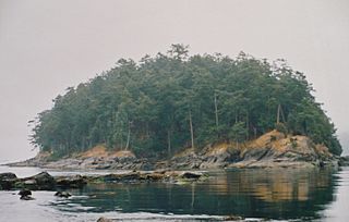
Gulf Islands National Park Reserve is a national park located on and around the Gulf Islands in British Columbia, Canada. In the National Parks System Plan, this park provides representation of the Strait of Georgia Lowlands natural region, the only place in Canada with a Mediterranean climate of dry, sunny summers and mild, wet winters, the result of a rain shadow effect from surrounding mountains between the region and the ocean. It has similar dominant vegetation as the Pacific Northwest, such as coastal Douglas-fir, western red cedar, shore pine, Pacific dogwood, bigleaf maple, and red alder, but also contains the northern extent of some of the more drought tolerant trees such as Garry oak and Arbutus. The park was created in 2003 as the fortieth national park. It covers 36 square kilometres (14 sq mi) of area on 16 islands and more than 30 islets, reefs and surrounding waters, making it the sixth smallest national park in Canada.
The Florida Suncoast is a local marketing name for the west-central peninsular Florida coastal area, also sometimes known as Florida's Beach communities. The region contains nearly 150 miles (240 km) of Gulf of Mexico beaches and the warm, sunny winter climate attracts tourists from across the US, Canada, and Europe. The name comes from the coast receiving the most days of sunshine per year.

Gulf Islands National Seashore offers recreation opportunities and preserves natural and historic resources along the Gulf of Mexico barrier islands of Florida and Mississippi. The protected regions include mainland areas and parts of seven islands. Some islands along the Alabama coast were originally considered for inclusion, but none are part of the National Seashore.

South-southwest of St. Petersburg, Florida, Fort De Soto Park is a park operated by Pinellas County on five offshore keys, or islands: Madelaine Key, St. Jean Key, St. Christopher Key, Bonne Fortune Key and the main island, Mullet Key. The keys are connected by either bridge or causeway. The island group is accessible by toll road from the mainland. Historically, the islands were used for military fortifications; remnants and a museum exhibit this history. Two piers, beaches, picnic area, hiking trails, bicycling trails, kayak trail, and a ferry to Egmont Key State Park are available.

Perdido Key is an unincorporated community in Escambia County, Florida, United States, between Pensacola, Florida and Orange Beach, Alabama. "Perdido" means "lost" in the Spanish and Portuguese languages. The community is located on and named for Perdido Key, a barrier island in northwest Florida and southeast Alabama. The Florida district of the Gulf Islands National Seashore includes the east end of the island, as well as other Florida islands. No more than a few hundred yards wide in most places, Perdido Key stretches some 16 miles (26 km) from near Pensacola to Perdido Pass Bridge near Orange Beach.
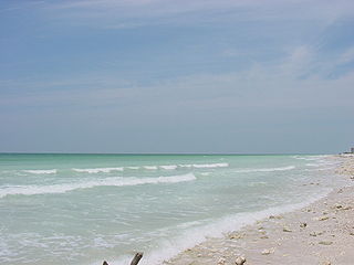
Honeymoon Island State Park is a Florida State Park located on Honeymoon Island, a barrier island across St. Joseph's Sound from Palm Harbor, Ozona, and Crystal Beach. The park is 385 acres (1.6 km2) in land area with 2,400 acres (10 km2) submerged and 4 miles (6 km) of beach. It lies at the western end of Causeway Boulevard, which becomes Curlew Road east of Alternate US 19. Its address is 1 Causeway Blvd. Consistently receiving more than one million visitors each year, it is the most-visited state park in Florida.

Cayo Costa State Park is a state park in the U.S. state of Florida, on Cayo Costa, an island directly south of Boca Grande and just north of North Captiva Island, approximately 12 miles (19 km) west of Cape Coral. The park is accessible only by charter boat, private boat, ferry or helicopter.

Delnor-Wiggins Pass State Park is a Florida state park located on a barrier island on Florida's southwest coast near Naples, Florida, 6 miles west of I-75 in North Naples. The Cocohatchee River and the Gulf of Mexico are accessible from the park, which contains a hard-bottom reef.

Hontoon Island State Park is a 1,648-acre (6.67 km2) Florida State Park located on Hontoon Island between the St. Johns River and the Hontoon Dead River in Volusia County. It is six miles (10 km) west of DeLand, off SR 44, and can only be reached by boat or park-operated passenger ferry. No motorized vehicles, other than wheelchairs, are allowed to be brought onto the island and there is no swimming. The island has pine flatwoods, palm and oak hammocks, bald cypress swamps and marshes. Hontoon Island is surrounded by the St. Johns River, the Hontoon Dead River, and Snake Creek.

Montague Harbour Marine Provincial Park is a provincial park in British Columbia, Canada, located on Galiano Island, one of the Gulf Islands off BC's South Coast in Canada. It is accessible by BC Ferries from Swartz Bay on Vancouver Island or Tsawwassen on the Mainland. The Island's ferry terminal is at Sturdies Bay, about 6km from Montague.
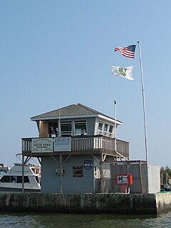
Davis Park is a hamlet in the Town of Brookhaven, Suffolk County, New York, United States. It is located on Fire Island, a barrier island separated from the southern side of Long Island by the Great South Bay off the South Shore village of Patchogue. It lies within the Fire Island National Seashore.
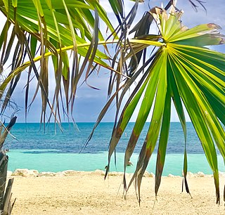
Bahia Honda is an island in the lower Florida Keys.
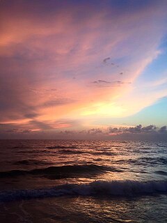
Clearwater Beach includes a resort area and a residential area on a barrier island in the Gulf of Mexico in Pinellas County on the west-central coast of Florida. Located just west over the Intracoastal Waterway by way of the Clearwater Memorial Causeway from the rest of the city of Clearwater, Florida, of which it is part, Clearwater Beach is at a geographic latitude of 27.57 N and longitude 82.48 W.

Singer Island is a peninsula on the Atlantic coast of Palm Beach County, Florida, in the South Florida metropolitan area. Most of it is in the city of Riviera Beach, but the town of Palm Beach Shores occupies its southern tip. Its latitude of is 26.784 N and its longitude is −80.037; Florida's easternmost point is in Palm Beach Shores. Before the Palm Beach Inlet was created, Singer Island was connected to the island of Palm Beach to the south.
Sidney Island is one of the southern Gulf Islands located between the southwest coast of British Columbia, Canada and Vancouver Island, BC, near James Island. Sidney Island has an elevation of 77 meters above mean sea level at its highest point. It is located just east of the town of Sidney which is on the east coast of the Saanich Peninsula. Sidney Island is a part of the Capital Regional District, while its land titles are legally described in the Cowichan Land District. In 1859 Captain Richards named the island for Frederick W. Sidney, who, like Richards served in the survey branch of the Royal Navy.

Sand Key is a barrier island on Florida's Gulf Coast that stretches from Madeira Beach through Redington Beach, North Redington Beach, Redington Shores, Indian Shores, Indian Rocks Beach, Belleair Shore, and Belleair Beach into Clearwater.
Myrtle Scharrer Betz (1895–1992) was an American author who wrote about life on Caladesi Island in the early 1900s.

The Dunedin Causeway is a series of three bridges that cross the St. Joseph Sound, part of the Gulf Intracoastal Waterway, connecting the barrier islands of Honeymoon Island State Park and the mainland of Dunedin, Florida. The causeway carries CR 586 and it was built in 1963.


