State Road 50 runs across the center of the U.S. state of Florida through Orlando, with its termini at SR 55 at Weeki Wachee and SR 5 in Titusville.
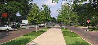
The West Orange Trail is a 22-mile (35 km) long multi-use rail trail owned by Orange County Parks and Recreation in Orange County, Florida, in the United States. The paved trail passes through downtown Oakland, Winter Garden, and Apopka with most of its length built on old railroad alignments. To the west of the West Orange Trail is the South Lake-Lake Minneola Scenic Trail in Lake County which was connected to the trail in 2007.
State Road 60, or Route 60 is an east–west route transversing Florida from the Gulf of Mexico to the Atlantic Ocean. The western terminus of SR 60 is at the Sunsets at Pier 60 site in Clearwater Beach. The eastern terminus is in Vero Beach near the Atlantic Coast just past State Road A1A.

The Greater Grand Forks Greenway is a huge greenway bordering the Red River and Red Lake River in the twin cities of Grand Forks, North Dakota and East Grand Forks, Minnesota. At 2,200 acres (9 km2), the Greenway is more than twice the size of New York City's Central Park. It has an extensive, 20-mile (32 km) system of bike paths, which are used by bikers, walkers, joggers, and rollerbladers. In 2007, the system was designated as a National Recreation Trail by the National Park Service.

Withlacoochee State Trail is a 46-mile (74 km) long paved, multi-use, non-motorized rail trail in Florida located in Citrus, Hernando and Pasco counties. It follows along the Withlacoochee River and passes through the Withlacoochee State Forest. It is the longest paved rail trail in Florida.

The Withlacoochee River or Crooked River is a river in central Florida, in the United States. It originates in the Green Swamp, east of Polk City, flowing west, then north, then northwest and finally west again before emptying into the Gulf of Mexico near Yankeetown. The river is 141 miles (227 km) long and has a drainage basin of 1,170 square miles (3,000 km2).

The Forest Preserve District of Cook County is a governmental commission in Cook County, Illinois, that owns and manages land containing forest, prairie, wetland, streams, and lakes. These land holdings are primarily managed as undeveloped natural areas and for outdoor recreation. The Forest Preserve District encompasses approximately 70,000 acres of land or approximately 11% of the land in Cook County, which contains the city of Chicago and is the most densely populated urban metropolitan area in the Midwest. The Forest Preserves also owns the lands on which the Brookfield Zoo and the Chicago Botanic Garden operate.

U.S. Highway 27 (US 27) in Florida is a north–south United States Numbered Highway. It runs 496.352 miles (798.801 km) from the Miami metropolitan area northwest to the Tallahassee metropolitan area. Throughout the state, US 27 has been designated the Claude Pepper Memorial Highway by the Florida Legislature. It was named after long-time Florida statesperson Claude Pepper, who served in both the U.S. Senate and House of Representatives. The stretch running from Miami to South Bay was originally designated the Thomas E. Will Memorial Highway by the Florida Legislature in 1937 when that portion was known as State Road 26 (SR 26). Thomas E. Will, the founder of Okeelanta, had worked for almost 20 years to get the state to build a road from Miami to the area south of Lake Okeechobee. For most of its length in the state, US 27 is a divided highway.

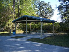
Colt Creek State Park is a Florida State Park in Central Florida, 16 miles (26 km) north of Lakeland off of State Road 471. This 5,067 acre park nestled within the Green Swamp Wilderness Area and named after one of the tributaries that flows through the property was opened to the public on January 20, 2007. Composed mainly of pine flatwoods, cypress domes and open pasture land, this piece of pristine wilderness is home to many animal species including the American bald eagle, Southern fox squirrel, gopher tortoise, white-tailed deer, wild turkey and bobcat.

The Jordan River Parkway is an approximately 40-mile (64 km) urban park that runs along the Jordan River within the U.S. state of Utah. The parkway follows along the river from Utah Lake in Utah County, through Salt Lake County and onto the Great Salt Lake in Davis County. The majority of a mixed-use trail has been completed with a shared-use path for cyclists, skaters, and joggers. A separate equestrian path runs on the southern portion of the trail. Many trail-heads, city and county parks and golf courses are also located along the parkway.

State Road 33 (SR 33) is a state highway running through Lake and Polk counties in the U.S. state of Florida.
Green Pond is a small area in Polk County, Florida, United States, south of Clermont and north of Polk City, on the edge of the Green Swamp.

Mabel is an unincorporated community in central Sumter County, Florida, United States. The postal codes are 33597, which is shared by Webster to the northwest and 33514, which is shared by Center Hill to the north.
The Cumberland County Biker/Hiker Trail is a Pennsylvania rail trail at Pine Grove Furnace State Park and is almost entirely on the "Old Railroad Bed Road" between Fuller Lake and Laurel Lake. The trail is a pleasant 2.2 miles within the Pine Grove Furnace State Park located in the Michaux State Forest. The park is home to many species of wildlife and is a common attraction for locals and tourists alike. Walking, hiking, and biking are the opportunities offered by the trail year round. The biker/hiker trail shares roughly half of its trail with the Appalachian Trail and is a very popular route within the State Park.

Little Sugar Creek Greenway is a linear park and stream restoration project in Mecklenburg County, North Carolina. When completed it will consist of twenty miles of trails and paved walkways running from Cordelia Park just north of uptown Charlotte, then south through midtown Charlotte, and continuing all the way to the South Carolina state line. The Little Sugar Creek Greenway is a key part of the Cross Charlotte Trail (XCLT) and a segment in the Carolina Thread Trail, a regionwide network of trails that pass through 15 counties.

McKay Bay is the name given to the northeastern corner of Tampa Bay, a body of water in Tampa, Florida. The McKay Bay Greenway runs through the area on the east side of McKay Bay and connects to the Tampa Bypass Canal. McKay Bay Nature Park is located at 685 North 34th Street in Tampa. The area also includes the McKay Bay Resource Recovery Plant, a power plant fueled with refuse. The lake was man-made and was once used as a cooling pond for a city incinerator. McKay Bay is at the northeast corner of Hillsborough Bay, which is the name given to the portion of Tampa Bay on the east side of Tampa's Interbay Peninsula. It is named after James McKay Sr.
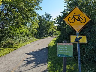
The Camp Chase Trail is a paved multi-use trail in Madison and Franklin counties in the U.S. state of Ohio. It serves as the Southwest Columbus segment of the 326-mile (525 km) Ohio to Erie Trail. The entire length of the Camp Chase Trail is part of the Great American Rail-Trail, U.S. Bicycle Route 21 and U.S. Bicycle Route 50.

The Auburndale TECO Trail is a 6.5-mile (10.5 km) multi-use path in Auburndale, Florida, United States. The southern terminus of the trail is at the northeast corner of Plymouth Road and Berkley Road southeast of the Lake Myrtle Sports Complex. The southern trailhead is on Denton Avenue west of Berkeley Road. At the northern terminus, the trail joins the General James A. Van Fleet State Trail in Polk City. Plentiful parking is available at both trailheads. The route is almost completely flat, with an ascent of less than 5 feet (1.5 m). The trail is approximately 12 feet (3.7 m) wide and, like the Van Fleet Trail, it was constructed on an abandoned Seaboard Air Line Railroad corridor. The path is maintained by Polk County in cooperation with TECO Energy, and is sometimes referred to as the Van Fleet Trail extension. In the future, the route will be linked to the Hilochee Wildlife Management Area.
The Lake Apopka Loop Trail is a trail running along Lake Apopka North Shore, connecting Magnolia Park and the Green Mountain Scenic Overlook and Trailhead. It is managed by the St. Johns River Water Management District.