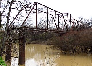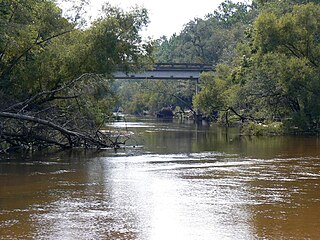
The Suwannee River is a river that runs through south Georgia southward into Florida in the southern United States. It is a wild blackwater river, about 246 miles (396 km) long. The Suwannee River is the site of the prehistoric Suwanee Straits that separated the panhandle from the continent.

The Sunflower River is one of the main tributaries of the Yazoo River in the U.S. state of Mississippi. It is navigable by barge for 50 miles. It rises in De Soto County, Mississippi near the Tennessee border and flows south for 100 miles to the Yazoo River, a major tributary of the Mississippi River. At Clarksdale, the county seat of Coahoma County, the annual Sunflower River Blues & Gospel Festival is held.

The Apalachicola River is a river, approximately 160 mi (180 km) long in the state of Florida. The river's large watershed, known as the ACF River Basin, drains an area of approximately 19,500 square miles (50,500 km2) into the Gulf of Mexico. The distance to its farthest head waters in northeast Georgia is approximately 500 miles (800 km). Its name comes from the Apalachicola people, who used to live along the river.

Lake George or Lake Welaka is a broad and shallow brackish lake on the St. Johns River in the U.S. state of Florida.

The Sandhills or Carolina Sandhills is a 10-35 mi wide physiographic region within the U.S. Atlantic Coastal Plain province, along the updip (inland) margin of this province in the States of North Carolina, South Carolina, and Georgia. The extent of the Carolina Sandhills is shown in maps of the ecoregions of North Carolina, South Carolina, and Georgia.

The Ocala National Forest ls the second largest nationally protected forest in the U.S. State of Florida. It covers 607 square miles (1,570 km2) of northern Florida. It is located three miles (5 km) east of Ocala and 16 miles (26 km) southeast of Gainesville. The Ocala National Forest, established in 1908, is the oldest national forest east of the Mississippi River and the southernmost national forest in the continental U.S. The word Ocala is thought to be a derivative of a Timucuan term meaning "fair land" or "big hammock". The forest is headquartered in Tallahassee, as are all three National Forests in Florida, but there are local ranger district offices located in Silver Springs and Umatilla.

The Apalachicola National Forest is the largest U.S. National Forest in the state of Florida. It encompasses 632,890 acres and is the only national forest located in the Florida Panhandle. The National Forest provides water and land-based outdoors activities such as off-road biking, hiking, swimming, boating, hunting, fishing, horse-back riding, and off-road ATV usage.

De Soto National Forest, named for 16th-century Spanish explorer Hernando de Soto, is 518,587 acres of pine forests in southern Mississippi. It is one of the most important protected areas for the biological diversity of the Gulf Coast ecoregion of North America.

Papakating Creek is a 20.1-mile-long (32.3 km) tributary of the Wallkill River located in Frankford and Wantage townships in Sussex County, New Jersey in the United States. The creek rises in a small swamp located beneath the eastern face of Kittatinny Mountain in Frankford and its waters join the Wallkill to the east of Sussex borough.
Grass Lake National Wildlife Refuge is in the central section of the U.S. state of Montana and is an integral part of the Charles M. Russell National Wildlife Refuge Complex, managed from the Charles M. Russell National Wildlife Refuge. This refuge provides nesting habitat for migratory bird species.

The Ochlockonee River is a fast running river, except where it has been dammed to form Lake Talquin in Florida, originating in Georgia and flowing for 206 miles (332 km) before terminating in Florida.

The Blackwater River of Florida is a 56.6-mile-long (91.1 km) river rising in southern Alabama and flowing through the Florida Panhandle to the Gulf of Mexico. The river enters Florida in Okaloosa County and flows through Santa Rosa County to Blackwater Bay, an arm of Pensacola Bay. The river passes through Blackwater River State Forest and Blackwater River State Park. Milton, the county seat of Santa Rosa County, is located on the river.
Ribault River is a tributary of the Trout River. It is located entirely in Jacksonville, Florida. The river is named after Jean Ribault, a French naval officer. The river's headwaters are near Old Kings Road at an elevation of 7 feet (2.1 m) above sea level. The river cuts through the forest floor near its source, that portion of the river being classified as a creek. The river flows northward, as does the St. Johns River and many of the other tributaries of the Trout River. The river is 6.4 miles (10.3 km) long.

The Withlacoochee State Forest is 157,479-acre (637 km2) in the western central part in the U.S. state of Florida, near Lecanto, Inverness, Floral City, Brooksville, Ridge Manor, and Dade City. The forest was named for the Withlacoochee River, which passes through some of the major tracts within.
The East River is a 10-mile-long (16 km) river entirely within Wakulla County, Florida, draining part of the St. Marks National Wildlife Refuge into the St. Marks River.
Sturgeon River is a 106-mile-long (171 km) river in Baraga County and Houghton counties in the U.S. state of Michigan. 25.0 miles (40.2 km) of the river were added to the National Wild and Scenic Rivers System in 1992.
Cottage Hill State Forest is located in Escambia County, Florida. In 2013 it was reported that the lands might be sold to raise money.
Deep Creek State Forest (DCSF) is a 380-acre state forest 11 miles north of St. Augustine, Florida in St. Johns County, Florida. Deep Creek State Forest is located on both sides of Deep Creek, for which it is named. The state forest is west of the Guana River Wildlife Management Area across the Intracoastal Waterway.
Connecticut Lakes State Forest is a 1,648-acre (667 ha) state forest in the town of Pittsburg, New Hampshire, in the United States. The forest forms a narrow strip on either side of U.S. Route 3, running south from the Canadian border around Third and south past Second Connecticut Lake before ending up short of First Connecticut Lake. The area is known for its moose viewing opportunities in late spring and summer during the mornings and evenings, earning it the name nickname "Moose Alley".
Etonia Creek, also known as Etoniah Creek, is a stream in Putnam and Clay counties in Florida. It is the major tributary of Rice Creek, which is a tributary of the St. Johns River. The upper or western part of the stream's basin, the Upper Etonia Creek Basin, contains about 100 lakes. Many of those lakes do not have outflowing streams. On leaving its upper basin, Etonia Creek flows eastward, and then southeastward to its juncture with Rice Creek.


