Coalmont, Colorado | |
|---|---|
 Coalmont Schoolhouse circa 1915. Restored 1997 by Spicer Club | |
 Coalmont Location of Coalmont, Colorado.  Coalmont Coalmont (Colorado) | |
| Coordinates: 40°33′45″N106°26′40″W / 40.5625°N 106.4445°W [1] | |
| Country | United States |
| State | Colorado |
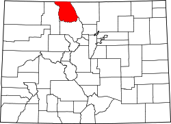
| County | Jackson [2] |
| Government | |
| • Type | unincorporated community |
| • Body | Jackson County [2] |
| Elevation | 8,209 ft (2,502 m) |
| Time zone | UTC−07:00 (MST) |
| • Summer (DST) | UTC−06:00 (MDT) |
| ZIP code [3] | Walden 80480 |
| Area codes | 970/748 |
Coalmont is an unincorporated community and U.S. Post Office in Jackson County, Colorado, United States.