Dismal River culture

Last updated
Dismal River culture
Geographical range Colorado, Kansas, Nebraska, South Dakota.
Period Formative stage
DatesAD 1650-1750
Type site Lovitt Site in Dismal River area of Nebraska
Major sitesScott County State Park (Kansas)
Preceded by Archaic

The Dismal River culture refers to a set of cultural attributes first seen in the Dismal River area of Nebraska in the 1930s by archaeologists William Duncan Strong, Waldo Rudolph Wedel and A. T. Hill. Also known as Dismal River aspect and Dismal River complex, dated between 1650 and 1750 A.D., is different from other prehistoric Central Plains and Woodland traditions of the western Plains. The Dismal River people are believed to have spoken an Athabascan language and to have been part of the people later known to Europeans as the Apache. [1] [2] [3] [4]

Contents

Western Plains

Dismal River culture sites have been found in Nebraska, Kansas, Colorado and South Dakota. [3] 18 sites were located in Hayes, Hooker, Cherry, Thomas and Lincoln counties in the Sandhills of Nebraska. [5]

Notable sites include:

Other village cultures of the Western Plains include the Antelope Creek phase, Apishapa culture, Purgatoire phase, and Sopris phase. [7]

Apache

Pre-contact distribution of Athapascan, including the Apache and Navajo, after they migrated further south from the Plains Na-Dene langs.png
Pre-contact distribution of Athapascan, including the Apache and Navajo, after they migrated further south from the Plains

The Apache evolved from the Athabaskan peoples who migrated onto the North American continent through the current state of Alaska and northwestern Canada. There are two theories about how the ancestors of the Apache migrated into the Great Plains and southwestern United States. They may have traveled through the mountains, staying in a climate that they were accustomed to, or they may have migrated along the plains. [6] Their descendants, the Navajo and Apache, speak Athabaskan languages. [2]

The Apache bands generally attributed to the Dismal River culture are the Paloma and Quartelejo (also Cuartelejo) Apache people. Jicarilla Apache pottery has also been found in some of the Dismal River complex sites. [8]

Some of the Dismal River people joined the Kiowa in the Black Hills of South Dakota to become the Kiowa-Apache or Plains Apache, migrating south to Texas and Oklahoma early in the 19th century. Most of the Dismal River people migrated south in the first half of the 18th century due to pressure from the Comanche from the west and Pawnee and French from the east. They later joined the Lipan Apache and Jicarilla Apache nations. [8]

There have been no sites found to date of the period in which the Southern Athabaskans were nomadic, starting about 1500 A.D. [8]

Architecture

Dismal River villages generally had 15-20 structures and were located near streams. [3] Round houses, shaped like hogans, were built slightly underground or on level ground, about 25 feet (7.6 m) in diameter. [6] The structures were supported by wooden posts and covered with hides or other materials. [2] In the center of their homes were hearths. Bell-shaped baking pits were found in the villages, which sometimes contained remains of human burial. [3]

Culture

The people of the Dismal River culture hunted, primarily bison, [2] using small side-notched, triangular or unnotched projectile points made of stone. [3]

They supplemented their diet with cultivated corn and squash and gathered nuts and berries. Stones and bones were used for tools and they made pottery, called Dismal River pottery, which was distinctly gray-black. [2] Much of the pottery were plain bowls, but there were also ollas, or jars, that were stamped with simple designs and had lips that were punctuated or incised. [8]

Contact with Europeans

In October 1719, the Spanish governor of New Mexico, Antonio Valverde y Cosio ventured onto the Great Plains with a large force of Spanish and Indian soldiers to attempt to punish the Comanche and Ute Indians who were raiding Spanish and Jicarilla settlements. Valverde found no Comanches, but he met with El Cuartelejo Apaches (the Dismal River people) on the Arkansas (Napestle) River in what is now eastern Colorado. The Cuartelejo complained to him that the French were giving firearms to the Pawnee and "Jumano" (Wichita) peoples to their east. Valverde gives few details about the Cuartelejo but notably does not mention the existence of horses among them, commenting that they transported their goods with dogs. [9]

In October 1724, the experienced French frontiersman, Étienne de Veniard, Sieur de Bourgmont, visited the Dismal River people at an encampment in Central Kansas, probably located south and west of Salina. He called the people "Padoucas." On approaching the encampment, Bourgmont was met by 80 mounted men illustrating that some of the Dismal River people possessed horses by this time. Bourgmont described the encampment as having a population of more than 4,000 people, the people living in large dwellings occupied by about 30 persons each. The population was probably swollen by visitors who came from other villages to meet with Bourgmont. His observation that they lived in large dwellings (type of dwelling not described) is at odds with archaeological data. Bourgmont distributed gifts to the Indians, including a few guns. The Padouca had never seen such a variety of European goods. They were frightened of the guns. [10]

Bourgmont wrote that the Padouca maintained permanent villages. They sent out regular hunting parties, in groups of 50-100 households. As one hunting party returned, another would leave, so that the village was occupied at all times. They journeyed up to five or six days travel from their village to hunt. The Padouca sowed corn and pumpkins. They obtained tobacco and horses from trade with the Spanish in New Mexico in exchange for tanned buffalo skins. The explorer noticed that some of the Apache still used flint knives for skinning buffalo and felling trees, an indicator that not much European trade had reached them. [10]

Within a few years after Bourgmont's visit, the Padouca or Dismal River people whom he had met in Kansas were gone, pushed south by the Comanche. [10]

See also

Related Research Articles

William Duncan Strong (1899–1962) was an American archaeologist and anthropologist noted for his application of the direct historical approach to the study of indigenous peoples of North and South America.

<span class="mw-page-title-main">Jicarilla Apache</span> Ethnic group of Native Americans

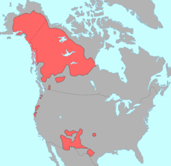
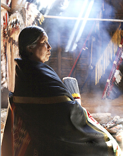
Jicarilla Apache, one of several loosely organized autonomous bands of the Eastern Apache, refers to the members of the Jicarilla Apache Nation currently living in New Mexico and speaking a Southern Athabaskan language. The term jicarilla comes from Mexican Spanish meaning "little basket", referring to the small sealed baskets they used as drinking vessels. To neighboring Apache bands, such as the Mescalero and Lipan, they were known as Kinya-Inde.

<span class="mw-page-title-main">Plains Apache</span> Native America tribe in southwest Oklahoma

The Plains Apache are a small Southern Athabaskan group who live on the Southern Plains of North America, in close association with the linguistically unrelated Kiowa Tribe. Today, they are centered in Southwestern Oklahoma and Northern Texas and are federally recognized as the Apache Tribe of Oklahoma.

<span class="mw-page-title-main">El Cuartelejo</span> Region in Colorado and Kansas, United States

El Cuartelejo, or El Quartelejo, is a region in eastern Colorado and western Kansas where Plains Apache cohabited with Puebloans. Subject to religious persecution, Puebloans fled the Spanish Nuevo México territory and cohabitated with the Cuartelejo villagers in the 1600s.

Oshara Tradition, the northern tradition of the Picosa culture, was a Southwestern Archaic tradition centered in the area now called New Mexico and Colorado. Cynthia Irwin-Williams developed the sequence of Archaic culture for Oshara during her work in the Arroyo Cuervo area of northwestern New Mexico. Irwin contends that the Ancestral Puebloans developed, at least in part, from the Oshara.

<span class="mw-page-title-main">Hawkins Preserve</span> Conservation easement in Colorado

Hawkins Preserve is a 122-acre (0.49 km2) property within the city limits of Cortez, Colorado. It is protected by a conservation easement held by the Montezuma Land Conservancy.

Waldo Rudolph Wedel was an American archaeologist and a central figure in the study of the prehistory of the Great Plains. He was born in Newton, Kansas to a family of Mennonites.

Prehistory of Colorado provides an overview of the activities that occurred prior to Colorado's recorded history. Colorado experienced cataclysmic geological events over billions of years, which shaped the land and resulted in diverse ecosystems. The ecosystems included several ice ages, tropical oceans, and a massive volcanic eruption. Then, ancient layers of earth rose to become the Rocky Mountains.

Asa Thomas Hill was an American businessman and archaeologist. His work on sites in and around Nebraska, with such collaborators as William Duncan Strong and Waldo Wedel, was instrumental in the development of Great Plains archaeology.

<span class="mw-page-title-main">Franktown Cave</span> Archaeological site in Colorado, United States

Franktown Cave is located 25 miles (40 km) south of Denver, Colorado on the north edge of the Palmer Divide. It is the largest rock shelter documented on the Palmer Divide, which contains artifacts from many prehistoric cultures. Prehistoric hunter-gatherers occupied Franktown Cave intermittently for 8,000 years beginning about 6400 BC The site held remarkable lithic and ceramic artifacts, but it is better known for its perishable artifacts, including animal hides, wood, fiber and corn. Material goods were produced for their comfort, task-simplification and religious celebration. There is evidence of the site being a campsite or dwelling as recently as AD 1725.

<span class="mw-page-title-main">Jones-Miller Bison Kill Site</span>

The Jones-Miller Bison Kill Site, located in northeast Colorado, was a Paleo-Indian site where Bison antiquus were killed using a game drive system and butchered. Hell Gap complex bones and tools artifacts at the site are carbon dated from about ca. 8000-8050 BC.

<span class="mw-page-title-main">Magic Mountain site</span> Archaeological site in Colorado, United States

The Magic Mountain site is an Archaic and Woodland village site in Jefferson County, Colorado dating from 4999 BC to 1000 AD. The site was added to the National Register of Historic Places in 1980.

The Trinchera Cave Archeological District (5LA9555) is an archaeological site in Las Animas County, Colorado with artifacts primarily dating from 1000 BC to AD 1749, although there were some Archaic period artifacts found. The site was added to the National Register of Historic Places in 2001 and is located on State Trust Lands.

<span class="mw-page-title-main">Panhandle culture</span> Prehistoric culture

Panhandle culture is a prehistoric culture of the southern High Plains during the Middle Ceramic Period from AD 1200 to 1400. Panhandle sites are primarily in the panhandle and west central Oklahoma and the northern half of the Texas Panhandle.

<span class="mw-page-title-main">Cody complex</span>

The Cody complex is a Paleo-Indian culture group first identified at a bison antiquus kill site near Cody, Wyoming in 1951. Points possessing characteristics of Cody Complex flaking have been found all across North America from Canada to as far south as Oklahoma and Texas.

<span class="mw-page-title-main">Cedar Point Village</span>

Cedar Point Village is an archaeological site located in Elbert County, Colorado near Limon. It is a prehistoric residential site with artifacts of the Dismal River culture and likely inhabited by early Apachean people.

<span class="mw-page-title-main">Outline of Colorado prehistory</span> Overview of and topical guide to the prehistory of Colorado

The following outline is provided as an overview of and topical guide to the prehistoric people of Colorado, which covers the period of when Native Americans lived in Colorado prior to contact with the Domínguez–Escalante expedition in 1776. People's lifestyles included nomadic hunter-gathering, semi-permanent village dwelling, and residing in pueblos.

The Apishapa culture, or Apishapa Phase, a prehistoric culture from 1000 to 1400, was named based upon an archaeological site in the Lower Apishapa canyon in Colorado. The Apishapa River, a tributary of the Arkansas River, formed the Apishapa canyon. In 1976, there were 68 Apishapa sites on the Chaquaqua Plateau in southeastern Colorado.

<span class="mw-page-title-main">Prehistoric agriculture on the Great Plains</span>

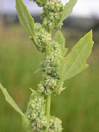
Agriculture on the precontact Great Plains describes the agriculture of the Indigenous peoples of the Great Plains of the United States and southern Canada in the Pre-Columbian era and before extensive contact with European explorers, which in most areas occurred by 1750. The principal crops grown by Indian farmers were maize (corn), beans, and squash, including pumpkins. Sunflowers, goosefoot, tobacco, gourds, and plums, were also grown.

Juan de Ulibarrí or Uribarrí (1670-1716) was a Spanish or Criollo soldier and explorer who lived in New Mexico. In 1706 he led an expedition to El Cuartelejo on the Great Plains of western Kansas and eastern Colorado. Ulibarrí's diary survives and is an important source for the history of Spanish exploration of the Great Plains and relationships with the Apache and Pueblo Indians. The purpose of Ulibarrí's expedition was to find and escort back to New Mexico about 60 people from Picuris Pueblo who had earlier fled Spanish rule in New Mexico and established communities on the Great Plains. The Cuartelejo Ruins in Kansas are a remnant of the Pueblos who lived on the plains.

References

  1. Cassells, E. Steve. (1997). The Archeology of Colorado, Revised Edition. Boulder, Colorado: Johnson Books. pp. 234, 236. ISBN   1-55566-193-9.
  2. 1 2 3 4 5 "Emergence of Historic Tribes: The Dismal River Culture". Nebraska Studies. Archived from the original on 2012-09-10. Retrieved September 2, 2021.
  3. 1 2 3 4 5 6 Gibbon, Guy E.; Ames, Kenneth M. (1998) Archaeology of Prehistoric Native America: An Encyclopedia. p. 212. ISBN   0-8153-0725-X.
  4. Gibbon, Guy E.; Ames, Kenneth M. (1998) Archaeology of Prehistoric Native America: An Encyclopedia. pp. 213, 768. ISBN   0-8153-0725-X.
  5. Koch, Amy. (1999).Sand Hills Archaeology [Usurped!] Nebraska History. Joint effort by the State Historic Preservation Office and the Archeology Division of the Nebraska State Historical Society. p.13. Retrieved November 26, 2011.
  6. 1 2 3 Cassells, E. Steve. (1997). The Archeology of Colorado, Revised Edition. Boulder, Colorado: Johnson Books. pp. 236. ISBN   1-55566-193-9.
  7. Guy E. Gibbon; Kenneth M. Ames, eds. (1998). Archaeology of Prehistoric Native America: An Encyclopedia. Taylor & Francis. ISBN   978-0-8153-0725-9.
  8. 1 2 3 4 Gibbon, Guy E.; Ames, Kenneth M. (1998) Archaeology of Prehistoric Native America: An Encyclopedia. p. 213. ISBN   0-8153-0725-X.
  9. Polt, H. R., ed., "Log and Itinerary of Governor Antonio Valverde Cosio in his Campaign against the Utes and Comanches, 1719", Retrieved February 23, 2015
  10. 1 2 3 Norall, Frank (1988), Bourgmont, Explorer of the Missouri, 1698-1725, Lincoln: University of Nebraska Press, pp. 67-79 ISBN   0803233167.